Fairlie, New Zealand

Last updated

Fairlie
Town
Fairlie James McKenzie Statue.JPG
A statue of James Mckenzie and his dog, in the centre of the town
Fairlie, New Zealand
Coordinates: 44°06′S170°50′E / 44.100°S 170.833°E / -44.100; 170.833
Country New Zealand
Region Canterbury
Territorial authority Mackenzie District
WardOpuha Ward
CommunityFairlie Community
Electorates
Government
  Territorial authority Mackenzie District Council
  Regional council Environment Canterbury
   Mayor of Mackenzie Anne Munro
   Waitaki MP Miles Anderson
   Te Tai Tonga MP Tākuta Ferris
Area
[1]
  Total4.95 km2 (1.91 sq mi)
Population
 (June 2023) [2]
  Total950
  Density190/km2 (500/sq mi)
Time zone UTC+12 (New Zealand Standard Time)
  Summer (DST) UTC+13 (New Zealand Daylight Time)
Postcode
7925
Area code 03
Local iwi Ngāi Tahu
Website http://www.mackenzie.govt.nz/

Fairlie is a Mackenzie District service town (or township) located in the Canterbury region of the South Island of New Zealand. The estimated population was 950 as of June 2023. [2] Being on state highway 8 between Christchurch (182 km, 2 hours 20 minutes drive) and Queenstown (300 km 3.5 hours drive), tourism is fast becoming a major industry within the town. Kimbell is 8 km west of Fairlie via state highway 8. Geraldine is 45 km east via state highway 79 and Timaru is 58 km southeast of Fairlie via state highway 8. Fairlie sits at an altitude of 301 metres above sea level. [3]

Contents

From 1884 to 1968, the town was served by the Fairlie Branch railway, [4] [5] though until 1934, this branch line actually terminated a kilometre beyond Fairlie in Eversley.

Fairlie is commonly known as the gateway to the Mackenzie Basin. [6] [7] The town was initially called Fairlie's Creek, a name purportedly chosen by David Hamilton, the brother-in-law of James Lister (or Lizter), who had built a boarding house near the creek. The name Hamilton had been suggested, but was rejected due to similarity to the City of Hamilton in the North Island. David Hamilton suggested the town be named Fairlie after Fairlie, Scotland, which he had visited as part of his honeymoon. [8] After 1892, the town's name was shortened to Fairlie. [9]

The Ōpihi River runs past Fairlie.

Climate

The bridge over the Opihi River just before Fairlie (July 2022) Fairlie 39.jpg
The bridge over the Ōpihi River just before Fairlie (July 2022)

Fairlie has cool winters with an average high temperature of 9 degrees Celsius and an average low temperature of 2 degrees Celsius in July. Summers are warm with an average high temperature of 22 degrees Celsius and an average low temperature of 11 degrees Celsius in February. The wettest month of the year is December with an average of 66mm of rain and the driest is September with 50mm rain on average. [10]

Climate data for Fairlie, elevation 300 m (980 ft), (1991–2020)
MonthJanFebMarAprMayJunJulAugSepOctNovDecYear
Mean daily maximum °C (°F)22.8
(73.0)
22.2
(72.0)
20.7
(69.3)
17.5
(63.5)
14.5
(58.1)
11.3
(52.3)
10.8
(51.4)
12.8
(55.0)
15.4
(59.7)
17.2
(63.0)
19.0
(66.2)
20.6
(69.1)
17.1
(62.7)
Daily mean °C (°F)16.1
(61.0)
15.6
(60.1)
13.8
(56.8)
10.5
(50.9)
7.6
(45.7)
4.3
(39.7)
3.8
(38.8)
5.8
(42.4)
8.2
(46.8)
10.4
(50.7)
12.2
(54.0)
14.4
(57.9)
10.2
(50.4)
Mean daily minimum °C (°F)9.3
(48.7)
9.1
(48.4)
6.8
(44.2)
3.5
(38.3)
0.7
(33.3)
−2.7
(27.1)
−3.3
(26.1)
−1.2
(29.8)
1.0
(33.8)
3.6
(38.5)
5.4
(41.7)
8.2
(46.8)
3.4
(38.1)
Average rainfall mm (inches)59
(2.3)
47
(1.9)
74
(2.9)
52
(2.0)
71
(2.8)
45
(1.8)
51
(2.0)
49
(1.9)
44
(1.7)
63
(2.5)
60
(2.4)
67
(2.6)
682
(26.8)
Mean monthly sunshine hours 1791581541411271171241421521751791691,817
Source: NIWA (rain and sun 1951–1980) [11]

Demographics

Fairlie is described by Statistics New Zealand as a rural settlement. It covers 4.95 km2 (1.91 sq mi) [1] and had an estimated population of 950 as of June 2023, [2] with a population density of 192 people per km2.

Historical population for Fairlie
YearPop.±% p.a.
2006867    
2013861−0.10%
2018885+0.55%
Source: [12]

Fairlie had a population of 885 at the 2018 New Zealand census, an increase of 24 people (2.8%) since the 2013 census, and an increase of 18 people (2.1%) since the 2006 census. There were 378 households, comprising 435 males and 447 females, giving a sex ratio of 0.97 males per female. The median age was 47.3 years (compared with 37.4 years nationally), with 138 people (15.6%) aged under 15 years, 141 (15.9%) aged 15 to 29, 369 (41.7%) aged 30 to 64, and 234 (26.4%) aged 65 or older.

Ethnicities were 89.5% European/Pākehā, 7.8% Māori, 0.3% Pasifika, 5.8% Asian, and 1.4% other ethnicities. People may identify with more than one ethnicity.

The percentage of people born overseas was 20.3, compared with 27.1% nationally.

Although some people chose not to answer the census's question about religious affiliation, 45.4% had no religion, 44.4% were Christian, 0.3% had Māori religious beliefs, 0.7% were Buddhist and 1.0% had other religions.

Of those at least 15 years old, 105 (14.1%) people had a bachelor's or higher degree, and 189 (25.3%) people had no formal qualifications. The median income was $25,700, compared with $31,800 nationally. 78 people (10.4%) earned over $70,000 compared to 17.2% nationally. The employment status of those at least 15 was that 348 (46.6%) people were employed full-time, 123 (16.5%) were part-time, and 6 (0.8%) were unemployed. [12]

Opua statistical area

The Opua statistical area surrounds but does not include Fairlie. It covers 1,978.38 km2 (763.86 sq mi) [1] and had an estimated population of 1,500 as of June 2023, [2] with a population density of 0.76 people per km2.

Historical population for Opua
YearPop.±% p.a.
20061,107    
20131,263+1.90%
20181,347+1.30%
Source: [13]

Opua had a population of 1,347 at the 2018 New Zealand census, an increase of 84 people (6.7%) since the 2013 census, and an increase of 240 people (21.7%) since the 2006 census. There were 501 households, comprising 726 males and 621 females, giving a sex ratio of 1.17 males per female. The median age was 40.0 years (compared with 37.4 years nationally), with 294 people (21.8%) aged under 15 years, 240 (17.8%) aged 15 to 29, 660 (49.0%) aged 30 to 64, and 153 (11.4%) aged 65 or older.

Ethnicities were 95.5% European/Pākehā, 6.0% Māori, 1.1% Pasifika, 2.0% Asian, and 1.6% other ethnicities. People may identify with more than one ethnicity.

The percentage of people born overseas was 12.9, compared with 27.1% nationally.

Although some people chose not to answer the census's question about religious affiliation, 49.7% had no religion, 41.0% were Christian, 0.7% were Hindu, 0.2% were Buddhist and 0.2% had other religions.

Of those at least 15 years old, 165 (15.7%) people had a bachelor's or higher degree, and 192 (18.2%) people had no formal qualifications. The median income was $36,600, compared with $31,800 nationally. 171 people (16.2%) earned over $70,000 compared to 17.2% nationally. The employment status of those at least 15 was that 633 (60.1%) people were employed full-time, 198 (18.8%) were part-time, and 12 (1.1%) were unemployed. [13]

Governance

The Mackenzie District Council provide local government services to Fairlie. The Mackenzie District Council offices are located at 53 Main Street, Fairlie. [14] Fairlie is part of the Waitaki electorate. Miles Anderson of the National Party is the current member of parliament. [15]

Education

Fairlie War Memorial in the town centre (July 2021) Fairlie war memorial 27.jpg
Fairlie War Memorial in the town centre (July 2021)

Fairlie has three schools:

Facilities and sports

Mackenzie agricultural and pastoral show

Fairlie Public Library (1916) Fairlie Public Library, 1916.jpg
Fairlie Public Library (1916)

Fairlie hosts the annual Mackenzie District Agricultural and Pastoral show every Easter Monday. The first show was in 1899. The 100th edition ran in 1998. The show has been cancelled three times. Firstly in 1925 because of a polio epidemic, in 1943 due to WWII and 1948 due to an infantile paralysis epidemic. [20]

Ski fields

Fairlie is near the Two Thumb mountain range. There are two ski fields close located nearby. Mount Dobson Ski Field is 28 km drive from Fairlie, as is Fox Peak Ski Field. [21] [22]

Golf course

The Fairlie Golf Club is an 18-hole golf course located on Talbot Street. [23] The flat course has a 5526 metre long men's course with par being 70 and a 5017 metre long women's course with par being 72. The Fairlie 500 is a 72-hole tournament which is played on the third weekend of March each year. In April each year, the Glencairn ladies pairs tournament is held. [24]

Rugby

The former Fairlie courthouse Fairlie 38 Courthouse.jpg
The former Fairlie courthouse

The Mackenzie rugby football club is based in Fairlie at Strathconan Park. It plays in all grades in the South Canterbury Rugby Union competitions. [25] The Fairlie Creek Football Club was established in 1884 and played the rival Albury club two to three times each year initially. The Mackenzie sub union was formed in 1907 after the formation of the Cricklewood Club in 1907. Two other teams, Cave in 1911 and Alpine in 1912, also joined the Mackenzie sub union. After World War II, Tekapo and Pukaki also joined the Mackenzie sub union. In 1953, after the retirement of a number of players, the various clubs merged to form the Mackenzie rugby football club. [26]

Swimming pool

The Strathconan pool is located on School Road, Fairlie. It is open between October and March each year. The facility includes a 25-metre heated indoor swimming pool. [27] Management of the pool was transferred from the Mackenzie District Council to Belgravia Leisure for the 2020–2021 season. [28]

Ice skating

The Fairlie Ice Rink is located between the Fairlie Domain and the Fairlie Campground. The ice rink is based on a man made pond and is reliant on cold weather which determines the length of the ice skating season. The location of the ice rink is two degrees Celsius colder than the town. The ice rink has been operating since the 1930s. [29] [30]

Half marathon

The Mackenzie Half-Marathon which first ran in July 2020 starts in Fairlie. 355 runners competed. The second edition ran in July 2021. The course includes a river crossing. [31] [32]

Skateboarding

A$100,000 skateboard park was proposed for Fairlie. [33] It was finished in early 2021 and would have cost the community significantly more had not 1200 hours of work been completed by local volunteers. [34]

Fairlie heritage museum

Fairlie Heritage Museum (July 2021) Fairlie Heritage Museum 27.jpg
Fairlie Heritage Museum (July 2021)

The Fairlie heritage museum contains a collection of farm machinery, as well as many buildings including the old railway station. [35] [36] The Fairlie Heritage Museum has one of the biggest vintage wagon and carriage collections in the country. [7]

Notable residents

Jack Lovelock lived in Fairlie between 1919 and 1923. He was dux of the primary section of Fairlie School. [37] [38] The Jack Lovelock memorial track is an eight kilometre walking trail in Fairlie, named in his honour. [39]

Notable buildings

The Gladstone Grand Hotel is a category two listed building built in 1884. [40]

The Mount Cook Line building (which were formerly stables dating from 1906). This category two building was listed in 1984. [41]

Fairlie is known for its pies produced at the Fairlie Bakehouse. [42] [43]

There are two church buildings, St Columba on Main Street and St Stephen's on Kirke Street. They are part of Mackenzie Cooperating Parish, an ecumenical parish. [44] [45] Saint Patrick and All Saints Catholic Church is located at 7 Gall Street. [46]

In 2017, Westpac closed their Fairlie branch which left the town without a bank. [47]

Related Research Articles

<span class="mw-page-title-main">Alexandra, New Zealand</span> Town in Otago, New Zealand

Alexandra is a town in the Central Otago district of the South Island of New Zealand. It is on the banks of the Clutha River, on State Highway 8, 188 kilometres (117 mi) by road from Dunedin and 33 kilometres (21 mi) south of Cromwell. The nearest towns to Alexandra via state highway 8 are Clyde seven kilometres to the northwest and Roxburgh forty kilometres to the south. State highway 85 also connects Alexandra to Omakau, Lauder, Oturehua, Ranfurly and on to Palmerston on the East Otago coast.

<span class="mw-page-title-main">Timaru</span> City in Canterbury, New Zealand

Timaru is a port city in the southern Canterbury Region of New Zealand, located 157 km (98 mi) southwest of Christchurch and about 196 km (122 mi) northeast of Dunedin on the eastern Pacific coast of the South Island. The Timaru urban area is home to 28,900 people, and is the largest urban area in South Canterbury, and the third-largest in the Canterbury Region overall, after Christchurch and Rolleston. The town is the seat of the Timaru District, which includes the surrounding rural area and the towns of Geraldine, Pleasant Point and Temuka, which combined have a total population of 48,900.

<span class="mw-page-title-main">Geraldine, New Zealand</span> Town in Canterbury, New Zealand

Geraldine is a town in the Canterbury region in the South Island of New Zealand. It is about 140 km south of Christchurch, and inland from Timaru, which is 38 km to the south. Geraldine is located on State Highway 79 between the Orari and Hae Hae Te Moana Rivers and 45 kilometres to the east of Fairlie.

<span class="mw-page-title-main">Arrowtown</span> Town in Otago, New Zealand

Arrowtown is a historic gold mining town in the Otago region of the South Island of New Zealand. Arrowtown is located on the banks of the Arrow River approximately 7.5 km from State Highway 6. Arrowtown is located 19.5 kilometres to the east of Queenstown. As well as the route via State Highway 6 at Arrow Junction, there is also road access directly to Queenstown via Arthurs Point and a third route via the picturesque Lake Hayes.

<span class="mw-page-title-main">Cromwell, New Zealand</span> Town in Otago, New Zealand

Cromwell is a town in Central Otago region of the South Island of New Zealand. Cromwell is located on the shores of Lake Dunstan where the Kawarau river joins Lake Dunstan. Cromwell was established during the Otago gold rush and is now more known as one of the sub regions of the Central Otago wine region. In 2018, the town of Cromwell was home to a population of 5610 people.

<span class="mw-page-title-main">Hanmer Springs</span> Town in the South Island of New Zealand

Hanmer Springs is a small town in the Canterbury region of the South Island of New Zealand. The Māori name for Hanmer Springs is Te Whakatakanga o te Ngārahu o te ahi a Tamatea, which means “where the ashes of Tamate’s (sic) fire lay”, referring to Tamatea, the captain of the canoe Tākitimu.

<span class="mw-page-title-main">Dargaville</span> Town in Northland, New Zealand

Dargaville is a town located in the North Island of New Zealand. It is situated on the bank of the Northern Wairoa River in the Kaipara District of the Northland region. Dargaville is located 55 kilometres (34 mi) southwest of Whangārei, and 174 kilometres (108 mi) north of Auckland.

<span class="mw-page-title-main">Naseby, New Zealand</span> Town in the South Island of New Zealand

Naseby is a small town, formerly a borough, in the Maniototo area of Central Otago, New Zealand. It is named after a village in Northamptonshire, England. Previous names of the township were Parker's, Hogburn and Mt Ida. The town catch phrase is "2000 feet above worry level" indicating its altitude. Naseby is 395 km from Christchurch and 143 km from Dunedin.

<span class="mw-page-title-main">Motueka</span> Town in Tasman District, New Zealand

Motueka is a town in the South Island of New Zealand, close to the mouth of the Motueka River on the western shore of Tasman Bay. It is the second largest in the Tasman Region, with a population of 8,320 as of June 2023.

<span class="mw-page-title-main">Twizel</span> Town in the South Island of New Zealand

Twizel is the largest town in the Mackenzie District, in the Canterbury Region of the South Island of New Zealand. The town was founded in 1968 to house construction workers on the Upper Waitaki Hydroelectric Scheme. Today, Twizel is a service and tourist town for visitors to the area. It has a resident population of 1,850 ; during the summer, holidaymakers nearly triple the town's population.

<span class="mw-page-title-main">Wairoa</span> Town in Hawkes Bay, New Zealand

Wairoa is a town and territorial authority district in New Zealand's North Island. The town is the northernmost in the Hawke's Bay region, and is located on the northern shore of Hawke Bay at the mouth of the Wairoa River and to the west of Māhia Peninsula. It is on State Highway 2, 118 kilometres (73 mi) northeast of Napier, and 92 kilometres (57 mi) southwest of Gisborne. Wairoa is the nearest town to the Te Urewera protected area and former national park that is accessible from Wairoa via State Highway 38. It is the largest town in the district of Wairoa, and is one of three towns in New Zealand, the others being Kawerau and Ōpōtiki, where Māori outnumber other ethnicities, with 62.29% of the population identifying as Māori.

<span class="mw-page-title-main">Temuka</span> Town in Canterbury, New Zealand

Temuka is a town on New Zealand's Canterbury Plains, 15 kilometres north of Timaru and 142 km south of Christchurch. It is located at the centre of a rich sheep and dairy farming region, for which it is a service town. It lies on the north bank of the Temuka River, just above its confluence with the Ōpihi River.

<span class="mw-page-title-main">Lake Tekapo (town)</span> Town in Canterbury, New Zealand

Lake Tekapo is a small township located at the southern end of the lake of the same name in the inland South Island of New Zealand. It had 558 residents according to the 2018 census, being one of five settlements in the sparsely populated Mackenzie Basin.

<span class="mw-page-title-main">Springfield, New Zealand</span> Settlement in Canterbury, New Zealand

Springfield, called Kowai Pass until 1880, is a small town in the Selwyn District of Canterbury, in the South Island, of New Zealand. Springfield is situated in the foothills of the Southern Alps as the most westerly town of the Canterbury Plains. Springfield is 65 kilometres (40 mi) west of Christchurch on State Highway 73, 9.7 kilometres (6.0 mi) northwest of Sheffield and 22.7 kilometres (14.1 mi) from Darfield. It is located close to Porters Ski Area, Mount Cheeseman, Broken River, Temple Basin and Craigieburn ski fields. Springfield has a long association with the Midland railway line.

<span class="mw-page-title-main">Mackenzie District</span> Territorial authority district in South Island, New Zealand

Mackenzie District is a local government district on New Zealand's South Island, administered by the Mackenzie District Council. It is part of the larger Canterbury Region. The region takes its name from the Mackenzie Basin, an elliptical intermontane basin which covers much of inland Canterbury.

<span class="mw-page-title-main">Opua</span> Place in Northland Region, New Zealand

Opua is a locality in the Bay of Islands, in the sub-tropical Northland Region of New Zealand. It is notable as the first port for overseas yachts arriving in the country after crossing the Pacific Ocean. In the original 1870s plans for the town, it was named Newport. The town of Paihia is nearby, and the small settlement of Te Haumi is in between.

Nightcaps is a town in the Southland region of New Zealand's South Island. It is suggested that Nightcaps got its name either from the snow that is often seen on the Takitimu Mountains, or when early settlers observed fog on the hills known as the Nobbles. State Highway 96 passes through Nightcaps as it runs between Ohai and Winton. The town has a golf course and two primary schools that cater to students from Nightcaps, the surrounding rural area, and since the 2003 closure of its own school, Ohai.

<span class="mw-page-title-main">Lower Moutere</span> Rural locality in Tasman, New Zealand

Lower Moutere is a settlement in the Tasman District of New Zealand's upper South Island. It is a farming community it the Lower Moutere valley, 6 km (3.7 mi) from Motueka close to the Moutere Inlet.

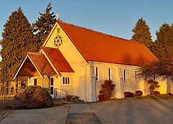
Kimbell is a small township in New Zealand's Mackenzie District, 9 kilometres (5.6 mi) northwest of Fairlie. It is located on SH 8, not far from Burkes Pass, and is a 20 kilometres (12 mi) drive from Mount Dobson ski field. Kimbell was named after Frederick J. Kimbell, who purchased the nearby Three Springs farm in 1866.

Clydevale is a township on the banks of the Clutha River / Mata-Au, in the Clutha Valley, 29 kilometres north-west of Balclutha.

References

  1. 1 2 3 "ArcGIS Web Application". statsnz.maps.arcgis.com. Retrieved 24 November 2021.
  2. 1 2 3 4 "Population estimate tables - NZ.Stat". Statistics New Zealand . Retrieved 25 October 2023.
  3. "Worldwide Elevation Finder". elevation.maplogs.com. Retrieved 20 November 2021.
  4. "Opening of the Railway to Fairlie Creek", Timaru Herald (31 January 1884): 3.
  5. "Branch line closures a sign of the times but infuriating for locals". Kiwirail. Archived from the original on 1 May 2016. Retrieved 25 May 2016.
  6. "Fairlie". Discover New Zealand: A Wises Guide (9th ed.). 1994. p. 376.
  7. 1 2 "Things to see and do in Fairlie, New Zealand". newzealand.com. Retrieved 17 September 2020.
  8. "Fairlie". New Zealand Ministry for Culture and Heritage. Retrieved 25 May 2016.
  9. "Fairlie | NZHistory, New Zealand history online". nzhistory.govt.nz. Retrieved 12 November 2021.
  10. "Climate Fairlie". meteoblue. Retrieved 18 September 2020.
  11. "CliFlo – National Climate Database : Fairlie 2, Fairlie". NIWA. Retrieved 19 May 2024.
  12. 1 2 "Statistical area 1 dataset for 2018 Census". Statistics New Zealand. March 2020. Fairlie (342000). 2018 Census place summary: Fairlie
  13. 1 2 "Statistical area 1 dataset for 2018 Census". Statistics New Zealand. March 2020. Opua (Mackenzie District) (341900). 2018 Census place summary: Opua (Mackenzie District)
  14. Council, Mackenzie District (20 May 2021). "Contact Us". mackenzie.govt.nz. Retrieved 11 November 2021.
  15. "Waitaki: Electoral Profile – New Zealand Parliament". parliament.nz. Retrieved 11 November 2021.
  16. Education Counts: Fairlie School
  17. 1 2 3 "New Zealand Schools Directory". New Zealand Ministry of Education. Retrieved 14 March 2024.
  18. Education Counts: Mackenzie College
  19. Education Counts: Saint Joseph's School
  20. "History". Mackenzie A&P Show. Retrieved 19 November 2021.
  21. "Ski resorts near Fairlie – skiing near Fairlie". skiresort.info. Retrieved 17 December 2021.
  22. Us, Chill-Explore With. "Mackenzie District & Waitaki Valley". Chill – Explore With Us. Retrieved 17 December 2021.
  23. "Fairlie Golf Club". golf.fairlienz.com. Retrieved 27 December 2021.
  24. "Fairlie Golf Club :: Aorangi Golf Association". aorangigolf.org.nz. Retrieved 27 December 2021.
  25. "Mackenzie RFC – Home". sporty.co.nz. Retrieved 18 December 2021.
  26. "Mackenzie Rugby Club" . Retrieved 18 December 2021.
  27. Council, Mackenzie District (10 June 2021). "Strathconan Swimming Pool – Fairlie". mackenzie.govt.nz. Retrieved 13 December 2021.
  28. "Mackenzie District Council hands pool management over to Aussies". Stuff. 19 September 2021. Retrieved 13 December 2021.
  29. "Volunteers keep Fairlie community treasure open". Stuff. 15 July 2021. Retrieved 12 November 2021.
  30. "new-zealand-ice-rinks". 1964 mountain culture / aotearoa. 4 July 2021. Retrieved 12 November 2021.
  31. "Home". Mackhalfmarathon. Retrieved 13 December 2021.
  32. "Mackenzie half marathon to spur runners of all abilities". Stuff. 22 July 2021. Retrieved 13 December 2021.
  33. "Fairlie skatepark is about to happen". Stuff. 18 September 2020. Retrieved 18 September 2020.
  34. "Work on Fairlie's new $100,000 skate park gaining momentum". Stuff. 1 February 2021. Retrieved 13 December 2021.
  35. "Contact". fairlieheritagemuseum.co.nz. Retrieved 24 July 2021.
  36. "Fairlie Heritage Museum". Mackenzie Region. Retrieved 24 July 2021.
  37. "Jack Lovelock | NZHistory, New Zealand history online". nzhistory.govt.nz. Retrieved 16 January 2022.
  38. Taonga, New Zealand Ministry for Culture and Heritage Te Manatu. "Lovelock, John Edward". teara.govt.nz. Retrieved 16 January 2022.
  39. "Short Walks in Fairlie". Mackenzie Region. Retrieved 16 January 2022.
  40. "Search the List | Gladstone Grand Hotel 1884 | Heritage New Zealand". heritage.org.nz. Retrieved 24 July 2021.
  41. "Search the List | Mt Cook Line Building (Former Stables) 1906 | Heritage New Zealand". heritage.org.nz. Retrieved 24 July 2021.
  42. "Fairlie Bakehouse as easy as pie for Franz Lieber". Stuff. 12 May 2020. Retrieved 17 September 2020.
  43. "Our state pieways: New Zealand's best small town bakeries to stop at". Stuff. 13 July 2021. Retrieved 14 July 2021.
  44. "Mackenzie Community Church" . Retrieved 14 October 2021.
  45. "Mackenzie Co-operating Parish". presbyterian.org.nz. Presbyterian Church of Aotearoa New Zealand . Retrieved 14 October 2021.
  46. "Mackenzie – St Patrick's and All Saints Parish – St Patrick's Church (Fairlie) – Catholic Diocese of Christchurch" . Retrieved 15 July 2022.
  47. "Bank closure irritates busy Fairlie business owners". Stuff. 11 January 2017. Retrieved 11 November 2021.

Commons-logo.svg Media related to Fairlie, New Zealand at Wikimedia Commons