Fallowfield, Ottawa

Last updated

Fallowfield
Unincorporated Village
Fallowfield mosbo6.jpg
Sign located on Steeple Hill Crescent at Fallowfield Road
Fallowfield, Ottawa
Location of Fallowfield within the City of Ottawa
CountryFlag of Canada (Pantone).svg  Canada
Province Flag of Ontario.svg  Ontario
CityFlag of Ottawa, Ontario.svg  Ottawa
Settled1820s
Post office1872
Government
   MPs Chandra Arya
   MPPs Lisa MacLeod
   Councillors David Brown
Elevation
110 m (350 ft)
Population
 (2021)
  Total471
  Canada 2021 Census
Time zone UTC-5 (Eastern (EST))
Postal code span
K2R 1G2-6, K2R 1C8-9, K2R 1E1-3
Area code (613)

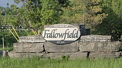
Fallowfield is an unincorporated village [1] (also known as Fallowfield Village) in the city of Ottawa, Ontario, Canada, located south-west of Bells Corners, west of Barrhaven and the 416 and north-east of Richmond within the southwest area of the city.

Contents

Fallowfield is located in the triangle of Fallowfield Road, Old Richmond Road and Steeple Hill Crescent and also includes Old Richmond Road north up to Hope Side Road. [2] The village serves as a bedroom community for the larger urban area of Ottawa as there are no retail or commercial enterprises in the village. [2] It assumes a rather prominent position over the surrounding countryside as the major part of the village is located on a gently terraced escarpment. [2] The population of the village is estimated at 471 people as of 2021. [3] [4] Public high school students in this area go to South Carleton High School in Richmond.

History

Road Gang extending Fallowfield Road to the West at Richmond Road, circa 1880 The Edward Monaghan house, pictured behind the workers, still stands and is designated under the Ontario Heritage Act. Fallowfield Road Gang 1880.jpg
Road Gang extending Fallowfield Road to the West at Richmond Road, circa 1880 The Edward Monaghan house, pictured behind the workers, still stands and is designated under the Ontario Heritage Act .

Fallowfield Village was originally settled in the 1820s [2] by Irish immigrants from counties Tipperary and Cork, [5] at which time the majority of Carleton County was similarly settled. There are two churches, both along Steeple Hill: St. Patrick's Roman Catholic Church built in 1833 [6] with the current stone chapel completed in 1866 and the Fallowfield United Church built in 1868 with the current chapel completed in 1886. [7] The cornerstone for the United (then Methodist) church was laid by Canada's first Prime Minister, Sir John A. Macdonald. The name for the area was Piety Hill but the village name was not formalized to Fallowfield until June 1, 1872, with the appointment of a postmaster, P. Omeara, [8] and the opening of a post office. [8] As a direct result of this action, the village received its name, the origin of which was inspired by nearby fields that were in the process of being fallowed for the summer [2] and is not historically linked to Fallowfield, in Manchester, England. The post office was closed June 30, 1914. [8] For a timeline perspective, the Rideau Canal was built between 1826 and 1832 and the village of Richmond, to the southwest, was settled in 1818.

Fallowfield village was a strategic stopover point for travels between Perth, Richmond and Bytown (later to become Ottawa). [2] By the turn of the century, Fallowfield was a bustling village and it became a favourite stopping place for travellers, especially farmers with their produce wagons and horse teams, en route to and from the market in Ottawa. At one time there were four hotels in the village to serve the travelling public. In addition, there were three carriage shops, two blacksmiths, a grist mill, tailor shop, cheese factory, shoemaker, general store and weigh scales for the farmers to weigh their produce. The widespread use of the automobile most likely rendered the village into a bedroom community as farther distances could be travelled in one day with no need for stopovers like what Fallowfield village offered.

The majority of the development was established in the early 1980s.

Rooney Park is named after the Rooney family who were Irish farmers in the village.

Fallowfield village was originally part of Carleton County, Nepean but has been within the City of Ottawa since January 1, 2001 as part of amalgamation. [9]

June 23, 2002 saw numerous tragedies in the Ottawa area. The Lady Duck sank, [10] [11] the Ontario Power Generation Barrett Chute dam overflowed into the Madawaska River, killing a mother and son [12] and Fallowfield village had a late day F2 tornado at around 5:15pm. [13] [14] Many trees were uprooted and homes damaged. Barns were levelled and garages damaged to the point of demolition.

Churches

L to R: St. Barnabas Anglican, St. John's Presbyterian, and Fallowfield Methodist c.1910 SteepleHill Churches ca1910.jpg
L to R: St. Barnabas Anglican, St. John's Presbyterian, and Fallowfield Methodist c.1910

Old Richmond Road used to follow what is now known as Steeple Hill, the current name coming from the fact that no less than four churches were located in a one kilometre stretch of road. These churches are, from North to South: St. Patrick's Catholic (1866), St. Barnabas Anglican (1889), St. John's Presbyterian (1886) and Fallowfield Methodist (1886). In 1925 the United Church was formed between the Presbyterian, Methodist and Congregationalist and St. John's Presbyterian was vacated and demolished in the 1940s. St. Barnabas Anglican was also demolished in the 1940s and only two churches of the original churches remain today.

Public transit

The village is within 2 kilometres of an interchange with Highway 416 at Fallowfield Road.

As of 2024, the community is served by two OC Transpo routes. Route 110 offers all-day service on weekdays and limited service on weekends, connecting the community to Innovation station in Kanata and Fallowfield station in Barrhaven. Route 283 offers 6 trips towards Tunney's Pasture station in the morning peak and 4 trips towards Richmond in the afternoon peak on weekdays, with some trips also serving Munster Hamlet and Stittsville. [15]

Related Research Articles

<span class="mw-page-title-main">Westboro, Ottawa</span> Neighbourhood in Ontario, Canada

Westboro is an area in the west end of Ottawa, Ontario, Canada. Located along the Ottawa River, Island Park Drive defines Westboro's eastern border, while the Ottawa River defines its northern border. Under this definition, the population of the area is 22,725.

<span class="mw-page-title-main">OC Transpo</span> Public transit service in Ottawa, Ontario, Canada

OC Transpo is the organisation that operates and plans public transport in the city of Ottawa. OC Transpo's system includes bus rapid transit, light rail, conventional bus routes, and door-to-door paratransit.

<span class="mw-page-title-main">Nepean, Ontario</span> Former municipality in Ontario, Canada

Nepean is a former municipality and now geographic area of Ottawa, Ontario, Canada. Located west of Ottawa's inner core, it was an independent city until amalgamated with the Regional Municipality of Ottawa–Carleton in 2001 to become the new city of Ottawa. However, the name Nepean continues in common usage in reference to the area. The population of Nepean is about 186,593 people.

<span class="mw-page-title-main">Transitway (Ottawa)</span> Bus rapid transit system in Ottawa, Canada

The Transitway is a bus rapid transit (BRT) network operated by OC Transpo in Ottawa, Ontario, Canada. It comprises a series of bus-only roadways and reserved lanes on city streets and highways. The dedicated busways ensure that buses and emergency vehicles on the Transitway rarely intersect directly with the regular traffic, and make it possible for them to continue at full speed even during rush hour. OC Transpo operates a network of rapid routes which use the Transitway to connect communities with the O-Train light rail system. Additional bus routes also use segments of the Transitway.

<span class="mw-page-title-main">Barrhaven</span> Community in Ontario, Canada

Barrhaven is a suburb of Ottawa, Ontario, Canada. It is located about 17 km (11 mi) southwest of the city's downtown core. Prior to amalgamation with Ottawa in 2001, Barrhaven was part of the City of Nepean. Its population as of the Canada 2021 Census was 103,234.

<span class="mw-page-title-main">Woodroffe Avenue</span> Road in Ottawa, Ontario, Canada

Woodroffe Avenue is a major north-south arterial road in Ottawa, Ontario, Canada's west end. It runs south from the Kichi Zibi Mikan through Baseline Road and Barrhaven to just short of Prince of Wales Drive near Manotick. The road runs through the heart of Nepean in Ottawa's west end. A satellite Via Rail station is also located at the intersection of Fallowfield Road.

<span class="mw-page-title-main">North Gower</span> Community in Ontario, Canada

North Gower is a small village in eastern Ontario, originally part of North Gower Township, now part of the city of Ottawa. Surrounding communities include Richmond, Kemptville, Kars and Manotick. Public high school students in this area go to South Carleton High School in Richmond. Elementary school students go to Marlborough Public School in North Gower.

<span class="mw-page-title-main">Bells Corners</span> Community in Ontario, Canada

Bells Corners is a suburban neighbourhood in Ottawa, Ontario, Canada. It is located along Robertson Road west of downtown, within Ottawa's western Greenbelt, in College Ward. As of the Canada 2016 Census, the community had a population of 9,272.

<span class="mw-page-title-main">Merivale Road</span>

Merivale Road is an arterial road in the west end of Ottawa, Ontario, Canada. It starts at Island Park Drive just north of Highway 417 and continues south until it ends at Prince of Wales Drive in Rideau Glen. South of Clyde Avenue, Merivale is known as Ottawa Road #17, while north of Clyde it is Ottawa Road #63.

<span class="mw-page-title-main">Barrhaven West Ward</span> Place in Ontario, Canada

Barrhaven West Ward is a city ward in Ottawa, Ontario, Canada. The ward consists of the western half of the Barrhaven subdivision. It consists of the neighbourhoods of Cedarhill Estates, Orchard Estates, Strandherd Meadows, Old Barrhaven, Barrhaven Mews, Jockvale, Halfmoon Bay and Stonebridge.

<span class="mw-page-title-main">Strandherd station</span>

Strandherd Station is a transit station in Ottawa, Ontario. It opened on January 2, 2007 and contains a park and ride facility with over 300 parking spaces available. It is located northeast of the intersection of Strandherd Drive and the access to the Riocan Marketplace shopping area, where Barrhaven Centre Station and Marketplace Station opened in mid-2012. This is part of OC Transpo's plans to extend its southwest transitway to its suburb areas.

<span class="mw-page-title-main">Marketplace station</span>

Marketplace is a Southwest Transitway station in the Barrhaven neighbourhood of Ottawa, Ontario, Canada. The station is located at the Chapman Mills Marketplace shopping centre, an extensive commercial zone which contains big-box stores and department stores.

<span class="mw-page-title-main">Fallowfield station (Ontario)</span> Bus and train station in Ottawa, Ontario, Canada

Fallowfield station or Fallowfield Train Station is an inter-city passenger railway station and bus rapid transit station located at 3347 Fallowfield Road in the suburban neighbourhood of Barrhaven in Ottawa, Ontario, Canada.

<span class="mw-page-title-main">Parkwood Hills</span> Neighbourhood

Parkwood Hills is a neighbourhood in Knoxdale-Merivale Ward in the west end of Ottawa, Canada. Prior to amalgamation in 2001, it was located in the City of Nepean. It is notable for the thriller Parkwood Hills (2002) which was filmed on location in the area by Kolin Casagrande, and for being a typical and illustrative example of town planning and development by Minto in the context of its position as the property manager for the National Capital Commission.

The Nepean Museum is a museum in Ottawa, Ontario, Canada. It is a community-focused museum that preserves, makes accessible and communicates the former municipality of Nepean's history. Artifacts related to Nepean, from its beginnings to the 20th century, are restored and displayed in the museum galleries and grounds. The museum has an open concept exhibit area of approximately 2000sq ft. The museum collects, preserves, researches, exhibits and interprets the works of man and nature in Nepean. Its address is 16 Rowley Avenue, Ottawa, Ontario, Canada.

<span class="mw-page-title-main">Vimy Memorial Bridge</span> Bridge in southern Ottawa

The Vimy Memorial Bridge is a bridge in Ottawa, Ontario, Canada. Completed in 2014, it crosses the Rideau River, connecting Strandherd Drive in Barrhaven and Earl Armstrong Road in Riverside South. The bridge was the 2015 winner of the Gustav Lindenthal Medal. It is named after the Battle of Vimy Ridge, as suggested by two Royal Canadian Legions in Ottawa.

Country Place is a residential neighbourhood near the geographical centre of Ottawa, Canada, in Knoxdale-Merivale Ward. Prior to 2001, it was part of the former city of Nepean. It is a mature residential subdivision with about 400 houses located just inside the Ottawa greenbelt near the Rideau River, and about 11 km from downtown Ottawa. It is bordered by the Black Rapids Creek and the greenbelt to the south, Prince of Wales Drive to the east, Merivale Road to the west, and the Pineglen community to the north. Amberwood Crescent meanders through the community, exiting onto Prince of Wales and Merivale. Tennyson Drive links Country Place to Pineglen.

The following outline is provided as an overview of and topical guide to Ottawa:

References

  1. City of Ottawa Planning Department (2007). "City of Ottawa Official Plan, Volume 2c, Village Plans" (PDF). Ottawa: City of Ottawa. p. 12.
  2. 1 2 3 4 5 6 City of Nepean Planning Department (September 12, 1980). "Village of Fallowfield Secondary Plan" (Document). Nepean: City of Nepean. pp. 4–31.
  3. "Census of Population". Statistics Canada . Retrieved 2024-05-20.
  4. Population calculated by combining Dissemination Blocks 35061386041, 35061386042, 35061386065, and 35061680001.
  5. "Migration and Settlement in the Ottawa, Canada area in the 1800s - Table 2" . Retrieved 2007-10-23.
  6. "St. Patrick's Fallowfield, History of the church". Archived from the original on 2007-05-06. Retrieved 2007-10-23.
  7. "Fallowfield United Church 1886 to the present". Archived from the original on October 23, 2009. Retrieved 2007-10-23.
  8. 1 2 3 "Some Early Post Offices and Postmasters in Carleton County" . Retrieved 2007-10-23.
  9. "Nepean Museum". Archived from the original on 2007-11-25. Retrieved 2007-11-29. The Nepean Museum
  10. "Marine Investigation Report M02C0030". Transportation Safety Board of Canada. 7 April 2004. Retrieved 2 September 2020.
  11. "Lax safety measures cited in Lady Duck sinking". Canadian Broadcasting Corporation. 2004-06-03.
  12. "'Wall of water' kills mother, son". Canadian Broadcasting Corporation. 2002-06-24.
  13. Environment Canada (October 1, 2002). "ONTARIO SEVERE WEATHER SUMMARY" . Retrieved 2008-09-30.
  14. "Ontario Tornados of 2002". Archived from the original on 2008-08-28. Retrieved 2008-09-30.
  15. "Home | OC Transpo". www.octranspo.com. Retrieved 2024-05-20.