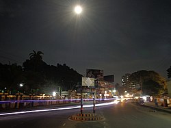
Dhaka, formerly known as Dacca, is the capital and largest city of Bangladesh. It is the sixth-largest and seventh-most densely populated city in the world. Dhaka is a megacity, and has a population of 10.2 million residents as of 2022, and a population of over 22.4 million residents in Greater Dhaka. It is widely considered to be the most densely populated built-up urban area in the world. Dhaka is the most important cultural, economic, and scientific hub of Eastern South Asia, as well as a major Muslim-majority city. Dhaka ranks third in South Asia and 39th in the world in terms of GDP. Lying on the Ganges Delta, it is bounded by the Buriganga, Turag, Dhaleshwari and Shitalakshya rivers. Dhaka is also the largest Bengali-speaking city in the world.
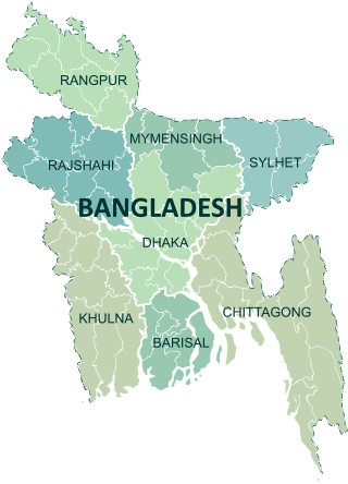
Divisions are the first-level administrative divisions in Bangladesh. As of 2023, there are eight divisions of Bangladesh, each named after the major city within its jurisdiction that also serves as the administrative seat of that division. Each division is divided into several districts which are further subdivided into upazilas, then union councils.

Dhaka Division is an administrative division within Bangladesh. Dhaka serves as the capital city of the Dhaka Division, the Dhaka District and Bangladesh. The division remains a population magnet, covers an area of 20,508.8 km2 with a population in excess of 44 million, growing at 1.94% rate since prior count, compared with national average of 1.22%. However, national figures may include data skewing expatriation of male labor force as gender ratio is skewed towards females.
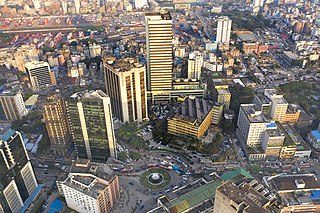
Khulna is the third-largest city in Bangladesh, after Dhaka and Chittagong. It is the administrative centre of Khulna District and Khulna Division. Khulna's economy is the third-largest in Bangladesh, contributing $53 billion in gross state product and $95 billion in purchasing power parity (PPP) in 2020. In the 2022 census, the city had a population of 718735.
Pabna District is a district in central Bangladesh. It is an economically important district. Its administrative capital is the eponymous Pabna town.
Gopalganj is a district in the Dhaka Division of Bangladesh. The district has about 1,172,415 civilians and its surface area is 1,490 km2. The main city of the district is also called Gopalganj. It stands on the bank of the Madhumati river and located at 23°00’47.67" N 89°49’21.41". It is bounded by Faridpur district on the North, Pirojpur and Bagerhat district on the south, Madaripur & Barisal district on the East and Narail district on the West.

Faridpur District is a district in south-central Bangladesh. It is a part of the Dhaka Division. It is bounded by the Padma River to its northeast. The district was named after Farīd-ud-Dīn Masʿūd, a 13th-century Sufi saint. A separate district was created by severing Dhaka district in 1786 and was called Dacca Jelalpur. A municipality was established in 1869. Historically, the town was known as Fatehabad. It was also called Haveli Mahal Fatehabad.

Bangladesh is divided into 8 divisions (bibhag) and 64 districts, although these have only a limited role in public policy. For the purposes of local government, the country is divided into upazilas (sub-districts), "municipalities" or town councils (pourashova), city corporations and union councils . The diagram below outlines the five tiers of government in Bangladesh.
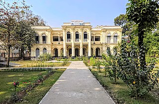
Faridpur Sadar Upazila is an upazila (sub-district) of Faridpur District in the Division of Dhaka, Bangladesh. It contains Faridpur Town near the banks of the Padma River.
Dohar is an upazila of Dhaka District in the division of Dhaka, Bangladesh. The upazila is situated in the southernmost part of Dhaka District. The Padma River borders the southern part of the upazila.
Alfadanga is an upazila of Faridpur District in the Division of Dhaka, Bangladesh.

Charbhadrasan or Char Bhadrasan is an upazila of Faridpur District in the Division of Dhaka, Bangladesh.
Boalmari is an upazila (sub-district) of Faridpur District in central Bangladesh, located in the Dhaka Division. It is named after its headquarters, the town of Boalmari.
Madhukhali is an upazila of Faridpur District in the Division of Dhaka, Bangladesh. Mathurapur village in Madhukhali has the 16th century ancient Mathurapur Deul and one of the 15 Sugar mills in Bangladesh.
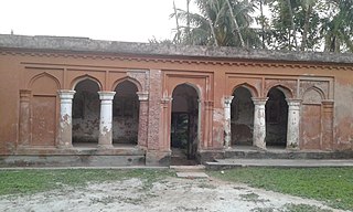
Nagarkanda is an upazila of Faridpur District in the Division of Dhaka, Bangladesh. In this upazila, in the village of Kodalia, the Pakistani Army killed at least 22 people including women and children on 1 June 1971. The incident is also recorded on film.
Sadarpur is an upazila of Faridpur District in the Division of Dhaka, Bangladesh.
Kuliarchar - কুলিয়ারচর is an upazila of Kishoreganj District under the Division of Dhaka, Bangladesh. It is about 97.6 km (61 mi) northwest of the capital city of Dhaka. It is also a center of business, especially the fish, jute trade and processing plants, and the shoes sector of the country.

The divisions of Bangladesh are divided into 64 districts or zila. The headquarters of a district is called a district seat. The districts are further subdivided into 495 subdistricts or upazilas.

Padma Division is a proposed administrative division within Bangladesh for the southern parts of the existing Dhaka Division, comprising Faridpur, Gopalganj, Madaripur, Rajbari, and Shariatpur Districts of Dhaka Division. The headquarters of the division is to be in Faridpur. This division will be named after its affiliated river Padma.