Farmersville, Illinois | |
---|---|
Coordinates: 39°26′28″N89°39′08″W / 39.44111°N 89.65222°W [1] | |
Country | United States |
State | Illinois |
County | Montgomery |
Township | Bois D'Arc |
Area | |
• Total | 0.70 sq mi (1.82 km2) |
• Land | 0.70 sq mi (1.82 km2) |
• Water | 0.00 sq mi (0.00 km2) |
Elevation | 640 ft (200 m) |
Population | |
• Total | 689 |
• Density | 978.69/sq mi (378.07/km2) |
Time zone | UTC-6 (CST) |
• Summer (DST) | UTC-5 (CDT) |
ZIP code | 62533 |
Area code | 217 |
FIPS code | 17-25440 |
GNIS feature ID | 2398863 [1] |
Wikimedia Commons | Farmersville, Illinois |
Farmersville is a village in Montgomery County, Illinois, United States. The population was 689 at the 2020 census. [3]
Farmersville is in northern Montgomery County, 25 miles (40 km) northwest of Hillsboro, the county seat. Interstate 55 runs along the eastern border of the village, with access from Exit 72 (Mine Avenue / Main Street). I-55 leads north 23 miles (37 km) to Springfield, the state capital, and southwest 74 miles (119 km) to St. Louis.
According to the U.S. Census Bureau, Farmersville has a total area of 0.70 square miles (1.81 km2), all land. [2] Macoupin Creek crosses the southeast corner of the village, flowing southwest and then west to the Illinois River.
Census | Pop. | Note | %± |
---|---|---|---|
1900 | 315 | — | |
1910 | 533 | 69.2% | |
1920 | 513 | −3.8% | |
1930 | 553 | 7.8% | |
1940 | 558 | 0.9% | |
1950 | 485 | −13.1% | |
1960 | 495 | 2.1% | |
1970 | 495 | 0.0% | |
1980 | 686 | 38.6% | |
1990 | 698 | 1.7% | |
2000 | 768 | 10.0% | |
2010 | 724 | −5.7% | |
2020 | 689 | −4.8% | |
U.S. Decennial Census [4] |
As of the census [5] of 2000, there were 768 people, 313 households, and 210 families residing in the village. The population density was 777.7 inhabitants per square mile (300.3/km2). There were 350 housing units at an average density of 354.4 per square mile (136.8/km2). The racial makeup of the village was 98.18% White, 0.39% Native American, 1.30% Asian, and 0.13% from two or more races. Hispanic or Latino of any race were 0.52% of the population.
There were 313 households, out of which 34.2% had children under the age of 18 living with them, 56.5% were married couples living together, 7.3% had a female householder with no husband present, and 32.6% were non-families. 29.7% of all households were made up of individuals, and 13.1% had someone living alone who was 65 years of age or older. The average household size was 2.45 and the average family size was 3.04.
In the village, the population was spread out, with 27.3% under the age of 18, 8.5% from 18 to 24, 30.6% from 25 to 44, 21.1% from 45 to 64, and 12.5% who were 65 years of age or older. The median age was 35 years. For every 100 females, there were 86.9 males. For every 100 females age 18 and over, there were 81.8 males.
The median income for a household in the village was $35,893, and the median income for a family was $41,417. Males had a median income of $35,263 versus $21,328 for females. The per capita income for the village was $16,606. About 5.5% of families and 8.2% of the population were below the poverty line, including 7.1% of those under age 18 and 12.8% of those age 65 or over.
Farmersville currently has festival days entitled "Irish Days" which takes place the last weekend of May into June beginning on Thursday and ending Saturday night. [6]
Farmersville is one of four main communities that make up the Panhandle School District (also known as Panhandle CUSD #2). The district's junior and senior high schools are located in the same building in Raymond, which is located approximately ten miles southeast of Farmersville in Montgomery County. Farmersville itself is served by Farmersville Grade School (Pre-K through 1st Grade).
Montgomery County is a county located in the U.S. state of Illinois. According to the 2020 census, it had a population of 28,288. Its county seat is Hillsboro.
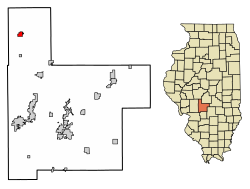
Donnellson is a village in Montgomery and Bond counties, Illinois, United States. The population was 153 as of the 2020 census, down from 210 in 2010.
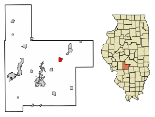
Panama is a village in Montgomery and Bond counties, Illinois, United States. The population was 337 at the 2020 census.
Harvel is a village in Christian and Montgomery counties in the U.S. state of Illinois. The population was 178 at the 2020 census, down from 223 in 2010.
Rutland is a village in LaSalle County, Illinois, United States. It is part of the Ottawa Micropolitan Statistical Area. As of the 2020 census, the population was 259, down from 318 at the 2010 census.
Butler is a small village in Montgomery County, Illinois, United States. The population was 164 at the 2020 census.
Coalton is a village in Montgomery County, Illinois, United States. The population was 317 at the 2020 census.
Fillmore is a village in Montgomery County, Illinois, United States. The population was 305 at the 2020 census.
Irving is a village in Montgomery County, Illinois, United States. The population was 373 at the 2020 census, down from 495 in 2010.
Raymond is a village in Montgomery County, Illinois, United States. The population was 949 at the 2020 census.
Schram City is a village in Montgomery County, Illinois, United States. The population was 563 at the 2020 census.
Taylor Springs is a village in Montgomery County, Illinois, United States. The population was 724 at the 2020 census.
Waggoner is a village in Montgomery County, Illinois, United States. The population was 181 at the 2020 census, down from 266 in 2010 census.
Walshville is a small village in Montgomery County, Illinois, United States. The population was 61 at the 2020 census.
Wenonah is a small village in Montgomery County, Illinois, United States. The population was 32 at the 2020 census.
Witt is a city in Montgomery County, Illinois, United States. The population was 785 at the 2020 census, down from 903 in 2010.
Farmersville is a town located in the eastern border of Cattaraugus County, New York, United States. The population was 1,081 at the 2020 census.
Farmersville is a village in Jackson Township, Montgomery County, Ohio, United States. The population was 975 at the 2020 census. It is part of the Dayton Metropolitan Statistical Area.
Germantown is a city in Montgomery County, Ohio, United States. The population was 5,796 at the 2020 census. A part of the Dayton metropolitan area, Germantown was founded by German Americans from Pennsylvania and was once home to a cigar industry.
Black Earth is a village in Dane County, Wisconsin, United States. The population was 1,338 at the 2010 census. The village is located within the Town of Black Earth. It is part of the Madison Metropolitan Statistical Area.