Farmingdale (CDP), Maine

Last updated

Farmingdale, Maine
Kennebec County Maine incorporated and unincorporated areas Farmingdale (CDP) highlighted.svg
Location in Kennebec County and the state of Maine
Coordinates: 44°15′15″N69°46′42″W / 44.25417°N 69.77833°W / 44.25417; -69.77833 Coordinates: 44°15′15″N69°46′42″W / 44.25417°N 69.77833°W / 44.25417; -69.77833
CountryUnited States
State Maine
County Kennebec
Town Farmingdale
Area
[1]
  Total2.58 sq mi (6.69 km2)
  Land2.38 sq mi (6.16 km2)
  Water0.20 sq mi (0.53 km2)
Elevation
52 ft (16 m)
Population
 (2020)
  Total2,000
  Density841.40/sq mi (324.87/km2)
Time zone UTC-5 (Eastern (EST))
  Summer (DST) UTC-4 (EDT)
ZIP code
04344
Area code 207
FIPS code 23-24635
GNIS feature ID0566053

Farmingdale is a census-designated place (CDP) in the town of Farmingdale in Kennebec County, Maine, United States. The population was 1,970 at the 2010 census, [2] out of 2,956 in the entire town.

Contents

Geography

Farmingdale is located in southern Kennebec County at 44°15′15″N69°46′41″W / 44.25417°N 69.77806°W / 44.25417; -69.77806 (44.254253, −69.778199). [3] It occupies the eastern part of the town of Farmingdale and is bordered to the north by the city of Hallowell, to the south by the city of Gardiner, and to the east across the Kennebec River by the towns of Chelsea and Randolph. The western boundary of the CDP follows Blaine Road, Bowman Street, and Peacock Road.

U.S. Route 201 and Maine State Route 27 run through the community as Maine Avenue, leading north into Hallowell and 5 miles (8 km) to Augusta, the state capital. To the southwest US 201 leads through Gardiner and 26 miles (42 km) to Brunswick, while SR 27 crosses the Kennebec to pass through Randolph and leads southeast 18 miles (29 km) to Wiscasset.

According to the United States Census Bureau, the Farmingdale CDP has a total area of 2.6 square miles (6.7 km2), of which 2.4 square miles (6.2 km2) are land and 0.2 square miles (0.5 km2), or 7.93%, are water. [2]

Demographics

Historical population
CensusPop.Note
2020 2,000
U.S. Decennial Census [4]

As of the census [5] of 2000, there were 1,935 people, 864 households, and 529 families residing in the CDP. The population density was 826.8 inhabitants per square mile (319.2/km2). There were 914 housing units at an average density of 390.6 per square mile (150.8/km2). The racial makeup of the CDP was 97.00% White, 0.93% Black or African American, 0.41% Native American, 0.67% Asian, 0.10% from other races, and 0.88% from two or more races. Hispanic or Latino of any race were 0.57% of the population.

There were 864 households, out of which 29.7% had children under the age of 18 living with them, 44.3% were married couples living together, 14.4% had a female householder with no husband present, and 38.7% were non-families. 33.7% of all households were made up of individuals, and 11.3% had someone living alone who was 65 years of age or older. The average household size was 2.20 and the average family size was 2.78.

In the CDP, the population was spread out, with 23.7% under the age of 18, 8.0% from 18 to 24, 26.6% from 25 to 44, 25.2% from 45 to 64, and 16.6% who were 65 years of age or older. The median age was 39 years. For every 100 females, there were 83.6 males. For every 100 females age 18 and over, there were 80.3 males.

The median income for a household in the CDP was $35,240, and the median income for a family was $39,750. Males had a median income of $36,548 versus $24,973 for females. The per capita income for the CDP was $18,948. About 11.2% of families and 11.6% of the population were below the poverty line, including 17.3% of those under age 18 and 3.8% of those age 65 or over.

Related Research Articles

<span class="mw-page-title-main">Kennebec County, Maine</span> County in Maine, United States

Kennebec County is a county located in the South-central portion of the U.S. state of Maine. At the 2020 census, the population was 123,642. Its county seat is Augusta, the state capital. The county was established on February 20, 1799, from portions of Cumberland and Lincoln Counties. The name Kennebec comes from the Eastern Abenaki /kínipekʷ/, meaning "large body of still water, large bay."

<span class="mw-page-title-main">Brunswick Station, Maine</span> Census-designated place in Maine, United States

Brunswick Station was a census-designated place (CDP) within the town of Brunswick in Cumberland County, Maine, United States. The population was 578 at the 2010 census. It consists of an area that was part of the former Naval Air Station Brunswick and was part of the Portland–South Portland–Biddeford, Maine Metropolitan Statistical Area. The 2020 census shows it as part of the Brunswick CDP.

<span class="mw-page-title-main">Benton, Maine</span> Town in the state of Maine, United States

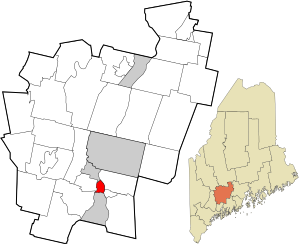
Benton is a town in Kennebec County, Maine, United States. It was formed in 1842, as a subdivision of the town of Clinton. The population was 2,715 at the 2020 census. The town was named for Missouri Senator Thomas Hart Benton.

<span class="mw-page-title-main">Chelsea, Maine</span> Town in the state of Maine, United States

Chelsea is a town in Kennebec County, Maine, United States. The population was 2,778 at the 2020 census. It is home to the Togus Veterans Administration facilities.

<span class="mw-page-title-main">Hallowell, Maine</span> City in Maine, United States

Hallowell is a city in Kennebec County, Maine, United States. The population was 2,570 at the 2020 census. Popular with tourists, Hallowell is noted for its culture and old architecture. Hallowell is included in the Augusta, Maine, micropolitan New England City and Town Area.

<span class="mw-page-title-main">Manchester, Maine</span> Town in Maine, United States

Manchester is a town in Kennebec County, Maine, United States, located at 44.33°N 69.87°W. The population was 2,456 at the 2020 census. The southern part of the town bordering Cobbosseecontee Lake is a popular recreation spot in central Maine, and part of the Winthrop Lakes Region. Manchester is included in the Augusta, Maine micropolitan New England City and Town Area.

<span class="mw-page-title-main">Sidney, Maine</span> Town in the state of Maine, United States

Sidney is a town in Kennebec County, Maine, United States. The population was 4,645 at the 2020 census. Sidney was incorporated as a town on January 30, 1792. The town was named for Sir Philip Sidney, an English author. Sidney is included in the Augusta, Maine micropolitan New England City and Town Area. Since 1937, the town is the home of the New England Music Camp.

<span class="mw-page-title-main">Vienna, Maine</span> Town in the state of Maine, United States

Vienna is a town in Kennebec County, Maine, United States. The population was 578 at the 2020 census.

<span class="mw-page-title-main">Windsor, Maine</span> Town in the state of Maine, United States

Windsor is a town in Kennebec County, Maine, United States. The population was 2,632 at the 2020 census. Windsor is included in the Augusta, Maine micropolitan New England City and Town Area.

<span class="mw-page-title-main">Arrowsic, Maine</span> Town in the state of Maine, United States

Arrowsic is a town in Sagadahoc County, Maine, United States. The population is 477 as of the 2020 United States Census. It is part of the Portland–South Portland–Biddeford, Maine metropolitan statistical area. During the French and Indian Wars, Arrowsic was site of a succession of important and embattled colonial settlements. It is a favorite with artists and birdwatchers.

<span class="mw-page-title-main">Farmington (CDP), Maine</span> Census-designated place in Maine, United States

Farmington is a census-designated place (CDP) comprising the center of the town of Farmington, which is the county seat of Franklin County in Maine, United States. The population of the CDP was 4,288 at the 2010 census, out of 7,760 people in the town as a whole. The University of Maine at Farmington is located within the CDP.

<span class="mw-page-title-main">Clinton (CDP), Maine</span> Census-designated place in Maine, United States

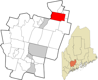
Clinton is a census-designated place (CDP) and the primary village in the town of Clinton in Kennebec County, Maine, United States. The population was 1,419 at the 2010 census, out of 3,486 in the entire town of Clinton.

<span class="mw-page-title-main">Farmingdale, Maine</span> Town in the state of Maine, United States

Farmingdale is a town in Kennebec County, Maine, United States. The population was 2,995 at the 2020 census. Farmingdale is included in the Augusta, Maine micropolitan New England City and Town Area.

<span class="mw-page-title-main">Oakland (CDP), Maine</span> Census-designated place in Maine, United States

Oakland is a census-designated place (CDP) comprising the main population center in the town of Oakland in Kennebec County, Maine, United States. The population was 2,602 at the 2010 census, out of 6,240 in the entire town of Oakland.

<span class="mw-page-title-main">Winthrop (CDP), Maine</span> Census-designated place in Maine, United States

Winthrop is a census-designated place (CDP) comprising the primary settlement in the town of Winthrop in Kennebec County, Maine, United States. The population was 2,650 at the 2010 census, out of 6,092 in the town of Winthrop as a whole.

<span class="mw-page-title-main">Thomaston (CDP), Maine</span> Census-designated place in Maine, United States

Thomaston is a census-designated place (CDP) comprising the main village in the town of Thomaston in Knox County, Maine, United States. The population was 1,875 at the 2010 census, out of 2,781 in the town of Thomaston as a whole.

Dexter is a census-designated place (CDP) comprising the main settlement within the town of Dexter in Penobscot County, Maine, United States. The population of the CDP was 2,158 at the 2010 census.

<span class="mw-page-title-main">Fairfield (CDP), Maine</span> CDP in Maine, United States

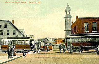
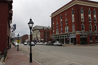
Fairfield is a census-designated place (CDP) in the town of Fairfield in Somerset County, Maine, United States. The population was 2,569 at the 2000 census.

Hartland is a census-designated place (CDP) in the town of Hartland in Somerset County, Maine, United States. The population was 872 at the 2000 census.

<span class="mw-page-title-main">Skowhegan (CDP), Maine</span> CDP in Maine, United States

Skowhegan is a census-designated place (CDP) in the town of Skowhegan in Somerset County, Maine, in the United States. The population was 6,696 at the 2000 census.

References

  1. "2020 U.S. Gazetteer Files". United States Census Bureau. Retrieved April 8, 2022.
  2. 1 2 "Geographic Identifiers: 2010 Census Summary File 1 (G001), Farmingdale CDP, Maine". American FactFinder. U.S. Census Bureau. Archived from the original on February 13, 2020. Retrieved March 8, 2019.
  3. "US Gazetteer files: 2010, 2000, and 1990". United States Census Bureau. February 12, 2011. Retrieved April 23, 2011.
  4. "Census of Population and Housing". Census.gov. Retrieved June 4, 2016.
  5. "U.S. Census website". United States Census Bureau . Retrieved 2008-01-31.