
A hillfort is a type of earthwork used as a fortified refuge or defended settlement, located to exploit a rise in elevation for defensive advantage. They are typically European and of the Bronze Age or Iron Age. Some were used in the post-Roman period. The fortification usually follows the contours of a hill and consists of one or more lines of earthworks, with stockades or defensive walls, and external ditches. Hillforts developed in the Late Bronze and Early Iron Age, roughly the start of the first millennium BC, and were used in many Celtic areas of central and western Europe until the Roman conquest.

Maiden Castle is an Iron Age hillfort 1.6 mi (2.6 km) south west of Dorchester, in the English county of Dorset. Hill forts were fortified hill-top settlements constructed across Britain during the Iron Age.

Danebury is an Iron Age hill fort in Hampshire, England, about 19 kilometres (12 mi) north-west of Winchester. The site, covering 5 hectares, was excavated by Barry Cunliffe in the 1970s. Danebury is considered a type-site for hill forts, and was important in developing the understanding of hill forts, as very few others have been so intensively excavated.

The Cambrian Archaeological Association was founded in 1846 to examine, preserve and illustrate the ancient monuments and remains of the history, language, manners, customs, arts and industries of Wales and the Welsh Marches and to educate the public in such matters. The association's activities include sponsoring lectures, field visits, and study tours; as well as publishing its journal, Archaeologia Cambrensis, and monographs. It also provides grants to support research and publications.

Maiden Castle is an Iron Age hill fort, one of many fortified hill-top settlements constructed across Britain during the Iron Age, but one of only seven in the county of Cheshire in northern England. The hill fort was probably occupied from its construction in 600 BC until the Roman conquest of Britain in the 1st century AD. At this time the Cornovii tribe are recorded to have occupied parts of the surrounding area but, because they left no distinctive pottery or metalworking, their occupation has not been verified. Since then it has been quarried and used for military exercises. It is protected as a Scheduled Ancient Monument, and is owned by the National Trust. The hill fort is open to visitors, but unrestricted access to the site has resulted in it being classified as "at high risk" from erosion.

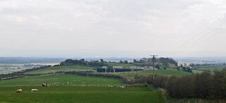
Burrough Hill is an Iron Age hillfort in Burrough on the Hill, 7 miles (11 km) south of Melton Mowbray in the English county of Leicestershire. Situated on a promontory about 210 metres (690 ft) above sea level, the site commands views over the surrounding countryside for miles around. There has been human activity in the area since at least the Mesolithic, and the hillfort was founded in the early Iron Age. In the medieval period, after the hillfort was abandoned, the hill was used as farmland. This ended in the 17th century when the parish the hill was in was enclosed. Traces of ridge and furrow show where the medieval fields were ploughed. Since the 1930s the site has been the subject of archaeological investigations and renewed excavations under the auspices of the University of Leicester began in 2010. Part of Burrough Hill Country Park and open to the public, the hillfort is protected as a Scheduled Ancient Monument.

Kelsborrow Castle is an Iron Age hill fort in Cheshire, northern England. Hill forts were fortified hill-top settlements constructed across Britain during the Iron Age. It is one of only seven hill forts in the county of Cheshire and was probably in use for only a short time. In the 19th century, a bronze palstave was recovered from the site. It is protected as a Scheduled Ancient Monument.
Eddisbury hill fort, also known as Castle Ditch, is an Iron Age hill fort near Delamere, Cheshire, in northern England. Hill forts are fortified hill-top settlements constructed across Britain during the Iron Age. Eddisbury is the largest and most complex of the seven hill forts in the county of Cheshire. It was constructed before 200–100 BC and expanded in 1–50 AD. In the 1st century AD, the Romans slighted the site. It was reoccupied in the 6th–8th centuries AD, and an Anglo-Saxon burh was probably established at Eddisbury in 914. In the medieval and post-medieval periods quarrying and farming have damaged the site. Ownership is currently split between the Forestry Commission and a local farm. Eddisbury is protected as a Scheduled Ancient Monument.

Blewburton Hill is the site of an Iron Age hillfort located in Oxfordshire, in the southeast of England. It was a univallate hillfort. The area is mostly farmland with some small areas of wooded copse to the south and the northeast. The hill fort may have been occupied from the 4th century BC to the 1st century BC, and replaced a small settlement surrounded by a stockade, which is estimated to have been built in the 5th or 6th century BC.
Hillforts in Britain refers to the various hillforts within the island of Great Britain. Although the earliest such constructs fitting this description come from the Neolithic British Isles, with a few also dating to later Bronze Age Britain, British hillforts were primarily constructed during the British Iron Age. Some of these were apparently abandoned in the southern areas that were a part of Roman Britain, although at the same time, those areas of northern Britain that remained free from Roman occupation saw an increase in their construction. Some hillforts were reused in the Early Middle Ages, and in some rarer cases, into the Later Medieval period as well. By the early modern period, these had essentially all been abandoned, with many being excavated by archaeologists in the nineteenth century onward.

Bratton Castle is a bivallate Iron Age built hill fort on Bratton Down, at the western edge of the Salisbury Plain escarpment. The hill fort comprises two circuits of ditch and bank which together enclose a pentagonal area of 9.3 hectares.
Llandyssil is a village in Powys, Wales, about two miles from the town of Montgomery.

Hillforts in Scotland are earthworks, sometimes with wooden or stone enclosures, built on higher ground, which usually include a significant settlement, built within the modern boundaries of Scotland. They were first studied in the eighteenth century and the first serious field research was undertaken in the nineteenth century. In the twentieth century there were large numbers of archaeological investigations of specific sites, with an emphasis on establishing a chronology of the forts. Forts have been classified by type and their military and ritual functions have been debated.

Bryan Hugh St. John O’Neil was a British archaeologist who became Chief Inspector of Ancient Monuments for England and Wales.

Parciau hill fort is a hill fort on the Welsh island of Anglesey. It stands on the summit of Bryn Ddiôl, whose name means "trackless hill".

Beacon Hill, also known as Harting Beacon, is a hillfort on the South Downs, in the county of West Sussex in southern England. The hillfort is located in the parish of Elsted and Treyford, in Chichester District. It is a Scheduled Ancient Monument with a list entry identification number of 1015915. The hilltop enclosure is dated to the Late Bronze Age, from the 8th to 6th centuries BC. The hillfort defences were renewed during the Late Iron Age.

Braich-y-Dinas was an extensive hillfort at the summit of Penmaenmawr, one of the northernmost peaks of the Carneddau mountain range on North coast of Wales. It was once considered the best preserved and most complete hillfort in North-West Wales, but completely disappeared in the first half of the 20th century due to a massive quarrying effort by the Darbishire family; which overwhelmed and eventually destroyed all traces of it, despite efforts by the Royal Commission to save the site.

Castell Caer Seion is an Iron Age hillfort situated at the top of Conwy Mountain, in Conwy County, North Wales. It is unusual for the fact that the main fort contains a smaller, more heavily defended fort, complete with its own distinct defences and entrance, with no obvious means of access between the two. The construction date of the original fort is still unknown, but recent excavations have revealed evidence of occupation as early as the 6th century BC, whilst the smaller fort can be dated with reasonable certainty to around the 4th century BC. Whilst the forts were constructed in different periods, archaeologists have uncovered evidence of concurrent occupation, seemingly up until around the 2nd century BC. The larger fort contained around 50 roundhouses during its lifetime, whereas examinations of the smaller fort have turned up no more than six. The site was traditionally associated with Maelgwyn Gwynedd, but there is no evidence pointing to a 6th-century occupation. The fort and wider area beyond its boundaries have been said to retain significant archaeological potential, and are protected by law as a scheduled ancient monument.

Hollingbury Castle, also known as Hollingbury Camp and Hollingbury Hillfort, is an Iron Age hillfort on the northern edge of Brighton, in East Sussex, England. It is adjacent to Hollingbury Park Golf Course.

Maiden Bower is an Iron Age hillfort near Dunstable in Bedfordshire, England. The site, which also has traces of a Neolithic causewayed enclosure, is a scheduled monument.

