
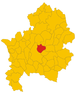
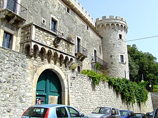
The Province of Caserta is a province in the Campania region of Italy. Its capital is the city of Caserta, situated about 36 kilometres (22 mi) by road north of Naples. The province has an area of 2,651.35 square kilometres (1,023.69 sq mi), and a total population of 924,414 as of 2016. The Palace of Caserta is located near to the city, a former royal residence which was constructed for the Bourbon kings of Naples. It was the largest palace and one of the largest buildings erected in Europe during the 18th century. In 1997, the palace was designated a UNESCO World Heritage Site.

Scapoli is a town and comune located in province of Isernia, which is part of the region of Molise, southern Italy. As of 2011 it had a population of was of 758.

Venafro is a comune in the province of Isernia, region of Molise, Italy. It has a population of around 11,000, having expanded quickly in the post-war period.

Acquafondata is a comune (municipality) in the Province of Frosinone in the Italian region Lazio, located in the Monti della Meta area, about 130 kilometres (81 mi) southeast of Rome and about 50 kilometres (31 mi) east of Frosinone.

Acquaviva d'Isernia is a comune (municipality) in the Province of Isernia in the southern Italian region of Molise, located about 45 kilometres (28 mi) west of Campobasso and about 10 kilometres (6 mi) northwest of Isernia. The town is located in the valley of the Volturno river.

Castelpetroso is a comune (municipality) in the Province of Isernia in the Italian region Molise, located about 25 kilometres (16 mi) west of Campobasso and about 10 kilometres (6 mi) southeast of Isernia. As of 31 December 2004, it had a population of 1,708 and an area of 22.6 square kilometres (8.7 sq mi).
Castelpizzuto is a comune (municipality) in the Province of Isernia in the Italian region Molise, located about 30 kilometres (19 mi) west of Campobasso and about 11 kilometres (7 mi) southeast of Isernia. As of 31 December 2004, it had a population of 156 and an area of 15.2 square kilometres (5.9 sq mi).
Castel San Vincenzo is a comune (municipality) in the Province of Isernia in the Italian region Molise, located about 50 kilometres (31 mi) west of Campobasso and about 15 kilometres (9 mi) northwest of Isernia. The Abbey of San Vincenzo al Volturno is located in its territory. It is also home to an artificial lake, created in the 1950s for a hydroelectric plant.

Cerro al Volturno is a comune (municipality) in the Province of Isernia in the Italian region Molise, located about 45 kilometres (28 mi) west of Campobasso and about 10 kilometres (6 mi) northwest of Isernia.
Colli a Volturno is a comune (municipality) in the Province of Isernia in the Italian region Molise, located about 45 kilometres (28 mi) west of Campobasso and about 11 kilometres (7 mi) west of Isernia. As of 31 December 2004, it had a population of 1,377 and an area of 24.3 square kilometres (9.4 sq mi).

Conca Casale is a comune (municipality) in the Province of Isernia in the Italian region Molise, located about 50 kilometres (31 mi) west of Campobasso and about 20 kilometres (12 mi) southwest of Isernia.
Macchia d'Isernia is a comune (municipality) in the Province of Isernia in the Italian region Molise, located about 40 kilometres (25 mi) west of Campobasso and about 7 kilometres (4 mi) southwest of Isernia.
Miranda is a comune (municipality) in the Province of Isernia in the Italian region Molise, located about 35 kilometres (22 mi) northwest of Campobasso and about 6 kilometres (4 mi) north of Isernia. As of 31 December 2004, it had a population of 1,065 and an area of 22.3 square kilometres (8.6 sq mi).
Monteroduni is a comune (municipality) in the Province of Isernia in the Italian region Molise, located about 40 kilometres (25 mi) west of Campobasso and about 11 kilometres (7 mi) southwest of Isernia.

Pescolanciano is a comune (municipality) in the Province of Isernia in the Italian region Molise, located about 30 kilometres (19 mi) northwest of Campobasso and about 12 kilometres (7 mi) northeast of Isernia.

Pozzilli is an Italian comune (municipality) of the Province of Isernia, in the region Molise, located about 50 kilometres (31 mi) west of Campobasso and about 15 kilometres (9 mi) southwest of Isernia.

Rocchetta a Volturno is a comune (municipality) in the Province of Isernia in the Italian region Molise, located about 50 kilometres (31 mi) west of Campobasso and about 13 kilometres (8 mi) west of Isernia.
Sessano del Molise is a comune (municipality) in the Province of Isernia in the Italian region Molise, located about 30 kilometres (19 mi) northwest of Campobasso and about 9 kilometres (6 mi) northeast of Isernia. As of 31 December 2004, it had a population of 871 and an area of 24.7 square kilometres (9.5 sq mi).
Sesto Campano is a comune (municipality) in the Province of Isernia in the Italian region Molise, located about 50 kilometres (31 mi) southwest of Campobasso and about 25 kilometres (16 mi) southwest of Isernia.
Cerasuolo is an Italian village, the most populated hamlet (frazione) of Filignano, a municipality in the province of Isernia, Molise. As of 2009 its population was of 151.


