Findlay Creek

Last updated

Findlay Creek
Neighbourhood
Findlay Creek Village mosbo6.jpg
CountryCanada
Province Ontario
City Ottawa
Government
   MPs Pierre Poilievre
   MPPs Goldie Ghamari
   Councillors Steve Desroches
Population
 (2021)
  Total14,089
  Canada 2021 Census
Time zone UTC-5 (Eastern (EST))
  Summer (DST)-4

Findlay Creek is a suburban neighbourhood in Riverside South-Findlay Creek Ward in the south end of Ottawa, Ontario, Canada. According to the 2021 Canadian Census, the population of the community was 14,089 and there were 4,395 dwellings. [1]

Contents

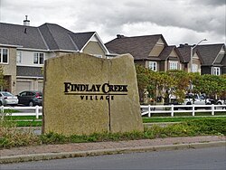
The Findlay Creek Community Association is the volunteer group representing the interests of the community.

Findlay Creek also has a small shopping centre and 3 gas stations.

History

In May 1988, the Regional Municipality of Ottawa-Carleton began rezoning this future urban area. Official plans were released in May 1989 with the Leitrim Official Plan Amendment No. 10. [2] This initial plan was met with push-back from groups such as the Ottawa Field Naturalists Club due to the sensitive nature of the wetland system this subdivision would partially destroy, however plans ultimately went forward.

Prior to the establishment of the Findlay Creek community, the area was a primarily undeveloped and used for a mix of residential, industrial, and institutional needs. In November 2003, the Leitrim Community Design Plan (CDP) was initiated to develop the community with a mix of land uses and housing types.

A plan to widen Bank Street along Findlay Creek was announced in 2020, slated to begin in 2022. [3]

Geography

Findlay Creek is located just south-west of the intersection of Leitrim Road and Bank Street, and stretches west to Albion Road. The eponymous Findlay Creek springs in the Leitrim Wetlands, directly south of the neighbourhood, and is a tributary of the North Castor River.

Transport

The south end of Findlay Creek backs directly onto the Leitrim Wetlands Findlay Creek Dr mosbo6.jpg
The south end of Findlay Creek backs directly onto the Leitrim Wetlands

As of fall 2021, two regular OC Transpo routes serve Findlay Creek: the local route 93 and the connexion route 294. In addition, the school route 699 serving École secondaire publique Pierre-De-Blois in Barrhaven passes through the neighbourhood. [4]

Schools

Related Research Articles

<span class="mw-page-title-main">Blossom Park</span> Neighbourhood in Ottawa, Ontario, Canada

Blossom Park is a neighbourhood in Gloucester-Southgate Ward in the south-end of the city of Ottawa, Ontario, Canada. Before the 2001 city of Ottawa amalgamation it was a suburb of the city of Gloucester. The current limits of the neighbourhood are: Hunt Club Road to the north, Airport Parkway to the west, Conroy Road to the east and the Greenbelt to the south.

<span class="mw-page-title-main">Bank Street (Ottawa)</span> Street in Ottawa, Ontario, Canada

Bank Street is the major commercial north-south street in Ottawa, Ontario, Canada. It runs south from Wellington Street in downtown Ottawa, south through the neighbourhoods of Centretown, The Glebe, Old Ottawa South, Alta Vista, Hunt Club, and then through the villages of Blossom Park, Leitrim, South Gloucester, Greely, Metcalfe, Spring Hill, and Vernon before exiting the city limits at Belmeade Road.

<span class="mw-page-title-main">Old Ottawa South</span> Neighbourhood in Ottawa, Ontario, Canada

Old Ottawa South is an older urban neighbourhood in Capital Ward in Ottawa, Ontario, Canada. Old Ottawa South is a relatively small and compact neighbourhood, located between the Rideau Canal and the Rideau River. The eastern boundary is Avenue Road. Bronson Avenue forms the western border of the residential neighbourhood. Carleton University is on the other (western) side of Bronson but the campus can be considered to be geographically within Old Ottawa South as the campus is also nestled between the river and the canal.

Russell Road is an arterial road in Eastern Ontario, Canada. It begins in Ottawa in the Riverview neighbourhood and runs eastward through the rural communities of Ramsayville, Carlsbad Springs and Bearbrook in Ottawa and through the Municipality of Clarence-Rockland, connecting the communities of Cheney and Bourget, ending at Boundary Road on the eastern border of Clarence Rockland. In Ottawa it is officially Ottawa Road #26, and in Clarence-Rockland as United Counties of Prescott and Russell County Road #2.

<span class="mw-page-title-main">Orléans (federal electoral district)</span> Federal electoral district in Ontario, Canada

<span class="mw-page-title-main">Greely, Ontario</span>

Greely is a suburban-rural community in Ottawa, Ontario, Canada. Located south of the city in Osgoode Ward, it was part of the Township of Osgoode prior to amalgamation in 2001. Greely is currently the largest rural village in terms of land area and the third largest in terms of population in the City of Ottawa. According to the Greely Community Association, it is bounded on the east by Sale Barn Road and Greyscreek Road, on the north by Mitch Owens on the west by Manotick Station Road, and on the south by Snake Island Road. According to the Canada 2011 Census, the population within these boundaries was 9,049.

<span class="mw-page-title-main">Barrhaven</span> Community in Ontario, Canada

Barrhaven is a suburb of Ottawa, Ontario, Canada. It is located about 17 km (11 mi) southwest of the city's downtown core. Prior to amalgamation with Ottawa in 2001, Barrhaven was part of the City of Nepean. Its population as of the Canada 2021 Census was 103,234.

<span class="mw-page-title-main">Woodroffe Avenue</span> Road in Ottawa, Ontario, Canada

Woodroffe Avenue is a major north-south arterial road in Ottawa, Ontario, Canada's west end. It runs south from the Kichi Zibi Mikan through Baseline Road and Barrhaven to just short of Prince of Wales Drive near Manotick. The road runs through the heart of Nepean in Ottawa's west end. A satellite Via Rail station is also located at the intersection of Fallowfield Road.

<span class="mw-page-title-main">Albion Road (Ottawa)</span>

Albion Road is an important north–south road in the southern part of Ottawa, Ontario, Canada. The street begins in the north as Albion Road North, at Walkley Road.

Riverside South is a suburban community in Gloucester-South Nepean Ward in the south end of the city of Ottawa, Ontario, Canada, just southwest of Ottawa Macdonald–Cartier International Airport. Prior to amalgamation in 2001, the area was located in the city of Gloucester. Its population, according to the Canada 2021 Census, was 19,802.

Leitrim is a dispersed rural community in the South Gloucester section of Ottawa, Ontario, Canada, and is named for the Irish County Leitrim. The area comprises the rapidly growing Findlay Creek suburban neighbourhood.

King's Highway 31, commonly referred to as Highway 31 and historically known as the Metcalfe Road, was a provincially maintained highway in the Canadian province of Ontario. The 76.93-kilometre (47.80 mi) route connected Highway 2 in Morrisburg with the Chaudière Bridge at the Ontario–Quebec boundary in downtown Ottawa.

<span class="mw-page-title-main">Ottawa Road 174</span> Controlled-access highway in Ottawa

Ottawa Road 174, formerly Ottawa-Carleton Regional Road 174 and commonly referred to as Highway 174, is a city-maintained road in the City of Ottawa which serves the eastern suburbs of Orléans and Cumberland. The four-lane freeway segment between Highway 417/Aviation Parkway junction to Trim Road is also known as the Queensway, in addition the Queensway name continues to be applied to Highway 417 west of that intersection. Although the road continues through the towns of Rockland and Hawkesbury to the Quebec border, the portion east of the Ottawa city boundary is known as Prescott and Russell County Road 17.

<span class="mw-page-title-main">Orléans (provincial electoral district)</span> Provincial electoral district in Ontario, Canada

<span class="mw-page-title-main">Leitrim Wetlands</span>

The Leitrim Wetlands is a large provincially significant bog just south of Findlay Creek, a suburban neighbourhood in the city of Ottawa, Ontario, Canada. Efforts to protect it from development have been a longstanding issue for environmental organizations in the city.

Katimavik-Hazeldean is a neighbourhood in Kanata South Ward in the west end of Ottawa, Ontario, Canada. It is located in the former City of Kanata which amalgamated into Ottawa in 2001. It is located in south-central Kanata, bounded by Eagleson Road to the east, Hazeldean Road to the south, the Carp River to the west, and Highway 417 to the north.

<span class="mw-page-title-main">Riverview station</span>

Riverview is an OC Transpo transit station located in the Riverside South community in Ottawa, Ontario. The station is located south of Earl Armstrong Road east of River Road.

<span class="mw-page-title-main">Leitrim station</span> Railway station in Ottawa, Ontario, Canada

Leitrim is an OC Transpo transit station in the suburban community of Leitrim in Ottawa, Ontario. It is located on Gilligan Road, which is just west of Albion Road and south off Leitrim Road, near the former Bytown and Prescott Railway Line.

Country Place is a residential neighbourhood near the geographical centre of Ottawa, Canada in Knoxdale-Merivale Ward. Prior to 2001, it was part of the former city of Nepean. It is a mature residential subdivision with about 400 houses located just inside the Ottawa greenbelt near the Rideau River, and about 11 km from downtown Ottawa. It is bordered by the Black Rapids Creek and the greenbelt to the south, Prince of Wales Drive to the east, Merivale Road to the west, and the Pineglen community to the north. Amberwood Crescent meanders through the community, exiting onto Prince of Wales and Merivale. Tennyson Drive links Country Place to Pineglen.

References

  1. "35060161 Ontario [Aggregate dissemination area]". 9 February 2022. Retrieved 14 April 2022.
  2. Dugal, Albert W. (1990). "Albion Road Wetlands: Part 1". Trail & Landscape. 24 (2): 56–78.
  3. "Councillors announce widening of Bank Street to four lanes in Findlay Creek area". Ottawa. 2020-05-25. Archived from the original on 2021-10-02. Retrieved 2021-10-02.
  4. "Travel Planner". plan.octranspo.com. Archived from the original on 2021-09-10. Retrieved 2021-10-02.
  5. "Our School". Ottawa-Carleton District School Board. Archived from the original on August 3, 2021. Retrieved August 3, 2021.

45°19′10″N75°35′59″W / 45.3195°N 75.5997°W / 45.3195; -75.5997