Floodwood River (Michigan)

Last updated
Floodwood River
Country United States
Physical characteristics
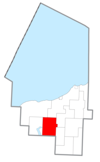
Main source Ontonagon County
River mouth Lake Superior
600 ft (180 m) [1]

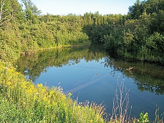
Floodwood River is an 11.0-mile-long (17.7 km) [2] river in Ontonagon County in the U.S. state of Michigan.

Ontonagon County, Michigan County in the United States

Ontonagon County is a county in the Upper Peninsula of the U.S. state of Michigan. As of the 2010 United States Census, the population was 6,780, making it Michigan's third-least populous county. The county seat is Ontonagon. The county was set off in 1843, and organized in 1848. Its territory had been organized as part of Chippewa and Mackinac counties. With increasing population in the area, more counties were organized. After Ontonagon was organized, it was split to create Gogebic County. It is also the westernmost U.S. county that uses the Eastern Time Zone.

U.S. state constituent political entity of the United States

In the United States, a state is a constituent political entity, of which there are currently 50. Bound together in a political union, each state holds governmental jurisdiction over a separate and defined geographic territory and shares its sovereignty with the federal government. Due to this shared sovereignty, Americans are citizens both of the federal republic and of the state in which they reside. State citizenship and residency are flexible, and no government approval is required to move between states, except for persons restricted by certain types of court orders. Four states use the term commonwealth rather than state in their full official names.

Michigan State of the United States of America

Michigan is a state in the Great Lakes and Midwestern regions of the United States. The state's name, Michigan, originates from the Ojibwe word mishigamaa, meaning "large water" or "large lake". With a population of about 10 million, Michigan is the tenth most populous of the 50 United States, with the 11th most extensive total area, and is the largest state by total area east of the Mississippi River. Its capital is Lansing, and its largest city is Detroit. Metro Detroit is among the nation's most populous and largest metropolitan economies.

The Floodwood River rises from the highlands of southern Ontonagon Township at 46°43′13″N89°23′04″W / 46.72028°N 89.38444°W / 46.72028; -89.38444 (Floodwood River (source)) [1] and flows north into Lake Superior at 46°50′58″N89°23′51″W / 46.84944°N 89.39750°W / 46.84944; -89.39750 (Floodwood River (mouth)) [1] approximately 4 miles (6.4 km) west of the village of Ontonagon.

Ontonagon Township, Michigan Civil township in Michigan, United States

Ontonagon Township is a civil township of Ontonagon County in the U.S. state of Michigan. The population was 2,954 at the 2000 census.

Lake Superior largest of the Great Lakes of North America

Lake Superior, the largest of the Great Lakes of North America, is also the world's largest freshwater lake by surface area, and the third largest freshwater lake by volume. The lake is shared by the Canadian province of Ontario to the north, the U.S. state of Minnesota to the west, and Wisconsin and the Upper Peninsula of Michigan to the south. The farthest north and west of the Great Lakes chain, Superior has the highest elevation of all five great lakes and drains into the St. Mary's River.

Ontonagon, Michigan Village in Michigan, United States

Ontonagon is a village in the U.S. state of Michigan. The population was 1,494 at the 2010 census. It is the county seat of Ontonagon County.

The Floodwood is one of several nearly parallel streams draining the highlands of Ontonagon Township. Other nearby rivers (from west to east) include:

The Little Iron River is a 17.9-mile-long (28.8 km) river in western Ontonagon County on the Upper Peninsula of Michigan in the United States. It is a tributary of Lake Superior.

The Iron River is a 17.1-mile-long (27.5 km) river in Iron County, Michigan, in the United States. It flows from northwest to southeast through the city of Iron River to the Brule River. It is part of the Menominee River watershed, flowing to Lake Michigan.

Mineral River river in the United States of America

The Mineral River is an 18.7-mile-long (30.1 km) tributary of Lake Superior on the western Upper Peninsula of Michigan in the United States. It flows for its entire length in western Ontonagon County, rising in the Ottawa National Forest and flowing generally northward to meet Lake Superior about 11 miles (18 km) west-southwest of Ontonagon. The United States Board on Geographic Names settled on "Mineral River" as the stream's name in 1976; according to the Geographic Names Information System it has also been known historically as "Beaver Creek".

Related Research Articles

Sagola Township, Michigan Civil township in Michigan, United States

Sagola Township is a civil township of Dickinson County in the U.S. state of Michigan. The population was 1,106 at the 2010 census, slightly down from 1,169 at the 2000 census.

Garfield Township, Mackinac County, Michigan Civil township in Michigan, United States

Garfield Township is a civil township of Mackinac County in the U.S. state of Michigan. The population was 1,146 at the 2010 census.

Matchwood Township, Michigan Civil township in Michigan, United States

Matchwood Township is a civil township of Ontonagon County in the U.S. state of Michigan. The population was 115 at the 2000 census.

McMillan Township, Ontonagon County, Michigan Civil township in Michigan, United States

McMillan Township is a civil township of Ontonagon County in the U.S. state of Michigan. The population was 601 at the 2000 census.

Stannard Township, Michigan Civil township in Michigan, United States

Stannard Township is a civil township of Ontonagon County, in the U.S. state of Michigan. The population was 833 at the 2000 census.

Firesteel River is an 18.3-mile-long (29.5 km) river in Ontonagon County on the Upper Peninsula of the U.S. state of Michigan. The river flows generally northwest between the Flintsteel River and the West Sleeping River and empties into Lake Superior. Branches of the river are identified as the West Branch and East Branch, and the river receives Black Creek about three miles north of the junction of the two main branches.

Black River is an 11.0-mile-long (17.7 km) river on the Upper Peninsula of the U.S. state of Michigan. The river flows into Lake Michigan at 46°05′37″N85°20′30″W, approximately 5 miles (8 km) east of Naubinway.

Cedar River (Gladwin County, Michigan) river in Clare and Gladwin counties, Michigan, United States

The Cedar River is a 29.0-mile-long (46.7 km) river in the U.S. state of Michigan, flowing through Clare County and Gladwin County.

Ontonagon River river in Michigan

The Ontonagon River is a river flowing to Lake Superior on the western Upper Peninsula of Michigan in the United States. The main stem of the river is 25 miles (40 km) long and is formed by a confluence of several longer branches, portions of which have been collectively designated as a National Wild and Scenic River. Several waterfalls occur on the river including Agate Falls and Bond Falls.

The Mitchigan River is a 14.9-mile-long (24.0 km) stream in the Upper Peninsula of the U.S. state of Michigan. It flows into the Fence River at 46°17′27″N88°09′58″W in northeast Iron County in Mansfield Township. The Fence River is a tributary of the Michigamme River, which is itself a tributary the Menominee River, flowing to Lake Michigan. The Mitchigan River has its source in the southeast corner of Baraga County at 46°24′58″N88°08′05″W. It flows mostly southward along the boundary between Iron and Marquette counties, crossing briefly into western Marquette County.

Richland, California Former settlement in California, United States

Richland is a former settlement in Butte County, California. It was located 3.5 miles (5.6 km) east-southeast of Biggs, at an elevation of 102 feet. It still appeared at its prior location on maps as of 1912 but moved half a mile west by 1952.

The Floodwood River is a 32.1-mile-long (51.7 km) tributary of the Saint Louis River of Minnesota, United States, joining the Saint Louis at the city of Floodwood.

The East Sleeping River is a 21.3-mile-long (34.3 km) river in Ontonagon County, Michigan, in the United States. It is a tributary of Lake Superior.

The Pelton River is a 5.9-mile-long (9.5 km) tributary of the Slate River in Gogebic County on the Upper Peninsula of Michigan in the United States. Via the Slate River, its water flows to Lake Gogebic, which feeds the West Branch Ontonagon River, flowing to the Ontonagon River and ultimately to Lake Superior.

The West Sleeping River is an 8.5-mile-long (13.7 km) river in Ontonagon County, Michigan, in the United States. It is a tributary of Lake Superior.

The Little Black River is a 19.6-mile-long (31.5 km) stream in Gogebic County in the U.S. state of Michigan. It rises in Bessemer Township at 46°21′23″N89°53′09″W} and flows mostly north to Sunday Lake in Wakefield, then westward for approximately a mile before emptying into the Black River at 46°29′18″N89°59′49″W, just north of Ramsay. The water is approximately 14 inches (360 mm) deep.

Carp River is a 10.3-mile-long (16.6 km) river in Gogebic and Ontonagon counties in the U.S. state of Michigan. The Carp River is formed by the outflow of the Lake of the Clouds at 46°48′04″N89°45′38″W in the Porcupine Mountains of the Upper Peninsula.

Little Carp River is a 15-mile-long (24 km) river in Gogebic and Ontonagon counties in the U.S. state of Michigan. The Carp River rises at 46°45′54″N89°44′44″W in the Porcupine Mountains of the Upper Peninsula.

References

  1. 1 2 3 "Floodwood River". Geographic Names Information System . United States Geological Survey.
  2. U.S. Geological Survey. National Hydrography Dataset high-resolution flowline data. The National Map Archived 2012-04-05 at WebCite , accessed February 3, 2012