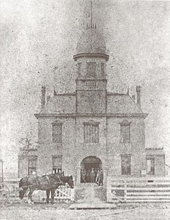
St. Mary Parish is a parish located in the U.S. state of Louisiana. As of the 2010 census, the population was 54,650. The parish seat is Franklin. The parish was created in 1811.

Acadia Parish is a parish located in the U.S. state of Louisiana. As of the 2010 census, the population was 61,773. The parish seat is Crowley. The parish was founded from parts of St. Landry Parish in 1886, and later an election was held to determine the parish seat, ending when Crowley beat Rayne and Prairie Hayes.

Norco is a census-designated place (CDP) in St. Charles Parish, Louisiana, United States. The population was 3,579 at the 2000 census. The community is home to a major Shell petroleum refinery. The CDP's name is derived from the New Orleans Refining Company.

St Florence is a village, parish and community situated 4 miles (6 km) to the west of the seaside town of Tenby in Pembrokeshire, Wales. It had a population of 490, 650 751(Parish Headcount) in 2001. The present name of the village is taken from the saint to whom the church is dedicated, St. Florentius.

Scott Landing is an unincorporated community in Madison Parish, Louisiana and Richland Parish, Louisiana, United States. The community is located 5 miles SE. of Dunn, Louisiana.

Warden is an unincorporated community in Richland Parish, Louisiana, United States. The community is located 5 miles N. of Delhi, Louisiana.

Enon is an unincorporated community in Washington Parish, Louisiana, United States. The community is located 9 miles SE of Franklinton, Louisiana.

Catfish Landing is an unincorporated community in Livingston Parish, Louisiana, United States. The community is located less than 2 miles east of Maurepas and 5 miles southwest of Killian on the bank of Amite River.

Denson also known as Bear Island is an unincorporated community in Livingston Parish, Louisiana, United States. The community is located 2 miles southeast of Maurepas and 6 miles southwest of Killian north of the Blind River.

Georgeville is an unincorporated community in Livingston Parish, Louisiana, United States. The community is located 8 miles southwest of Livingston and 2 miles southeast of Montpelier on Louisiana Highway 43.

Head of Island is an unincorporated community in Livingston Parish, Louisiana, United States. The community is located on Louisiana Highway 22, 5 miles west of Maurepas and 5 miles southeast of French Settlement south of the Amite River.

Horse Bluff Landing is an unincorporated community in Livingston Parish, Louisiana, United States. The community is located less than 3 miles west of Killian and 5 miles northeast of Maurepas on the bank of Tickfaw River. The Tickfaw State Park is located 1 mile to the northwest across the Tickfaw River.

Magnolia, also known as Otts Mill, is an unincorporated community in Livingston Parish, Louisiana, United States. The community is located 5 miles northwest of Livingston and 2 miles west of Starns on Louisiana Highway 442 at the intersection with Louisiana Highway 1036.

Van Buren is an unincorporated community in Livingston Parish, Louisiana, United States. The community is located less than 4 miles south of Holden and 6 miles southeast of Livingston near the Tickfaw River.

Verdun is an unincorporated community in Livingston Parish, Louisiana, United States. The community is located less than 4 miles east of French Settlement and 5 miles northwest of Maurepas.

Fred is an unincorporated community in East Baton Rouge Parish, Louisiana, United States. The community is located less than 3 miles east of Zachary and 5 miles northeast of Baker near the Comite River.

Gecko is an unincorporated community in St. Martin Parish, Louisiana, United States. The community is located less than 2 miles northwest of Breaux Bridge and 5 miles southwest of Cecilia on the bank of Bayou Teche.


