Florida State Road 145

Last updated

Florida 145.svg

State Road 145

Florida State Road 145
Florida State Road 145 highlighted in red
Route information
Maintained by FDOT
Main segment
Length13.723 mi [1]  (22.085 km)
South endUS 90.svgFlorida 53.svg US 90  / SR 53 in Madison
North endGeorgia 31.svg SR 31 towards Valdosta, GA
Fort Walton Beach segment
Length0.5 mi [2]  (800 m)
South endUS 98.svg US 98 in Fort Walton Beach
North endFlorida 85.svg SR 85 in Fort Walton Beach
Location
Country United States
State Florida
Counties Madison, Okaloosa
Highway system
Florida 143.svg SR 143 Florida 152.svg SR 152

State Road 145 (SR 145) runs north from US 90 and State Road 53 in Madison to the Georgia border, where it becomes State Route 31. [3] It is also a short route in Fort Walton Beach between US 98 and State Road 85. [4]

Contents

Route description

Madison County

Southern terminus FL 145 End, Madison.jpg
Southern terminus

State Road 145 begins in Madison at the southeastern terminus of the US 90/SR 53 overlap as Duval Street. It runs for four blocks until the intersection of East Livingston Street, where it makes a sharp turn to the right. After intersecting the southern terminus of County Road 591 (Rocky Ford Road), the Madison County Four Freedoms Trail [5] begins along the southeast side of the road, which begins to curve toward the north and the street name is changed to Colin Kelly Highway. The surroundings along SR 145 north of Madison are typical of most state and county two-lane roads along the Florida Panhandle, consisting of random farms and forests with occasional embankments over wetlands. The road runs mostly northeast from the city, but straightens out briefly around the intersection of Rocky Springs Church Road. It curves back to the northeast after the intersection of two dirt roads named Northeast 113th and 115th Avenues. where the Four Freedoms Trail crosses from the east side to the west side. The closest resemblance to a major intersection at this point is with County Road 150, where a concurrency begins just before the road enters the unincorporated community of Pinetta. Within Pinetta, the trail moves away from SR 145/CR 150 just south of the intersection of Poppy Trail and runs along the parallel Northeast Persimmon Drive, while SR 145/CR 150 continues north through the town. The SR 145/CR 150 concurrency ends at Northeast Belleville Road where CR 150 turns east, and after this SR 145 curves even more toward the northeast than it was since leaving Madison. Eventually, that eastern trajectory begins to wane. As the road curves back toward the north, the last intersection in the state is with Northeast Oak Hill Road and the street name of SR 145 changes from Colin Kelly Highway to Madison Highway. State Road 145 ends at the Florida-Georgia State Line, becoming Georgia State Route 31 as it crosses a bridge over the Withlacoochee River.

Fort Walton Beach

The other State Road 145 can be found in Fort Walton Beach, and has no connection to the SR 145 in Madison County. Known locally as Perry Avenue Southeast, it has two northbound lanes and one southbound lane, although provisions for left turn lanes can be found in either direction. The route begins at US 98 east of the wye intersection with SR 85 and west of the John T. Brooks Bridge. It runs straight north and south until the intersection with Southeast Ferry Road Southeast which it joins running northeast. At the intersection of Chestnut Avenue Southeast, Perry Avenue breaks away from Ferry Road and joins that street until halfway between Third and Fourth Streets where it branches off to the northwest to terminate at State Road 85.

Major intersections

The entire route is in Madison County.

Locationmi [1] kmDestinationsNotes
Madison 0.0000.000US 90.svgFlorida 53.svgTo plate blue.svg
I-10.svg
US 90  / SR 53 (Base Street / Duval Street / SR 10) to I-10  Live Oak, Greenville
0.2180.351East Livingston Street - Downtown Madison
0.4770.768North plate county.svg
CR 591 jct.svg
CR 591 north (Northeast Rocky Ford Road)
3.5815.763East plate county.svg
CR 254 jct.svg
CR 254 east (Northeast Dusty Miller Avenue)
9.01614.510West plate county.svg
CR 150 jct.svg
CR 150 west
Pinetta 10.01316.114East plate county.svg
CR 150 jct.svg
CR 150 east (Northeast Bellville Road)
13.72322.085North plate.svg
Georgia 31.svg
SR 31 north Valdosta
Georgia state line
1.000 mi = 1.609 km; 1.000 km = 0.621 mi

Related Research Articles

<span class="mw-page-title-main">U.S. Route 331</span> Highway in the United States

U.S. Route 331 is a spur of U.S. Route 31. It currently runs for 150 miles (240 km) from Santa Rosa Beach, Florida east of Fort Walton Beach at US 98 to Montgomery, Alabama at US 80 and US 82. Unlike US 131, US 231, and US 431, US 331 never intersects with its "parent" route, US 31; however, the two routes do come within 4 miles (6.4 km) of each other in Montgomery.

<span class="mw-page-title-main">Florida State Road 50</span> Highway in Florida

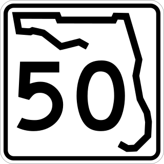
State Road 50 runs across the center of the U.S. state of Florida through Orlando, with its termini at SR 55 at Weeki Wachee and SR 5 in Titusville.

<span class="mw-page-title-main">Florida State Road 15A</span> Highway in Florida

State Road 15A is part of the Florida State Road System, and a suffixed alternate of State Road 15. Along with its parent route, SR 15A is signed north–south.

<span class="mw-page-title-main">Florida State Road 54</span> Highway in Florida

State Road 54 is located in the Tampa Bay Area, north of Tampa itself, and runs from US 19 in Elfers in the west to US 301 in Zephyrhills, in the east. In between it passes through Wesley Chapel, Land o' Lakes, and Elfers.

<span class="mw-page-title-main">Florida State Road 100</span> Highway in Florida

State Road 100 is a 153-mile-long (246 km) east–west highway serving northeast Florida. Its western terminus is at the Georgia-Florida border four miles (6.4 km) north of Avoca, Florida ; its eastern terminus is an intersection with Shore Scenic Highway in Flagler Beach. The portion west of Lake City is only signed as portions of US 41 and US 129, both of which run north–south.

<span class="mw-page-title-main">Florida State Road 40</span> Highway in Florida

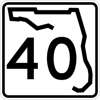
State Road 40 is a 91.8-mile-long (147.7 km) east–west highway across northern and east-central Florida, running from U.S. Highway 41 (US 41) in Rainbow Lakes Estates eastwards through Ocala over the Ocklawaha River and through the heart of the Ocala National Forest to SR A1A in Ormond Beach. Names of the road include Silver Springs Boulevard in Ocala, Fort Brooks Road from Silver Springs through Astor, Butler Road in Astor, and Granada Boulevard in Ormond Beach. Former sections in Ormond Beach are named "Old Tomoka Road" and "Old Tomoka Avenue."

<span class="mw-page-title-main">Florida State Road 12</span> Highway in Florida

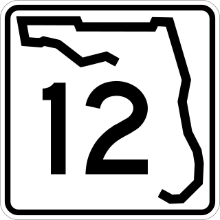
State Road 12 (SR 12) is an east–west route in the Florida Panhandle, running from SR 20 in Bristol to U.S. Route 27 (US 27) in Havana.

<span class="mw-page-title-main">Florida State Road 6</span> State highway in Florida, United States

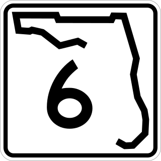
State Road 6 (SR 6) is an east–west route in Madison and Hamilton Counties, running from U.S. Route 90 (US 90) east of Madison to US 129 in Jasper, the last five miles (8 km) concurrent with US 41.

<span class="mw-page-title-main">Florida State Road 24</span> Highway in Florida

State Road 24 is an east–west state highway that runs between Cedar Key on the Gulf of Mexico and Waldo, Florida, at US 301. State Road 24 runs along a former branch of the Seaboard Air Line Railroad. This branch was originally owned by the Florida Railway and Navigation Company, and used to lead to ferries to both Pensacola, Florida and New Orleans, Louisiana. It also passes through Rosewood, site of the infamous 1923 massacre.

<span class="mw-page-title-main">Florida State Road 26</span> Highway in Florida

State Road 26 is a 62.172-mile-long (100.056 km) east–west route across North Central Florida.

<span class="mw-page-title-main">Florida State Road 48</span> Highway in Florida

State Road 48 (SR 48) was an east–west state highway that ran from U.S. Highway 41 in Floral City, Florida, to Florida State Road 19 in Howey-in-the-Hills, Florida. In the last years of the route's existence, it was a 2.167 miles (3.487 km) state road in Bushnell, Florida, which ran from Interstate 75 (I-75) at exit 314 to U.S. Highway 301 (US 301). Today, all segments are designated County Road 48 (CR 48), where they are under county maintenance. Segments in Sumter County are part of the Scenic Sumter Heritage Byway.

<span class="mw-page-title-main">U.S. Route 41 in Florida</span> Highway in Florida

U.S. Highway 41 (US 41) in the state of Florida is a north–south United States Highway. It runs 479 miles (771 km) from Miami in South Florida northwest to the Georgia state line north of the Lake City area. Within the state, US 41 is paralleled by Interstate 75 (I-75) all the way from Miami to Georgia, and I-75 has largely supplanted US 41 as a major highway.

<span class="mw-page-title-main">U.S. Route 90 in Florida</span> United States historic place

U.S. Route 90 (US 90) in the state of Florida is the northernmost east–west United States Numbered Highway in the state. US 90 passes through the county seats of all 15 counties on its course in Florida, and it is also the road upon which many of the county courthouses are located. It is never more than six miles (9.7 km) from Interstate 10 (I-10) throughout the state. It runs as a two-lane highway through most of the sparsely populated inland areas of the Florida Panhandle, widening to four lanes through and near several towns. The speed limit is 55 mph (89 km/h) for all rural points west of Monticello, and it is 60 mph (97 km/h) on all rural points from where it enters Madison County as far as Glen St. Mary.

<span class="mw-page-title-main">U.S. Route 98 in Florida</span> Highway in Florida

U.S. Route 98 is a major east-west thoroughfare through the U.S. state of Florida. Spanning 670.959 miles (1,079.804 km), it connects Pensacola and the Alabama/Florida state line to the west with Palm Beach and the Atlantic coast in the east. It is the longest US road in Florida, as well as the longest US road in any state east of the Mississippi River.

<span class="mw-page-title-main">Florida State Road 18</span> Highway in Florida

State Road 18 is a short state road in the U.S. state of Florida. It begins in Worthington Springs in southern Union County and travels eastward for 6.60 miles (10.62 km) into Bradford County until it becomes County Road 18 at Brooker. It also has county road extensions, one of which is between Fort White and Worthington Springs, and the other between Brooker and SR 100 north of Theressa.

<span class="mw-page-title-main">Florida State Road 83</span> State highway in Florida, United States

State Road 83 is the state designation for U.S. Route 331 between US 98(SR 30) in Santa Rosa Beach and US 90(SR 10) in DeFuniak Springs. It also includes an independent route from DeFuniak Springs to the Florida-Alabama State Line. The entire route is in Walton County.

<span class="mw-page-title-main">Florida State Road 69</span> State highway in Florida, United States

State Road 69 is a road running through Calhoun and Jackson counties in northwest Florida. The road is almost entirely two-lanes wide.

<span class="mw-page-title-main">Florida State Road 247</span> State highway in Florida, United States

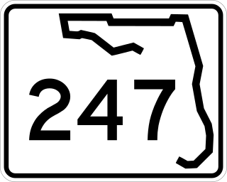
State Road 247 is a southwest to northeast state highway between U.S. Route 129 in Branford, Suwannee County, Florida and US 90 in Lake City, Columbia County, Florida. It is almost entirely a two-lane undivided highway except at its termini, and some intersections, where it contains left-turn lanes. Between its termini, SR 247 intersects with no state roads other than former ones.

<span class="mw-page-title-main">Florida State Road 73</span> State highway in Florida, United States

State Road 73, the Wayne Mixson State Highway, is a state highway in northwest Florida that runs through Calhoun and Jackson Counties, although it runs through more of the former county than the latter one. The road is always on the west side of the Chipola River, and is almost entirely two-lanes wide, except with its concurrency with US 90 in Marianna where it is four-lanes wide. It was named in honor of former Florida governor Wayne Mixson.

References

Template:Attached KML/Florida State Road 145
KML is not from Wikidata
  1. 1 2 FDOT straight line diagrams Archived March 6, 2014, at the Wayback Machine , accessed March 2014
  2. Florida State Road 145 distance on Google Maps
  3. "FDOT Map of Madison County (Including SR 145; Madison through Pinetta)" (PDF). Archived from the original (PDF) on 2012-05-30. Retrieved 2013-01-17.
  4. "FDOT Map of Okaloosa County (Including SR 145; Fort Walton Beach)" (PDF). Archived from the original (PDF) on 2013-02-14. Retrieved 2013-01-17.
  5. Four Freedoms Trail (Madison County, Florida Recreation Department)