Florida State Road 97

Last updated

Florida 97.svg

State Road 97

Florida State Road 97
SR 97 highlighted in red
Route information
Maintained by FDOT
Length22.507 mi [1]  (36.222 km)
Major junctions
South endCR 95A jct.svg CR 95A in Molino
Major intersectionsUS 29.svg US 29 in Molino
CR 99A jct.svg CR 99A in Walnut Hill
North endAlabama 21.svg SR 21 in Atmore, AL
Location
Country United States
State Florida
Counties Escambia
Highway system
Florida 95.svg SR 95 US 98.svg US 98

State Road 97 (SR 97) is a south-north two-lane highway entirely in Escambia County, Florida. It runs from County Road 95A, just southeast of U.S. Highway 29 in Molino, to the Alabama state line near Atmore, where it becomes State Route 21. The road runs through the community of Walnut Hill and serves primarily to connect Pensacola to the northwest Escambia County and Atmore areas. In combination with SR 21, the road also provides a connection to Interstate 65.

Contents

Route description

View south from the north end of SR 97, March 2016 2016-03-23 08 00 16 "Welcome to Florida" sign along southbound Florida State Route 97 entering Escambia County, Florida from Atmore, Alabama.jpg
View south from the north end of SR 97, March 2016

SR 97 heads northwest from its southern terminus at County Road 95A, just east of passing under U.S. Highway 29/SR 95, in Molino. The road heads northwest through rural Escambia County and slowly turns into a northerly direction as it approaches Walnut Hill, north of which it is also known as Atmore Highway. Heading directly north from Walnut Hill, the road meets its northern terminus south of Atmore at the Alabama state line, where it becomes State Route 21. SR 97 intersects with several county roads, but does not meet with other state roads or US highways. [2]

The Florida Department of Transportation annual average daily traffic (AADT) numbers for 2012 show average numbers between 5,600 vehicles on the southern portion of the road, decreasing to 4,300 vehicles around Walnut Hill, and again increasing to 5,000 north of Walnut Hill, back to 5,600 vehicles at the road's northern terminus. [3] [4]

History

A 1922 map of Florida auto trails shows an unimproved auto trail running from Quintette, south of Molino, through what appears to be the Walnut Hill area, and then to Atmore. It appears that the portion of today's SR 97 from Walnut Hill (starting around mile 15) to its northern terminus corresponds to this 1922 auto trail. The southern portion also appears on this map, but is indicated as an unimportant road. [5]

In 1935, the current routing of SR 97, from Molino northwest to Walnut Hill, then north to Atmore, was extant as a third-class graded road, and was signed as SR 87 at the time. [6]

By 1955, SR 4 is being shown as a bituminous road, with its start at the intersection with US 29/SR 95 (now CR 95A) west of Molino, and traveling its current routing to Atmore. The road intersected what were then SR 99 and SR 380 (now both CR 99) around Walnut Hill, and SR 4 (now CR 4) south of the Alabama state line. [7]

On maps from 1978, the entire road had been paved in hard surface. The state roads it had intersected in 1955 had all been re-signed as county roads, bringing SR 97 to its current form. [8]

Major intersections

The entire route is in Escambia County.

Locationmi [1] kmDestinationsNotes
Molino 0.0000.000CR 95A jct.svg CR 95A
0.6100.982US 29.svg US 29 (SR 95) Cantonment, Century south end of state maintenance
Walnut Hill 13.50921.741North plate county.svg
CR 99 jct.svg
CR 99 north
14.24622.927South plate county.svg
CR 99 jct.svg
CR 99 south
15.13424.356CR 99A jct.svg CR 99A (Arthur Brown Road)
17.14327.589East plate county.svg
CR 164 jct.svg
CR 164 east
20.05032.267East plate county.svg
CR 4 jct.svg
CR 4 east Century
22.50736.222North plate.svg
Alabama 21.svg
SR 21 north Atmore
Continuation beyond Alabama state line
1.000 mi = 1.609 km; 1.000 km = 0.621 mi

See also

Related Research Articles

<span class="mw-page-title-main">U.S. Route 92</span> Highway in the United States

U.S. Route 92 or U.S. Highway 92 is a 181-mile (291 km.) U.S. Route entirely in the U.S. state of Florida. The western terminus is at US 19 Alt. and SR 687 in downtown St. Petersburg. The eastern terminus is at SR A1A in Daytona Beach.

<span class="mw-page-title-main">Florida State Road 916</span> State highway in Florida, United States

State Road 916, locally known as Northwest 138th Street, West 84th Street, North 135th Street, Opa-locka Boulevard, and Natural Bridge Road is a 10.253 miles (16.501 km) long east–west highway crossing northern Miami-Dade County, Florida. Its western terminus is at an interchange with Interstate 75 (I-75), the Palmetto Expressway, and the Gratigny Parkway on the boundary between Hialeah and Miami Lakes, traveling east to Biscayne Boulevard.

<span class="mw-page-title-main">Florida State Road 944</span> State highway in Florida, United States

State Road 944, locally known as Hialeah Drive and North 54th Street, is a 5.822-mile-long (9.370 km) east–west street spanning Hialeah and Miami, Florida. The western terminus is an intersection with Okeechobee Road in Hialeah; its eastern terminus is an intersection with Biscayne Boulevard. Along with the north–south Palm Avenue, Hialeah Drive is a baseline for addresses in the City of Hialeah.

<span class="mw-page-title-main">Florida State Road 295</span> Highway in Florida

State Road 295 is a major highway in the Pensacola metropolitan area. Locally, SR 295 is also called Navy Boulevard, New Warrington Road, and Fairfield Drive. The southern terminus is at the entrance to Pensacola Naval Air Station, and the northern terminus is at an intersection with Fairfield Drive, Ninth Avenue and 12th Avenue in the city of Pensacola. This roadway is the main artery between southwestern Escambia County and the city of Pensacola.

<span class="mw-page-title-main">Florida State Road 100</span> Highway in Florida

State Road 100 is a 153-mile-long (246 km) east–west highway serving northeast Florida. Its western terminus is at the Georgia-Florida border four miles (6.4 km) north of Avoca, Florida ; its eastern terminus is an intersection with Shore Scenic Highway in Flagler Beach. The portion west of Lake City is only signed as portions of US 41 and US 129, both of which run north–south.

<span class="mw-page-title-main">Florida State Road 145</span> State highway in Florida, United States

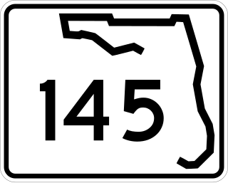
State Road 145 runs north from US 90 and State Road 53 in Madison to the Georgia border, where it becomes State Route 31. It is also a short route in Fort Walton Beach between US 98 and State Road 85.
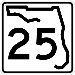
<span class="mw-page-title-main">Florida State Road 882</span> State highway in Florida, United States

State Road 882 (SR 882), locally known as Forest Hill Boulevard, is a 9.233-mile-long (14.859 km) east–west highway serving central Palm Beach County, Florida. Its western terminus is at an intersection of US 441-SR 7 in Wellington, Florida; and its eastern terminus is at an intersection with South Dixie Highway (U.S.1/SR 805 in West Palm Beach, Florida. SR 882 also serves as a primary commuter road for Greenacres, Palm Springs, Lake Clarke Shores, and West Palm Beach.

<span class="mw-page-title-main">Florida State Road 173</span> State highway in Florida, United States

State Road 173, locally known as Blue Angel Parkway, is a major thoroughfare in the Pensacola, Florida metropolitan area. SR 173 has its southern terminus at the western entrance to NAS Pensacola, and runs south–north through West Pensacola to its northern terminus at State Road 297.

<span class="mw-page-title-main">Florida State Road 296</span> State highway in Florida, United States

State Road 296 is a major thoroughfare in the Pensacola, Florida metropolitan area. It is an east–west route running roughly through midtown Pensacola and West Pensacola. Locally, it is known as Michigan Avenue, Beverly Parkway, Brent Lane, Bayou Boulevard, and Perry Avenue. The western terminus of SR 296 is at U.S. Route 90. Westward of this intersection, County Road 296 connects to State Road 173. The eastern terminus of State Road 296 is again at US 90, this time in eastern Pensacola, where it is known as Cervantes Street.

<span class="mw-page-title-main">Alabama State Route 21</span> State highway in Alabama, United States

State Route 21 (SR 21) is a 279-mile (449 km) state highway that extends from the Florida state line, near Atmore in Escambia County to Piedmont in Calhoun County. The route travels almost the entire length of the state from the northeast to the southwest. It is the longest signed state route in Alabama.

<span class="mw-page-title-main">Ohio State Route 515</span> State highway in Holmes County, Ohio, US

State Route 515 is a north-south state highway located in east-central Ohio. Existing entirely within the northeastern portion of Holmes County in Ohio's Amish Country, SR 515 has its southern terminus at a signalized intersection with SR 39 in the unincorporated community of Walnut Creek. Its northern terminus is at a T-intersection with U.S. Route 62 (US 62) one mile (1.6 km) southwest of the hamlet of Winesburg.

<span class="mw-page-title-main">Florida State Road 4</span> State highway in Florida, United States

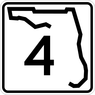
State Road 4 is a 43.705-mile-long (70.336 km) two-lane state highway in Escambia, Santa Rosa, and Okaloosa counties in the western corner of the Florida Panhandle. It is signed east–west, but the road is slightly diagonal. The road runs from Century near the Alabama state line at an intersection with U.S. Highway 29 (US 29), to the farming community of Milligan at an intersection with US 90.

<span class="mw-page-title-main">U.S. Route 29 in Florida</span> Highway in Florida

U.S. Highway 29 (US 29) in the state of Florida is the westernmost north–south United States Numbered Highway in the state. It runs 43.6 miles (70.2 km) from downtown Pensacola north to the Alabama state line entirely within Escambia County. US 29 runs as a four-lane highway through much of the Florida Panhandle, becoming six lanes through and near several towns. The highway's hidden state road designation is entirely State Road 95 (SR 95).

<span class="mw-page-title-main">U.S. Route 90 in Florida</span> United States historic place

U.S. Route 90 (US 90) in the state of Florida is the northernmost east–west United States Numbered Highway in the state. US 90 passes through the county seats of all 15 counties on its course in Florida, and it is also the road upon which many of the county courthouses are located. It is never more than six miles (9.7 km) from Interstate 10 (I-10) throughout the state. It runs as a two-lane highway through most of the sparsely populated inland areas of the Florida Panhandle, widening to four lanes through and near several towns. The speed limit is 55 mph (89 km/h) for all rural points west of Monticello, and it is 60 mph (97 km/h) on all rural points from where it enters Madison County as far as Glen St. Mary.

<span class="mw-page-title-main">U.S. Route 301 in Florida</span> Highway in Florida

U.S. Route 301 in Florida runs from the Sarasota-Bradenton-Venice, Florida Metropolitan Statistical Area northeast to the Greater Jacksonville Metropolitan Area. The road is a spur of U.S. Route 1, which it intersects in Callahan.

<span class="mw-page-title-main">Florida State Road 289</span> State highway in Florida, United States

State Road 289, known locally as North 9th Avenue, is a north–south major thoroughfare in Pensacola, Florida.

<span class="mw-page-title-main">Florida State Road 298</span> State highway in Florida, United States

State Road 298, known locally as Lillian Highway, is a mostly east–west thoroughfare in Pensacola, Florida. It runs from its intersection with U.S. Highway 98 and Dog Track Road, skirting Perdido Bay on its way east to its terminus at the West Pensacola spur of SR 295. SR 298 passes under the mainline of SR 295 without an interchange. It serves as a major route through the communities of Myrtle Grove and West Pensacola.

<span class="mw-page-title-main">Florida State Road 329</span> State highway in Florida, United States

State Road 329 (SR 329) was a short state highway traveling south and north through Gainesville, Florida. It comprised Main Street through Gainesville. The full length of the road extended from SR 331 to County Road 232 (CR 232). In the 1970s, the northern portion of the road, most of North Main Street, became County Road 329 (CR 329) while South Main Street was relinquished by the Florida Department of Transportation (FDOT) to the city. A small portion of the former state road in Gainesville is still maintained by the state as a portion of SR 20.
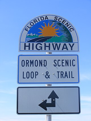
<span class="mw-page-title-main">Florida State Road 89</span> State highway in Florida, United States

State Road 89 is a north–south highway in the state of Florida that extends from U.S. Route 90 to the Alabama state line where it becomes County Road 55. All of SR 89 is contained within Santa Rosa County, and most of the road is a two-lane undivided highway, except between Milton and Point Baker, where it is a four-lane divided highway.

<span class="mw-page-title-main">Florida State Road 99</span> Highway in Florida

State Road 99 is a 2.56-mile-long (4.12 km) north–south highway running along Belulah Avenue in unincorporated Escambia County, Florida. It is the westernmost north–south two-digit highway in Florida. The southern terminus is at the intersection with Mobile Highway and Belulah Avenue, while the northern terminus is at the intersection of Isaacs Lane and Belulah Avenue.

References

  1. 1 2 FDOT straight line diagrams Archived March 6, 2014, at the Wayback Machine , accessed February 2014
  2. Florida Department of Transportation. "Florida County maps - Escambia County" (PDF). Archived from the original (PDF) on December 2, 2013. Retrieved November 14, 2013.
  3. Florida Department of Transportation. "FDOT GIS Geodatabase data" . Retrieved November 14, 2013.
  4. Florida Department of Transportation. "FDOT Florida Traffic Online (2012)". Archived from the original on July 28, 2013. Retrieved November 14, 2013.
  5. Rand McNally. "Rand McNally official 1922 auto trails map, district no. 21, State of Florida". Birmingham Public Library Digital Collections. Retrieved November 14, 2013.
  6. Florida -- State Road Dept. "State of Florida by counties State Road Dept. series (Escambia) - 1935". George A. Smathers Libraries, University of Florida. Retrieved November 14, 2013.
  7. Florida - Traffic and Planning Division United States - Bureau of Public Roads. "Escambia County, Florida general highway map - 1955". George A. Smathers Libraries, University of Florida. Retrieved November 14, 2013.
  8. Florida Dept. of Transportation. "General highway map Escambia County - 1978". George A. Smathers Libraries, University of Florida. Retrieved November 14, 2013.
Template:Attached KML/Florida State Road 97
KML is from Wikidata

Commons-logo.svg Media related to Florida State Road 97 at Wikimedia Commons