Gallery
 James John Floyd
 John Floyd
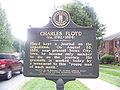 Charles Floyd
 2008 Area Scene
Floyd's Station was a fort on Beargrass Creek in what is now St. Matthews, Kentucky. In November 1779 James John Floyd built cabins and a stockade near what is now Breckenridge Lane. [1] In 1783, John Floyd, future Governor of Virginia was born in the Station. The pioneer's father was killed by Indians twelve days before the birth of his son. [2] The station was one of six on Beargrass Creek and was involved in local conflict with Native Americans in the area for the next five years. [3] All that remain today of Floyd's Station are a spring house and cemetery. [4]
Approximate location: 38°14′22.28″N85°38′46.85″W / 38.2395222°N 85.6463472°W


Jefferson County is located in the north central portion of the U.S. state of Kentucky. As of the 2020 census, the population was 782,969. It is the most populous county in the commonwealth.
Fern Creek is a historic community in southeastern Jefferson County, Kentucky, United States. The population was 20,009 at the 2008 census. In 2003, The area was annexed to the city of Louisville as part of a merger between the city and Jefferson County's unincorporated communities. Fern Creek was formerly a census-designated place. It is now considered a neighborhood of Louisville. It is located about 12 miles from Downtown Louisville.

Hurstbourne is a home rule-class city in Jefferson County, Kentucky, United States. The population was 4,216 at the 2010 census, up from 3,884 at the time of the 2000 U.S. census. It is part of the Louisville Metro Government.

St. Matthews is a city in Jefferson County, Kentucky, United States. It forms part of the Louisville Metro government but is separately incorporated as a home rule-class city. The population was 17,472 at the 2010 census, up from 15,852 at the 2000 census. It is the 23rd-largest city in the state. St. Matthews is one of the state's major shopping areas, home to the fifth-largest mall in Kentucky along with many smaller shopping centers along Shelbyville Road.

The Louisville metropolitan area is the 43rd largest metropolitan statistical area (MSA) in the United States. It had a population of 1,395,855 in 2020 according to the latest official census, and its principal city is Louisville, Kentucky.
Irish Hill is a neighborhood east of downtown Louisville, Kentucky USA. It is bounded by Baxter Avenue to the west, Lexington Road to the north, the middle fork of Beargrass Creek and I-64 to the east. Cave Hill Cemetery is located directly south of Irish Hill. It is in the inner Highlands area of Louisville.

Crescent Hill is a neighborhood four miles (6 km) east of downtown Louisville, Kentucky USA. This area was originally called "Beargrass" because it sits on a ridge between two forks of Beargrass Creek. The boundaries of Crescent Hill are N Ewing Ave to the St. Matthews city limit by Brownsboro Road to Lexington Road. Frankfort Avenue generally bisects the neighborhood.
Cherokee-Seneca is a neighborhood in Louisville, Kentucky, United States. It is bounded by I-64 and other neighborhoods, and includes the two large parks Cherokee Park and Seneca Park, as well as the homes built around those parks. The area is hilly, consisting of ridges around the middle fork of Beargrass Creek. It is home to the former Gardencourt Mansion, now part of the Louisville Presbyterian Theological Seminary.
Poplar Level is a neighborhood five miles (8 km) southeast of downtown Louisville, Kentucky, United States. It is part of the larger Camp Zachary Taylor area.
The Point was a thriving 19th century neighborhood in Louisville, Kentucky, east of Downtown Louisville and opposite Towhead Island along the Ohio River. It was also located north of the present day Butchertown area.

Louisville is a city in Jefferson County, in the U.S. state of Kentucky. It is located at the Falls of the Ohio River.

The Highlands is an area in Louisville, Kentucky which contains a high density of nightclubs, eclectic businesses, and many upscale and fast food restaurants. It is centered along a three-mile (5 km) stretch of Bardstown Road and Baxter Avenue and is so named because it sits atop a ridge between the middle and south forks of Beargrass Creek. The commercial area extends from the intersection of Bardstown Road and Taylorsville Road/Trevillian Way in the south, to the intersection of Baxter Avenue and Lexington Road in the north, a length of 3.2 miles (5.1 km). A 1⁄2-mile (800 m) section of the nearby Barret Avenue also contains many similar businesses. The residential area is separated from other adjacent areas like Germantown and Crescent Hill by the south and north forks of Beargrass Creek. The middle fork runs through Cherokee Park, and the south fork divides Germantown from Tyler Park, after flowing past several cemeteries and undeveloped forests downstream from Joe Creason Park. Due to its large collection of night clubs and restaurants, it is locally known as "Restaurant Row".
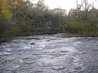
Beargrass Creek is the name given to several forks of a creek in Jefferson County, Kentucky. The Beargrass Creek watershed is one of the largest in the county, draining over 60 square miles (160 km2). It is fairly small, with an average discharge of 103 cubic feet per second at River Road in Louisville.
The Long Run massacre occurred on 13 September 1781 at the intersection of Floyd's Fork creek with Long Run Creek, along the Falls Trace, a trail in what is now eastern Jefferson County, Kentucky.
Eleven Jones Cave is located by Beargrass Creek in Louisville, Kentucky. It is 1,600 feet (490 m) southeast of the corner of Eastern Parkway and Poplar Level Road on the west bank, between Louisville Cemetery and Calvary Cemetery, near St. Xavier High School. It is developed in Louisville Limestone 448 feet above sea level. A spring discharges water into Beargrass Creek.

James John Floyd (1750–1783) was an early settler of St. Matthews, Kentucky, and helped lay out Louisville. In Kentucky he served as a Colonel of the Kentucky Militia in which he participated in raids with George Rogers Clark and later became one of the first judges of Kentucky.

Low Dutch Station was established in 1780 on the middle fork of Beargrass Creek in Kentucky. This station was settled by Dutch pioneers from Pennsylvania and was also known as New Holland Station. The station was one of a group of seven forts established on Beargrass Creek during this period in this area that is now a part of Louisville. The leader of the group was Hendrick Banta. The group of settlers were a part of the "Low Dutch Company" and had their own bylaws, a formal charter, and accounting procedures. The group had as its purpose the preservation of the language, culture and religion of the Dutch. The Dutch traveled from a settlement near Harrodsburg to Low Dutch Station.
Springs Station was a fort, established in 1780 in the area of Beal's Branch of Beargrass Creek in what is now Louisville, Kentucky. It was established at the time of the founding of Louisville as part of the settlement's defensive network of six forts, to protect settlers from attack by the Indians who were allied with the British.
Big Spring Country Club is a country club located in Louisville Metro. Prior to the 2003 city-county merger, the club's location was in an unincorporated part of Jefferson County, Kentucky, bordered by Louisville and St. Matthews. The club borders the Middle Fork of Beargrass Creek and the site of Floyd's Station, a fort built by John Floyd in 1779. It was named Big Spring because of a "big spring" which once furnished water for pioneer settlers in the area. This spring, located just below the 13th green of the golf course, is still flowing today.

Coxs Creek is an unincorporated community along U.S. Routes 31E/150 in Nelson County, Kentucky, United States, 4½ miles north of the county seat of Bardstown. It is named for Colonel Isaac Cox of Pennsylvania, who built a "fort" at the site in April 1775 before he fought in the American Revolutionary War, with the help of his brother James. The land had actually been his father's, but David moved back to Virginia before he developed it. More of a station, Cox's 1,000 acres (4.0 km2) was said to be the first pioneer station in Nelson County. Isaac Cox would later be the last white man to be killed by Indians during the time of the great Indian wars in what later became Kentucky.
| | This article related to a building or structure in Louisville, Kentucky is a stub. You can help Wikipedia by expanding it. |