Follett, Texas

Last updated

Follett, Texas
TXMap-doton-Follett.PNG
Location of Follett, Texas
Lipscomb County Follett.svg
Coordinates: 36°26′02″N100°08′27″W / 36.43389°N 100.14083°W / 36.43389; -100.14083
Country United States
State Texas
County Lipscomb
Area
[1]
  Total0.97 sq mi (2.52 km2)
  Land0.97 sq mi (2.52 km2)
  Water0.00 sq mi (0.00 km2)
Elevation
[2]
2,608 ft (795 m)
Population
 (2010)
  Total459
  Estimate 
(2019) [3]
441
  Density454.17/sq mi (175.32/km2)
Time zone UTC-6 (Central (CST))
  Summer (DST) UTC-5 (CDT)
ZIP code
79034
Area code 806
FIPS code 48-26328 [4]
GNIS feature ID2410515 [2]

Follett is a town in Lipscomb County, Texas, United States, which was established in 1917 by Santa Fe railroad official Thomas C. Spearman as a townsite on the North Texas and Santa Fe Railway. It was named for Horace Follett, a locating engineer for the line. The population was 459 at the 2010 census.

Contents

Geography

According to the United States Census Bureau, the town has a total area of 1.0 square mile (2.6 km2), all land.

Climate

According to the Köppen Climate Classification system, Follett has a semi-arid climate, abbreviated "BSk" on climate maps. [5] The hottest temperature recorded in Follett was 112 °F (44.4 °C) on July 20, 2022, while the coldest temperature recorded was −18 °F (−27.8 °C) on December 22, 1989. [6]

Climate data for Follett, Texas, 1991–2020 normals, extremes 1934–present
MonthJanFebMarAprMayJunJulAugSepOctNovDecYear
Record high °F (°C)82
(28)
93
(34)
97
(36)
98
(37)
104
(40)
111
(44)
112
(44)
110
(43)
107
(42)
102
(39)
90
(32)
84
(29)
112
(44)
Mean maximum °F (°C)71.4
(21.9)
77.2
(25.1)
84.8
(29.3)
89.7
(32.1)
93.8
(34.3)
99.1
(37.3)
101.7
(38.7)
101.3
(38.5)
96.4
(35.8)
90.6
(32.6)
78.5
(25.8)
70.4
(21.3)
103.7
(39.8)
Mean daily maximum °F (°C)48.6
(9.2)
52.6
(11.4)
62.2
(16.8)
70.9
(21.6)
79.8
(26.6)
88.7
(31.5)
93.3
(34.1)
92.2
(33.4)
84.6
(29.2)
72.5
(22.5)
60.2
(15.7)
49.4
(9.7)
71.3
(21.8)
Daily mean °F (°C)35.7
(2.1)
38.8
(3.8)
47.5
(8.6)
56.0
(13.3)
66.0
(18.9)
75.5
(24.2)
80.1
(26.7)
78.9
(26.1)
71.2
(21.8)
58.8
(14.9)
46.6
(8.1)
37.0
(2.8)
57.7
(14.3)
Mean daily minimum °F (°C)22.8
(−5.1)
25.0
(−3.9)
32.9
(0.5)
41.0
(5.0)
52.2
(11.2)
62.3
(16.8)
66.9
(19.4)
65.6
(18.7)
57.8
(14.3)
45.0
(7.2)
32.9
(0.5)
24.7
(−4.1)
44.1
(6.7)
Mean minimum °F (°C)6.0
(−14.4)
8.7
(−12.9)
15.8
(−9.0)
26.6
(−3.0)
37.1
(2.8)
51.0
(10.6)
58.2
(14.6)
56.7
(13.7)
43.3
(6.3)
27.5
(−2.5)
16.9
(−8.4)
7.8
(−13.4)
1.1
(−17.2)
Record low °F (°C)−12
(−24)
−15
(−26)
−4
(−20)
12
(−11)
28
(−2)
42
(6)
46
(8)
47
(8)
29
(−2)
7
(−14)
3
(−16)
−18
(−28)
−18
(−28)
Average precipitation inches (mm)0.80
(20)
0.74
(19)
1.74
(44)
2.08
(53)
3.12
(79)
3.45
(88)
2.74
(70)
2.54
(65)
2.12
(54)
2.15
(55)
0.94
(24)
0.82
(21)
23.24
(592)
Average snowfall inches (cm)2.8
(7.1)
1.1
(2.8)
3.5
(8.9)
0.1
(0.25)
0.0
(0.0)
0.0
(0.0)
0.0
(0.0)
0.0
(0.0)
0.0
(0.0)
0.7
(1.8)
2.2
(5.6)
2.7
(6.9)
13.1
(33.35)
Average extreme snow depth inches (cm)0.9
(2.3)
0.9
(2.3)
0.4
(1.0)
0.1
(0.25)
0.0
(0.0)
0.0
(0.0)
0.0
(0.0)
0.0
(0.0)
0.0
(0.0)
0.0
(0.0)
0.4
(1.0)
0.7
(1.8)
1.8
(4.6)
Average precipitation days (≥ 0.01 in)2.53.34.75.16.76.56.56.54.24.43.23.457.0
Average snowy days (≥ 0.1 in)0.90.70.80.00.00.00.00.00.00.20.50.94.0
Source 1: NOAA [7]
Source 2: National Weather Service [6]

Demographics

Historical population
CensusPop.Note
1930 658
1940 431−34.5%
1950 54025.3%
1960 466−13.7%
1970 52212.0%
1980 5474.8%
1990 441−19.4%
2000 412−6.6%
2010 45911.4%
2019 (est.)441 [3] −3.9%
U.S. Decennial Census [8]

As of the census [4] of 2000, there were 412 people, 174 households, and 112 families residing in the town. The population density was 425.1 inhabitants per square mile (164.1/km2). There were 242 housing units at an average density of 249.7 per square mile (96.4/km2). The racial makeup of the town was 91.75% White, 1.46% Native American, 6.07% from other races, and 0.73% from two or more races. Hispanic or Latino of any race were 7.28% of the population.

There were 174 households, out of which 28.2% had children under the age of 18 living with them, 56.9% were married couples living together, 6.9% had a female householder with no husband present, and 35.1% were non-families. 33.3% of all households were made up of individuals, and 21.8% had someone living alone who was 65 years of age or older. The average household size was 2.37 and the average family size was 3.04.

In the town the population was spread out, with 26.5% under the age of 18, 5.6% from 18 to 24, 21.8% from 25 to 44, 26.5% from 45 to 64, and 19.7% who were 65 years of age or older. The median age was 42 years. For every 100 females, there were 89.9 males. For every 100 females age 18 and over, there were 83.6 males.

The median income for a household in the town was $29,583, and the median income for a family was $36,000. Males had a median income of $33,750 versus $15,781 for females. The per capita income for the town was $16,315. About 12.3% of families and 17.3% of the population were below the poverty line, including 21.0% of those under age 18 and 24.4% of those age 65 or over.

Education

The Town of Follett is served by the Follett Independent School District.

Related Research Articles

<span class="mw-page-title-main">Enterprise, Kansas</span> City in Dickinson County, Kansas

Enterprise is a city in Dickinson County, Kansas, United States. As of the 2020 census, the population of the city was 708.

<span class="mw-page-title-main">Burlingame, Kansas</span> City in Osage County, Kansas

Burlingame is a city in Osage County, Kansas, United States. As of the 2020 census, the population of the city was 971.

<span class="mw-page-title-main">Overbrook, Kansas</span> City in Osage County, Kansas

Overbrook is a city in Osage County, Kansas, United States. As of the 2020 census, the population of the city was 1,005.
<span class="mw-page-title-main">China Grove, Texas</span> Town in Texas, United States

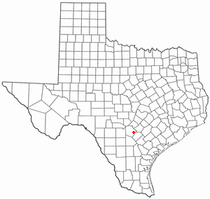
China Grove is a town in Bexar County, Texas, United States, located on the far east side of San Antonio. The population was 1,141 at the 2020 census. It is part of the San Antonio Metropolitan Statistical Area.

<span class="mw-page-title-main">Spearman, Texas</span> City in Texas, United States

Spearman is a city in and the county seat of Hansford County, Texas, United States. As of the 2010 census, the city population was 3,368. It is known for its collection of windmills from the J.B. Buchanan windmill collection.

<span class="mw-page-title-main">Bynum, Texas</span> Town in Texas, United States

Bynum is a town in Hill County, Texas, United States. The population was 171 at the 2020 census.

<span class="mw-page-title-main">Thornton, Texas</span> Town in Texas, United States

Thornton is a town in Limestone County, Texas, United States. The population was 526 at the 2010 census.

<span class="mw-page-title-main">Darrouzett, Texas</span> Town in Texas, United States

Darrouzett is a town in Lipscomb County, Texas, United States. The population was 350 at the 2010 census, up from 303 at the 2000 census. The town is named for John Louis Darrouzet, a Texas state legislator who served as an attorney for the Santa Fe Railroad.

<span class="mw-page-title-main">Higgins, Texas</span> Town in Texas, United States

Higgins is a rural small town in Lipscomb County, Texas, United States, named after G.H. Higgins, a stockholder in the Santa Fe Railroad. The population was 397 at the 2010 census.

<span class="mw-page-title-main">Goldthwaite, Texas</span> City in Texas, United States

Goldthwaite is a town and the county seat of Mills County, Texas, United States. The population was 1,878 at the 2010 census.

<span class="mw-page-title-main">Mullin, Texas</span> Town in Texas, United States

Mullin is a town in Mills County in northwestern Central Texas, United States. The population was 179 at the 2010 census.

<span class="mw-page-title-main">Gary City, Texas</span> Town in Texas, United States

Gary City is a town in Panola County, Texas, United States. The population was 336 as of the 2020 census.

<span class="mw-page-title-main">Annona, Texas</span> Town in Texas, United States

Annona is a town in Red River County, Texas, United States. The population was 315 at the 2010 census.

<span class="mw-page-title-main">Broaddus, Texas</span> Town in Texas, United States

Broaddus is a town in San Augustine County, Texas, United States. The population was 207 at the 2010 census.
<span class="mw-page-title-main">Trent, Texas</span> Town in Texas, United States

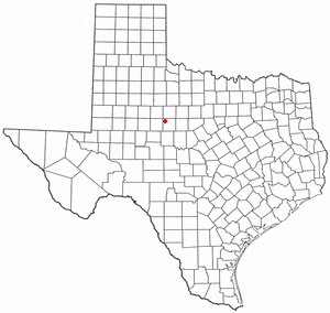
Trent is a town in Taylor County, Texas, United States, that was established in 1881. The population was 337 at the 2010 census. It is part of the Abilene, Texas Metropolitan Statistical Area. Trent, Texas was named in honor of West Texas pioneer and cattleman, Isaac Riley Trent.
<span class="mw-page-title-main">Rankin, Texas</span> City in Texas, United States

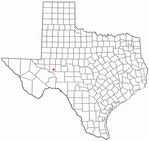
Rankin is a city in Upton County, Texas, United States. Its population was 778 at the 2010 census. It is named after F.E. Rankin, a local rancher. It is the county seat of the thinly populated county; in 2010, only 3,355 people lived in the entire county, and McCamey was the only larger town. During the early 20th century, the town grew due to the discovery of oil in the nearby Yates Oil Field. However, following a second oil boom in the '80s the town saw a decline in its economy and population.
<span class="mw-page-title-main">Thorntonville, Texas</span> Town in Texas, United States

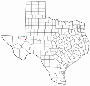
Thorntonville is a town in Ward County, Texas, United States. The population was 476 according to the 2010 census.

<span class="mw-page-title-main">Plains, Texas</span> Town in Texas, United States

Plains is a town and the county seat of Yoakum County of western Texas, United States, particularly the south (inner) half of the panhandle's plains. The city's population was 1,355 at the 2020 census. Plains is in the Texas High Plains Wine country.

<span class="mw-page-title-main">Reklaw, Texas</span> City in Texas, United States

Reklaw is a city in Cherokee and Rusk counties in the U.S. state of Texas. The population was 379 at the 2010 census.

<span class="mw-page-title-main">Booker, Texas</span> Town in Texas, United States

Booker is a town in Lipscomb and Ochiltree counties in the U.S. state of Texas. The population was 1,516 as of the 2010 census. It was named for B.F. Booker, a civil engineer for the Panhandle and Santa Fe Railway.

References

  1. "2019 U.S. Gazetteer Files". United States Census Bureau. Retrieved August 7, 2020.
  2. 1 2 U.S. Geological Survey Geographic Names Information System: Follett, Texas
  3. 1 2 "Population and Housing Unit Estimates". United States Census Bureau. May 24, 2020. Retrieved May 27, 2020.
  4. 1 2 "U.S. Census website". United States Census Bureau . Retrieved January 31, 2008.
  5. Climate Summary for Follett, Texas
  6. 1 2 "NOAA Online Weather Data - NWS Amarillo". National Weather Service. Retrieved November 1, 2022.
  7. "U.S. Climate Normals Quick Access - Station: Follett, TX". National Oceanic and Atmospheric Administration. Retrieved November 1, 2022.
  8. "Census of Population and Housing". Census.gov. Retrieved June 4, 2015.