Related Research Articles
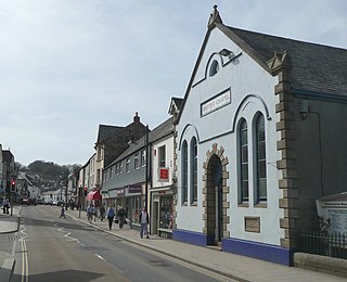
Okehampton is a town and civil parish in West Devon in the English county of Devon. It is situated at the northern edge of Dartmoor, and had a population of 5,922 at the 2011 census. Two electoral wards are based in the town. Their joint population at the same census was 7,500.

West Devon is a local government district and borough in Devon, England. Towns and villages in the district include Chagford, Okehampton, Princetown and Tavistock, where the council is based.

Ilsington is a village and civil parish situated on the eastern edge of Dartmoor, Devon, England. It is one of the largest parishes in the county, and includes the villages of Ilsington, Haytor Vale, Liverton and South Knighton. The parish is surrounded, clockwise from the north, by the parishes of Bovey Tracey, Teigngrace, Newton Abbot, Ogwell, Bickington, Ashburton, Widecombe-in-the-Moor and Manaton. In 2001 the population of the parish was 2,444, greatly increased from the 886 residents recorded in 1901. The parish is represented in parliament by Mel Stride, as part of the Central Devon constituency.

The Dartmoor line is a 15+1⁄2-mile (24.9 km) railway line in Devon, England. From Crediton, the line runs alongside the Tarka Line to the site of the former Coleford Junction where it diverges west to Okehampton. Previously a heritage line, it is owned by Network Rail.

Belstone is a small village and civil parish in the West Devon District of Devon, England. Lying on the northern side of Dartmoor, the western boundary of the parish is mostly formed by the East Okement River and the eastern by the River Taw; its highest point is Belstone Tor in the south, at 1,508 feet. The parish is surrounded, clockwise from the north, by the parishes of Sticklepath, South Tawton, Dartmoor Forest and Okehampton Hamlets. In 2001 its population was 257, relatively unchanged from the 1901 figure of 236.

Broadwoodkelly is a village and civil parish in the West Devon district of Devon, England. According to the 2001 census it had a population of 218. The village is situated about 9 miles (14 km) north of Okehampton.

Buckland Monachorum is a village and civil parish in the West Devon district of Devon, England, situated on the River Tavy, about 10 miles north of Plymouth.

Central Devon is a constituency represented in the House of Commons of the UK Parliament since 2010 by Mel Stride, a Conservative.

Bridestowe is a civil parish and village in the district of West Devon, Devon, England. The parish is surrounded clockwise from the north by the parishes of Bratton Clovelly, Sourton, Bridestowe and Sourton Common, Lydford, Lewtrenchard and Thrushelton.

Northlew is a village and civil parish in the West Devon district of the county of Devon, England. To the west of the village, but within the parish, are the hamlets of West Kimber and East Kimber. The village falls within the electoral ward of Lew Valley. Its population at the 2011 census was 2,024.
Exbourne is a village and civil parish in the English county of Devon. The Anglo-Saxon origin of the name is gæces burn - Cuckoo Stream. It occupies a hillside location between the River Okement and the Hole Brook, about 5 miles north of Okehampton in West Devon, and height above sea level ranges between 280 Ft. and 484 Ft. It lies in a primarily agricultural location and the local parish council represents both Exbourne and nearby Jacobstowe. The population of the ward which represents Exbourne and all surrounding villages was 1,695 at the 2011 census.

Cheriton Bishop is a village and civil parish situated on the northern borders of Dartmoor National park between Exeter and Okehampton, in Devon, England. The population at the 2011 Census was 652. The history of the settlement can be traced back over a thousand years when the old village centre was established as a commercial centre for the local farming community.

Bratton Clovelly is a village, parish and former manor in the west part of Devon, England. It is situated about 8 miles (13 km) south-west of Okehampton immediately north of the A30 road. The manor of Bratton Clovelly was listed in the Domesday Book of 1086. The parish church dedicated to St Mary is 15th-century, with many Norman features. The former village stocks are kept in the belfry. The parish is thought to have been the birthplace of influential 13th-century jurist Henry de Bracton; however, this claim is also made for at least two other places.
Brightley Priory was founded in 1133 as a Cistercian monastery. It was built in 1136 and was situated about two miles north of Okehampton in Devon and was abandoned by the monks after only 5 years on their removal to a nearby site which became Forde Abbey.

Throwleigh is a village and civil parish located 3 miles from Chagford and 6 miles from Okehampton, in the West Devon district, in the county of Devon, England. The parish incorporates the village of Throwleigh and the hamlets of Wonson, Providence, and Murchington, whose combined population is approximately 350.

Stowford is a village and civil parish in the district of West Devon in the English county of Devon. It is situated to the west of Dartmoor. Stowford is about 1 mile west of the village of Lewdown and about 11 miles south-west of Okehampton in Devon and 7 miles east of Launceston in Cornwall. The parish is very rural, and includes the hamlet of Sprytown.

East Worlington is a civil parish and hamlet in the North Devon administrative area, in the English county of Devon, England.

Germansweek is a village and civil parish in the West Devon district, to the west of Okehampton in the county of Devon, England.

Monkokehampton is a village and civil parish in West Devon, England. The village lies on the River Okement, about 3 miles (4.8 km) east-north-east of Hatherleigh. The parish is bounded by Hatherleigh, Exbourne, Broadwoodkelly and Iddesleigh, and had a population of 139 at the 2011 Census.

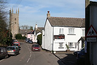
Inwardleigh is a village and civil parish about 3 and a half miles north north west of Okehampton railway station, in the West Devon district, in the county of Devon, England. The parish contains the village of Folly Gate. The A386 road runs through the parish. In 2011 the parish had a population of 491. The parish touches Hatherleigh, Sampford Courtenay, Okehampton Hamlets, Jacobstowe and Northlew.
References
- ↑ "Inwardleigh Parish Council". Inwardleigh Parish Council. Retrieved 6 April 2019.
- ↑ "Folly Gate, West Devon - area information, map, walks and more". OS GetOutside. Retrieved 12 October 2017.
- ↑ "Okehampton II (Folly Gate) - Airfields of Britain Conservation Trust UK". www.abct.org.uk. Retrieved 12 October 2017.
- ↑ "FOLLY GATE". domesday. Retrieved 12 October 2017.
Coordinates: 50°45′47″N4°01′26″W / 50.763°N 4.024°W
| | This Devon location article is a stub. You can help Wikipedia by expanding it. |