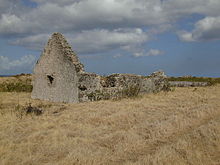
Fort Charles is an abandoned British fort on the island of Nevis. It is now mostly in ruins.

Fort Charles is an abandoned British fort on the island of Nevis. It is now mostly in ruins.
Initial construction of Fort Charles began as early as the 1630s, with the aim of protecting Charlestown and its harbour. [1] Mounting 26 cannon, Fort Charles was the main fort on the island, although there were numerous other, smaller gun emplacements. The reason for all of these fortifications was the protection of Nevis' lucrative sugar trade, which at one time was more profitable for Britain than all of the North American colonies combined. [2]
In 1706, the entire island was overrun by French forces under Pierre Le Moyne d'Iberville. During this action, Fort Charles was outflanked and taken from the landward entrance. Many of the cannon on the island were disabled by the French prior to their leaving. [2] : 115, 120 In 1782, the fort elected to hold its fire when French Admiral Count François de Grasse passed within range on his way to Saint Kitts; the French fleet was vastly superior to Nevisian defences. The entire island of Nevis subsequently surrendered to de Grasse without a shot, allowing him to lay siege to Brimstone Hill on Saint Kitts. Fort Charles was briefly manned by a small French garrison during this time, and all serviceable guns were removed for use against the British on Saint Kitts. Although de Grasse was successful in taking Saint Kitts, the Treaty of Paris returned both Saint Kitts and Nevis to the British. Two more attacks were made on Nevis in 1805 and 1806 by French forces led by Jérôme Bonaparte, but were repulsed. [2] : 142–145

By 1854, all forts on Nevis were abandoned. Currently the site is largely overgrown; there remains an old wall, a cistern, a powder magazine, and several cannons. [2] : 160

Nevis is a small island in the Caribbean Sea that forms part of the inner arc of the Leeward Islands chain of the West Indies. Nevis and the neighbouring island of Saint Kitts constitute the Federation of Saint Kitts and Nevis, a singular nation state. Nevis is located near the northern end of the Lesser Antilles archipelago about 350 kilometres (220 mi) east-southeast of Puerto Rico and 80 kilometres (50 mi) west of Antigua. Its area is 93 square kilometres (36 sq mi) and the capital is Charlestown.

Saint Kitts and Nevis, officially the Federation of Saint Christopher and Nevis, is an island country consisting of the two islands of Saint Kitts and Nevis, both located in the West Indies, in the Leeward Islands chain of the Lesser Antilles. With 261 square kilometres (101 sq mi) of territory, and roughly 50,000 inhabitants, it is the smallest sovereign state in the Western Hemisphere, in both area and population, as well as the world's smallest sovereign federation. The country is a Commonwealth realm, with Charles III as King and head of state.

Saint Kitts and Nevis have one of the longest written histories in the Caribbean, both islands being among Spain's and England's first colonies in the archipelago. Despite being only two miles apart and quite diminutive in size, Saint Kitts and Nevis were widely recognized as being separate entities with distinct identities until they were forcibly united in the late 19th century.

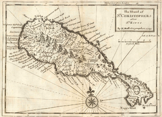
Saint Kitts, officially Saint Christopher, is an island in the West Indies. The west side of the island borders the Caribbean Sea, and the eastern coast faces the Atlantic Ocean. Saint Kitts and the neighbouring island of Nevis constitute one country: the Federation of Saint Kitts and Nevis. Saint Kitts and Nevis are separated by a shallow 3-kilometre (2 mi) channel known as "The Narrows".

Basseterre is the capital and largest city of Saint Kitts and Nevis with an estimated population of 14,000 in 2018. Geographically, the Basseterre port is located at 17°18′N62°44′W, on the south western coast of Saint Kitts Island, and it is one of the chief commercial depots of the Leeward Islands. The city lies within Saint George Basseterre Parish.

Charlestown is the capital of the island of Nevis in the Federation of Saint Kitts and Nevis in the Leeward Islands of the West Indies. Charlestown is situated on the leeward side of the island of Nevis near the southern end of Pinney's Beach.

The British West Indies (BWI) were colonised British territories in the West Indies: Anguilla, the Cayman Islands, Turks and Caicos Islands, Montserrat, the British Virgin Islands, Antigua and Barbuda, The Bahamas, Barbados, Dominica, Grenada, Jamaica, Saint Kitts and Nevis, Saint Lucia, Saint Vincent and the Grenadines, British Guiana and Trinidad and Tobago. Other territories include Bermuda, and the former British Honduras.

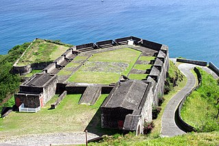
Brimstone Hill Fortress National Park is a UNESCO World Heritage Site, a well-preserved fortress on a hill on the island of St. Kitts in the Federation of St. Christopher and Nevis in the Eastern Caribbean. It was designed by British military engineers, and was built and maintained by enslaved Africans. It is one of the best preserved historical fortifications in the Americas.

Saint Christopher-Nevis-Anguilla was a British colony in the West Indies from 1882 to 1983, consisting of the islands of Anguilla, Nevis, and Saint Christopher. From 1882 to 1951, and again from 1980, the colony was known simply as Saint Christopher and Nevis. Saint Christopher and Nevis gained independence in 1983 as the Federation of Saint Kitts and Nevis, while Anguilla would remain a British overseas territory.

Saint Anne Sandy Point is one of 14 administrative parishes that make up Saint Kitts and Nevis. It is the smallest parish on St. Kitts in terms of area, at just 5 square miles (13 km2). It is located on the main island of Saint Kitts and the parish capital is Sandy Point Town.

The Battle of Saint Kitts, also known as the Battle of Frigate Bay, was a naval battle fought on 25 and 26 January 1782 during the American Revolutionary War between a British fleet under Rear Admiral Sir Samuel Hood and a larger French fleet under the Comte de Grasse.

Saint Thomas Middle Island is one of 14 administrative parishes that make up Saint Kitts and Nevis. It is the third largest parish on the island of Saint Kitts, and fourth largest in the federation. The parish capital is Middle Island.

Fort Charles, also called Cleverley Point Fort, is a historic British colonial fort site on the island of St. Kitts, located in the present day nation of Saint Kitts and Nevis in the Caribbean.

The Battle of St. Kitts or St. Cristopher was a successful Spanish expedition that seized the islands of Saint Kitts and Nevis from the English and French during the Anglo-Spanish War (1625–30).

The Capture of Grenada was an amphibious expedition in July 1779 during the American Revolutionary War. Charles Hector, comte D'Estaing led French forces against the British-held West Indies island of Grenada. The French forces landed on 2 July and the assault occurred on the night of 3–4 July. The French forces assaulted the British fortifications on Hospital Hill, overlooking the island's capital, Saint George's. The British cannons were captured and turned against Fort George. British Governor Lord Macartney opened negotiations to surrender.

The French invasion of Saint Kitts also known as the siege of Brimstone Hill, from 19 January–13 February 1782, was a part of the American Revolutionary War. After landing on Saint Kitts, the French troops of the Marquis de Bouillé stormed and besieged the fortress of Brimstone Hill. After a month of battle, the heavily outnumbered and cut-off British garrison surrendered. The Comte de Grasse, who delivered de Bouillé's troops and supported the siege, was outmanoeuvred and deprived of his anchorage by Admiral Samuel Hood. Even though Hood's force was inferior by one-third, de Grasse was beaten off when he attempted to dislodge Hood. Hood's attempts to relieve the ongoing siege were unsuccessful, and the garrison capitulated after one month. About a year later, the Treaty of Paris restored Saint Kitts and adjacent Nevis to British rule.

The Capture of Sint Eustatius took place in February 1781 during the Fourth Anglo-Dutch War when British army and naval forces under Lieutenant-General Sir John Vaughan and Admiral George Rodney seized the Dutch-owned Caribbean island of Sint Eustatius. The capture was controversial in Britain, as it was alleged that Vaughan and Rodney had used the opportunity to enrich themselves and had neglected more important military duties. The island was subsequently taken by Dutch-allied French forces in late 1781, ending the British occupation.
The Invasion of Curaçao in 1800 during the War of the Second Coalition was launched by French forces against the Batavian Republic. The French had landed on the island on 22 July, and on 5 September attacked and captured a fort protecting the town of Willemstad, Curaçao. The American consul sent for help, and on 10 September the Dutch governor of the island surrendered to a British frigate, HMS Nereide, under the command of Frederick Watkins. On 22 September the American sloops USS Patapsco and USS Merrimack arrived, and on 23 September the Patapsco sailed into the harbor and landed troops to reinforce the garrison protecting the town. On 23 September and 24 September the French fired upon the defenders, consequently exchanging cannon and musket fire with them throughout the day and night. Though it appeared a French assault was imminent, French forces left the island during the night. Significantly, the French suffered many killed or wounded in contrast to two American wounded. The British took control of the island, and American forces sailed away.
Afro-Kittitians and Nevisians are Saint Kitts and Nevis people whose ancestry lies within the continent of Africa, most notably West Africa.
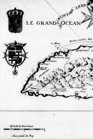
Charles de Courbon, comte de Blénac was a French colonial administration who served as governor general of the French Antilles during the 17th century. He was an experienced soldier and fought for the king during the Fronde before becoming a naval officer in the French Navy. Towards the end of the Franco-Dutch War he led the land forces that captured Tobago from the Dutch before taking command of the French Antilles. During the Nine Years' War he was active in the struggle with the English and Dutch in the Windward Islands. He captured Sint Eustatius and Saint Kitts, and defended Martinique against a large English expedition in 1693.
17°07′58″N62°38′00″W / 17.132845°N 62.633282°W