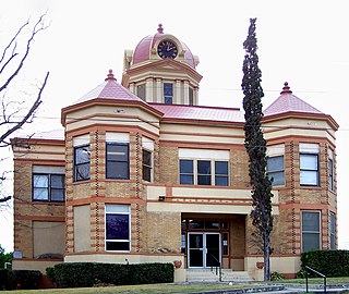
Kinney County is a county located in the U.S. state of Texas. As of the 2020 census, its population was 3,129. Its county seat is Brackettville. The county was created in 1850 and later organized in 1874. It is named for Henry Lawrence Kinney, an early settler.

North Weeki Wachee is a census-designated place (CDP) in Hernando County, Florida, United States. The population was 8,524 at the 2010 census, up from 4,253 at the 2000 census.
Gages Lake is a census-designated place (CDP) in Warren Township, Lake County, Illinois, United States. The population was 10,637 at the 2020 census.

Chaparral is an unincorporated community and census-designated place (CDP) in Doña Ana and Otero counties, New Mexico. The population was 14,631 at the 2010 census. Chaparral is primarily a bedroom community for the neighboring city of El Paso, Texas, and the neighboring military installations of White Sands Missile Range and Fort Bliss. It is officially part of the Las Cruces Metropolitan Statistical Area.
Calcium is a census-designated place (CDP) in Jefferson County, New York, United States. The population was 3,573 as of the 2020 census. The CDP is in the town of Le Ray and includes the hamlets of Calcium and Sanfords Four Corners.

Olmito is a census-designated place (CDP) in Cameron County, Texas, United States. Olmito is Spanish for "little elm". The population was 1,210 at the 2010 census. It is part of the Brownsville–Harlingen Metropolitan Statistical Area. Olmito is the self-described "mesquite capital of the world."

Brackettville is a city in Kinney County, Texas, United States. The population was 1,688 at the 2010 census, down from 1,876 at the 2000 census. It is the county seat of Kinney County.
Pylesville is an unincorporated community and census-designated place (CDP) in Harford County, Maryland, United States. The population was 693 at the 2010 census. It is part of the Baltimore metropolitan area.The town was named after Brandon Pyles. Until 1958, this community was served by the Maryland and Pennsylvania Railroad at milepost 40.3.

Refton is an unincorporated community and census-designated place (CDP) in Strasburg Township, Lancaster County, Pennsylvania, United States, with a ZIP code of 17560. The community is located along U.S. Route 222. As of the 2010 census, the population was 298.

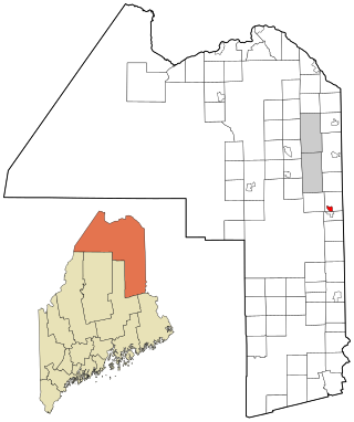
Mars Hill is a census-designated place (CDP) comprising the main village within the town of Mars Hill in Aroostook County, Maine, United States. The population of the CDP was 980 at the 2010 census, out of a population of 1,493 for the entire town. Prior to 2010, the village was part of the Mars Hill-Blaine CDP.

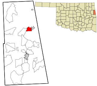
Old Green is a census-designated place (CDP) in Adair County, Oklahoma, United States. The population was 315 at the 2010 census.
McKinney Acres is a census-designated place (CDP) in Andrews County, Texas, United States. The population was 815 at the 2010 census. This was a new CDP for the 2010 census.

Waldoboro is a census-designated place (CDP) comprising the central village in the town of Waldoboro in Lincoln County, Maine, United States. The population was 1,300 at the 2020 census, out of 5,075 people in the entire town of Waldoboro.
Spring Ridge is census-designated place (CDP) and suburban housing community in Frederick County, in the U.S. state of Maryland, just outside the city of Frederick. As of the 2020 census it had a population of 6,005. Before 2010, it was part of the Linganore-Bartonsville, Maryland census-designated place, which was split into three for the 2010 census.
Bluetown is a census-designated place (CDP) in Cameron County, in the U.S. state of Texas. The population was 356 at the 2010 census. Prior to the 2010 census the community was part of the Bluetown-Iglesia Antigua CDP. It is part of the Brownsville–Harlingen Metropolitan Statistical Area.
Iglesia Antigua is a census-designated place (CDP) in Cameron County, in the U.S. state of Texas. The population was 413 at the 2010 census. Prior to the 2010 census the community was part of the Bluetown-Iglesia Antigua CDP. It is part of the Brownsville–Harlingen Metropolitan Statistical Area.
Fort Covington is a census-designated place (CDP) within the town of Fort Covington, Franklin County, New York, United States. It consists of the hamlet of Fort Covington, as well as a large amount of rural land surrounding the hamlet, such that the CDP occupies about one half of the area within the town limits. The population of the CDP was 1,308 at the 2010 census, out of a total town population of 1,676.

Pottery Addition is a census-designated place (CDP) in Jefferson County, Ohio, United States. Its population was 258 as of the 2020 census. The community is located along the Ohio River and is served by Ohio State Route 7.
Wiscon is an unincorporated community and census-designated place in Hernando County, Florida, United States. Its population was 681 as of the 2020 census. Florida State Road 50 passes through the community.
Fort Green Springs is an unincorporated community and census-designated place (CDP) in Hardee County, Florida, United States. Its population was 190 as of the 2020 census.


