
Fort McPherson, originally called Cantonment McKean and popularly known as Fort Cottonwood and Post Cottonwood, was an Indian Wars-era U.S. Army installation in the Nebraska Territory, located near the site of present-day North Platte, Nebraska.
Fort McPherson, originally called Cantonment McKean and popularly known as Fort Cottonwood and Post Cottonwood, was an Indian Wars-era U.S. Army installation in the Nebraska Territory, located near the site of present-day North Platte, Nebraska.
It was located on the banks of the North Platte River, at the mouth of Cottonwood Canyon, a strategic location near the junction of South and North Platte Rivers. Cottonwood Springs, a natural spring in an abandoned bed of the river, was the only spring for many miles along the river and a favored spot used by the plains Indians.
We started early on October 11th, and passed Gilmans' ranch, which was built of cedar, and, going fifteen miles farther, camped at a spring called Cottonwood Springs. A man by the name of Charles MacDonald had built a cedar ranch at the mouth of Cottonwood Canyon, which canyon came down to the river near Cottonwood Springs. Cottonwood Springs was merely a seep in a gully which had been an old bed of the river, and which had curved up towards Cottonwood Canyon. The water-bed of the river being largely composed of gravel, the water came down in the underflow, and seeped out at a place down in the bank where there had grown a large cottonwood tree. This spring had been dug out, and was the only spring as far as known along the Platte for two hundred miles. It was at the mouth of Cottonwood Canyon that we were to build our military post. The place was a great crossing for the Indians going north and south. The valley here was several miles wide. There was a large island in the river of several thousand acres, upon which grew the finest grass to be found in the country, and there were some scrubby willows and cottonwoods; so that the Indians coming from the north found it a good stopping-place to feed their ponies either in summer or winter, because in the winter the ponies could eat the cottonwood brush. In addition to this, Cottonwood Canyon gave a fine passage to the south. A road went up on the floor of the canyon, between the trees, until it rose onto the tableland twenty miles south. The canyon furnished fuel and protection. It was for the purpose of breaking up this Indian run-way that we were ordered to build a post at the mouth of the canyon. [1]
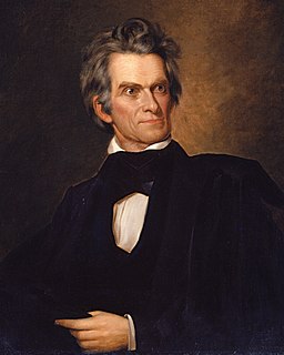
The decision to build the fort was following the Dakota War of 1862. It was an outpost to protect travelers along the Oregon and California Trails, between Fort Kearny and Colorado and to keep the peace with the local Native Americans. The fort was built by troops of the 7th Regiment Iowa Volunteer Cavalry using cedar logs cut in Cottonwood Canyon. [2] It was completed in October 1863. Originally named Cantonment McKean, on February 26, 1866 it was renamed Fort McPherson in the honor of Major General James B. McPherson. However, it was always popularly known as Fort Cottonwood.
Numerous expeditions were launched from Fort McPherson during the Indian Wars. The most important was the expedition of General Eugene Asa Carr which finished with the defeat of the Cheyenne Indians at the Battle of Summit Springs.
In 1873, Captain Charles Meinhold and his small command from the fort were the first to travel up the Massacre Canyon after a large-scale Pawnee-Sioux battle. [3] "We advanced from the mouth of the ravine to its head and found fifty-nine dead Pawnees...", wrote Army doctor David Franklin Powell. [4]
The fort was abandoned in 1880.
A cemetery was created along with the fort. In 1873, 20 acres (81,000 m2) were set aside for Fort McPherson National Cemetery, and the remains interred in the original post cemetery were moved to it. [5]
Coordinates: 41°00′58″N100°31′03″W / 41.01611°N 100.51750°W

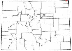
Lincoln County is a county located in the U.S. state of Nebraska. As of the 2020 census, the population was 34,676. Its county seat is North Platte. Despite the county's name, the state capital city of Lincoln is not in or near Lincoln County. The city is located in Lancaster County.

Fort Kearny was a historic outpost of the United States Army founded in 1848 in the western U.S. during the middle and late 19th century. The fort was named after Col. and later General Stephen Watts Kearny. The outpost was located along the Oregon Trail near Kearney, Nebraska. The town of Kearney took its name from the fort. The "e" was added to Kearny by postmen who consistently misspelled the town name. A portion of the original site is preserved as Fort Kearny State Historical Park by the Nebraska Game and Parks Commission.

The Otoe are a Native American people of the Midwestern United States. The Otoe language, Chiwere, is part of the Siouan family and closely related to that of the related Iowa, Missouria, and Ho-Chunk tribes.

The Sioux Wars were a series of conflicts between the United States and various subgroups of the Sioux people which occurred in the later half of the 19th century. The earliest conflict came in 1854 when a fight broke out at Fort Laramie in Wyoming, when Sioux warriors killed 31 American soldiers in the Grattan Massacre, and the final came in 1890 during the Ghost Dance War.
The Battle of the Tongue River, sometimes referred to as the Connor Battle, was an engagement of the Powder River Expedition that occurred on August 29, 1865. In the battle, U.S. soldiers and Indian scouts attacked and destroyed an Arapaho village.

The Powder River Expedition of 1865 also known as the Powder River War or Powder River Invasion, was a large and far-flung military operation of the United States Army against the Lakota Sioux, Cheyenne, and Arapaho Indians in Montana Territory and Dakota Territory. Although soldiers destroyed one Arapaho village and established Fort Connor to protect gold miners on the Bozeman Trail, the expedition is considered a failure because it failed to defeat or intimidate the Indians.

The Colorado War was an Indian War fought in 1864 and 1865 between the Southern Cheyenne, Arapaho, and allied Brulé and Oglala Sioux peoples versus the U.S. army, Colorado militia, and white settlers in Colorado Territory and adjacent regions. The Kiowa and the Comanche played a minor role in actions that occurred in the southern part of the Territory along the Arkansas River. The Cheyenne, Arapaho, and Sioux played the major role in actions that occurred north of the Arkansas River and along the South Platte River, the Great Platte River Road, and the eastern portion of the Overland Trail. The United States government and Colorado Territory authorities participated through the 1st Colorado Cavalry Regiment, often called the Colorado volunteers. The war was centered on the Colorado Eastern Plains, extending eastward into Kansas and Nebraska.
The 1st Nebraska Cavalry Regiment was a cavalry regiment that served in the Union Army during the American Civil War.
The 7th Iowa Cavalry Regiment was a cavalry regiment that served in the Union Army during the Indian Wars.

The Great Platte River Road was a major overland travel corridor approximately following the course of the Platte River in present-day Nebraska and Wyoming that was shared by several popular emigrant trails during the 19th century, including the Trapper's Trail, the Oregon Trail, the Mormon Trail, the California Trail, the Pony Express route, and the military road connecting Fort Leavenworth and Fort Laramie. The road, which extended nearly 800 miles (1,300 km) from the Second Fort Kearny to Fort Laramie, was utilized primarily from 1841 to 1866. In modern times it is often regarded as a sort of superhighway of its era, and has been referred to as "the grand corridor of America's westward expansion".

Native American tribes in the U.S. state of Nebraska have been Plains Indians, descendants of succeeding cultures of indigenous peoples who have occupied the area for thousands of years. More than 15 historic tribes have been identified as having lived in, hunted in, or otherwise occupied territory within the current state boundaries.

The Massacre Canyon battle took place in Nebraska on August 5, 1873 near the Republican River. It was one of the last hostilities between the Pawnee and the Sioux and the last battle/massacre between Great Plains Indians in North America. The massacre occurred when a large Oglala/Brulé Sioux war party of over 1,500 warriors led by Two Strike, Little Wound, and Spotted Tail attacked a band of Pawnee during their summer buffalo hunt. In the ensuing rout, more than 150 Pawnees were killed. The victims, who were mostly women and children, suffered mutilation and some were set on fire.
The 1st Nebraska Militia was a temporary military force mobilized by Territorial Governor Alvin Saunders in August, 1864 during the Indian uprising of 1864 which threatened travelers on the Overland Trail and settlers on the frontier. The 1st Nebraska Militia reinforced the 7th Iowa Cavalry Regiment, which had previously been deployed and had constructed Fort McPherson near present-day North Platte, Nebraska, and the 1st Nebraska Veteran Cavalry Regiment.
The Nebraska MILITIA were frontiersmen who furnished their own horses and arms. They were, as soldiers, first-class in every respect. The companies were small but efficient.

Pahuk, also written Pahaku, or Pahuk Hill, is a bluff on the Platte River in eastern Nebraska in the United States. In the traditional Pawnee religion, it was one of five dwellings of spirit animals with miraculous powers. The Pawnee occupied three villages near Pahuk in the decade prior to their removal to the Pawnee Reservation on the Loup River in 1859.
The Yellowstone expedition was an expedition to the American frontier in 1819 and 1820 authorized by United States Secretary of War John C. Calhoun, with the goal of establishing a military fort or outpost at the mouth of the Yellowstone River in present-day North Dakota. Sometimes called the Atkinson–Long Expedition after its two principal leaders, Colonel Henry Atkinson and Major Stephen Harriman Long, it led to the creation of Fort Atkinson in present-day Nebraska, the first United States Army post established west of the Missouri River, but was otherwise a costly failure, stalling near Council Bluffs, Iowa.

Pawnee Scouts were employed by the United States Army in the latter half of the 19th century. Like other groups of Indian scouts, Pawnee men were recruited in large numbers to aid in the ongoing conflicts between settlers and the Native Americans in the United States. Because the Pawnee people were at war with the Sioux and Cheyenne and had been under constant pressure and aggression by those tribes, some of them were more than willing to serve with the army for pay. A number of Pawnee served between 1864 and 1871. They were armed with rifles, revolvers and were issued scout uniforms.
The Battle of Julesburg took place on January 7, 1865 near Julesburg, Colorado between 1,000 Cheyenne, Arapaho, and Lakota Indians and about 60 soldiers of the U.S. army and 40 to 50 civilians. The Indians defeated the soldiers and over the next few weeks plundered ranches and stagecoach stations up and down the South Platte River valley.
The Battle of Platte Bridge, also called the Battle of Platte Bridge Station, on July 26, 1865 was the culmination of a summer offensive by the Lakota Sioux and Cheyenne Indians against the United States army. In May and June the Indians raided army outposts and stagecoach stations over a wide swath of Wyoming and Montana. In July, they assembled a large army, estimated by Cheyenne warrior George Bent to number 3,000 warriors, and descended upon Platte Bridge. The bridge, across the North Platte River near present-day Casper, Wyoming, was guarded by 120 soldiers. In an engagement near the bridge, and another against a wagon train guarded by 28 soldiers a few miles away, the Indians killed 29 soldiers while suffering at least eight dead.

O'Fallons Bluff is a section of bluffs about 20 miles (32 km) long that run along the south side of the Platte river near Sutherland in Lincoln County, Nebraska. The Oregon and California trails ran up and over these bluffs. They were characterized by American pioneers heading west to Oregon and California as sparse in vegetation with a number of violent incidents involving Native Americans. In the early 1860s, a Pony Express station was located about 5 miles (8 km) west of where the wagon trails went up the bluff. During construction of Interstate 80, the steep part of the bluffs were cut away but wagon ruts remained, which are marked by iron hoops signifying wagon wheels. It was listed in the National Register of Historic Places in 1974.

The Powder River Massacre, part of the Powder River Expedition, occurred on August 17, 1865, and was carried out by United States soldiers and Pawnee scouts against 24 Cheyenne people. The incident occurred near the Powder River in Dakota Territory, in present-day Johnson County, Wyoming.