| Fort Rouge | |
|---|---|
| in Assiniboine River in Winnipeg, Manitoba, Canada | |
| Type | depot |
| Site history | |
| Built | 1738 |
| In use | 1738–1749 |
| Official name | Forts Rouge, Garry, and Gibraltar National Historic Site of Canada |
| Designated | 1924 |
Fort Rouge was a fort located on the Assiniboine River in Manitoba, Canada, on the site of what is now the city of Winnipeg. Its exact location is unknown. Its name in English means "red fort".
In 1738 Sieur Louis Damours de Louvières built Fort Rouge on the Assiniboine River for Pierre Gaultier de Varennes, sieur de La Vérendrye. La Vérendrye and his sons, Louis-Joseph and Francois, proceeded further west on the Assiniboine and constructed Fort La Reine. The fort seems to have had a primary purpose as a depot and was abandoned by 1749.
A new commandant of the French western forts, Jacques Legardeur de Saint-Pierre, spent the winter of 1752–1753 at the Forks, and likely rebuilt Fort Rouge at its original location. Much research points to this site being on the north bank of the Assiniboine near the forks although some scholars place the original fort on the south bank.
Trading posts were built near Fort Rouge by Bruce and Boyer in 1780 and by Alexander Henry the younger in 1803, as was Fort Gibraltar in 1807.
The district of Fort Rouge in south-central Winnipeg is named for the fort.
A site near Winnipeg's Union Station, believed to be the location of Fort Rouge, was designated a National Historic Site in 1924 as part of the "Forts Rouge, Garry, and Gibraltar National Historic Site of Canada". [1]
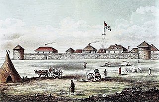
Fort Garry, also known as Upper Fort Garry, was a Hudson's Bay Company trading post at the confluence of the Red and Assiniboine rivers in what is now downtown Winnipeg.

Pierre Gaultier de Varennes, sieur de La Vérendrye was a French Canadian military officer, fur trader, and explorer. In the 1730s, he and his four sons explored the area west of Lake Superior and established trading posts there. They were part of a process that added Western Canada to the original New France territory that was centred along the Saint Lawrence basin.

Fort Douglas was the Selkirk Settlement fort and the first fort associated with the Hudson's Bay Company near the confluence of the Red and Assiniboine rivers in today's city of Winnipeg. Named for Thomas Douglas, 5th Earl of Selkirk, founder of the Selkirk Settlement, the fort was built by Scottish and Irish settlers beginning in 1813. Completed in 1815, it was in the immediate vicinity of the North West Company establishment, Fort Gibraltar.


Louis-Joseph Gaultier de La Vérendrye was a French Canadian fur trader and explorer. He, his three brothers, and his father Pierre La Vérendrye pushed trade and exploration west from the Great Lakes. He, his brother, and two colleagues are thought to be the first Europeans to have crossed the northern Great Plains and seen the Rocky Mountains in Wyoming.
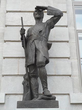
Pierre Gaultier de La Vérendrye de Boumois was the second son of Pierre Gaultier de Varennes, sieur de La Vérendrye. An explorer and fur trader who served many years under the command of his father, he was born on Île aux Vaches, near Sorel, New France.
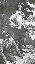
Christopher Dufrost de La Jemeraye ,(b. December 6, 1708 – d. May 10, 1736), was the lieutenant and nephew of Pierre Gaultier de Varennes et de La Vérendrye in the exploratory party that headed west from Fort Kaministiquia, Ontario, Canada, in 1731. He and Jean Baptiste de La Vérendrye established Fort St. Charles on Lake of the Woods in 1732. In the spring of 1733, he and Jean Baptiste headed down the Winnipeg River to set up a post in the Lake Winnipeg area. Ice stopped them and La Jemeraye returned to Fort St. Charles while his cousin established a small temporary fort named La Barrière.
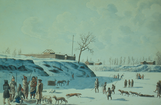
Fort Gibraltar was founded in 1809 by Alexander Macdonell of Greenfield of the North West Company in present-day Manitoba, Canada. It was located at the confluence of the Red and Assiniboine rivers in or near the area now known as The Forks in the city of Winnipeg. Fort Gibraltar was renamed Fort Garry after the merger of North West Company and the Hudson's Bay Company in 1821, and became Upper Fort Garry in 1835.

Fort Rouge is a district of Winnipeg, Manitoba, in Canada. Located in the south-central part of the city, it is bounded on the north by the Assiniboine River, on the east and south by the Red River, and on the west by Stafford Street and Pembina Highway.

Fort La Reine was built in 1738 and is one of the forts of the western expansion directed by Pierre Gaultier de Varennes et de La Vérendrye, first military commander in the west of what is now known as Canada. Located on the Assiniboine River where present day Portage la Prairie, Manitoba, stands, the fort served as a fur trading post. It was also the base of operations for much exploration north and west. From Fort La Reine, explorers made their way to Lake Manitoba and Lake Winnipegosis, Lake Winnipeg and the Saskatchewan River.

Fort Maurepas was the name of two forts, or one fort in two locations, built by the French in the Lake Winnipeg area in the 1730s. They were both named after Jean-Frédéric Phélypeaux, Count of Maurepas who, as Minister of Marine, was in charge of French colonies and chief adviser to King Louis XVI.

Fort Dauphin, was built in 1741 near Winnipegosis, Manitoba with Pierre Gaultier de La Vérendrye, the western military commander, directing construction. The area provided a post located between the Assiniboine River and the Saskatchewan River. It was named for the Dauphin prince of France.

Fort Saint Pierre on Rainy Lake was the first French fort built west of Lake Superior. It was the first of eight forts built during the elder Vérendrye's expansion of trade and exploration westward from the Great Lakes.
Verendrye National Monument was a federally protected area in the U.S. state of North Dakota from 1917 to 1956. In the latter year it was withdrawn as a national monument. It is located in southwestern Mountrail County, west of the city of New Town. It lies within the Fort Berthold Indian Reservation.
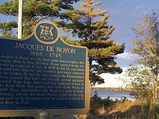
Jacques de Noyon was a French Canadian explorer and coureur des bois. He is the first known European to visit the Boundary Waters region west of Lake Superior.

The history of Winnipeg comprises its initial population of Aboriginal peoples through its settlement by Europeans to the present day. The first forts were built on the future site of Winnipeg in the 1700s, followed by the Selkirk Settlement in 1812. Winnipeg was incorporated as a city in 1873 and experienced dramatic growth in the late 19th and early 20th centuries. Following the end of World War I, the city's importance as a commercial centre in Western Canada began to wane. Winnipeg and its suburbs experienced significant population growth after 1945, and the current City of Winnipeg was created by the unicity amalgamation in 1972.
This is a timeline of the history of Winnipeg.

Varennes is a neighbourhood in the city of Winnipeg, Manitoba, Canada, located in the northern section of the district of St. Vital. It is a small triangular neighbourhood located, and is bounded by St. Mary's Road on the west, Fermor Avenue on the south, and St. Anne's Road on the east. In the 2001 census, Varennes had a population of 1,080.

Bas de la Rivière is a geographical area on both sides of the Winnipeg River at and near the mouth where it empties into Lake Winnipeg. It had a storied historical period in the opening of the west and the subsequent fur trade and settlement.
Most of the following timelines for Manitoba's history is taken from either the Manitoba Historical Society, or from the Heritage Manitoba and the Gimli Municipal Heritage Advisory Committee, as adapted from a three-volume history of Manitoba published in 1993 titled Manitoba: 125.