Fortifications of Paris in the 19th and 20th centuries

Last updated
Vestige of the Thiers Wall
(the poterne des Peupliers) Poterne-des-peupliers.jpg
Vestige of the Thiers Wall
(the poterne des Peupliers)
Fort de Charenton Fort de charenton4.JPG
Fort de Charenton

The fortifications of Paris in the 19th and 20th centuries comprise:

Contents

They were built in two stages:

From a military point of view, Paris is a fortified camp situated in a basin. During the 19th century, both Prussian invasions (1814–15 and 1870) saw the bombardment of Paris from the surrounding heights. Fortifications were extended outwards after each invasion as the range of artillery continued to develop, in order to deny the use of the heights to the enemy.

Chronology

Louis XIV

1670 The king demolishes the walls of Charles V and Louis XIII. Paris becomes an open city and remains so for two centuries.

1689 Vauban recommends the enclosure of Paris, with the construction of a second enclosure to include the then-villages of Chaillot, Montmartre and Belleville (located on heights overlooking the city), and two citadels flanking the city to the east and west to delay an enemy's approach.

Louis XVI

1784 The king orders the construction of the Farmers General Wall, built not as a fortification, but as a means of taxation.

Empire

1814-1815 Paris is occupied twice at the end of the reign of Napoleon I.

First fortification program

1818 Minister of War Laurent de Gouvion-Saint-Cyr creates a commission to "present its views on the best defense system" for Paris.

1820 The commission concludes that Paris must be placed in a state of defense, but proposes no specific project.

1830 Creation of a committee to study fortification which returns to the debate and again concludes that fortification is necessary, without consensus on how this is to be done.

1833 The defense plan for Paris envisages:

1836 Creation of a commission on the defense of the kingdom.

1838 On July 16 a plan of defense is adopted, combining the two options in a show of unanimity.

1840 The Convention of London and Near Eastern crisis raises the prospect of an anti-French alliance, and Adolphe Thiers seizes the occasion to commence the construction of the new fortifications. On September 1 General Guillaume Dode de la Brunerie is named director of the fortification program. The appointment and work is publicly announced on September 13.

1841 Over the reservations of the General Council of the Seine, 140 million francs are appropriated for the work, allocated, including 17,970 million francs for land acquisition, 16,608 million francs for earthwork, and 83,356 million francs for masonry. [1] The law authorizing work was promulgated by Louis-Philippe I on April 3, authorizing a continuous wall for both sides of the Seine, known as the Thiers Wall, supported by sixteen detached forts.

1845 Work is completed.

1860. The limits of the city of Paris are extended from the Farmers General Wall to the Thiers Wall, as part of the reorganization of the Paris urban fabric planned and executed by Georges-Eugène Haussmann.

Franco-Prussian War

July 1870 France declares war on Prussia, July 13.

September 1870 Napoleon III is captured at Sedan and capitulates. A republic is proclaimed and the Prussians move toward Paris. The capital is transformed into a fortified camp. A portion of the Thiers Wall gates are closed, along with canals and rail line entries. Houses are demolished in the designated "zone 'non aedificandi" to clear lines of fire. The Prussians arrive on 19 September and establish a siege, which will last four months.

January 1871 On the 28th the Treaty of Versailles is signed, stipulating that all of the forts forming the perimeter defense of Paris, together with their armaments, be handed over to the German forces. The treaty further stipulates the disarmament of the Thiers Wall.

March 1871 The German army abandons the forts on the left (south) bank of the Seine.

20 September 1871 The German army abandons the forts on the right (north) bank of the Seine. [2]

Second program of fortification

German post card prior to the 1914-1918 war, showing the defenses of Paris Plan fortifications place de Paris.JPG
German post card prior to the 1914-1918 war, showing the defenses of Paris
Fort de Villiers, 1878-1880, second ring of the Ile de France CartePostale FortVilliers couleur.jpg
Fort de Villiers, 1878-1880, second ring of the Ile de France

During the 1870 war, the fortifications were relatively ineffective.

1874 On 17 July, a law inspired by the ideas of Séré de Rivières creates new programs for defensive works in the north and east of France, including some intended for the defense of Paris.

1885. The program is completed. 196 forts, 58 smaller works and 278 batteries are in place on the borders and at strategic points within France at an estimated cost of 450 million francs for the works and 229 million francs for their armament.

The removal of the Thiers Wall

1883 On June 11 the municipal council of Paris votes to request the removal of the Thiers Wall, the property's transfer to the city and the end of restrictions on building in its vicinity.

1918 During World War I the Thiers Wall proves to be ineffective in the defense of Paris, as the range of German artillery such as the Paris Gun (120 km) renders walls irrelevant.

1919 On 19 April the city purchases the property for 100 million francs from the State of France. The city must purchase or expropriate the associated grounds and must maintain the "zone non aedificandi." Work begins on the demolition of the walls.

1925-1930 The "territoire zonier" is annexed to the city.

1930 A law is enacted to regulate the methods for compensation of the "zoniers."

The forts

Military doctrine for the employment of the forts

The doctrines for the use of the forts depend on the context of the time. During the 19th century the roads were few. Armies were obligated to move along existing lines of communication in order to maintain their provisioning without resorting to dirt roads in unfavorable seasons. Therefore, a fortification located on an important road would be able to slow or stop a large troop formation. For example the Fort de Charenton was placed to dominate Route Nationale 6, the Paris-Geneva road, and Route Nationale 19, the road to Belfort, as well as the fr:Pont de Charenton on the Marne and the fr:Pont à l’Anglais on the Seine.

In wartime, the fort would fulfill several functions, in the manner of a fortified town.

First ring of forts

The first ring of sixteen detached forts and complementary works, constituting the first line of defense a few kilometers from Paris, and supporting the Thiers Wall encircling Paris.

The sixteen forts

Panorama of the Fort de Romainville, at the beginning of the 20th century BF 2 - LES LILAS - Panorama du Fort de Romainville (cote Nord-Est).JPG
Panorama of the Fort de Romainville, at the beginning of the 20th century
Fort de Noisy Fort de NOISY - Casernement du 401e DDA.JPG
Fort de Noisy

The sixteen forts built around Paris between 1840 and 1845 are shown in the following table.

The order described in the first column describes the forts in order as they appear as one proceeds clockwise around Paris (north-east-south-west). Forts are named for the communities they defended, not necessarily those in which they are located.

Order


Dir.


NameEmplacement


Distance
from the
Farmers General wall
Distance
from the
Louvre
Other works


1N Fort couronne de la Briche Saint-Denis 6900 m9600 m
2N Fort de la Double-Couronne Saint-Denis 6850 m9600 m
3N/E Fort de l'Est Saint-Denis 5000 m7900 m
4N/E Fort d'Aubervilliers Aubervilliers 3875 m7250 mWorks and battery
5E Fort de Romainville Les Lilas 3500 m6650 mLunette + Courtine
6E Fort de Noisy Romainville 4800 m8300 mLunette + Redoubt
7E Fort de Rosny Rosny-sous-Bois 5750 m9800 mLunette
8S/E Fort de Nogent Fontenay-sous-Bois 5900 m10300 mLunette
9S/E Fort Neuf de Vincennes Vincennes 2800 m7800 m
10S/E Fort de Charenton Maisons-Alfort 4000 m8400 mRigole
11S Fort d'Ivry Ivry-sur-Seine 3900 m7300 m
12S Fort de Bicêtre Le Kremlin-Bicêtre 2650 m6100 m
13S Fort de Montrouge Arcueil 2900 m5800 m
14S Fort de Vanves Malakoff [3] 3600 m6400 m
15S Fort d'Issy Issy 3900 m6850 m
16W Fort Mont-Valérien Suresnes 5250 m9100 m

Complementary works

Order
Dir.
Name
Emplacement
Date
1 Digue du Croult Saint-Denis
2 Digue du ru de Montfort, Saint-Denis
3 Batterie des Vertus Aubervilliers
4 Redoute de la Flache Aubervilliers
5 Batterie de Pantin Pantin
6 Redoute de Montreuil [ where? ]
7 Redoute de la Boissière Rosny-sous-Bois 1831
8 Redoute de Fontenay-sous-Bois Fontenay-sous-Bois
9 Redoute de Gravelle Paris (bois de Vincennes)
10 Redoute de la Faisanderie [ where? ]
11 Batterie du Rouvray [ where? ]

Second ring of forts

This section includes those works completed between 1870 and 1890 as part of the Séré de Rivières fortifications, in the region of 20 kilometers from the capital. [4]


Dir.
Name
Emplacement
Date
1N Fort de Cormeilles-en-Parisis Cormeilles-en-Parisis
2N Fort de Montlignon Montlignon
3N Fort de Domont Domont
4N Fort de Montmorency Montmorency
5N Fort d'Écouen Écouen
6N Redoute de la Butte-Pinson Montmagny 1875–1877
7N Fort de Stains Garges-les-Gonesse
8E Fort de Vaujours Courtry
9E Fort de Chelles Chelles
10E Fort de Villiers Noisy-le-Grand 1878 [5]
11E Fort de Champigny Champigny-sur-Marne
12E Fort de Sucy Sucy-en-Brie
13E Fort de Villeneuve Villeneuve-Saint-Georges 1876 [6]
14S/W Fort de Palaiseau Palaiseau
15S/W Fort de Châtillon Châtillon-sous-Bagneux
Fontenay-aux-Roses
16S/W Fort de Villeras Saclay
17S/W Batterie de Bouviers Guyancourt 1879
18S/W Batterie du Ravin de Bouviers Versailles
19S/W Fort du Haut-Buc Buc (Yvelines) 1879
20S/W Fort de Saint-Cyr Montigny-le-Bretonneux 1879
21S/W Fort du Trou-d'Enfer Marly-le-Roi 1881
22S/W Fort de Bois-d'Arcy Bois d'Arcy

Sources

See also

Related Research Articles

<span class="mw-page-title-main">Louis Faidherbe</span> French general and colonial administrator (1818–1889)

Louis Léon César Faidherbe was a French general and colonial administrator. He created the Senegalese Tirailleurs when he was governor of Senegal.

Wall of the <i>Ferme générale</i> 18th-century city wall of Paris

The Wall of the Ferme générale was one of the several city walls of Paris built between the early Middle Ages and the mid 19th century. Built between 1784 and 1791, the 24 km wall crossed the districts of the Place de l'Étoile, Batignolles, Pigalle, Belleville, Nation, the Place d'Italie, Denfert-Rochereau, Montparnasse and the Trocadéro, roughly following the route now traced by line 2 and line 6 of the Paris Métro. The wall was demolished in the early 1860s, although elements of some of its gates remain.

<span class="mw-page-title-main">Hubert Rohault de Fleury (soldier)</span> French soldier (1779–1866)

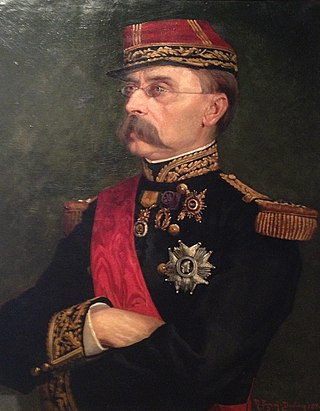
General Baron Hubert Rohault de Fleury was a French soldier who played a major role in the fortifications of Lyon.

<span class="mw-page-title-main">Séré de Rivières system</span> Fortifications in France

The Séré de Rivières system was an ensemble of fortifications built from 1874 along the frontiers, ridges and coasts of France. The fortifications were named after their architect, Brigadier-General Raymond Adolphe Séré de Rivières. The fortresses were obsolescent by 1914 but were used during the First World War.

<span class="mw-page-title-main">City walls of Paris</span>

The city walls of Paris refers to the city walls that surrounded Paris, France, as it grew from ancient times until the 20th century, built primarily to defend the city but also for administrative reasons. Several successive city walls were built over the centuries, either adding to existing walls or replacing demolished ones, through 1846, when construction of the Thiers wall was completed.

<span class="mw-page-title-main">Thiers wall</span> Former defensive wall in Paris

The Thiers wall was the last of the defensive walls of Paris. It was an enclosure constructed between 1841 and 1846 and was proposed by the French prime minister Adolphe Thiers but was actually implemented by his successor. The 33 kilometres (21 mi) long wall and ditch made a complete circuit around the city as it stood at the time of the July Monarchy. It was bombarded by the Prussian Army during the Franco-Prussian War, captured by government troops during the Paris Commune and refortified at the start of the First World War. However, by then it had become obsolete as a fortification and was a barrier to the expansion of the city. The area immediately outside of it, known as "the zone", had become a shanty town. The wall was demolished in the interwar period; its path today can be traced by the Boulevards of the Marshals which originally ran just behind the fortifications and by the Boulevard Périphérique which was later built just outside. A few remnants of the wall can still be seen.

<span class="mw-page-title-main">Fort de l'Est</span>

Fort de l'Est is a military strong point designed to protect Paris. It was built between 1841 and 1843 in Saint-Denis at the direction of French prime minister Adolphe Thiers, and was part of an immense defensive belt comprising 17 detached forts and the Thiers Wall surrounding Paris. The evolution of artillery quickly made these fortifications obsolete.

<span class="mw-page-title-main">Fort d'Ivry</span>

Fort d'Ivry was built in the Paris suburb of Ivry-sur-Seine between 1841 and 1845, as one of the forts in a ring of strong points surrounding Paris. The fort is about 1 kilometre outside the Thiers Wall, built by the same program in response to a perception that Paris was vulnerable to invasion and occupation. The fort was upgraded in the 1870s, to cope with improvements in artillery performance as part of the Séré de Rivières system. In 1946, the fort was vacated by the garrison. It is now the home of the Communication and Audiovisual Production Company for the Department of Defense.

<span class="mw-page-title-main">Fort de Charenton</span>

Fort de Charenton is a fortification built in 1842 in the community of Maisons-Alfort, and part of the Paris defences planned by Adolphe Thiers.

<span class="mw-page-title-main">Fort de Villiers</span> 19th c. French fort near Paris

Fort de Villers was built following the Franco-Prussian War to defend Paris. Located to the east of Paris in Villiers-sur-Marne, the fort was part of an outer ring of eighteen major fortifications built in response to improvements in the range and effectiveness of artillery since the construction of the Thiers fortifications of the 1840s. It was built in accordance with improved principles of fortification developed for the Séré de Rivières system.

<span class="mw-page-title-main">Fortified region of Belfort</span>

The fortified region of Belfort formed the first line of defense in the Séré de Rivières system of fortifications in the Belfort Gap. Located in northeastern France between Épinal and Besançon, the primary line was built in the late 19th century to deal with advances in artillery that had made older defensive systems obsolete.

<span class="mw-page-title-main">Fort du Salbert</span>

Fort du Salbert, also known as Fort Lefebvre, was built between 1874 and 1877. It was named after General François Joseph Lefebvre. It forms part of the Séré de Rivières system fortifications in the fortified region of Belfort in northeastern France. It is located at the summit of Salbert hill to the northwest of Belfort. During the early years of the Cold War it briefly served as an air defense coordination center.

<span class="mw-page-title-main">Fort des Basses Perches</span> French Fort

Fort des Basses Perches, also known as Fort Valmy, was built between 1874 and 1877 in Danjoutin and Belfort in northeastern France. It is part of the first ring of fortifications around the city of Belfort. The Forts des Perches were unique among the first group in their re-use of older sites. They were rebuilt as part of the Séré de Rivières system and incorporated improvements to deal with the improvement in efficacy of artillery in the late 19th century. The fort's official name was derived from François-Christophe Kellermann, Duke of Valmy and Marshal of France.

<span class="mw-page-title-main">Fort de Vaujours</span>

The Fort de Vaujours, located in the commune of Courtry, Seine-Saint-Denis, near the town of Vaujours, is one of the forts built at the end of the 19th century to defend Paris. It became a research center for the Commissariat à l'énergie atomique (CEA), France's Atomic Energy Commission. The center was closed in 1997.

<span class="mw-page-title-main">Raymond Adolphe Séré de Rivières</span>

Raymond Adolphe Séré de Rivières was a French military engineer and general whose ideas revolutionized the design of fortifications in France. He gave his name to the Séré de Rivières system of fortifications constructed after the Franco-Prussian War of 1870. Described as the Vauban of the 19th century, his Belgian counterpart was Henri Alexis Brialmont.

<span class="mw-page-title-main">Fort de Bicêtre</span>

The Fort de Bicêtre is a military structure built between 1841 and 1845 during the reign of Louis-Philippe during a time of tension between France and England, in the Paris suburb of Kremlin-Bicêtre. The fort is part of the Thiers Wall fortifications of Paris, built under a program of defensive works initiated by Adolphe Thiers. The fort served as a prison for those involved in the French coup of 1851.

The forts of Metz are two fortified belts around the city of Metz in Lorraine. Built according to the design and theory of Raymond Adolphe Séré de Rivières at the end of the Second Empire—and later Hans von Biehler while Metz was under German control—they earned the city the reputation of premier stronghold of the German reich. These fortifications were particularly thorough given the city's strategic position between France and Germany. The detached forts and fortified groups of the Metz area were spared in World War I, but showed their full defensive potential in the Battle of Metz at the end of World War II.

<span class="mw-page-title-main">Fort d'Issy</span>

Fort d'Issy was one of the fortifications of the city of Paris, France, built between 1841 and 1845. It was one of six forts built to the south of the main wall around the city. The fort was placed too close to the city to be effective, and had a poor design that did not take into account recent experience of siege warfare. It was quickly silenced during the Franco-Prussian War of 1870–71. After the armistice of February 1871 the fort was defended by National Guards of the Paris Commune against the French regular army in April–May 1871. The defense was irresolute and the fort was soon occupied. Today the site of the fort is an "eco-district", an ecologically friendly residential area.

<span class="mw-page-title-main">Ceintures de Lyon</span> Fortifications in nineteenth-century France

The ceintures de Lyon were a series of fortifications built between 1830 and 1890 around the city of Lyon, France, to protect the city from foreign invasion.

<span class="mw-page-title-main">Mont Saint-Quentin in Moselle Valley</span> Summit near Metz in Grand Est, France

Mount Saint-Quentin is a summit that lays in Moselle Valley to the west of the Metz area. Due to its location, it played a strategic role in observation, protection, and communication for the city of Metz located below.

References

  1. Lazare, Félix; Lazare, Louis (1993). Maisonneuve and Laroze (ed.). Dictionnaire historique des rues et monuments de Paris en 1855 (in French). p. 132.
  2. de Villefort, Alfred. "Recueil des traités, conventions, lois, décrets et autres actes relatifs à la paix avec l'Allemagne". Journal Officiel du 22 septembre 1871 (in French). Paris: Imprimerie Nationale. II (1872): 282.
  3. d'abord Châtillon-sous-Bagneux, puis Vanves, et enfin à Malakoff
  4. "Les forts de la deuxième ceinture autour de Paris - Inventaire du devenir des 16 forts construits de 1870 à 1885" (PDF) (in French). Association de sauvegarde du Fort de Villiers (ASFV). April 2008. Archived from the original (PDF) on 20 July 2011. Retrieved 12 January 2010.
  5. « Association de Sauvegarde du Fort de Villiers », at the site asfv.eu.
  6. « Patrimoine culturel », at the site of the town of Villeneuve-Saint-Georges,

Bibliography