
Charlestown is a town in Washington County, Rhode Island, United States. The population was 7,997 at the 2020 census.

West Warwick is a town in Kent County, Rhode Island, United States. The population was 31,012 at the 2020 census.

The Pawcatuck River is a river in the US states of Rhode Island and Connecticut flowing approximately 34 miles (55 km). There are eight dams along the river's length. USS Pawcatuck was named after the river.
The Rhode Island Historical Preservation and Heritage Commission, often called RIHPHC, is an agency run by the state of Rhode Island that aims to preserve the state's history and heritage. The commission works statewide to protect and upkeep historical buildings, districts, archæological sites and structures. It offers partial funding to those renovating or maintaining historical properties. It also has the role of establishing programs designed to record and celebrate the state's culture and heritage. RIHPHC has also published a series of publications on the history of each of Rhode Island's thirty nine communities and with a list of important historical places located in each.

The Slater Mill is a historic water-powered textile mill complex on the banks of the Blackstone River in Pawtucket, Rhode Island, modeled after cotton spinning mills first established in England. It is the first water-powered cotton spinning mill in America to utilize the Arkwright system of cotton spinning as developed by Richard Arkwright.

The Eleazer Arnold House is a historic house built for Eleazer Arnold in about 1693, and located in the Great Road Historic District at Lincoln, Rhode Island. It is now a National Historic Landmark owned by Historic New England, and open to the public on weekends.

This is a list of the National Register of Historic Places listings in Newport County, Rhode Island.

This is a list of the National Register of Historic Places listings in Providence County, Rhode Island.
Carolina is a village that straddles the border of the towns of Charlestown and Richmond on the Pawcatuck River in Washington County, Rhode Island. Rhode Island Route 112 passes through the village. Carolina is identified as a census-designated place, with a population of 970 at the 2010 census.

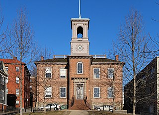
The College Hill Historic District is located in the College Hill neighborhood of Providence, Rhode Island. It was designated a National Historic Landmark District on December 30, 1970. The College Hill local historic district, established in 1960, partially overlaps the national landmark district. Properties within the local historic district are regulated by the city's historic district zoning ordinance, and cannot be altered without approval from the Providence Historic District Commission.

This is a list of the National Register of Historic Places listings in Providence, Rhode Island.

The Benjamin Barker House was a historic house on Main Road in Tiverton, Rhode Island. Built c. 1850, it was a two-story wood-frame structure with an impressive Greek Temple front, with full-height fluted Ionic columns supporting a full triangular pediment. The pediment had an astylistic triple window in it. The roof was topped by an octagonal cupola with belvedere, with two narrow chimneys piercing the ridge line. It is possible the house was designed by Russell Warren, who is documented to have designed a number of other high-style Greek Revival houses in the region. The purchaser is believed to be Benjamin Barker, a lumber merchant operating in nearby Fall River, Massachusetts.

The Captain Stephen Olney House is a historic site in North Providence, Rhode Island. It is a 2+1⁄2-story wood-frame structure, five bays wide, with a pair of interior chimneys. The principal exterior decoration is in the front door surround, which features pilasters supporting an entablature and gable pediment. The house was built in 1802 by Stephen Olney, a veteran of the American Revolutionary War, on what was then a large farm. His descendants enlarged the house in the 1840s, adding an ell to the south.

The Sassafras Site, designated RI-55, is a prehistoric archaeological site in Albion, a village of Lincoln, Rhode Island. The site was discovered by archaeologists while surveying an area for a potential replacement for the Albion Street bridge, which spans the Blackstone River between Lincoln and Cumberland. The site encompasses a regionally significant quartz stone tool workshop.

The Woonsocket Company Mill Complex is a historic district encompassing one of the largest mill complexes in Woonsocket, Rhode Island. The district includes all of the buildings historically associated with the Woonsocket Company, a major manufacturer of cotton textiles in the 19th century. The complex is located along the eastern bank of the Blackstone River between Court and Bernon Streets. It includes three handsome stone mills, built between 1827 and 1859, and a power plant that was built on the site of the former #3 mill between 1890 and 1920, as well as the remnants of the canal that originally carried water to the buildings for power.

St. Ann's Church Complex is now a historic cultural center in Woonsocket, Rhode Island on Cumberland Street. It was formerly a Roman Catholic church within the Diocese of Providence.

The Historic Village of the Narragansetts in Charlestown is an historic district in Charlestown, Rhode Island encompassing what were for nearly two centuries the reservation lands of the Narragansett people. The district covers 5,600 acres (23 km2) and is bounded by Route 112 on the east, U.S. Route 1 on the south, King's Factory Road on the west, and Route 91 on the north. These lands served as the Narragansett reservation between 1709 and 1880, when the tribe sold the land to the state and was formally detribalized. Because of this long period of Native occupation, the area is archaeologically important, containing both historic and prehistoric artifacts. The Narragansetts have since received federal recognition.

The Indian Burial Ground is a historic Native American cemetery on Narrow Lane in Charlestown, Rhode Island. The small cemetery is believed to have been the burying ground for leaders of the Narragansett and Niantic tribes. It is now fenced off by an iron post and rail fence, erected in the late 19th century.
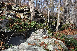
The Tomaquag Rock Shelters (RI-HP-1) are a prehistoric rock shelter site off Maxson Hill Road in Hopkinton, Rhode Island. The shelters are located under two east-facing granite outcrops in the valley drained by Tomaquag Brook. Nathan Kaye discovered the shelters in the late 1950s. Materials recovered from test excavations resulted in dating one shelter to 800 BC and the other to AD 800. Materials recovered include projectile points, stone knives, and evidence of stone tool construction. Both sites included evidence pointing to the presence of a fire pit.

Charlestown Breachway State Beach is a seaside public recreation area on Block Island Sound in the town of Charlestown, Rhode Island. It is located on the east side of the manmade channel that connects Ninigret Pond with the Atlantic Ocean.
