This article includes a list of general references, but it lacks sufficient corresponding inline citations .(July 2024) |
You can help expand this article with text translated from the corresponding article in French. (October 2022)Click [show] for important translation instructions.
|
Franceville Masuku | |
|---|---|
 | |
 Coat of arms | |
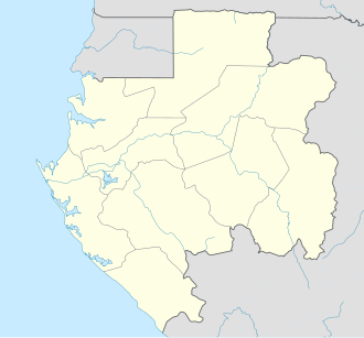 Franceville Location in Gabon  Franceville Franceville (Africa) | |
| Coordinates: 1°38′00″S13°35′30″E / 1.63333°S 13.59167°E | |
| Country | |
| Province | Haut-Ogooué Province |
| Department | Mpassa Department |
| Government | |
| • Mayor | Jean Pierre Doumbeneny |
| Elevation | 303 m (994 ft) |
| Population (2013 census) | |
• Total | 110,568 |
Franceville is one of the four largest cities in Gabon, with a population of 110,568 at the 2013 census. It lies on the Mpassa River and at the end of the Trans-Gabon Railway and the N3 road. It grew from a village named Masuku.