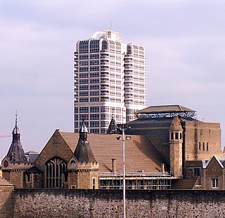
Swindon is a town in Wiltshire, England. At the time of the 2021 Census the population of the built-up area was 183,638, making it the largest settlement in the county. Located in South West England, Swindon lies on the M4 corridor, 71 miles (114km) to the west of London and 36 miles to the east of Bristol. The Cotswolds lie just to the town's north and the North Wessex Downs to its south.
Winchmore Hill is a suburb and electoral ward in the London Borough of Enfield, north London, England, in the N21 postal district. The Winchmore Hill conservation area serves as the focal point of the district. Geographically, it is bounded on the east by Green Lanes, Barrowell Green, Firs Lane and Fords Grove. To the northwest, it is bordered by Grovelands Park. The southern boundary extends to part of Aldermans Hill, while the northern boundary reaches Vicars Moor Lane and Houndsden Road. Winchmore Hill is 8.9 miles (14.3 km) northeast of Charing Cross.

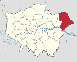
The London Borough of Havering in East London, England, forms part of Outer London. It has a population of 259,552 inhabitants; the principal town is Romford, while other communities include Hornchurch, Upminster, Collier Row and Rainham. The borough is mainly suburban, with large areas of protected open space. Romford is a major retail and night time entertainment centre, and to the south the borough extends into the London Riverside redevelopment area of the Thames Gateway. The name Havering is a reference to the Royal Liberty of Havering which occupied the area for several centuries. The local authority is Havering London Borough Council. It is the easternmost London borough.

The Borough of Swindon is a unitary authority area with borough status in Wiltshire, England. Centred on Swindon, it is the most north-easterly district of South West England.

Ingleby Barwick is a town and civil parish in the Borough of Stockton-on-Tees, North Yorkshire, England. It is south of the River Tees and north-east of the River Leven.

Swindon South is a constituency in the Borough of Swindon, Wiltshire, represented in the House of Commons of the UK Parliament since 2024 by Heidi Alexander of the Labour Party. Alexander had previously been MP for Lewisham East from 2010 to 2018.

Llansamlet is an electoral ward in the City and County of Swansea, Wales, UK.

Lydiard Park is a 260-acre (110-hectare) country park at Lydiard Tregoze, which was its former name, about 3 miles (5 km) west of central Swindon, Wiltshire, England, in West Swindon parish, near Junction 16 of the M4 motorway.

Exhall is a suburban village in the Nuneaton and Bedworth borough in Warwickshire, England. It forms part of the Coventry and Bedworth urban area and is contiguous with the Coventry suburb of Longford and the village of Hawkesbury Village.
Wall Heath is a suburban village in the Dudley Metropolitan Borough in the West Midlands of England. It is located on the A449 road, approximately 1.5 miles northwest of Kingswinford, 5 miles west of Dudley Town Centre and 9 miles north of Kidderminster. It forms part of the West Midlands-South Staffordshire border.
Lydiard Park Academy, formerly known as Greendown Community School, is a mixed sex comprehensive secondary school for students aged between 11 and 18 years in the Grange Park area of Swindon, England. As of December 2022, there were 1271 students enrolled. It adopted academy status in August 2011 and is the founding member of The Park Academies Trust.

The civil parish of Haydon Wick is a northern suburb of the town of Swindon, Wiltshire, in England. It had a population of 25,036 at the 2021 census. The parish includes the former hamlet of Haydon and the suburbs of Greenmeadow and Rodbourne Cheney.

Lydiard Tregoze is a small village and civil parish on the western edge of Swindon in the county of Wiltshire, in the south-west of England. Its name has in the past been spelt as Liddiard Tregooze.

Lydiard Millicent is a village and civil parish in Wiltshire, England, about 3+1⁄2 miles (6 km) west of the centre of Swindon. The parish contains the hamlets of Lydiard Green, Lydiard Plain, Greatfield and Green Hill; in the northeast the parish extends to Common Platt, which is now contiguous with the Peatmoor area of Swindon.

The 2011 Swindon Borough Council election took place on 5 May 2011 to elect members of Swindon Unitary Council in Wiltshire, England. One third of the council was up for election and the Conservative Party stayed in overall control of the council.

West Swindon is a civil parish in the borough of Swindon, Wiltshire, England. In 2021 it had a population of 26,846.
Lydiard and Freshbrook is an electoral ward in the Borough of Swindon, England. Since 2012, the ward has elected three councillors to Swindon Borough Council.


