
Guadalupe Mountains National Park is an American national park in the Guadalupe Mountains, east of El Paso, Texas. The mountain range includes Guadalupe Peak, the highest point in Texas at 8,751 feet (2,667 m), and El Capitan used as a landmark by travelers on the route later followed by the Butterfield Overland Mail stagecoach line. The ruins of a stagecoach station stand near the Pine Springs visitor center. The restored Frijole Ranch contains a small museum of local history and is the trailhead for Smith Spring. The park covers 86,367 acres in the same mountain range as Carlsbad Caverns National Park, about 25 miles (40 km) to the north in New Mexico. The Guadalupe Peak Trail winds through pinyon pine and Douglas-fir forests as it ascends over 3,000 feet (910 m) to the summit of Guadalupe Peak, with views of El Capitan and the Chihuahuan Desert.
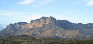
The Guadalupe Mountains are a mountain range located in West Texas and southeastern New Mexico. The range includes the highest summit in Texas, Guadalupe Peak, 8,751 ft (2,667 m), and the "signature peak" of West Texas, El Capitan, both of which are located within Guadalupe Mountains National Park. The Guadalupe Mountains are bordered by the Pecos River valley and Llano Estacado to the east and north, Delaware Mountains to the south, and Sacramento Mountains to the west. One of the clearest exposures of a prehistoric reef is preserved in the mountain range's bedrock geology. Bedrock contains fossils of reef-dwelling organisms from the Permian period, and the geology is widely studied, mostly by stratigraphers, paleontologists, and Paleoecologists.

Spring Mountain Ranch State Park is a public recreation area located within the Red Rock Canyon National Conservation Area in Nevada's Cottonwood Valley, five miles (8.0 km) northwest of Blue Diamond, Nevada. The state park preserves the historic Sandstone Ranch, which was entered into the National Register of Historic Places as a historic district in 1976.
The Snake River Ranch, near Wilson, Wyoming, is the largest deeded ranch in the Jackson Hole area. The ranch buildings are grouped into three complexes comprising headquarters, residential and shop complexes. The ranch combined two neighboring homesteads and was first owned by advertising executive Stanley B. Resor and his wife, Helen Lansdowne Resor. The Resors used the property as a vacation home, but the ranch was also a full-time, self-sustaining operation.
The Lamar Buffalo Ranch is a historic livestock ranch in the Lamar River valley of Yellowstone National Park, in the U.S. state of Wyoming. As an early contribution to the conservation of bison, it was created to preserve one of the last free-roaming American bison (buffalo) herds in the United States. The ranch was established in 1907 when 28 bison were moved from Fort Yellowstone to the Lamar Valley in the northeast corner of the park.
The Hunter Hereford Ranch was first homesteaded in 1909 by James Williams in the eastern portion of Jackson Hole, in what would become Grand Teton National Park. By the 1940s it was developed as a hobby ranch by William and Eileen Hunter and their foreman John Anderson. With its rustic log buildings it was used as the shooting location for the movie The Wild Country, while one structure with a stone fireplace was used in the 1963 movie Spencer's Mountain. The ranch is located on the extreme eastern edge of Jackson Hole under Shadow Mountain. It is unusual in having some areas of sagebrush-free pasture.

The Faraway Ranch Historic District is part of the Chiricahua National Monument in southeastern Arizona, and preserves an area associated with the final conflicts with the local Apache, one of the last frontier settlements, and in particular, its association with the people who promoted the establishment of the Chiricahua National Monument. Faraway Ranch is located in Bonita Canyon, which lies at an approximate altitude of 5160 feet and opens in a southwesterly direction into the Sulphur Springs Valley.

The James Cant Ranch is a pioneer ranch complex in Grant County in eastern Oregon, United States. The ranch is located on both sides of the John Day River in the John Day Fossil Beds National Monument. The ranch was originally homesteaded by Floyd Officer in 1890. Officer sold the property to James Cant in 1910. Cant increased the size of the property and built a modern ranch complex on the west bank of the river. The National Park Service bought the ranch from the Cant family in 1975, and incorporated the property into the John Day Fossil Beds National Monument. The National Park Service used the main house as a visitor center until 2003. Today, the Cant Ranch complex is preserved as an interpretive site showing visitors an early 20th-century livestock ranch. The James Cant Ranch is listed on the National Register of Historic Places.

The Sod House Ranch is a historic ranch in Harney County in southeastern Oregon, United States. The remaining ranch structures are located south of Malheur Lake in the Malheur National Wildlife Refuge. The ranch was built by Peter French, a well known 19th-century cattle baron. The Sod House Ranch became the headquarters for the northern operating division of the French-Glenn Livestock Company, which eventually covered over 140,000 acres (570 km2). After French was murdered in 1897, the French-Glenn Livestock Company slowly sold off its ranch property. In 1935, the United States Government purchased the Sod House Ranch property to add to an adjacent wildlife refuge. The eight remaining Sod House Ranch buildings are now listed on the National Register of Historic Places.

The David L. Shirk Ranch is a historic ranch located in the Guano Valley of eastern Lake County, Oregon, United States. The ranch was originally homesteaded in 1881. It was purchased by David L. Shirk in 1883. He operated the ranch until 1914. The property was acquired by the United States Government in 1942. The ranch is now administered by the Bureau of Land Management. The remaining historic ranch buildings are listed on the National Register of Historic Places.

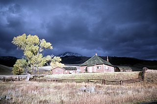
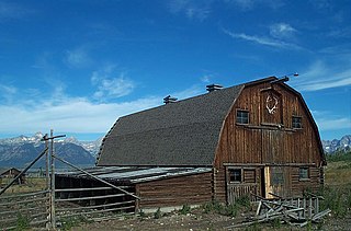
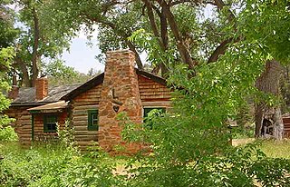
The historical buildings and structures of Grand Teton National Park include a variety of buildings and built remains that pre-date the establishment of Grand Teton National Park, together with facilities built by the National Park Service to serve park visitors. Many of these places and structures have been placed on the National Register of Historic Places. The pre-Park Service structures include homestead cabins from the earliest settlement of Jackson Hole, working ranches that once covered the valley floor, and dude ranches or guest ranches that catered to the tourist trade that grew up in the 1920s and 1930s, before the park was expanded to encompass nearly all of Jackson Hole. Many of these were incorporated into the park to serve as Park Service personnel housing, or were razed to restore the landscape to a natural appearance. Others continued to function as inholdings under a life estate in which their former owners could continue to use and occupy the property until their death. Other buildings, built in the mountains after the initial establishment of the park in 1929, or in the valley after the park was expanded in 1950, were built by the Park Service to serve park visitors, frequently employing the National Park Service Rustic style of design.
The Caroline Lockhart Ranch was established in 1926 by Caroline Lockhart, who purchased a 160-acre (65 ha) homestead near Davis Creek at the foot of the Pryor Mountains in Carbon County, Montana, while in her fifties. Lockhart expanded the ranch, adding buildings, land and grazing rights until the ranch comprised about 7,000 acres (2,800 ha). The region, known as Dryhead Country, is one of the most isolated places in Montana.
The Diamond Ranch was established near Chugwater, Wyoming in 1878 by George Rainsford, a New York native who came west to breed horses. Rainsford, an architect, designed many of the structures at the ranch. Horses bred at the ranch, mainly Morgans and Clydesdales, were widely known and sought after. The ranch was named after Rainsford's Diamond brand, one of the two oldest registered brands in Wyoming. Unlike most brands, which remain with the owner, the Diamond brand has remained with the property. The ranch features extensive barns for breeding and raising horses, as well as a more modest ranch house. In its prime there were formal gardens.
The Thexton Ranch, also known as Thextondale, was established by George Thexton in 1872 on the Madison River about 7 miles (11 km) south of Ennis, Montana. The ranch is a significant example of an operating Montana ranch, and has been listed on the National Register of Historic Places for its prominence in local history and its character as a ranching operation.

The N.K. Boswell Ranch is one of the oldest ranches on the edge of the Laramie Plains along the Big Laramie River in Albany County, Wyoming, USA. The ranch was established in the early 1870s, possibly by a man named C.T. Waldron. The ranch is significant for its association with Nathaniel K. Boswell, who was Albany County Sheriff at a time when the county extended from Colorado to Montana.
The Jelm-Frank Smith Ranch Historic District, also known as Old Jelm and Cummins City, comprises an area of bottomland on the Laramie River near Woods Landing, Wyoming where the mining boomtown of Cummins City, Wyoming was established in 1880. Gold had been discovered in the nearby mountains and the town was established by W.S. "Buck" Bramel and John Cummins. In 1881 Cummins City was described as having about 100 houses and a hotel. By this time the camp was already declining, and by 1886 mining in the district was largely inactive. However, in the 1890s copper was discovered in the Sierra Madre and Medicine Bow ranges. Cummins City was revived as Jelm in 1900. This boom also declined and in 1930 Jelm's population was 50.
The CM Ranch and Simpson Lake Cabins are separate components of a single historic district associated with Charles Cornell Moore, a Fremont County, Wyoming dude ranch operator. The CM ranch, named after Moore, operated as a dude ranch from 1920 to 1942 and resumed operating in 1945. The Simpson Lake Cabins were purchased by Moore in 1931 and were operated as a hunting camp, continuing until 1997 when the CM ranch was sold to new owners and the Simpson Lake property was taken over by the U.S. Forest Service.. The sites are separated by 13 miles (21 km).
The Diamond A Ranch, or Spring Ranch, is a ranch in the upper Wind River valley of Fremont County, Wyoming. The site was first settled by John Robert McDonald, a Scottish immigrant who had a 160-acre (65 ha) homestead on the site in 1891. McDonald sold the property to John Williamson in 1907. Jack Williamson and his brother David were Scots as well, working as stonemasons. The Williamsons had worked in New York City, at Princeton University, at the Mormon Temple in Salt Lake City and on bridge work for the Union Pacific Railroad. In 1888 they came from Salt Lake City to Lander, where they worked on a number of projects, as well as in Rawlins and at Fort Washakie. They joined their sister Jean Williamson Sinclair at the Upper Circle Ranch near Dubois in the early 1890s. David Williamson married Annie McKenzie, a friend of his sister's who had come with her from Scotland. When Jack died of tick fever in 1916, David moved to the ranch with his family. After David's death in 1934, his wife Annie operated the ranch until she sold it in 1966. The ranch is notable as one of several ranches established by Scottish immigrants.
The Gramberg Ranch, in Pennington County, South Dakota near Hermosa, was listed on the National Register of Historic Places in 1999. The listing included eight contributing buildings, six contributing structures, and four contributing sites.

The L. C. Ranch Headquarters, in Gila, New Mexico, was built mostly in 1890 and was listed on the National Register of Historic Places in 1978.


