Frederick is a city in and the county seat of Frederick County, Maryland, United States. It is located at an important crossroads at the intersection of a major north–south Native American trail and east–west routes to the Chesapeake Bay, both at Baltimore and what became Washington, D.C., and across the Appalachian mountains to the Ohio River watershed. Frederick's population was 78,171 people as of the 2020 census, making it the second-largest incorporated city in Maryland behind Baltimore. It is a part of the Washington metropolitan area, which is part of a greater Washington–Baltimore combined statistical area.
Pike County is a county in the U.S. state of Illinois. It is located between the Mississippi River and the Illinois River in western Illinois. According to the 2020 United States Census, it had a population of 14,739. Its county seat is Pittsfield.

Great Falls is a census-designated place (CDP) in Fairfax County, Virginia, United States. The population as of the 2010 census was 15,427, an increase of 80.5% from the 2000 census.

McLean is an unincorporated community and census-designated place (CDP) in Fairfax County in Northern Virginia. McLean is home to many diplomats, military, members of Congress, and high-ranking government officials partially due to its proximity to Washington, D.C., the Pentagon and the Central Intelligence Agency. It is the location of Hickory Hill, the former home of Ethel Kennedy, the widow of Robert F. Kennedy. It is also the location of Salona, the former home of Light-Horse Harry Lee, the Revolutionary War hero.

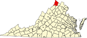
Stephens City is an incorporated town in the southern part of Frederick County, Virginia, United States, with a population of 2,016 at the time of the 2020 census, and an estimated population of 2,096 in 2022. Founded by Peter Stephens in the 1730s, the colonial town was chartered and named for Lewis Stephens in October 1758. It was originally settled by German Protestants from Heidelberg. Stephens City is the second-oldest municipality in the Shenandoah Valley after nearby Winchester, which is about 5 mi (8 km) to the north. "Crossroads", the first free black community in the Valley in the pre-Civil War years, was founded east of town in the 1850s. Crossroads remained until the beginning of the Civil War when the freed African Americans either escaped or were recaptured. Stephens City was saved from intentional burning in 1864 by Union Major Joseph K. Stearns. The town has gone through several name changes in its history, starting as "Stephensburg", then "Newtown", and finally winding up as "Stephens City", though it nearly became "Pantops". Interstate 81 and U.S. Route 11 pass close to and through the town, respectively.

The Cacapon River, located in the Appalachian Mountains of West Virginia's Eastern Panhandle region, is an 81.0-mile-long (130.4 km) shallow river known for its fishing, boating, wildlife, hunting, and wilderness scenery. As part of the Potomac River watershed, it is an American Heritage River.
Slanesville is an unincorporated community in northeastern Hampshire County in the U.S. state of West Virginia. Slanesville is located at the crossroads of Bloomery Pike with Slanesville Pike and Cold Stream Road. Slanesville Pike and Cold Stream Road formerly made up the Springfield Grade Road that ran from Capon Bridge to Springfield. According to the 2000 census, the Slanesville community has a population of 691.

West Virginia Route 127 is an east–west state highway located in northeast West Virginia. The western terminus is at West Virginia Route 29 near Forks of Cacapon in Hampshire County. The eastern terminus is at the Virginia state line west of U.S. Route 522 and east of Good, where WV 127 continues eastward as State Route 127.
Good is an unincorporated community in northeastern Hampshire County, West Virginia, United States atop Bear Garden Mountain. Good is located on the Bloomery Pike at I.L. Pugh Road east of Bloomery and northwest of Winchester on the West Virginia/Virginia border. Good partly lies in Frederick County, Virginia.
Back Creek is a 59.5-mile-long (95.8 km) tributary of the Potomac River that flows north from Frederick County, Virginia, to Berkeley County in West Virginia's Eastern Panhandle. Back Creek originates along Frederick County's border with Hampshire County, West Virginia, at Farmer's Gap in the Great North Mountain. Its name reflects its location to the west of North Mountain. The perspective of colonists from the east in the 18th century led them to call it "Back Creek", because it lay to the back of North Mountain.

The Winchester and Western Railroad is a shortline railroad operating from Gore through Winchester, Virginia and West Virginia to Hagerstown, Maryland. It also operates several lines in southern New Jersey, connecting to Conrail Shared Assets Operations at Millville and Vineland.

Clear Brook is an unincorporated farming community in northern Frederick County, Virginia. The community lies approximately six miles north of the county seat of Winchester along Martinsburg Pike. It is the site of the Kenilworth home, once owned by Harry K. Thaw, the old Hopewell Meeting House, Stonewall Elementary School, the Clearbrook Park, and the Frederick County Fairgrounds.

White Hall is an unincorporated farming community in northern Frederick County, Virginia, established in the late 1810s and located near the crossroads of Apple Pie Ridge Road with Green Spring and White Hall Roads, astride Apple Pie Ridge.
Reynolds Store is an unincorporated community in northern Frederick County, Virginia. Reynolds Store is located along the North Frederick Pike at its crossroads with Cumberland Trail Road and Reynolds Road. The post office of neighboring Cross Junction serves the community.
Cross Junction is an unincorporated community in northern Frederick County, Virginia, United States. Cross Junction is located on the North Frederick Pike at its intersection with Collinsville Road. Cross Junction also encompasses the residential communities at Lake Holiday to the south.
Nain is an unincorporated community in Frederick County, Virginia, United States. Nain is located northwest of Winchester along the North Frederick Pike. The community is situated within a gap in Little North Mountain and Flint Ridge.

James Wood High School is located at the northern tip of the Shenandoah Valley in Winchester, Virginia and is a part of the Frederick County Public School system. It is located at 161 Apple Pie Ridge Road.

Belfry High School is a high school in Belfry, Kentucky, United States. The school is located in the northeastern region of Pike County, approximately 22 miles northeast of Pikeville, Kentucky and 1 mile south of Williamson, West Virginia. The school moved from Belfry in 2005 to a new site 3 miles north near the West Virginia border in Goody, Kentucky. The school is one of five public high schools in the Pike County Public School System and one of six public high schools in Pike County.
Frederick County Public Schools is a public school system run for the residents of Frederick County, Virginia.