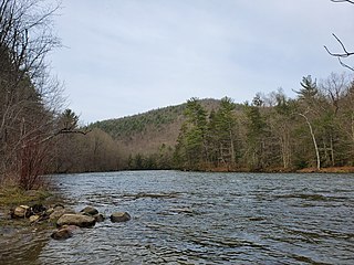
The Housatonic River is a river, approximately 149 miles (240 km) long, in western Massachusetts and western Connecticut in the United States. It flows south to southeast, and drains about 1,950 square miles (5,100 km2) of southwestern Connecticut into Long Island Sound.
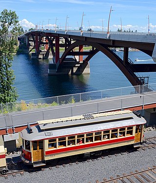
The Willamette Shore Trolley is a heritage railroad or heritage streetcar that operates along the west bank of the Willamette River between Portland and Lake Oswego in the U.S. state of Oregon. The right-of-way is owned by a group of local-area governments who purchased it in 1988 in order to preserve it for potential future rail transit. Streetcar excursion service began operating on a trial basis in 1987, lasting about three months, and regular operation on a long-term basis began in 1990. The Oregon Electric Railway Historical Society has been the line's operator since 1995.

The Cape Fear River is a 191.08-mile-long blackwater river in east-central North Carolina. It flows into the Atlantic Ocean near Cape Fear, from which it takes its name. The river is formed at the confluence of the Haw River and the Deep River in the town of Moncure, North Carolina. Its river basin is the largest in the state: 9,149 sq mi.
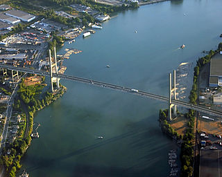
The Alex Fraser Bridge is a cable-stayed bridge over the Fraser River that connects Richmond and New Westminster with North Delta in Greater Vancouver, British Columbia. The bridge is named for Alex Fraser, a former British Columbia Minister of Transportation. The bridge was the longest cable-stayed bridge in the world when it opened on September 22, 1986, and was the longest in North America until the Arthur Ravenel Jr. Bridge, in the U.S. state of South Carolina opened in 2005.
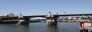
The Burnside Bridge is a 1926-built bascule bridge that spans the Willamette River in Portland, Oregon, United States, carrying Burnside Street. It is the second bridge at the same site to carry that name. It was added to the National Register of Historic Places in November 2012.

The Interstate Bridge is a pair of nearly identical steel vertical-lift, Parker through-truss bridges that carry Interstate 5 traffic over the Columbia River between Vancouver, Washington and Portland, Oregon in the United States.

State Road 404 (SR 404), the Pineda Causeway, is an east–west divided highway currently running from Interstate 95 (I-95) to SR A1A at Patrick Space Force Base, Florida, US. It was opened as a toll road in 1971 and classified as a state road two years later. The tolls were removed in 1990. It was named after Pineda, a former village east of Suntree on U.S. Route 1 (US 1). With interchanges at US 1 (SR 5), South Tropical Trail, and South Patrick Drive (SR 513), the Pineda Causeway is the primary access for Patrick Space Force Base and the southern end of Merritt Island. From US 1 to the eastern terminus, it is part of the Indian River Lagoon Scenic Highway system.
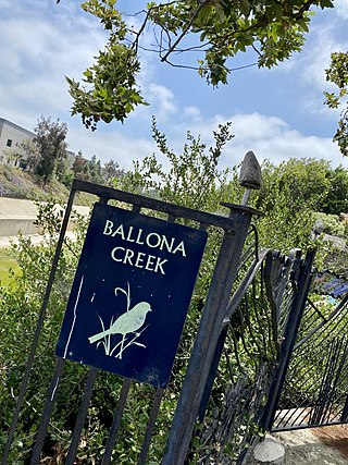
The Ballona Creek Bike Path is a 6.7-mile (10.8 km) Class I bicycle path and pedestrian route in California. The bike path follows the north bank of Ballona Creek until it reaches Santa Monica Bay at the Pacific Ocean. The route is defined by, and recognized for, the dramatic contrast between the channelized waterway’s stark cement geometry and the abundant wildlife of the verdant Ballona Wetlands.

The Canalside Rail Trail Bridge is a former New York, New Haven and Hartford Railroad rail bridge across the Connecticut River between Deerfield and Montague, Massachusetts. The bridge is on the Massachusetts Historic Bridge Inventory as a "Historic Metal Truss Bridge", currently the sixth oldest metal truss bridge on the state-wide historic registry. The Canalside Rail Trail, completed in Spring 2008, incorporates this bridge.

Circle Drive is a major road constructed as a ring road in Saskatoon, Saskatchewan, Canada. Its route constitutes both part of the Yellowhead Highway and Highway 11, signed as both along the entire length. It was first conceived in 1913 by the city commissioner and completed exactly 100 years later in 2013. Most of the route is a fully-controlled access freeway, however the segment between Airport Drive and Millar Avenue has at-grade intersections.
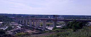
The Valley View Bridge is a trio of steel multi-stringer highway girder bridges that carry Interstate 480 over the Cuyahoga River valley in Valley View and Independence, Ohio. They are 215 feet (66 m) high and 4,150 feet (1,260 m) long.
The Yadkin River bridges are bridges crossing the Yadkin River between Rowan and Davidson Counties near Spencer, North Carolina in the United States. The northbound span of the Yadkin River Veterans Memorial Bridge, the first of two carrying Interstate 85 / U.S. Highway 52, opened May 5, 2012, and on August 2, 2012, southbound traffic moved to that span as well. A southbound span of the same bridge was completed in October 2012 and opened to traffic in March 2013. Each span carries four lanes of traffic.

The Georgian S1 route, is a "road of international importance" with a registered length of 542.7 kilometres (337.2 mi) within the Georgian classification system, which makes it the longest Georgian highway route. It runs from Tbilisi via Mtskheta, Gori, Khashuri, Zestaponi, Kutaisi, Samtredia, Senaki, Zugdidi, Sukhumi and Gagra to the border with Russia near Leselidze at the northwestern tip of the country, covering in practice 537 kilometres (334 mi). After crossing the Georgia–Russia border in breakaway Abkhazia, the highway continues to Sochi and Krasnodar as A147. It is part of European E60, E97 and E117 routes and Asian Highways AH5, AH81 and AH82, and connects with six other S-routes.
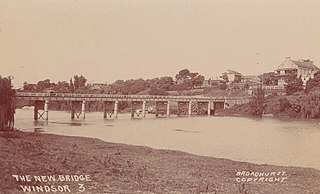
The Windsor Bridge, officially called the Hawkesbury River Bridge, Windsor, a beam bridge across the Hawkesbury River, is located in Windsor in north-western Sydney, New South Wales, Australia. The bridge was built in 1874. On 18 May 2020, the replacement bridge was opened to traffic within Windsor, NSW.

The Wil-Cox Bridge is a historic concrete arch pedestrian bridge spanning the Yadkin River between Rowan and Davidson counties in North Carolina. The bridge formerly carried two lanes of US 29/US 70/NC 150, but is now part of the Davidson County Greenway system and Yadkin River Park.
Horotiu is a small township on the west bank of the Waikato River in the Waikato District of New Zealand. It is on the Waikato Plains 13 km (8.1 mi) north of Hamilton and 5 km (3.1 mi) south of Ngāruawāhia. From early in the 20th century it developed around a freezing works and other industries.

Martin's Point Bridge spans the Presumpscot River in Maine, United States, near the river’s mouth with Casco Bay. It connects Falmouth Foreside, at Mackworth Point, in the north, to the East Deering neighborhood of Portland, at Martin's Point, in the south. 1,300 feet (400 m) in length, it carries vehicular and pedestrian traffic of U.S. Route 1. The bridge is two lanes, including a bicycle lane in each, with a pedestrian lane on the eastern side. A similar plan for the western side of the bridge was abandoned.


