Gallions railway station

Last updated

Gallions
Location Gallions Reach
Local authority London Borough of Newham
OwnerLondon & St. Katharine Docks Company
Number of platforms2
Key dates
1880 (1880)Opened
1886 (1886)Relocated east
1940 (1940)Closed
Other information
Underground sign at Westminster.jpg  London transportportal

Gallions was the name of two distinct railway stations that adjoined the River Thames by Gallions Reach in Beckton, east London.

Contents

Opening of the branch and First station

Construction of a railway line from Custom House to Gallions was authorized by an Act of Parliament that had also approved the construction of the Royal Albert Dock. The London & St. Katharine Docks Company opened the branch on 3 August 1880, initially as far as Central, and it was fully opened when it reached the Gallions terminus in November 1880. The facility consisted of two platforms. [1]

There were two primary reasons for building the branch. Firstly, the size of the docks necessitated a transport link to enable business and commuting to and from the docks. Secondly, because the Albert Dock handled passengers, easier access to the quays was required to connect ships that left for all parts of the British Empire. This was why a hotel was built adjacent to the terminus, which is mentioned in The Light That Failed by Rudyard Kipling (who actually stayed at the hotel) where the hero asks a P&O clerk, "Is it Tilbury and a tender or Gallions and the dock?". [2]

Second station

The station was subsequently relocated 275 yards further east, reopening on 12 December 1886, to facilitate the development of the dock. [3]

The new terminus was located on a different alignment from its predecessor, which diverged at Manor Way slightly to the north. [4] It consisted of an island platform with two platform faces: Platform 1 was generally used by the Great Eastern Railway (GER) services, and Platform 2 was used by the shuttle service operated by the dock company towards Custom House. Each of the platforms had a loop for locomotives to run around, with a water tower located at the end. Access to the platforms was from a footbridge at the west end of the station. The signal box contained 21 working and seven spare levers.

The tracks continued beyond the end of the platforms to the docks and a pier. In the later years, William Cory & Son Limited operated the pier, which handled coal and employed their locomotives for shunting. [5] [6]

Locomotives

The line was operated by locomotives wholly owned by the dock company. Initially, the first locomotives were hired from the construction contractors Lucas and Aird, but later they were replaced by three 2-4-0T locomotives that were formerly owned by the London and North Western Railway (LNWR). These were numbered as No. 5 (LNWR No. 1819, built 1850), No. 6 (LNWR No. 1927, built 1849) and No. 7 (LNWR No. 436, built 1847). [note 1] All three were allocated to the Custom House engine shed. In an 1890 photograph of one of these locomotives, it was seen carrying the name "Royal Albert Dock" on its water tanks. [7]

Services

When the service first started, two trains operated per hour. However, due to increased demand, the service was increased to three trains per hour by 1881. [8] The GER began offering regular through-services to Fenchurch Street, some of which were routed via Bow Road and Stratford, while most of them were routed via Bromley-by-Bow and a spur at Abbey Mills Junction. Additional Liverpool Street services and shorter workings from Stratford (low-level platforms) or Stratford Bridge were later introduced.

On 1 January 1889 the London & St. Katharine Docks Company and the East and West India Docks organizations united and started operating as a joint committee. They later merged in 1901 and became the London and Indian Docks Company.

The GER took over operation of all the train services in July 1896 when the Dock Company's three former LNWR locomotives were withdrawn. [9]

Around the turn of the century the line reached its zenith in terms of passengers carried and in 1900 there were 53 weekday services each way.

These broke down as: [10]

During World War I, Sunday services were withdrawn on 27 June 1915, followed by bank holiday workings in 1918. In early 1918, a special daily service was introduced for munitions workers of Woolwich Arsenal, which ran east of the station to a jetty for a connecting service; this service ceased at the end of the war.

On 31 March 1909 all remaining London dock companies merged and became the Port of London Authority (PLA), which became responsible for the operation of the branch and Gallions station. [11]

In 1923, the GER became part of the London and North Eastern Railway (LNER), which took over the train workings. Throughout the branch's lifetime, the signal boxes and level crossings were in the responsibility of the dock company.

Passenger services continued to decline, and in 1932 the shuttle service from Custom House was withdrawn, leaving only the remaining through services. At the beginning of World War II, the service was further reduced and stopped operating between 13:10 on Saturdays and 07:20 on Sundays.

The 1938 timetable showed:

Closure

After the Gallions terminus suffered severe bomb damage on 7 September 1940, it was closed and a replacement bus service was introduced. Goods trains continued to operate on the Royal Docks over adjacent PLA-owned lines.

The branch was eventually repaired and used for occasional trains to and from Cory's, as well as for wagon storage. This traffic ended in 1967. [6]

The station building at Gallions was probably demolished in the early 1960s. [note 2]

With the redevelopment of London Docklands in the 1980s and 1990s, the line between Custom House and Manor Way was turned into an extension of the Docklands Light Railway to Beckton. However, the final section between Manor Way and Gallions was not used and has since been built over. There is no trace of Gallions station left today, except for the hotel that stood adjacent to it. The hotel served as a public house until 1972 and included part of the original station platform. A study of photographs of the hotel in 2015 and via Google Earth suggests that the area has since been landscaped.

Notes

  1. Note that these numbers were the last ones they carried on the LNWR, and the dock company also had other locomotives to shunt the docks and wharves in the area.
  2. Noted by Connor as extant in the 1950s, but gone by 1965.

Related Research Articles

<span class="mw-page-title-main">Docklands Light Railway</span> Automated light metro system in the Docklands area of London, England

The Docklands Light Railway (DLR) is an automated light metro system primarily serving the redeveloped Docklands area of London and providing a direct connection between London's two major financial districts, Canary Wharf and the City of London. First opened on 31 August 1987, the DLR has been extended multiple times, giving a total route length of 38 km. Lines now reach north to Stratford, south to Lewisham, west to Tower Gateway and Bank in the City of London financial district, and east to Beckton, London City Airport and Woolwich Arsenal. Further extensions are being considered.

<span class="mw-page-title-main">Limehouse station</span> Docklands Light Railway and National Rail station

Limehouse is a National Rail and connected Docklands Light Railway (DLR) station in Limehouse, London, England. It is served by regional services operated by c2c to and from Fenchurch Street, and by light metro services provided by the DLR to and from Tower Gateway or Bank. On the main line, Limehouse is located 1 mile 58 chains (2.8 km) from Fenchurch Street and the following station is West Ham; on the DLR it is between Shadwell and Westferry in Travelcard Zone 2.

<span class="mw-page-title-main">Fenchurch Street railway station</span> Railway terminus in the City of London

Fenchurch Street railway station, also known as London Fenchurch Street, is a central London railway terminus in the southeastern corner of the City of London. It takes its name from its proximity to Fenchurch Street, a key thoroughfare in the City. The station and all trains are operated by c2c. Services run on lines built by the London and Blackwall Railway (L&BR) and the London, Tilbury and Southend Railway (LTSR) are to destinations in east London and south Essex, including Upminster, Grays, Basildon, Southend and Shoeburyness.
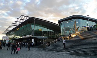
<span class="mw-page-title-main">Stratford station</span> London Underground, Docklands Light Railway and National rail station

Stratford is a major multi-level railway station serving the district of Stratford and the mixed-use development known as Stratford City, in the London Borough of Newham, east London. It is served by the London Underground, London Overground, Docklands Light Railway (DLR) and is also a National Rail station on the West Anglia Main Line and the Great Eastern Main Line, 4 miles 3 chains (6.5 km) from Liverpool Street.

<span class="mw-page-title-main">Custom House station</span> Railway and DLR station in London

Custom House is a railway station on the Docklands Light Railway (DLR) – on which it is branded Custom House for ExCeL – and on the Elizabeth line, by the Royal Docks, in Custom House in the London Borough of Newham, London, England. It is situated in Travelcard Zone 3. It takes its name from the old Custom House, which formerly stood nearby, and ExCeL London which it serves.

Originally called the Commercial Railway, the London and Blackwall Railway (L&BR) in east London, England, ran from Minories to Blackwall via Stepney, with a branch line to the Isle of Dogs, connecting central London to many of London's docks. It was operational from 1840 until 1926 and 1968, closing after the decline of inner London's docks. Much of its infrastructure was reused as part of the Docklands Light Railway. The L&BR was leased by the Great Eastern Railway in 1866, but remained independent until absorbed into the London and North Eastern Railway at the 1923 Grouping. Another branch was opened in 1871, the Millwall Extension Railway.

<span class="mw-page-title-main">London, Tilbury and Southend line</span> Commuter railway line in Essex, England

The London, Tilbury and Southend line, also known as Essex Thameside, is a commuter railway line on the British railway system. It connects Fenchurch Street station, in central London, with destinations in east London and Essex, including Barking, Upminster, Basildon, Grays, Tilbury, Southend and Shoeburyness.
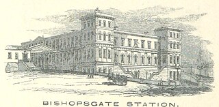
<span class="mw-page-title-main">Bishopsgate railway station</span> Disused railway station in London, England

Bishopsgate was a railway station located on the eastern side of Shoreditch High Street in the parish of Bethnal Green on the western edge of the East End of London and just outside the City of London.

<span class="mw-page-title-main">Great Eastern Railway</span> Pre-grouping British railway company

The Great Eastern Railway (GER) was a pre-grouping British railway company, whose main line linked London Liverpool Street to Norwich and which had other lines through East Anglia. The company was grouped into the London and North Eastern Railway in 1923.
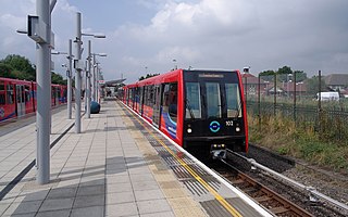
<span class="mw-page-title-main">Beckton DLR station</span> Docklands Light Railway station

Beckton is the eastern terminus of the Beckton branch of the Docklands Light Railway (DLR) in the Docklands area of east London. It is in Travelcard Zone 3.

The North London Railway (NLR) company had lines connecting the northern suburbs of London with the East and West India Docks further east. The main east to west route is now part of London Overground's North London Line. Other NLR lines fell into disuse but were later revived as part of the Docklands Light Railway, and London Overground's East London Line. The company was originally called the East & West India Docks & Birmingham Junction Railway (E&WID&BJR) from its start in 1850, until 1853. In 1909, it entered into an agreement with the London and North Western Railway which introduced common management, and the NLR was taken over completely by the LNWR in 1922. The LNWR itself became part of the LMS from the start of 1923. The railways were nationalised in 1948 and most LMS lines, including the North London route, then came under the control of the London Midland Region of British Railways.

<span class="mw-page-title-main">Bow Road railway station</span> Disused railway station in England

Bow Road is a closed railway station in Bow, East London, that was opened in 1876 on the Bow Curve branch line by the Great Eastern Railway (GER).

<span class="mw-page-title-main">Romford–Upminster line</span> London Overground line

The Romford–Upminster line is a railway branch line in Greater London that connects Romford, on the Great Eastern Main Line, to Upminster, on the London, Tilbury and Southend line and London Underground. The route is 3 miles 28 chains (5.4 km) in length and there is one intermediate station at Emerson Park which is located 1 mile 62 chains (2.9 km) from Romford. The line is part of Network Rail Strategic Route 7, SRS 07.09, and is classified as a rural line.

<span class="mw-page-title-main">Bow railway station</span> Disused railway station in England

Bow was a railway station in Bow, east London, that was opened in 1850 by the East & West India Docks and Birmingham Junction Railway, which was later renamed the North London Railway (NLR). The station was situated between Old Ford and South Bromley, and was located on the north side of Bow Road, close to the second Bow Road station which was open from 1892 to 1949. A covered footway connected the two stations between 1892 and 1917.

<span class="mw-page-title-main">Victoria Park railway station (England)</span> Former railway station in England

Victoria Park was a railway station near Victoria Park, east London, that was on the North London Railway (NLR) which opened in September 1850 to Bow and to the London Docks in January 1852.

Poplar (East India Road) was a railway station located on the East India Dock Road in Poplar, London. It was opened in 1866 by the North London Railway. It was the southern passenger terminus of the NLR, although goods trains ran on to connect to the London and Blackwall Railway (LBR) for the East India Docks or to the LBR's Millwall Extension Railway for the West India Docks.

The Eastern Counties and Thames Junction Railway in east London connected the Royal Docks with the Eastern Counties Railway (ECR). Authorised in 1844, it opened in 1846, and was absorbed by the ECR in 1847. The ECR amalgamated with other railways to form the Great Eastern Railway in 1862.
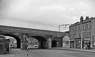
<span class="mw-page-title-main">Burdett Road railway station</span> Disused railway station in England

Burdett Road is a disused railway station located in Bow Common, east London. It was opened in 1871 by the Great Eastern Railway and closed in 1941.

The North and South Western Junction Railway (NSWJR) was a short railway in west London, England. It opened in 1853, connecting Willesden on the London and North Western Railway (LNWR) with Brentford on the London and South Western Railway (LSWR). After a difficult start it became an important freight route and that usage continues today. A passenger service linked LSWR stations with the North London Railway, and a branch was built to Hammersmith.

The London, Tilbury and Southend Railway (LT&SR), was a British railway company, whose network connected Fenchurch Street station, in central London, with destinations in east London and Essex, including Barking, Upminster, Grays, Tilbury, Southend and Shoeburyness. The company and its assets were sold to the Midland Railway in 1912. The network over which they operated is largely intact and is currently operated as part of the Essex Thameside franchise.

References

  1. Connor & (2001), p. vii.
  2. Green (2007), pp. 32, 38.
  3. Connor (2001), p. 115.
  4. Green (2007), p. 34.
  5. Jackson (1999), p. 446.
  6. 1 2 Marden (2013), p. 95.
  7. Connor (2001), p. 116.
  8. Connor (2001), p. x.
  9. Marden (2013), p. 19.
  10. Jackson (1999), p. 447.
  11. Connor (2001), p. VII.
Preceding station Disused railways Following station
Manor Way  London & St. Katharine Docks Company
Gallions Branch
 Terminus

51°30′24″N0°04′38″E / 51.5066°N 0.0771°E / 51.5066; 0.0771