
India is a federal union comprising 28 states and 8 union territories, with a total of 36 entities. The states and union territories are further subdivided into districts and smaller administrative divisions.

The Madras Presidency, or the Presidency of Fort St. George, also known as Madras Province, was an administrative subdivision (presidency) of British India. At its greatest extent, the presidency included most of southern India, including the whole of the Indian state of Tamil Nadu, and parts of Andhra Pradesh, Kerala, Karnataka, Telangana, Odisha and the union territory of Lakshadweep. The city of Madras was the winter capital of the Presidency and Ootacamund or Ooty, the summer capital. The coastal regions and northern part of Island of Ceylon at that time was a part of Madras Presidency from 1793 to 1798 when it was created a Crown colony. Madras Presidency was neighboured by the Kingdom of Mysore on the northwest, Kingdom of Cochin on the southwest, and the Kingdom of Hyderabad on the north. Some parts of the presidency were also flanked by Bombay Presidency (Konkan) and Central Provinces and Berar.

Ganjam district is a district in the Indian state of Odisha. Ganjam's total area is 8,070 km² (3,116 mi²). The district headquarters is Chhatrapur. Ganjam is divided into three sub-divisions Chhatrapur, Berhampur, and Bhanjanagar. The Imperial Gazetteer of India 1908 lists Ganjam, along with the Thanjavur and South Canara districts, as the three districts of the Madras Presidency where Brahmins were most numerous. As of 2011 it is the most populous district of Odisha.

Visakhapatnam district is one of the nine districts in the Coastal Andhra region of the Indian state of Andhra Pradesh, headquartered at Visakhapatnam. It is one of the twelve coastal districts of the state.The district share broders with in the north and east, Vizianagaram district and South Anakapalli district in the south-west and Bay of Bengal in the south.

The provinces of India, earlier presidencies of British India and still earlier, presidency towns, were the administrative divisions of British governance on the Indian subcontinent. Collectively, they have been called British India. In one form or another, they existed between 1612 and 1947, conventionally divided into three historical periods:
Chhatrapur is a town and a Notified Area Council in Ganjam district in the state of Odisha, India. It is the district headquarters town of Ganjam district. Chhatrapur is a Tehsil / Block (CD) in the Ganjam District of Odisha. According to Census 2011 information the sub-district code of Chhatrapur block is 03085. Total area of Chhatrapur is 124 km2 (48 sq mi) including 119.92 km2 (46.30 sq mi) rural area and 4.40 km2 (1.70 sq mi) urban area. Chhatrapur has a population of 94,683 people. There are 20,415 houses in the sub-district. There are about 46 villages in Chhatrapur block.
An agency of British India was an internally autonomous or semi-autonomous unit of British India whose external affairs were governed by an agent designated by the Viceroy of India.
The politics of Odisha are part of India's federal parliamentary representative democracy, where the union government exercises sovereign rights. Certain powers are reserved to the states, including Odisha. The state has a multi-party system, in which the two main parties are the nationalist Bharatiya Janata Party (BJP) and the regional, socialist Biju Janata Dal (BJD). The Indian National Congress (INC) has also significant presence.

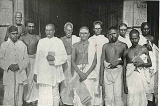
Bishwanath Das was a politician, lawyer and philanthropist from India. He was the prime minister of Odisha Province of British India 1937–39, the governor of Uttar Pradesh 1962–67 and later the chief minister of Odisha 1971–72.
Rao Bahadur Sir Annepu Parasuramdas PatroKCIE was an Indian politician, zamindar and education minister in the erstwhile Madras Presidency.

Odisha Day, also Utkal Dibas, is celebrated on 1 April in the Indian state of Odisha in memory of the formation of the state as a separate state out of Bihar and Orissa Province with addition of Koraput and Ganjam from the Madras Presidency on 1 April 1936. After losing its political identity completely in 1568 following the defeat and demise of the last king Mukunda Dev, efforts resulted in the formation of a politically separate state under British rule on a linguistic basis on 1 April 1936.
The first census of the Madras Presidency was taken in the year 1822. It returned a population of 13,476,923. The second census conducted in 1836-37 returned a population of 13,967,395, an increase of only 490,472 in 15 years. The first quinquennial enumeration of the population was made in 1851-52. It returned a population of 22,031,697. Subsequent enumerations were made in 1856-57, 1861–62 and 1866-67. The population of Madras Presidency was found to be 22,857,855 in 1851-52, 24,656,509 in 1861-62 and 26,539,052 in 1866-67.

The Madras Presidency was a province of British India comprising most of the present day Tamil Nadu and Andhra Pradesh along with a few districts and taluks of Karnataka, Kerala and Odisha. A few princely states, notably Ramnad and Pudukkottai also merged into the Presidency at some or the other time. The Presidency lasted till 1950, when it became the Madras State after India became a republic. In 1953, Telugu-speaking regions of the state split to form Andhra State. Subsequently, in 1959, Kannada- and Malayalam-speaking areas were merged with Mysore and Travancore.
Puroshottam Choudhary also spelled Purushottama Chaudhary or Purushothama Choudhari was a great 19th century Telugu Christian poet. He was a Christian preacher, evangelist, and pastor of the Berhampur Church, founded by Isaac Stubbins in 1838.

Raj-Ranpur is a small town in the district of Nayagarh in the eastern Indian state of Odisha. The village is also known as Ranpurgarh or simply Ranpur as per the modern usage. The village is historically significant especially during the British Raj when it was the capital of the princely state of Ranpur. The martyrs Shaheed Raghu-Dibakar who were hanged for their resistance to British rule belong to this place. Rajsunakhala and Tang-Chandapur are the nearest Town of Raj- Ranpur, which in almost 14 & 10 km from the village. Rajsunakhala is the most important business Town in Ranpur block under Nayagarh district.
Vizagapatam District was a district in the Madras Presidency of British India. Covering an area of 44,600 square kilometres (17,222 sq mi) and sub-divided into 22 taluks.
Orissa Province was a province of British India created in April 1936 by the partitioning of the Bihar and Orissa Province. Its territory corresponds with the modern-day State of Odisha.
The Districts of British India were administrative units of the Government of the British Raj or Indian Empire. Districts were generally subdivisions of the provinces and divisions of British India
The Vizagapatam Hill Tracts Agency was an agency in the Madras Presidency of British India. The agency was autonomous and supervised by an agent subordinate to the District Collector of Vizagapatam District.
The village of Kotia is the headquarters of a Gram Panchayat of the same name in the Pottangi block of Koraput District in Odisha, India. Along with other villages of the Gram Panchayat, it is the subject of a long pending border dispute between the states of Odisha and Andhra Pradesh, which claims it as a part of Salur mandal in Parvathipuram Manyam district of the State.