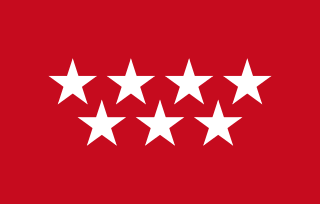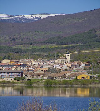
The Community of Madrid is one of the seventeen autonomous communities of Spain. It is located in the centre of the Iberian Peninsula, and of the Central Plateau. Its capital and largest municipality is the City of Madrid, which is also the capital of the country. The Community of Madrid is bounded to the south and east by Castilla–La Mancha and to the north and west by Castile and León. It was formally created in 1983, based on the limits of the province of Madrid, which was until then conventionally included in the historical region of New Castile.

Gurabo is a town and municipality in eastern Puerto Rico. It is located in the central eastern region, north of San Lorenzo; south of Trujillo Alto; east of Caguas; and west of Carolina and Juncos. Gurabo is spread over 9 barrios and Gurabo Pueblo. It is part of the San Juan-Caguas-Guaynabo Metropolitan Statistical Area.

Juncos is a town and one of the 78 municipalities of Puerto Rico. It is located in the eastern central region of the island to the west of the Caguas Valley, south of Canóvanas and Carolina; southeast of Gurabo; east of San Lorenzo; and west of Las Piedras. Juncos is spread over 9 barrios and Juncos barrio-pueblo. It is part of the San Juan-Caguas-Guaynabo Metropolitan Statistical Area.

San Pedro Carchá, usually referred to as Carchá, is a town, with a population of 16,353, and a municipality in the Guatemalan department of Alta Verapaz. It is situated at 1282 m above sea level. The municipality has a population of 235,275 and covers an area of 1310 km2.
San Bartolomé Milpas Altas is a town and municipality in the Guatemalan department of Sacatepéquez.

San Sebastián de los Reyes is a municipality in the Community of Madrid, Spain. Founded in 1492, it is located 20 kilometres (12 mi) north of Madrid.

San Agustín del Guadalix is a Spanish town located north of the Comunidad de Madrid, near to Sierra de Guadarrama.

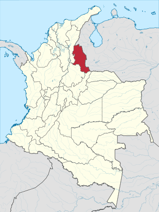
Barrancas is a town and municipality of the Colombian Department of La Guajira. The municipality of Barrancas is located to the left margin of the Ranchería River in a valley formed between the Sierra Nevada de Santa Marta mountains and the Serranía del Perijá. Barrancas has a total area of 742 km2 and at 40 meters over sea level. The average temperature is 28 °C throughout the year and distances from the capital of the Department of La Guajira, Riohacha. It became a municipality in 1892.

Sevilleja de la Jara is a municipality located in the province of Toledo, Castile-La Mancha, Spain. According to the 2006 census (INE), the municipality has a population of 0 inhabitants.Y no tienen agua

Colombian literature, as an expression of the culture of Colombia, is heterogeneous due to the coexistence of Spanish, African and Native American heritages in an extremely diverse geography. Five distinct historical and cultural traditions can be identified, with their own socioeconomic history: the Caribbean coast, Greater Antioquia, the Cundinamarca-Boyacá Highlands, Greater Tolima and the Western Valley. Colombia produced one of the richest literatures of Latin America, as much for its abundance as for its variety and innovation during the 19th and 20th centuries. Colombian intellectuals who forged the literature of this period also contributed decisively to the consolidation of Latin American literature.

North Santander is a department of Northeastern Colombia. It is in the north of the country, bordering Venezuela. Its capital is Cúcuta, one of the country's major cities.

Buitrago del Lozoya is a municipality of the autonomous community of Madrid in central Spain. It belongs to the comarca of Sierra Norte. The town is one of the few in the community that have maintained its walls, which are of Moorish origin and have been restored in the 15th century. It lies on a peninsula surrounded by the Lozoya river.

Lozoya is a municipality in the Community of Madrid, Spain. The municipality covers an area of 57.94 km2. It is located at 1,116 metres above sea level.

Madarcos is a municipality of the Community of Madrid, Spain. It has an area of 8.46 km2 with a population of 49 inhabitants and a density of 5.79 inhabitants / km2 it is the town with the lowest population in the Community of Madrid.

El Molar is a municipality of the Community of Madrid, Spain.

The Castle of Buitrago del Lozoya is a castle located inside the walls of Buitrago del Lozoya, Community of Madrid region, Spain.

Oteruelo del Valle is a Spanish town of the province and community of Madrid, situated in the valley of Lozoya, exactly in the northwest of the province. The nearest villages are Alameda del Valle (1.4 km), Rascafría (2.3 km) and Pinilla del Valle (2.8 km). It was an independent township until 1975, but since then it is part of Rascafría, being considered as one of the nucleus of the population.
Gargantilla may refer to:

Robregordo is a municipality of the Community of Madrid, Spain.
Lozoya is a municipality in the Community of Madrid, Spain.


