Related Research Articles

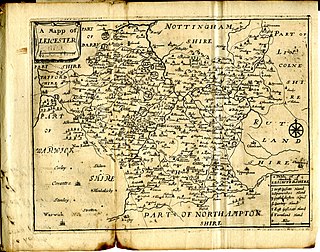
Leicestershire is a ceremonial and non-metropolitan county in the East Midlands, England. The county borders Nottinghamshire to the north, Lincolnshire to the north-east, Rutland to the east, Northamptonshire to the south-east, Warwickshire to the south-west, Staffordshire to the west, and Derbyshire to the north-west. The border with most of Warwickshire is Watling Street, the modern A5 road.

Market Harborough is a market town and unparished area in the Harborough district of Leicestershire, England, in the far southeast of the county, forming part of the border with Northamptonshire.

Oadby and Wigston is a local government district and borough in the county of Leicestershire, England. It was formed in 1974, under the Local Government Act 1972, from the merger of the Oadby and Wigston urban districts. The population of the district at the 2011 census was 56,170. The district forms part of the Harborough constituency.

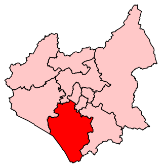
Harborough is a local government district of Leicestershire, England, named after its main town, Market Harborough. Covering 230 square miles (600 km2), the district is by far the largest of the eight district authorities in Leicestershire and covers almost a quarter of the county. The district also covers the town of Lutterworth and villages of Broughton Astley and Ullesthorpe.
This article is intended to give an overview of the history of Leicestershire.

Scraptoft is a village in Leicestershire, England. It has a population of about 1,500, measured at the 2011 census as 1,804. It lies north of the A47 road east of Leicester, and runs directly into the built up area of Thurnby and Bushby to the south. For local government the village forms part of the district of Harborough, and constitutes a civil parish.

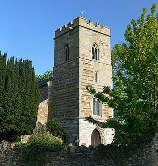
Great Easton is a village and civil parish in the Harborough district of Leicestershire, England. The parish had a population of 558 according to the 2001 census, increasing to 671 at the 2011 census.
East Goscote Hundred was a hundred of Leicestershire, that arose from the division of the ancient Goscote hundred into two. It covered the eastern part of today's Charnwood district, along with the northern part of Harborough District, and extended south-east to meet Rutland.

Burton Overy is a village and civil parish in the Harborough district of Leicestershire, about nine miles south-east of Leicester city centre, and not far from Great Glen. According to the 2001 census, the parish had a population of 289., increasing at the 2011 census to 440.

Carlton Curlieu is a small village and civil parish in the Harborough district of Leicestershire, about eleven miles south-east of Leicester city centre, and not far from Kibworth.
Cranoe is a small village and civil parish in the Harborough district of Leicestershire, England. The parish had a population of 35 in 2001. The population remained less than 100 and was included in the civil parish of Glooston.

Glooston is a small village and civil parish in the Harborough district of Leicestershire, England. According to the 2001 census the parish had a population of 54, increasing to 147 at the 2011 census.
South Leicestershire is a constituency represented in the House of Commons of the UK Parliament since 2015 by Alberto Costa, a member of the Conservative Party.

Stockerston is a village and civil parish in the Harborough district of Leicestershire, England, located on the border with Rutland, by the Eye Brook. According to the 2001 census the parish had a population of 35. The population remained less than 100 at the 2011 census and is included in the civil parish of Horninghold.

Medbourne is a village and civil parish in the Harborough district, in the county of Leicestershire, England. The population of the civil parish at the 2011 census was 473.

Little Bowden is an area on the edge of Market Harborough and former civil parish, now in the unparished area of Market Harborough, in the Harborough district, in the county of Leicestershire, England. As a village it was formerly part of Northamptonshire. The River Jordan runs through part of the area. Now, it's been integrated into Market Harborough and is fully part of the town using the town's address of 'Market Harborough'. In 1921 the parish had a population of 2768. On 1 April 1927 the parish was abolished and merged with Market Harborough.
HM Prison Gartree is a Category B men's prison, located in Market Harborough, Leicestershire, England. Gartree is operated by His Majesty's Prison Service.
Tur Langton is a small village and civil parish in the Harborough district, in the heart of Leicestershire in England. Tur Langton is home to St Andrews Church and The Crown Inn, situated in the centre of the village. The next nearest settlement of significant size is the civil parish Kibworth Harcourt, found approximately 2 km west of Tur Langton. According to the 2011 census, Tur Langton had a population of 316.
Saddington is a village in the Harborough district of Leicestershire, England. It is close to Smeeton Westerby, Gumley, Kibworth and Fleckney. The population of the civil parish at the 2011 census was 309.

Harborough Museum was opened in 1983 in the former R & W H Symington corset factory that also houses the Harborough District Council offices in the historic market town of Market Harborough. It is run by a partnership between Leicestershire County Council, Harborough District Council and Market Harborough Historical Society. Since 2014, its affairs have been overseen by a new charitable organisation, the Harborough Museum Trust.
References
- ↑ Michael Wood, The Story of England. Published by Viking Penguin 2010 ( ISBN 978-0-670-91903-1).
- ↑ J. M. Lee and R. A. McKinley, A History of the County of Leicestershire: Volume 5 , Victoria County History
Coordinates: 52°30′N0°54′W / 52.5°N 0.9°W
| | This Leicestershire location article is a stub. You can help Wikipedia by expanding it. |