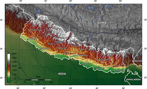
Nepal topography. The green/yellow zones hold the Inner Terai valleys.
The Gaur has a humid, tropical climate. The mean annual rainfall at the Gaur was 2,214mm (87.2in) between 1995 and 2006. More than 80% of the total annual rainfall occurs during the monsoon season from June to September. Average temperatures ranged from 8.08°C (46.54°F) in January to 34.91°C (94.84°F) in June.[5]
In the past, the inner and outer Terai were a formidable barrier between Nepal and potential invaders from India because marshes and forests were infested by anopheline mosquitos that transmitted virulent strains of malaria, especially during the hot spring and rainy summer monsoon.
There are several differences between the climate on the eastern edge of the Terai at Biratnagar in Nepal and on the western edge of the Terai at Nepaljung in Nepal to that of Gaur in Nepal although they lies in same plain of Terai.
Moving inland and away from monsoon sources in the Bay of Bengal, the climate becomes more continental with a greater difference between summer and winter.
In the far western Terai, which is five degrees latitude further north, the coldest months' average is 3°C (37°F) cooler.
Total rainfall markedly diminishes from east to west. The monsoon arrives later, is much less intense and ends sooner. However, winters are wetter in the west.au in Nepal near the central edge although both lies in Terai.
Moving inland and away from monsoon sources in the Bay of Bengal, the climate becomes more continental with a greater difference between summer and winter.
In the far western Terai, which is five degrees latitude further north, the coldest months' average is 3°C (37°F) cooler.
Total rainfall markedly diminishes from east to west. The monsoon arrives later, is much less intense and ends sooner. However, winters are wetter in the west.
Education
Shree Juddha Campus
The origin of this campus goes back to its former "Shree Juddha Higher Secondary School" and further "Shree Juddha Secondary School", the third-oldest school in Nepal inaugurated by Juddha Shamsher Jang Bahadur Rana during Rana dynasty. The school got its name from his name. The institution has about 1500 students.
Gaur-Chandranigahpur Highway, Birendra Highway, starts there and joins to East-West Highway in Chandrapur which connects Gaur to all major cities of Nepal.
As it is a border of Nepal that links India via Bairgania, one can reach to all major cities of India using Indian Railways available at Bairgania. Bairgania railway station is about 3km from Gaur and several local transport like Tanga, Rickshaw, etc. are available from here.
Communication
Nepal Telecom and Ncell have network coverage. Ncell has a 4G network for a long time there but now Nepal Telecom has now 4G network. Other cellular network available are UTL Nepal, Smart Cell. Indian network providers such as BSNL and MTS's network is available too. ISPs like Worldlink, UTL Nepal, and Nepal Telecom is available. Subisu is the largest ISPs in Rautahat district.
Border sharing with India
Gaur has its importance because of its border sharing with Bairgania, India also. No documents are required to cross the border. Certain restrictions are enforced on many edible and electronics products and they are properly checked before allowing them to cross.[7]
There is a customs office which keeps a check on vehicles that enter Gaur and have an Indian vehicle registration number. Certain taxes are imposed by the office on heavy products or items entering Nepal.
This page is based on this Wikipedia article Text is available under the CC BY-SA 4.0 license; additional terms may apply. Images, videos and audio are available under their respective licenses.