General Carrera Lake (Chilean part, officially renamed in 1959)[6] or Lake Buenos Aires (Argentine part) is a deep lake located in Patagonia and shared by Argentina and Chile. Both names are internationally accepted, while the autochthonous name of the lake is Chelenko, which means "stormy waters" in Aonikenk.[7] Another historical name is Coluguape from Mapuche, a derivative of this name is applied to Colhué Huapí Lake after Argentine explorer Francisco Moreno reached this lake in 1876 conflating it with Coluguape (General Carrera Lake).[8]
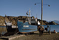
The area near the coast of the lake was first inhabited by criollos and European immigrants between 1900 and 1925. In 1971 and 1991, eruptions of the Hudson Volcano severely affected the local economy, especially that of sheep farming. A car ferry operates between Puerto Ingeniero Ibáñez and Chile Chico in the Chilean sector of the lake. The lake is known as a trout and salmon fishing destination.
Area
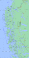
The lake has a surface of 1,850km2 (710sqmi) of which 970 square kilometres (370sqmi) are in the Chilean Aysén del General Carlos Ibáñez del Campo Region, and 880 square kilometres (340sqmi) in the Argentine Santa Cruz Province, making it the biggest lake in Chile, and the fourth largest in Argentina. In its western basin, Lake Gen. Carrera has 586m (1,923ft) maximum depth.[9]
The lake occupies a continental-scale graben formed by SWS-ENE normal faults that have resulted in down-dropping the bottom of the lake to 350 meters (1,150ft) below mean sea level.[10] Preservation of younger lithostratigraphic units within the graben form reverse stratigraphy with older units exposed at higher topographic elevations to the south. The graben channeled mountain glaciers which formed terminal moraine helping to modify the present-day shape of the lake. The tectonic activity that formed the depression can be inferred to subduction of the triple joint that has occurred over the past 20 million years, as indicated by ripple marks in volcaniclastic sediments observed along the southern shoreline. There is some speculation on whether the tectonics and crustal heat flow in the lake area are influenced by the asthenospheric window that exists beneath the crust in this region of Patagonia.[11]
The Marble Caves, Marble Chapel, and Marble Cathedral are unusual geological formations located on the shoreline midway along the lake's length. They represent a group of caverns, columns, and tunnels formed in monoliths of marble. The Marble Caves have been formed by wave action over the last 6,200 years.[12]
The northwestern shores have valuable mineral deposits of lead and zinc which were exploited intermittently from 1931 to 1996 in Puerto Cristal.[13]
There are various river deltas on the lake's shores and some of them have older parts that are raised showing ivendence of higher lake levels in the past. The three main deltas lie at the outlet of the rivers Maitenes, Aviles and Jeinimeni on the southern shores.[14]
↑ Murdie et al. 1999, Geo-Marine Letters 18:315-320.
↑ B. Scalabrino, et al., A morphotectonic analysis of central Patagonian Cordillera: Negative inversion of the Andean belt over a buried spreading center?, TECTONICS, VOL. 29, TC2010, doi:10.1029/2009TC002453, 2010
↑ Lagabrielle, Yves; Suárez, Manuel; Rossello, Eduardo A.; Hérail, Gérard; Martinod, Joseph; Régnier, Marc; de la Cruz, Rita (2004). "Neogene to Quaternary tectonic evolution of the Patagonian Andes at the latitude of the Chile Triple Junction". Tectonophysics. 385 (1–4): 211–241. Bibcode:2004Tectp.385..211L. doi:10.1016/j.tecto.2004.04.023.
This page is based on this Wikipedia article Text is available under the CC BY-SA 4.0 license; additional terms may apply. Images, videos and audio are available under their respective licenses.