County Wexford is a county in Ireland. It is in the province of Leinster and is part of the Southern Region. Named after the town of Wexford, it was based on the historic Gaelic territory of Hy Kinsella, whose capital was Ferns. Wexford County Council is the local authority for the county. The population of the county was 163,527 at the 2022 census.

A projected coordinate system – also called a projected coordinate reference system, planar coordinate system, or grid reference system – is a type of spatial reference system that represents locations on Earth using Cartesian coordinates (x, y) on a planar surface created by a particular map projection. Each projected coordinate system, such as "Universal Transverse Mercator WGS 84 Zone 26N," is defined by a choice of map projection (with specific parameters), a choice of geodetic datum to bind the coordinate system to real locations on the earth, an origin point, and a choice of unit of measure. Hundreds of projected coordinate systems have been specified for various purposes in various regions.
The Ordnance Survey National Grid reference system (OSGB) is a system of geographic grid references used in Great Britain, distinct from latitude and longitude.

A pole of inaccessibility with respect to a geographical criterion of inaccessibility marks a location that is the most challenging to reach according to that criterion. Often it refers to the most distant point from the coastline, implying a maximum degree of continentality or oceanity. In these cases, a pole of inaccessibility can be defined as the center of the largest circle that can be drawn within an area of interest without encountering a coast. Where a coast is imprecisely defined, the pole will be similarly imprecise.

A contour line of a function of two variables is a curve along which the function has a constant value, so that the curve joins points of equal value. It is a plane section of the three-dimensional graph of the function parallel to the -plane. More generally, a contour line for a function of two variables is a curve connecting points where the function has the same particular value.

There has long been debate over the exact location of the geographical centre of the United Kingdom, and its constituent countries, due to the complexity and method of the calculation, such as whether to include offshore islands, and the fact that erosion will cause the position to change over time. There are two main methods of calculating this "centre": either as the centroid of the two-dimensional shape made by the country, or as the point farthest from the boundary of the country. These two methods give quite different answers.

Kilbeggan is a town in County Westmeath, Ireland. It is in the barony of Moycashel.

Lough Ree, translated to English as King's Lake or King Lake, is a lake in the midlands of Ireland, the second of the three major lakes on the River Shannon. Lough Ree is the second largest lake on the Shannon after Lough Derg. The other two major lakes are Lough Allen to the north, and Lough Derg to the south. There are also several minor lakes along the length of the river. The lake serves as a border between the counties of Longford and Westmeath on the eastern side and County Roscommon in the province of Connacht on the western side. The lake is popular for fishing and boating. The lake supports a small commercial eel fishery and is locally famous for its eels on wheels truck. The town of Athlone is situated at the southern end of the lake, and has a harbour for boats going out on the lake. The small town of Lanesboro is at the northern end of the lake.
The Irish grid reference system is a system of geographic grid references used for paper mapping in Ireland. The Irish grid partially overlaps the British grid, and uses a similar co-ordinate system but with a meridian more suited to its westerly location.

The location of the geographical centre of Europe depends on the definition of the borders of Europe, mainly whether remote islands are included to define the extreme points of Europe, and on the method of calculating the final result. Thus, several places claim to host this hypothetical centre.

In demographics, the center of population of a region is a geographical point that describes a centerpoint of the region's population. There are several ways of defining such a "center point", leading to different geographical locations; these are often confused.

Ordnance Survey Ireland was the national mapping agency of Ireland. It was established on 4 March 2002 as a body corporate. It was the successor to the former Ordnance Survey of Ireland. It and the Ordnance Survey of Northern Ireland (OSNI) were themselves the successors to the Irish operations of the British Ordnance Survey. OSI was part of the Irish public service. OSI was headquartered at Mountjoy House in the Phoenix Park in Dublin, which had previously been the headquarters of the British Ordnance Survey in Ireland until 1922.

Eyeries is a village and its hinterland, on the Beara Peninsula in County Cork, Ireland, near the border with County Kerry. It lies at the foot of a hilly area, with a beach nearby, and is home to several retail and tourist businesses.

The Hill of Uisneach or Ushnagh is a hill and ancient ceremonial site in the barony of Rathconrath in County Westmeath, Ireland. It is a protected national monument. It consists of numerous monuments and earthworks—prehistoric and medieval—including a probable megalithic tomb, burial mounds, enclosures, standing stones, holy wells and a medieval road. Uisneach is near the geographical centre of Ireland, and in Irish mythology it is deemed to be the symbolic and sacred centre of the island. It was said to be the burial place of the mythical Tuatha Dé Danann, and a place of assembly associated with the druids and the festival of Bealtaine.
Irish Transverse Mercator (ITM) is the geographic coordinate system for Ireland. It was implemented jointly by the Ordnance Survey Ireland (OSi) and the Ordnance Survey of Northern Ireland (OSNI) in 2001. The name is derived from the Transverse Mercator projection it uses and the fact that it is optimised for the island of Ireland.

Ordnance Survey (OS) is the national mapping agency for Great Britain. The agency's name indicates its original military purpose, which was to map Scotland in the wake of the Jacobite rising of 1745. There was also a more general and nationwide need in light of the potential threat of invasion during the Napoleonic Wars. Since 1 April 2015, Ordnance Survey has operated as Ordnance Survey Ltd, a government-owned company, 100% in public ownership. The Ordnance Survey Board remains accountable to the Secretary of State for Science, Innovation and Technology. It was also a member of the Public Data Group.
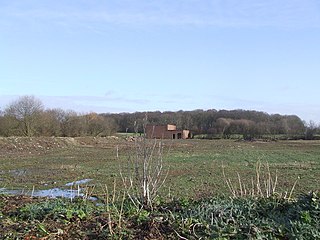
Lindley Hall Farm is a farm in Leicestershire, England, in close proximity to Fenny Drayton and Higham on the Hill. The farm is owned by Stephen Farmer. It has been best known as the geographical centre of England since the Ordnance Survey's investigation in 2002. A plaque has been erected by the Ordnance Survey denoting the geographical central point and disputing the historically believed idea that Meriden was the geographical centre.
Rathconrath, previously the barony of Rathcomyrta, before that Daltons country, is a barony in the west of County Westmeath, in Ireland. It was formed by 1542. It is bordered by County Longford to the north–west and five other Westmeath baronies: Moygoish to the north, Moyashel and Magheradernon to the east, Moycashel and Clonlonan to the south and Kilkenny West to the west. Note that the village of Rathconrath is not synonymous with the barony of the same name.

The barony of Knocktopher is a barony in the west of County Kilkenny, Ireland. The barony is 46,765 acres (189.25 km2) in size. There are 16 civil parishes made up of 125 townlands. It is one of 12 baronies in the county. The chief town is Mullinavat and it contains the settlements of Stonyford, Ballyhale, Hugginstown, Knocktopher, and Dunnamaggan. The M9 motorway bisects the barony.