Related Research Articles

Johannes Gerardus Keulemans was a Dutch bird illustrator. For most of his life he lived and worked in England, illustrating many of the best-known ornithology books of the nineteenth century.
Alexander Logie du Toit FRS was a geologist from South Africa and an early supporter of Alfred Wegener's theory of continental drift.
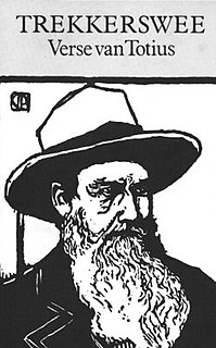
Jacob Daniël du Toit, better known by his pen name Totius, was an Afrikaner poet.

The Reverend Stephanus Jacobus du ToitAfrikaans pronunciation: [steˈfɑːnɵs jaˈkʊɵ̯bɵs dyˈtwa] was a controversial South African nationalist, theologian, journalist and failed politician. In his younger years Du Toit did much to promote the Afrikaans language as a symbol of Afrikaner nationalism. Apart from the years 1882-8 when he was Superintendent of Education in the South African Republic, he lived in or near the town of Paarl in the Cape Colony. Disillusionment with the Kruger regime led him, in later years, to moderate his views. He was instrumental in initiating the translation of the Bible into Afrikaans and was a proponent of the Afrikaans language. He died an outcast.

Gustaaf Adolf Frederik Molengraaff was a Dutch geologist, biologist and explorer. He became an authority on the geology of South Africa and the Dutch East Indies.

The Peirce quincuncial projection is the conformal map projection from the sphere to an unfolded square dihedron, developed by Charles Sanders Peirce in 1879. Each octant projects onto an isosceles right triangle, and these are arranged into a square. The name quincuncial refers to this arrangement: the north pole at the center and quarters of the south pole in the corners form a quincunx pattern like the pips on the five face of a traditional die. The projection has the distinctive property that it forms a seamless square tiling of the plane, conformal except at four singular points along the equator.

Many people of European heritage in South Africa are descended from Huguenots. Most of these originally settled in the Cape Colony, but were absorbed into the Afrikaner and Afrikaans-speaking population, because they had religious similarities to the Dutch colonists.

Morton Strait is the 9 km (4.9 nmi)-long and 6.2 km (3.3 nmi)-wide strait between Snow Island on the southwest and Rugged Island and Livingston Island on the northeast, in the South Shetland Islands, Antarctica. The Aim Rocks and Long Rock lie in the strait.

Shirreff Base is a seasonal field station in the Southern Ocean operated by the United States and opened in 1996. It is situated on the east side of Cape Shirreff on Ioannes Paulus II Peninsula on Livingston Island in the South Shetland Islands off the Antarctic peninsula.
Geologic mapping of Georgia is the creation of geologic maps, special-purpose maps made to show geological features, of the State of Georgia in the United States. Rock units or geologic strata are shown by colors or symbols to indicate where they are exposed at the surface. Structural features such as faults and shear zones are also shown. Since the first national geological map, in 1809, there have been numerous maps which included the geology of Georgia. The first Georgia-specific geologic map was created in 1825. The most recent state-produced geologic map of Georgia, by the Georgia Department of Natural Resources is 1:500,000 scale, and was created in 1976 by the department's Georgia Geological Survey. It was generated from a base map produced by the United States Geological Survey. The state geologist and Director of the Geological Survey of Georgia was Sam M. Pickering, Jr. Since 1976, several geological maps of Georgia, featuring the state's five distinct geologic regions, have been produced by the federal government.

The Diamond Fields Advertiser (DFA) is a daily newspaper published in Kimberley, South Africa, founded on 23 March 1878.
The Southern Africa Association for the Advancement of Science (S2A3 or S2A3) is a learned society, originally known as the South African Association for the Advancement of Science (SAAAS). Established in 1902, its principal aim is to increase the public awareness and understanding of science, engineering and technology, and their role in society, by means of various awards and by communicating the nature, processes, ethics, and excitement of science. Membership is open to all.

George William Stow was a South African geologist and ethnologist, a poet, historian, artist, cartographer, and writer.
Arthur William Rogers was a British and South African geologist. He was Director of the Geological Survey of South Africa.

Keith Henderson was a Scottish painter who worked in both oils and watercolours, and who is known for his book illustrations and his poster work for London Transport and the Empire Marketing Board. He had a long professional career that included periods as a war artist in both the First World War, in which he served in the trenches, and in the Second World War.
Stuart Weller was an American paleontologist and geologist.

Boris Choubert or Schuberth was a French geologist. An adept of Wegener's theory, he was the first to precisely reconstruct the layout of the continental masses of Africa, America, Europe and Greenland prior to the fragmentation of Pangaea, thirty years before the article generally credited for this discovery.
Anna Jonas Stose was a major geological pioneer, who worked for the American Museum of Natural History, Maryland Geological Survey, Pennsylvania Geological Survey, Virginia Geological Survey, and the United States Geological Survey. She is best known for her work mapping the Appalachian Mountain Range, documenting the structure of and exposure to the rock formations, and tracing crystalline rocks. Stose was among the first to implement petrographic and structural techniques to the Appalachian Mountains, which were still in development at the time. This was rare because women at this time didn't do physical work in the fields, and her hard efforts are now noted and appreciated. She contributed largely to the Geologic Map of Virginia and the Geologic Map of the United States.
Edward Morehouse Douglas was one of the first topographers employed by the U.S. Geological Survey. When Douglas began work in 1882, the goal of the new government agency was to produce an integrated topographic map of the United States to support development of natural resources including land, water, and forests. This was the plan of its director, appointed the previous year, John Wesley Powell (1834-1902). Douglas remained at the USGS for the next forty-eight years. A civil engineer who earned a degree at Columbia School of Mines in 1881, he eventually supervised all crews in the Rocky Mountain region extending from Montana to Arizona. In 1911 he became director of the Topographic Branch’s Computing Division. In 1923 he authored the standard work on boundary surveys that remained in use through the 1960s.
References
- ↑ Price, R.R.M., Catalogue of Publications of South African Geological Surveys and Government Publications on the Earth Sciences
- ↑ Hancock, Paul L.; Skinner, Brian J.; Dineley, David L. (2000), The Oxford Companion to The Earth , Oxford University Press, ISBN 0-19-854039-6