
Grand Isle is a town in Jefferson Parish in the U.S. state of Louisiana, located on a barrier island of the same name in the Gulf of Mexico. The island is at the mouth of Barataria Bay where it meets the gulf. The town of Grand Isle is statistically part of the New Orleans−Metairie−Kenner metropolitan statistical area, though it is not connected to New Orleans' continuous urbanized area.

Coastal erosion is the loss or displacement of land, or the long-term removal of sediment and rocks along the coastline due to the action of waves, currents, tides, wind-driven water, waterborne ice, or other impacts of storms. The landward retreat of the shoreline can be measured and described over a temporal scale of tides, seasons, and other short-term cyclic processes. Coastal erosion may be caused by hydraulic action, abrasion, impact and corrosion by wind and water, and other forces, natural or unnatural.

Beach nourishment describes a process by which sediment, usually sand, lost through longshore drift or erosion is replaced from other sources. A wider beach can reduce storm damage to coastal structures by dissipating energy across the surf zone, protecting upland structures and infrastructure from storm surges, tsunamis and unusually high tides. Beach nourishment is typically part of a larger integrated coastal zone management aimed at coastal defense. Nourishment is typically a repetitive process since it does not remove the physical forces that cause erosion but simply mitigates their effects.

A seawall is a form of coastal defense constructed where the sea, and associated coastal processes, impact directly upon the landforms of the coast. The purpose of a seawall is to protect areas of human habitation, conservation, and leisure activities from the action of tides, waves, or tsunamis. As a seawall is a static feature, it will conflict with the dynamic nature of the coast and impede the exchange of sediment between land and sea.

A breakwater is a permanent structure constructed at a coastal area to protect against tides, currents, waves, and storm surges. Breakwaters have been built since Antiquity to protect anchorages, helping isolate vessels from marine hazards such as wind-driven waves. A breakwater, also known in some contexts as a jetty or a Mole, may be connected to land or freestanding, and may contain a walkway or road for vehicle access.

The Mississippi River Delta is the confluence of the Mississippi River with the Gulf of Mexico in Louisiana, southeastern United States. The river delta is a three-million-acre area of land that stretches from Vermilion Bay on the west, to the Chandeleur Islands in the east, on Louisiana's southeastern coast. It is part of the Gulf of Mexico and the Louisiana coastal plain, one of the largest areas of coastal wetlands in the United States. The Mississippi River Delta is the 7th largest river delta on Earth (USGS) and is an important coastal region for the United States, containing more than 2.7 million acres of coastal wetlands and 37% of the estuarine marsh in the conterminous U.S. The coastal area is the nation's largest drainage basin and drains about 41% of the contiguous United States into the Gulf of Mexico at an average rate of 470,000 cubic feet per second.

Geotextiles are permeable fabrics which, when used in association with soil, have the ability to separate, filter, reinforce, protect, or drain. Typically made from polypropylene or polyester, geotextile fabrics come in two basic forms: woven and nonwoven.
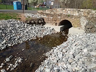
Riprap, also known as rip rap, rip-rap, shot rock, rock armour or rubble, is human-placed rock or other material used to protect shoreline structures against scour and water, wave, or ice erosion. Riprap is used to armor shorelines, streambeds, bridge abutments, foundational infrastructure supports and other shoreline structures against erosion. Common rock types used include granite and modular concrete blocks. Rubble from building and paving demolition is sometimes used, as well as specifically designed structures called tetrapods.

Coastal management is defence against flooding and erosion, and techniques that stop erosion to claim lands. Protection against rising sea levels in the 21st century is crucial, as sea level rise accelerates due to climate change. Changes in sea level damage beaches and coastal systems are expected to rise at an increasing rate, causing coastal sediments to be disturbed by tidal energy.
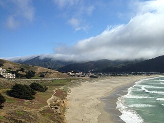
Pacifica State Beach is the southernmost of Pacifica, California's large beaches. It is a 0.75-mile-long (1.21 km) crescent-shaped beach located at the mouth of the San Pedro Valley in downtown Pacifica off State Route 1, in San Mateo County. Over one million people visit this beach annually.
Regarding the civil engineering of shorelines, soft engineering is a shoreline management practice that uses sustainable ecological principles to restore shoreline stabilization and protect riparian habitats. Soft Shoreline Engineering (SSE) uses the strategic placement of organic materials such as vegetation, stones, sand, debris, and other structural materials to reduce erosion, enhance shoreline aesthetic, soften the land-water interface, and lower costs of ecological restoration.
The Louisiana Coastal Protection and Restoration Authority (CPRA) is a governmental authority created by the Louisiana Legislature in the aftermath of Hurricanes Katrina and Rita. The organization takes advantage of both federal and state funding of around $1 billion annually. Since its founding, the organization has dredged over 60 miles of sediment into islands and artificial land, as well as 36,000 acres of marshland. CPRA predicts that over the next 50 years, over 1,450 square miles of land in Louisiana could be lost along coastal areas.

Coastal engineering is a branch of civil engineering concerned with the specific demands posed by constructing at or near the coast, as well as the development of the coast itself.

The Coastal Wetlands Planning, Protection and Restoration Act (CWPPRA) was passed by Congress in 1990 to fund wetland enhancement. In cooperation with multiple government agencies, CWPPRA is moving forward to restore the lost wetlands of the Gulf Coast, as well as protecting the wetlands from future deterioration. The scope of the mission is not simply for the restoration of Louisiana's Wetlands, but also the research and implementation of preventative measures for wetlands preservation.
A multi-purpose reef, also commonly known as an artificial surfing reef or surf reef, is a structure located offshore designed to induce wave breaking in a manner that creates a wave suitable for surfing or body boarding. Artificial surfing reefs can exist in many different configurations and be built from a variety of different materials. To date there have been fewer than ten attempts worldwide to build such structures.
Oyster reef restoration refers to the reparation and reconstruction of degraded oyster reefs. Environmental changes, modern fishing practices, over harvesting, water pollution, and other factors, have resulted in damage, disease, and ultimately, a large decline in global population and prevalence of oyster habitats. Aside from ecological importance, oyster farming is an important industry in many regions around the world. Both natural and artificial materials have been used in efforts to increase population and regenerate reefs.
The North Carolina Coastal Federation is a nonprofit organization that works with coastal residents and visitors to protect and restore the beautiful and productive N.C. coast. The four main areas in which the federation operates include: coastal advocacy; environmental education; habitat and water quality restoration and preservation; and support in the improvement and enforcement of environmental laws. The federation headquarters are located in Newport (Ocean), North Carolina, with regional offices in Wanchese and Wrightsville Beach, North Carolina. The federation is currently a member of Restore America's Estuaries (RAE).

Living shorelines are a relatively new approach for addressing shoreline erosion and protecting marsh areas. Unlike traditional structures such as bulkheads or seawalls that worsen erosion, living shorelines incorporate as many natural elements as possible which create more effective buffers in absorbing wave energy and protecting against shoreline erosion. The process of creating a living shoreline is referred to as soft engineering, which utilizes techniques that incorporate ecological principles in shoreline stabilization. The natural materials used in the construction of living shorelines create and maintain valuable habitats. Structural and organic materials commonly used in the construction of living shorelines include sand, wetland plants, sand fill, oyster reefs, submerged aquatic vegetation, stones and coir fiber logs.
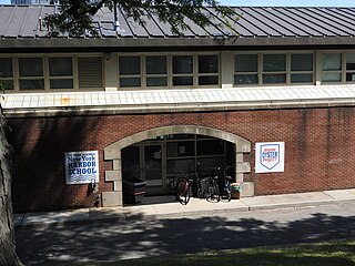
Billion Oyster Project is a New York City-based nonprofit organization with the goal of engaging one million people in the effort to restore one billion oysters to New York Harbor by 2035. Because oysters are filter feeders, they serve as a natural water filter, with a number of beneficial effects for the ecosystem. The reefs they form increase habitat and subsequent marine biodiversity levels, and help protect the city's shorelines from storm surges.

Coastal erosion in Louisiana is the process of steady depletion of wetlands along the state's coastline in marshes, swamps, and barrier islands, particularly affecting the alluvial basin surrounding the mouth of the Mississippi River. In the last century, Southeast Louisiana has lost a large portion of its wetlands and is expected to lose more in the coming years, with some estimates claiming wetland losses equivalent to up to one football field per hour. One consequence of coastal erosion is an increased vulnerability to hurricane storm surges, which affects the New Orleans metropolitan area and other communities in the region. The state has outlined a comprehensive master plan for coastal restoration and has begun to implement various restoration projects such as fresh water diversions, but certain zones will have to be prioritized and targeted for restoration efforts, as it is unlikely that all depleted wetlands can be rehabilitated.


