| Geography | |
|---|---|
| Coordinates | 6°59′02″S114°10′30″E / 6.984°S 114.175°E |
| Adjacent to | Bali Sea |
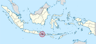
Gili Iyang is an island in the Bali Sea. The island is administered by Sumenep Regency of Indonesia's East Java province.
| Geography | |
|---|---|
| Coordinates | 6°59′02″S114°10′30″E / 6.984°S 114.175°E |
| Adjacent to | Bali Sea |
Gili Iyang is an island in the Bali Sea. The island is administered by Sumenep Regency of Indonesia's East Java province.
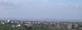
Gili Lyang is located in the Bali sea. The island is relatively underdeveloped and has been noted for its plant diversity and high concentrations of oxygen. [1] Several villages are located on the island, and a 2019 scholarly article notes that the local population relies heavily on local plants for food and medicine. [1] The island traditionally suffered from water shortages but infrastructure has gradually been improved and wells dug. [2]
The island's unusually high concentrations of oxygen have led to Gili Lyang being considered as a potential tourism hub. [3] [1]

Bali is a province of Indonesia and the westernmost of the Lesser Sunda Islands. East of Java and west of Lombok, the province includes the island of Bali and a few smaller offshore islands, notably Nusa Penida, Nusa Lembongan, and Nusa Ceningan to the southeast. The provincial capital, Denpasar, is the most populous city in the Lesser Sunda Islands and the second-largest, after Makassar, in Eastern Indonesia. The upland town of Ubud in Greater Denpasar is considered Bali's cultural centre. The province is Indonesia's main tourist destination, with a significant rise in tourism since the 1980s. Tourism-related business makes up 80% of its economy.

Lombok is an island in West Nusa Tenggara province, Indonesia. It forms part of the chain of the Lesser Sunda Islands, with the Lombok Strait separating it from Bali to the west and the Alas Strait between it and Sumbawa to the east. It is roughly circular, with a "tail" to the southwest, about 70 kilometres across and a total area of about 4,738.65 square kilometres including smaller offshore islands. The provincial capital and largest city on the island is Mataram.

Madura Island is an Indonesian island off the northeastern coast of Java. The island comprises an area of approximately 4,442 square kilometres (1,715 sq mi). Administratively, Madura is part of the province of East Java. It is separated from Java by the narrow Madura Strait. The administered area has a density of 756 people per km2 in 2022, while the main island has a somewhat higher figure of 826 per km2 in 2020.

East Java is a province of Indonesia located in the easternmost third of Java island. It has a land border only with the province of Central Java to the west; the Java Sea and the Indian Ocean border its northern and southern coasts, respectively, while the narrow Bali Strait to the east separates Java from Bali by around 2.29 kilometres (1.42 mi). Located in eastern Java, the province also includes the island of Madura, as well as the Kangean islands and other smaller island groups located further east and Masalembu archipelagos in the north. Its capital is Surabaya, the second largest city in Indonesia, a major industrial center and also a major business center. Banyuwangi is the largest regency in East Java and the largest on the island of Java.

Banyuwangi Regency is a regency of East Java province in Indonesia. This regency also known as the sun rise of Java because it is located at the easternmost end of Java Island. The town of Banyuwangi serves as a port for ferry services between Java and Bali. The regency is surrounded by mountains and forests to the west; by sea to the east and south - is separated by the Strait of Bali from Bali. With an area of 5,782.4 km2, this regency is the largest on the island of Java. The regency is a tourist destination, and subject to ongoing development as an international tourist destination with relevant infrastructure. Banyuwangi regency has been declared a taman bumi, or national geological park (Geopark) in 2018.

Tourism in Indonesia is an important component of the Indonesian economy as well as a significant source of its foreign exchange revenues. Indonesia was ranked at 20th in the world tourist Industry in 2017, also ranked as the ninth-fastest growing tourist sector in the world, the third-fastest growing in Asia and fastest-growing in Southeast Asia. In 2018, Denpasar, Jakarta and Batam are among of 10 cities in the world with fastest growth in tourism, 32.7, 29.2 and 23.3 percent respectively. The tourism sector ranked as the 4th largest among goods and services export sectors.

The Gili Islands are an archipelago of three small islands or Gili island triplets — Gili Trawangan, Gili Meno and Gili Air — just off the northwest coast of Lombok, Indonesia. The local name of these three islands is Gili Indah which means "small beautiful islands".

The Kangean Islands or simply Kangean is a collective name for a group of islands lying to the east of Madura. Kangean and its surrounding islands lie to the north of Bali in the northern Bali Sea, to the northwest of the Lesser Sunda Islands, and administratively they form three districts within Sumenep Regency, East Java Province. The group comprises a total of 91 islands including 27 inhabited islands. Kangean is located approximately 120 km (75 mi) in the north of Bali, the northwest of Lombok, and 120 km east of Madura. The biggest and most populous district is Arjasa, which includes the town of that name located in the west of the island. The Kangean Islands have a relatively large potential for natural resources, such as natural gas, teak, coconut, and salt production.

Sumenep Regency is a regency of the East Java province, Indonesia. It has an area of 2,093.59 km2 and a population of 1,042,312 inhabitants according to the 2010 census ; the 2020 census resulted in a total of 1,124,436. The official estimate as at mid 2022 was 1,135,903. The regency occupies the eastern end of Madura island and also includes numerous islands to the east, the north, and the south of Madura. It is bordered by the Pamekasan Regency to the west, Madura Strait to the south, and the Java Sea to the north and east. Its administrative capital is Sumenep. The airport nearby is Trunojoyo Airport with flights to Surabaya.

Madura Strait is a stretch of water that separates the Indonesian islands of Java and Madura, in the province of East Java. The islands of Kambing, Giliraja, Genteng, and Ketapang lie in the Strait. The Suramadu Bridge, the longest in Indonesia, spans the strait between Surabaya on Java and Bangkalan on Madura.
The following is the list of UFO sightings reported in Indonesia.

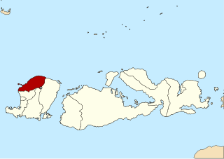
North Lombok Regency is a regency of the Indonesian Province of West Nusa Tenggara. It is located on the island of Lombok and the capital is Tanjung situated on the northwest coast of the island. The regency covers an area of 809.53 km2 and had a population of 200,072 at the 2010 Census and 247,400 at the 2020 Census; the official estimate as at mid 2022 was 256,438.

Barleria prionitis is a shrub in the family Acanthaceae, native to Island and Mainland Southeast Asia, China, the Indian Subcontinent, the Arabian Peninsula and northeastern Africa. It is widely spread as an ornamental and weed, occurring in naturalised populations around the world. It used not only as an ornamental but also as a hedge and extensively as a component of folk medicines. As a weed it is regarded as problematic in many areas.

Persatuan Sepakbola Sumenep 1977 or Perssu, commonly known as Perssu 1977 is an Indonesian football club based in Sumenep Regency, East Java. The club plays in the Liga 3.
Masalembu is an island located in the Java Sea and is the largest island in the Masalembu Islands. It is administered by the Masalembu District of the Sumenep Regency which is centered on the island of Madura and is made up of two administrative villages of Sukajeruk and Massalima.

On 11 October 2018, an earthquake struck off the coast of East Java, Indonesia, with the epicentre located off the coast of Situbondo Regency. The earthquake, which struck at dawn, killing four people in addition to destroying or damaging hundreds of houses, mostly on the small island of Sapudi.
Gili Genteng is an island located in the southeast Madura Island. Administratively, this island included in the Gili Genting District, Sumenep, East Java. Gili Genting District consists of two islands, namely Gili Raja Island, which is located on the west of Gili Genting Island, and Gili Genting Island as the center of the sub-district. Almost all the inhabitants of this island are Madurese people and most of the people migrated to Cirebon, Jakarta, Serang, and Banten. They mostly opened basic food stores. In Cirebon alone, nearly 500 shops were owned by people from Gili Genting, and had once established the IKAMA Organization which aims to discipline the Gili Genting people in Cirebon. Gili Genting District was officially formed in 1982, based on GOVERNMENT REGULATION OF THE REPUBLIC OF INDONESIA (PP) NUMBER 7 OF 1982 (7/1982). Gili Genting District consists of 8 villages namely: Aenganyar Village, Gedugan Village, Bringsang Village, Galis Village and Banbaru Village, Ban Maleng Village, Lombang Village, Jate Village.
Mursala Island, also known as Musala Island or Mursalah Island, is an island off the coast of Sumatra. It is administrated by as part of Indonesia's Central Tapanuli Regency in the province of North Sumatra.