
Berwick-upon-Tweed, sometimes known as Berwick-on-Tweed or simply Berwick, is a town and civil parish in Northumberland, England. Located 2+1⁄2 miles south of the Anglo-Scottish border, it is the northernmost town in England. The 2011 United Kingdom census recorded Berwick's population as 12,043.

Ancroft is a village and civil parish in Northumberland, England. Prior to 1844, Ancroft lay within the Islandshire exclave of County Durham. It is south of Berwick-upon-Tweed, and has a population of 885, rising slightly to 895 at the 2011 census.

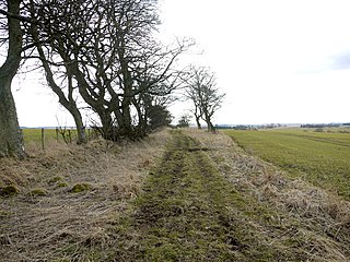
Berrington is a village in Northumberland, in England. It is situated to the south of Berwick-upon-Tweed, inland from the North Sea coast.

Bowsden is a village and civil parish in Northumberland, England. It is about 6 miles (10 km) to the south of Berwick-upon-Tweed, inland from the North Sea coast at Lindisfarne, and has a population of 157, rising to 178 at the 2011 Census.

Callaly is a village in Northumberland, England. It is about 9 miles (14 km) to the west of Alnwick. The main A697 road is 3 miles (5 km) away. It is on the line of the Roman road linking the Roman forts of High Rochester to the west and Learchild to the east, where it joins the Devil's Causeway Roman road to the north.

Capheaton is a village and civil parish in Northumberland, England, about 25 miles (40 km) to the northwest of Newcastle upon Tyne. The population at the 2001 census was 160, increasing to 175 at the 2011 Census. It was built as a planned model village in the late eighteenth century. The name Capheaton derives from Caput Heaton, i.e., Heaton Magna, nearby Kirkheaton being the original Heaton Parva.

Matfen is a village and a civil parish in Northumberland, England, near the town of Hexham and the city of Newcastle upon Tyne. It is an example of a 19th-century planned estate village. It was the birthplace of the 7th Premier of British Columbia, William Smithe.

Powburn is a small village on the A697 in Northumberland, England about 8 miles (13 km) south of Wooler and 10 miles (16 km) northwest of Alnwick.

Lowick is a village in Northumberland, north east England. Lowick lies on the B6353 road, about 10 miles (16 km) south of Berwick-upon-Tweed. The Anglican St John the Baptist's Parish Church dates from 1794, but a chapel was built in the 12th century by monks of Lindisfarne. The Grade II* listed Barmoor Castle, a castellated Tudor style country house is about a mile to the west of the village.

Great Whittington is a village in Northumberland, England, 7 miles NE of Hexham with a population of 401, as of the 2011 British Census and an area of 1494 acres, most of which is used as farmland, with only 12 acres urbanized.

Whittingham is a village and civil parish in Northumberland, England. It is situated on the banks of the River Aln, roughly 4.5 miles (7 km) east of its source at Alnham and 7.3 miles (12 km) west of Alnwick. The thirteenth/fourteenth century pele tower, Whittingham Tower, was converted into almshouses in 1845 and is now in private ownership.
Middleton is a settlement and civil parish in Northumberland, England. The parish is situated on the North Sea coast, south of the island of Lindisfarne, and contains the villages of Ross, Detchant and Elwick; all are shrunken medieval villages. Both the A1 London to Edinburgh road and East Coast Main Line pass through the parish. In the 2001 census the parish had a population of 136, falling to 115 at the 2011 Census.

Kirkheaton is a village in Capheaton parish, Northumberland, England. The village lies about 10 miles (16 km) north east of Hexham and about 5 miles (8 km) west of Belsay.
Netherwitton is a village in Northumberland, England about 8 miles (13 km) west of Morpeth.

Horton is a pair of small settlements, West Horton and East Horton, divided by a stream - the Horton Burn - in Northumberland, England 3 miles (5 km) north east of Wooler and 5 miles (8 km) west of Belford.
The Devil's Causeway is a Roman road in Northumberland, in North East England. It branches off Dere Street north of Corbridge and can be traced through Northumberland for about 55 miles (89 km) north to Berwick-upon-Tweed.
Goswick is a hamlet in Northumberland, England, situated approximately south-east of Berwick-upon-Tweed, England, between the A1 and the North Sea coast.

The Northumberland Coast Path is a long distance path in Northumberland in northern England. It now forms part of the England Coast Path.

