Related Research Articles

Glencoe or Glencoe Village is the main settlement in Glen Coe in the Lochaber area of the Scottish Highlands. It lies at the north-west end of the glen, on the southern bank of the River Coe where it enters Loch Leven.

The Great Glen, also known as Glen Albyn or Glen More, is a glen in Scotland running for 62 miles (100 km) from Inverness on the edge of the Moray Firth, in an approximately straight line to Fort William at the head of Loch Linnhe. It follows a geological fault known as the Great Glen Fault, and bisects the Scottish Highlands into the Grampian Mountains to the southeast and the Northwest Highlands to the northwest.

Glenalmond or Glen Almond is a glen which stretches for several miles to the west of the city of Perth in Perth and Kinross, Scotland and down which the River Almond flows. The upper half of the glen runs through mountainous country and is virtually uninhabited whilst the lower, easterly section of the glen is more open. The change in character takes place as the river crosses the Highland Boundary Fault, leaving the Grampian Highlands for the Central Lowlands.
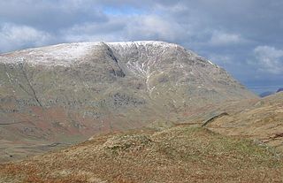
Red Screes is a fell in the English Lake District, situated between the villages of Patterdale and Ambleside. It may be considered an outlier of the Fairfield group in the Eastern Fells, but is separated from its neighbours by low cols. This gives Red Screes an independence which is reflected in its prominence.

Loch Tummel is a long, narrow loch, seven kilometres northwest of Pitlochry in the council area of Perth and Kinross, Scotland. It is fed and drained by the River Tummel, which flows into the River Tay about 13 km (8 mi) south-east of the Clunie Dam at the loch's eastern end.

Glen Tilt is a glen in the extreme north of Perthshire, Scotland. Beginning at the confines of Aberdeenshire, it follows a South-westerly direction excepting for the last 4 miles, when it runs due south to Blair Atholl. It is watered throughout by the Tilt, which enters the Garry after a course of 14 miles, and receives on its right the Tarf, which forms some falls just above the confluence, and on the left the Fender, which has some falls also. The attempt of George Murray, 6th Duke of Atholl to close the glen to the public was successfully contested by the Scottish Rights of Way Society in 1847. The massive mountain of Beinn a' Ghlò and its three Munros Càrn nan Gabhar, Bràigh Coire Chruinn-bhalgain and Càrn Liath (975) dominate the glen's eastern lower half.

Glen Shee is a glen in eastern Perthshire, Scotland. Shee Water flows through the glen. The head of the glen, where Gleann Taitneach and Glen Lochsie meet, is approximately 2 km north-west of the Spittal of Glenshee; it then runs south-east to Bridge of Cally where it merges with Strathardle to form Glen Ericht. Once known as the glen of the fairies it takes its name from the Gaelic "sith" meaning fairy and the old meeting place at the standing stone behind the present day church is called Dun Shith or Hill of the Fairies.

The River Oykel is a major river in northern Scotland that is famous for its salmon fishing. It rises on Ben More Assynt, a few miles from Ullapool on the west coast of Scotland, and drains into the North Sea via the Kyle of Sutherland. Traditionally it has marked the boundary between Ross to the south and Sutherland to the north.
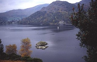
Glenridding Dodd is a small fell in the English Lake District, at the end of a ridge descending from the Helvellyn range in the Eastern Fells. It stands above the village of Glenridding and on the western shore of Ullswater. Although small and not of great elevation, its top is a fine viewpoint for Ullswater and for the fells clustered round the valleys above Patterdale.

Beinn Achaladair is a Scottish mountain situated six kilometres north east of the hamlet of Bridge of Orchy. The mountain stands on the border of the Perth and Kinross and Argyll and Bute council areas.

Ben Tee is a Scottish mountain situated in the Lochaber area of the Highland council area, some 15 kilometres north of Spean Bridge. It is rated as one of the best of Scotland's smaller mountains with Hamish Brown saying:
Ben Tee is such a shapely cone that it is instantly recognisable from anywhere around the Great Glen or along the Garry. Its isolated situation makes it one of Scotland’s finest summit viewpoints.

Càrn Mairg is a mountain in the Breadalbane region of the Scottish Highlands, with a height of 1,042 metres (3,419 ft). It stands in a group of four Munro mountains known as the 'Càrn Mairg group', on the north side of Glen Lyon, Perthshire.
Sgairneach Mhòr is a Scottish mountain which lies in a group of seven Munros near the summit of the Pass of Drumochter and are known as the Drumochter mountains or informerly as the “A9 Munros”. The mountain is situated 13 km SSW of Dalwhinnie and four km east of the large Loch Ericht.

Glen Shiel is a glen in the Northwest Highlands of Scotland.

The River Add is a river which runs through Argyll and Bute on the west coast of Scotland. Historically, it was known as the river Airigh but to avoid confusion with the Aray, it was renamed the River Add.

Sgùrr Thuilm is a mountain in the Glenfinnan area of the Highlands of Scotland. It stands at the head of Glen Finnan approximately 7 kilometres (4 mi) north of Loch Shiel.

Glen Cannich is a long glen in the Northwest Highlands of Scotland and through which runs the River Cannich. Emerging from the reservoir of Loch Mullardoch, the river flows east to merge with the River Affric at the village of Cannich, their combined waters forming the River Glass.

Ben Nevis and Glen Coe is a national scenic area (NSA) covering part of the Highlands of Scotland surrounding Ben Nevis and Glen Coe, in which certain forms of development are restricted. It is one of 40 such areas in Scotland, which are defined so as to identify areas of exceptional scenery and to ensure its protection from inappropriate development. The Ben Nevis and Glen Coe NSA covers 903 km2 (349 sq mi) of land, lying within the Highland, Argyll and Bute and Perth and Kinross council areas. A further 19 km2 (7.3 sq mi) of the NSA are marine, covering the sea loch of Loch Leven.
Glen Kingie is a glen or valley in the Northwest Highlands of Scotland which opens onto Glen Garry at its north-eastern end at Kingie. It is drained by the River Kingie which rises at a 650m col between the peaks of An Eag and Sgurr Cos na Breachd-laoidh. The river is fed by numerous burns both to north and south, key amongst which are Allt a' Chinn Bhric, Allt a' Choire Ghlais, Allt Coir' an Stangain Mhoir, Allt a' ùRiabhaich and Allt Torrain Dharaich. The waters of the Kingie enter those of the River Garry at Kingie Pool. Much of the northern side of the glen is formed by the slopes of 1003m high mountain of Sgurr Mor and the 919m high Gairich, both of which are Munros. The more broken southern side is dominated, at least in its upper reaches, by three (Corbetts; the 835m high Sgurr Cos na Breachd-laoidh, the 858m Fraoch Bheinn and the 880m Sgurr Mhurlagain. The glen runs through territory formed by psammites and pelites of the late Precambrian Moine Supergroup, a thick sequence of metamorphosed rocks which is intruded by the West Highland Granite Gneiss in the middle section of the glen.

The geology of the Isle of Mull in Scotland is dominated by the development during the early Palaeogene period of a ‘volcanic central complex’ associated with the opening of the Atlantic Ocean. The bedrock of the larger part of the island is formed by basalt lava flows ascribed to the Mull Lava Group erupted onto a succession of Mesozoic sedimentary rocks during the Palaeocene epoch. Precambrian and Palaeozoic rocks occur at the island's margins. A number of distinct deposits and features such as raised beaches were formed during the Quaternary period.
References
- ↑ "Geology of Britain viewer | British Geological Survey (BGS)". Archived from the original on 2 December 2016. Retrieved 13 October 2019.
- ↑ "Lochaber Natural History Society - Articles".
- ↑ "About Us".