Argyll and Bute is one of 32 unitary council areas in Scotland and a lieutenancy area. The current lord-lieutenant for Argyll and Bute is Jane Margaret MacLeod. The administrative centre for the council area is in Lochgilphead at Kilmory Castle, a 19th-century Gothic Revival building and estate. The current council leader is Robin Currie, a councillor for Kintyre and the Islands.

Argyll, sometimes called Argyllshire, is a historic county and registration county of western Scotland.

Cowal is a rugged peninsula in Argyll and Bute, on the west coast of Scotland. It is bounded on the west by Loch Fyne and on the east by Loch Long and the Firth of Clyde. The Kyles of Bute separate it from Bute to the south.

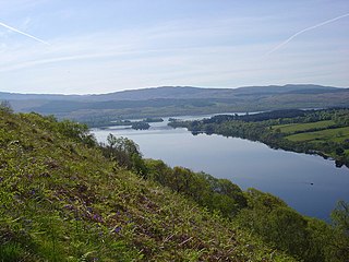
Loch Awe is a large body of freshwater in Argyll and Bute, Scottish Highlands. It has also given its name to a village on its banks, variously known as Loch Awe or Lochawe. There are islands within the loch such as Innis Chonnell and Inishail.

Loch Fyne, is a sea loch off the Firth of Clyde and forms part of the coast of the Cowal peninsula. Located on the west coast of Argyll and Bute, Scotland. It extends 65 kilometres (40 mi) inland from the Sound of Bute, making it the longest of the sea lochs in Scotland. It is connected to the Sound of Jura by the Crinan Canal. Although there is no evidence that grapes have grown there, the title is probably honorific, indicating that the river, Abhainn Fìne, was a well-respected river.

Robert Roy MacGregor was a Scottish outlaw, who later became a folk hero.

Rob Roy is a 1995 historical biographical drama film directed by Michael Caton-Jones. It stars Liam Neeson as Rob Roy MacGregor, an 18th-century Scottish clan chief becomes engaged in a dispute with a reprobate nobleman in the Scottish Highlands, played by John Hurt. Tim Roth won the BAFTA Award for Best Actor in a Supporting Role and was nominated for the Academy Award for Best Supporting Actor for his portrayal of Archibald Cunningham, one of Rob Roy's chief antagonists. Jessica Lange portrays Roy's wife, and Eric Stoltz, Brian Cox, and Jason Flemyng play supporting parts.

Glen Orchy is a glen in Argyll and Bute, Scotland. It runs from Bridge of Orchy to Dalmally.

Balquhidder is a small village in Perthshire located 10 miles (16 km) north-west of Callander. It is administered by the Stirling council area of Scotland and is overlooked by the dramatic mountain terrain of the 'Braes of Balquhidder', at the head of Loch Voil. Balquhidder Glen is also popular for fishing, nature watching and walking.

Glen Lyon is a glen in the Perth and Kinross region of Scotland. It is the longest enclosed glen in Scotland and runs for 34 miles from Loch Lyon in the west to the village of Fortingall in the east.

Dunderave Castle is an L-plan castle built in the 16th century as the Scottish seat of the MacNaughton clan.

The Battle of Glen Fruin was a Scottish clan battle fought on 7 February 1603 between the Clan Gregor and its allies on one side, and the Clan Colquhoun and its allies on the other. The Clan Gregor and Clan Colquhoun were at feud due to the MacGregors carrying out raids on the Colquhoun's lands. The Colquhouns gained royal support and raised an army against the MacGregors. However, during the subsequent battle of Glen Fruin, the Colquhouns were comprehensively defeated. Glen Fruin is in the Loch Lomond area, in the county of Dunbartonshire, Scotland. In the aftermath of the battle royal policy punished the MacGregors for 150 years.

The A815 is a major road located in Argyll and Bute, Scotland. It runs for about 35.7 miles (57.5 km) from the A83, near Cairndow, in the north to Toward in the south. It passes beside three lochs, while its final stretch is along the Firth of Clyde.

Beinn Bhuidhe is a mountain near the head of Loch Fyne in Argyll in the Scottish Highlands. It is a Munro with a height of 948 metres (3,110 ft).

River Shira is the river that runs for about 7 miles through Glen Shira, originating to the north-east at 350 metres (1,150 ft) altitude, near the start of the River Fyne.

Stob an Eas is a 2401 ft (732m) Graham in the Arrochar Alps, Argyll and Bute, Scotland.

The Rob Roy Way is a Scottish long distance footpath that runs from Drymen in Stirling to Pitlochry in Perth and Kinross. The path was created in 2002, and takes its name from Rob Roy MacGregor, a Scottish folk hero and outlaw of the early 18th century. It traverses countryside that he knew and travelled frequently. The route crosses the Highland Boundary Fault, a geological fault where the Highlands meet the Lowlands. Views from the trail overlook Loch Lubnaig, Loch Earn, Loch Venachar and Loch Tay. The way is 127 kilometres (79 mi) in length if the direct route along the southern shore of Loch Tay and the River Tay is followed between Ardtalnaig and Aberfeldy. An optional loop also links these places via Amulree: choosing this option increases the length by a further 27 kilometres (17 mi) to 154 kilometres (96 mi).

Old Castle Lachlan, also known as Castle Lachlan, is a ruined 15th-century castle on the shore of Loch Fyne, within the Cowal Peninsula, in Argyll and Bute, Scotland. It was probably built by Clan Maclachlan on lands first recorded in 1314 as "Castlelachlan". Nothing remains of this fourteenth-century castle. Instead, the enclosure of Old Castle Lachlan appears to date to the early fifteenth century, whilst the internal buildings seem to date to the later part of the century. The castle remained a residence of the clan's chiefs until New Castle Lachlan was built as a replacement in 1790, 0.8 kilometres (0.5 mi) east-north-east.

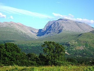
Ben Nevis and Glen Coe is a national scenic area (NSA) covering part of the Highlands of Scotland surrounding Ben Nevis and Glen Coe, in which certain forms of development are restricted. It is one of 40 such areas in Scotland, which are defined so as to identify areas of exceptional scenery and to ensure its protection from inappropriate development. The Ben Nevis and Glen Coe NSA covers 903 km2 (349 sq mi) of land, lying within the Highland, Argyll and Bute and Perth and Kinross council areas. A further 19 km2 (7.3 sq mi) of the NSA are marine, covering the sea loch of Loch Leven.

The Shira Hydro-Electric Scheme is a project initiated by the North of Scotland Hydro-Electric Board to use the waters of the River Shira, the River Fyne and other small streams to generate hydroelectricity. It is located between Loch Fyne and Loch Awe in Argyll and Bute, western Scotland. It consists of three power stations and three impounding dams.


