
Douglas County is a county in the northwestern part of the U.S. state of Nevada. As of the 2020 census, the population was 49,488. Its county seat is Minden. Douglas County comprises the Gardnerville Ranchos, NV Micropolitan Statistical Area, which is also included in the Reno–Carson City–Fernley, NV Combined Statistical Area.
Naukati Bay is a census-designated place (CDP) in the Prince of Wales-Hyder Census Area of the Unorganized Borough of the U.S. state of Alaska. The population was 113 at the 2010 census, down from 135 in 2000.
Dollar Point is a census-designated place (CDP) in Placer County, California, United States, along the northwest shore of Lake Tahoe. It is part of the Sacramento–Arden-Arcade–Roseville Metropolitan Statistical Area. The population was 1,215 at the 2010 census down from 1,539 at the 2000 census.

Kings Beach is a census-designated place (CDP) in Placer County, California, United States, on the north shore of Lake Tahoe. The population was 3,563 at the 2020 census.

Gardnerville is an unincorporated town in Douglas County, Nevada, adjacent to the county seat of Minden. The population was 6,211 at the 2020 census.
Stateline is a census-designated place (CDP) on the southeastern shore of Lake Tahoe in Douglas County, Nevada, United States. It lies next to the border with California and is conurbated with South Lake Tahoe. The population was 595 at the 2020 census. The population swells considerably during the busy winter and summer seasons, due to the high number of hotel rooms and rental accommodations available.

Incline Village is an upscale census-designated place (CDP) on the north shore of Lake Tahoe in Washoe County, Nevada, United States. The population was 8,777 at the 2010 census. It is part of the Reno−Sparks Metropolitan Statistical Area. Until the 2010 census, the CDP Crystal Bay, Nevada was counted jointly with Incline Village.

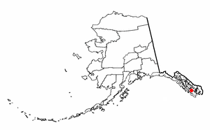
Zephyr Cove is a community and census-designated place (CDP) in Douglas County, Nevada, United States. The population was 565 at the 2010 census. Prior to 2010 it was part of the Zephyr Cove–Round Hill Village CDP.
Genoa is an unincorporated town in Douglas County, Nevada, United States. Founded in 1851, it was the first settlement in what became the Nevada Territory. It is situated within Carson River Valley and is approximately 42 miles (68 km) south of Reno. The population was 939 at the 2010 census. It is home to the oldest bar in the state of Nevada which opened in 1853.
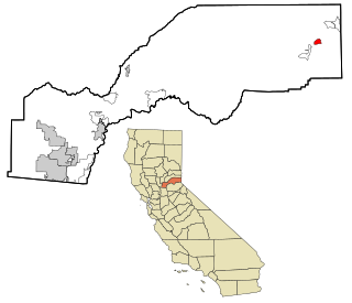
North Fork is an unincorporated community in Madera County, California, United States. As of the 2020 United States census it had a population of 3,250. For statistical purposes, the United States Census Bureau has defined North Fork as a census-designated place (CDP). North Fork is part of the Madera Metropolitan Statistical Area and is home to the tribal headquarters of the Northfork Rancheria of Mono Indians of California.

Crystal Bay is a census-designated place (CDP) located on the north shore of Lake Tahoe in Washoe County, Nevada, United States. The population was 305 at the 2010 census. It is part of the Reno−Sparks Metropolitan Statistical Area. Prior to 2010, it was listed by the U.S. Census Bureau within the Incline Village–Crystal Bay CDP.
Herbster is a census-designated place (CDP) in the Town of Clover in Bayfield County, Wisconsin, United States, located on the south shore of Lake Superior. Herbster is 7 miles (11 km) east of Port Wing and 8 miles (13 km) west of Cornucopia on Wisconsin Highway 13, the main route through the community. The primary north/south route is by Lenawee Road / Forest Road 262, leading from Lake Superior to the Chequamegon National Forest. As of the 2020 census, its population was 130, up from 104 at the 2010 census. Herbster has an area of 5.572 square miles (14.43 km2), all of it land.
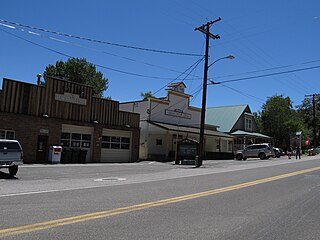
Meyers is a small an unincorporated community and census-designated place (CDP) in El Dorado County, California, United States, along U.S. Route 50 in the northern Sierra Nevada. It is 6 miles (10 km) south of South Lake Tahoe in the Lake Tahoe area and lies at an elevation of 6,378 feet. Established in 1851, Meyers started out as a stagecoach stop, trading post and Pony Express station. The town is now registered as California Historical Landmark #708. It serves as a popular stop on the way into and out of the Tahoe Basin for travelers on Highway 50 and Highway 89.
Topaz Lake is a census-designated place (CDP) in Douglas County, Nevada, United States. The population was 157 at the 2010 census.
Crystal is a census-designated place (CDP) comprising the main community in Crystal Township, Montcalm County, Michigan, United States. As of the 2020 census, it had a population of 888. The CDP includes the village proper of Crystal, at the east end of Crystal Lake, as well as all of the land surrounding the lake.
Lakeridge is a census-designated place (CDP) in Douglas County, Nevada, United States. The population was 371 at the 2010 census.
Logan Creek is a census-designated place (CDP) on the east shore of Lake Tahoe in Douglas County, Nevada, United States. The population was 26 at the 2010 census.

Round Hill Village is a census-designated place (CDP) in northwestern Douglas County, Nevada, United States. The population was 759 at the 2010 census. Prior to 2010, the community was part of the Zephyr Cove–Round Hill Village CDP.
North Canyon Creek is a 6.8-mile-long (10.9 km) southwestward-flowing stream originating on Snow Valley Peak in the Carson Range of the Sierra Nevada. Most of the stream is in Carson City, Nevada, United States. It is a tributary stream of Lake Tahoe culminating at Glenbrook in Douglas County on Tahoe's Nevada shore.

The Carson and Tahoe Lumber and Fluming Company (C&TL&F) was formed to move lumber from trees growing along the shore of Lake Tahoe to the silver mines of the Comstock Lode. Between 1872 and 1898 C&TL&F transferred 750 million board foot of lumber logged from 80,000 acres (32,000 ha) of virgin timberland.


