Glenlee, Queensland

Last updated

Glenlee
Queensland
Australia Queensland location map.svg
Red pog.svg
Glenlee
Coordinates 23°17′25″S150°28′07″E / 23.2902°S 150.4686°E / -23.2902; 150.4686 (Glenlee (centre of locality))
Population1,236 (2016 census) [1]
 • Density29.43/km2 (76.22/sq mi)
Postcode(s) 4711
Area42.0 km2 (16.2 sq mi)
Time zone AEST (UTC+10:00)
Location
LGA(s) Livingstone Shire
State electorate(s)
Federal division(s) Capricornia
Suburbs around Glenlee:
Alton Downs Glendale Etna Creek
Alton Downs Glenlee Rockyview
Alton Downs Pink Lily Parkhurst

Glenlee is a rural locality in the Livingstone Shire, Queensland, Australia. [2] In the 2016 census, Glenlee had a population of 1,236 people. [1]

Contents

Geography

The locality is bounded by an unnamed creek to the north, Yaamba Road to the east, Ramsay Creek to the south-east, and the Fitzroy River to the south-west and west. [3]

The North Coast railway line enters the locality from the south-east (Parkhurst) and exits to the north-east (Glendale). [3]

History

Glenlee began its existence as a housing estate development in the 1980s. Originally, there was only one entry to the estate via Neilsens Avenue, leading to Emmerson Drive (named after "The Morning Bulletin" cartoonist Rod Emmerson) and Swadling Avenue. Blocks of land were approximately 2 acres, and addresses consisted of Lot numbers. Expansion saw the addition of more streets, and a second entrance via Terranova Drive. Newer lots sold were only 1 acre in size, and lots were assigned street numbers. The postcode was originally 4702, but is now 4711 after being recognised as an official locality.[ citation needed ]

The School of Today opened in 1996. Some time prior to 2007, it was renamed Glenlee Christian College. The school was established by parents whose children who suffered from sensitivities to chemicals or who had learning difficulties linked to environmental factors. Therefore the school was established in a rural area away from the pollution of traffic and urban activities. [4] [5] As of 2007, the school had nine students and one teacher. [6] It was located at 46 Dawson Road ( 23°15′08″S150°29′38″E / 23.2522°S 150.4938°E / -23.2522; 150.4938 (Glenlee Christian College (former)) ) just to the east of the North Coast railway line. [3] The school subsequently closed. [7]

In January 2016, Carinity Education Rockhampton established a school on the site of the Glenlee Christian College. [8]

In the 2016 census, Glenlee had a population of 1,236 people. [1]

Education

Carinity Education Rockhampton is a private secondary (7-11) school for boys and girls at 46 Dawson Road ( 23°15′10″S150°29′37″E / 23.2527°S 150.4936°E / -23.2527; 150.4936 (Carinity Education - Rockhampton) ). [9] In 2017, the school had an enrolment of 89 students with 6 teachers and 11 non-teaching staff (9 full-time equivalent). [10] The school caters for students who have disengaged with mainstream education or are risk of doing so. [11]

There are no mainstream schools in Glenlee. The nearest primary school is Parkhurst State School in neighbouring Parkhurst to the south-west. The nearest secondary is Glenmore State High School in Kawana to the south. [3]

Related Research Articles

<span class="mw-page-title-main">Yeppoon</span> Town in Queensland, Australia

Yeppoon is a coastal town and locality in the Shire of Livingstone, Queensland, Australia. Yeppoon is renowned for its beaches, tropical climate, and the islands out on the bay. Located 41 kilometres (25 mi) from the city of Rockhampton, Yeppoon is the seat of the Shire of Livingstone and the principal town on the Capricorn Coast, a string of seaside communities stretching more than 150 kilometres (93 mi) from north to south. The beaches and shallow coves provide a destination both for tourists and retirees settling down in Central Queensland. Offshore, there are 27 islands including Great Keppel Island which is 20 kilometres (12 mi) from Yeppoon. In the 2021 census, the locality of Yeppoon had a population of 7,037 people; this does not include any neighbouring suburbs.

<span class="mw-page-title-main">Mount Morgan, Queensland</span> City in Queensland, Australia

Mount Morgan is a rural town and locality in the Rockhampton Region, Queensland, Australia. In the 2021 census the town of Mount Morgan had a population of 2,487 people.

<span class="mw-page-title-main">Berserker, Queensland</span> Suburb of Rockhampton, Queensland, Australia

Berserker is a suburb of Rockhampton in the Rockhampton Region, Queensland, Australia. It is situated about six kilometres north east of the central business district.

<span class="mw-page-title-main">Kawana, Queensland (Rockhampton)</span> Suburb of Rockhampton, Queensland, Australia

Kawana is a suburb of Rockhampton in the Rockhampton Region, Queensland, Australia. In the 2016 census, Kawana had a population of 4,426 people.

<span class="mw-page-title-main">Zilzie</span> Suburb of Shire of Livingstone, Queensland, Australia

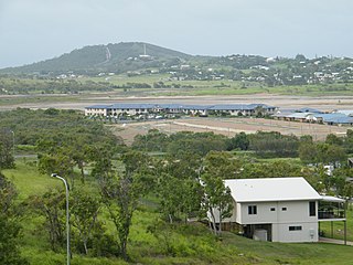
Zilzie is a coastal locality in the Livingstone Shire, Queensland, Australia. In the 2021 census, Zilzie had a population of 2,846 people.

<span class="mw-page-title-main">Taranganba</span> Town in Queensland, Australia

Taranganba is a town and locality in the Livingstone Shire, Queensland, Australia. In the 2016 census, the locality of Taranganba had a population of 2,276 people.

<span class="mw-page-title-main">Lammermoor, Queensland</span> Suburb of Shire of Livingstone, Queensland, Australia

Lammermoor is a coastal locality on the Capricorn Coast in the Livingstone Shire, Queensland, Australia. In the 2016 census, Lammermoor had a population of 2,167 people.

<span class="mw-page-title-main">Parkhurst, Queensland</span> Suburb of Rockhampton, Queensland, Australia

Parkhurst is a suburb of Rockhampton in the Rockhampton Region, Queensland, Australia. In the 2016 census, Parkhurst had a population of 2,476 people.

<span class="mw-page-title-main">Morinish, Queensland</span> Suburb of Rockhampton Region, Queensland, Australia

Morinish is a rural locality in the Rockhampton Region, Queensland, Australia. In the 2021 census, Morinish had a population of 62 people.

<span class="mw-page-title-main">Canoona</span> Suburb of Shire of Livingstone, Queensland, Australia

Canoona is a rural locality in the Livingstone Shire, Queensland, Australia. It was the site of the first North Australian gold rush. In the 2021 census, Canoona had a population of 90 people.

<span class="mw-page-title-main">Yaamba</span> Suburb of Shire of Livingstone, Queensland, Australia

Yaamba is a rural town and locality in the Livingstone Shire, Queensland, Australia. In the 2016 census, the locality of Yaamba had a population of 62 people.

<span class="mw-page-title-main">Nerimbera, Queensland</span> Suburb of Shire of Livingstone, Queensland, Australia

Nerimbera is a rural locality in the Livingstone Shire, Queensland, Australia. In the 2016 census, Nerimbera had a population of 293 people.

<span class="mw-page-title-main">Mount Chalmers, Queensland</span> Town in Queensland, Australia

Mount Chalmers is a rural town and locality in the Livingstone Shire, Queensland, Australia. In the 2016 census, the locality of Mount Chalmers had a population of 235 people.

<span class="mw-page-title-main">Cawarral</span> Town in Queensland, Australia

Cawarral is a rural town and locality in the Livingstone Shire, Queensland, Australia. In the 2016 census the locality of Cawarral had a population of 831 people.

<span class="mw-page-title-main">The Caves, Queensland</span> Town in Queensland, Australia

The Caves is a rural town and locality in the Livingstone Shire, Queensland, Australia. In the 2016 census the locality of The Caves had a population of 718 people.

Adelaide Park is a rural locality in the Livingstone Shire, Queensland, Australia. In the 2021 census, Adelaide Park had a population of 449 people.

Barmaryee is a rural locality in the Livingstone Shire, Queensland, Australia. In the 2016 census, Barmaryee had a population of 878 people.

Dalma is a rural locality in the Rockhampton Region, Queensland, Australia. In the 2016 census, Dalma had a population of 78 people.

Greenlake is a rural locality in the Livingstone Shire, Queensland, Australia. In the 2021 census, Greenlake had a population of 3 people.

Rockhampton–Yeppoon Road is a non-continuous 39.8 kilometres (24.7 mi) road route in the Rockhampton and Livingstone local government areas of Queensland, Australia. Most of the route is designated as State Route 4 (Regional) and Tourist Drive 10. It is a state-controlled regional road.

References

  1. 1 2 3 Australian Bureau of Statistics (27 June 2017). "Glenlee (SSC)". 2016 Census QuickStats. Retrieved 20 October 2018. OOjs UI icon edit-ltr-progressive.svg
  2. "Glenlee – locality in Livingstone Shire (entry 48654)". Queensland Place Names. Queensland Government . Retrieved 18 September 2020.
  3. 1 2 3 4 "Queensland Globe". State of Queensland . Retrieved 31 October 2020.
  4. Queensland Family History Society (2010), Queensland schools past and present (Version 1.01 ed.), Queensland Family History Society, ISBN   978-1-921171-26-0
  5. "Welcome to Glenlee Christian College!". Glenlee Christian College. Archived from the original on 5 January 2010. Retrieved 31 October 2020.
  6. "Glenlee Christian College-School Annual Report For 2007" (PDF). Glenlee Christian College. Archived from the original (PDF) on 13 October 2009. Retrieved 31 October 2020.
  7. "Non-state schools directory". Non-State Schools Accreditation Board. Queensland Government . Retrieved 31 October 2020.
  8. "Our History". Carinity Education Rockhampton. Archived from the original on 31 October 2020. Retrieved 31 October 2020.
  9. "State and non-state school details". Queensland Government. 9 July 2018. Archived from the original on 21 November 2018. Retrieved 21 November 2018.
  10. "ACARA School Profile 2017". Archived from the original on 22 November 2018. Retrieved 22 November 2018.
  11. "Carinity Education Rockhampton Annual Report 2020" (PDF). Carinity Education Rockhampton. Archived (PDF) from the original on 31 October 2020. Retrieved 31 October 2020.