Glenthompson, Victoria

Last updated

Glenthompson
Victoria
Glenthompson west approach.jpg
Western approach to Glenthompson on Glenelg Highway
Australia Victoria Southern Grampians Shire location map.svg
Red pog.svg
Glenthompson
Coordinates 37°38′0″S142°32′0″E / 37.63333°S 142.53333°E / -37.63333; 142.53333
Population232 (2016 census) [1]
Postcode(s) 3293
Location
LGA(s) Shire of Southern Grampians
State electorate(s) Lowan
Federal division(s) Division of Wannon

Glenthompson is a town in the Australian state of Victoria. It lies on the Glenelg Highway between Hamilton and Ballarat, close to the Grampian mountain range. At the 2016 census, Glenthompson and the surrounding area had a population of 234. [1]

Contents

Its most notable landmark is the tall brickworks chimney that is also the symbol of the town's main industry for a period of time, as it provided bricks for regional buildings constructed in the post-war era. [2] The brickworks is now closed but people can arrange a tour by appointment.

History

Originally, a small township named Yuppeckiar was built approximately five kilometres away, but it was moved to the present site of Glenthompson because of the construction of the railway linking Ballarat and Hamilton. The Post Office opened on November 1, 1866 as Glenthompson, was known for some months in 1872 as Yuppeckiar before reverting to Glenthompson. [3]

Pastoral settlement in the Glenthompson district began in 1848, and the subdivision of the land began in 1853. One of the resulting portions was the 'Glenronald' property (which may be the source of the first part of the town's name, with the second part believed to have come from the name of a surveyor or local land owner). [4]

Early village settlement occurred three miles (5 km) west of the present Glenthompson township, at a location on the Dunkeld Road known as Strathmore or Yuppeckiar (also locally known as The Nine-mile and Jack of Clubs). In 1865 there was one public-house at Strathmore, but the settlement attained further amenities as land selections were taken up in the vicinity. By 1872 Strathmore had two public-houses, a blacksmith, shoemaker, a large store, a Catholic church, a school and a steam-powered flour mill. [5]

The railway line between Ararat and Hamilton was completed in October 1877, with a station built at Glenthompson (which stimulated the growth of Glenthompson at the expense of Strathmore). [4] [6]

In 1901 the Thompson brothers opened a brickworks about 20 kilometres from Glenthompson. The brickworks were later transferred to a clay-pit near the township. [4]

Glenthompson War Memorial Swimming Pool Glenthompson Swimming Pool (2016).jpg
Glenthompson War Memorial Swimming Pool

Nowadays it is a very quiet country town that serves as a minor transport and services hub for the surrounding farming district.

Amenities

Glenthompson is distinctive in that the town's hotel, Mac's Hotel, was built across the road from the railway station, some distance from the main road, unlike other country pubs in towns of a similar size, highlighting the importance of the railway in the town's development. This hotel burned down during the late 1800s on a different plot of land than the one that closed in 2013. The hotel that closed in 2013 was actually a private home, that was converted in the mid 20th century to a hotel long after its construction.

Rose Cottage in McLennan Street was first built in 1850 and was used for business as a blacksmith, the local bakery, and the front room for dressmaking and alteration. [ citation needed ]

In 1996 residents startedthe Glenthompson Historical Group Inc. which operates a museum out of the former Glenthompson Railway Station. The History Centre is open to visit on Sundays from 12pm or by appointment.

St Peter's Anglican Church in McLennan St (Caramut Road) had the story of St Peter produced as a mural around the internal walls of the church. Local artist Gareth Colliton from Warrnambool used local identities in place of the traditional faces to produce this modern variation. The Church is open every day.

Sport

The town, in conjunction with nearby township Dunkeld, has an Australian Rules football team, Glenthompson-Dunkeld (AKA Rams), competing in the Mininera & District Football League (MDFL). In 2010, the team won the league Premiership.

Prior to 2004, the Glenthompson Football Club (AKA Bloods) had competed in the MDFL for more than half a century. The club had secured senior premierships in 1969, 1974, 1978, 1982, 1983 and 1985. [7] Over the history of the football club they have played in the now defunct Willaura and District Football Association (1921–27), Mount Rouse and Willaura District Football Association (1928), Western Football Association (1929), Hopkins Football Association (1930),Western and Hamilton Football Association (1931–33), Hamilton and District Football Association (1935–40) and the Dunkeld and District Football League (1945–47).

In the past, the town has had a number of different sports including having its own 9 hole golf course. Most clubs have now closed. Former sports clubs include - Glenthompson Golf Club, Glenthompson Tennis Club, Glenthompson Basketball team (c. 1923), Glenthompson Cricket Club

Education

The first school was opened in 1868. This was rebuilt in 1902, featuring a steeped structure. In the same year, a Mechanics' Institute was opened.

In 1998 the school amalgamated and became an outer campus of the Dunkeld Consolidated school. [4] In 2011, with only one student still enrolled at this campus, a decision was made to close the campus. The children of the town now go either to Dunkeld or Lake Bolac for their Primary years.

Secondary school is obtained in either Lake Bolac or Hamilton, with buses taking the children of the town and its surrounds.

Climate

Climate data for Glenthompson
MonthJanFebMarAprMayJunJulAugSepOctNovDecYear
Average rainfall mm36.329.233.145.152.653.363.370.460.756.250.240.9595.8
Average rainfall inches1.431.151.301.782.072.102.492.772.392.211.981.6123.46
Source: [8]

Related Research Articles

<span class="mw-page-title-main">Braybrook, Victoria</span> Suburb of Melbourne, Victoria, Australia

Braybrook is a suburb in Melbourne, Victoria, Australia, 10 km (6.2 mi) west of Melbourne's Central Business District, located within the City of Maribyrnong local government area. Braybrook recorded a population of 9,682 at the 2021 census.

<span class="mw-page-title-main">Ararat, Victoria</span> City in Victoria, Australia

Ararat is a city in south-west Victoria, Australia, about 198 kilometres (120 mi) west of Melbourne, on the Western Highway on the eastern slopes of the Ararat Hills and Cemetery Creek valley between Victoria's Western District and the Wimmera. Its urban population according to 2021 census is 8,500 and services the region of 11,880 residents across the Rural City's boundaries. It is also the home of the 2018/19 GMGA Golf Championship Final.

<span class="mw-page-title-main">Swifts Creek</span> Town in Victoria, Australia

Swifts Creek is a town in the Tambo Valley of East Gippsland, Victoria, Australia. The town is on the Great Alpine Road between Omeo and Ensay, 379 kilometres (235 mi) east of the state capital Melbourne and 300 metres (980 ft) above sea level. The area was originally settled by Europeans in the gold rushes of the mid-1800s. At the 2011 census, Swifts Creek and the surrounding area had a population of 419, with a median age of 47.

<span class="mw-page-title-main">Buninyong</span> Town in Victoria, Australia

Buninyong is a town 11 km from Ballarat in Victoria, Australia. The town is on the Midland Highway, south of Ballarat on the road to Geelong.
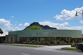
<span class="mw-page-title-main">Dunkeld, Victoria</span> Town in Victoria, Australia

Dunkeld is a town in Victoria, Australia, at the southern end of the Grampians National Park, in the Shire of Southern Grampians. It is approx 283 km west of Melbourne on the Glenelg Highway. The town's population is holding steady but ageing. At the 2016 census, Dunkeld had a population of 678.

<span class="mw-page-title-main">Lake Bolac, Victoria</span> Town in Victoria, Australia

Lake Bolac is a town in the Western District region of Victoria, Australia. The town is on the shores of Lake Bolac, and the Glenelg Highway passes through the town. At the 2021 census, Lake Bolac and the surrounding area had a population of 368.
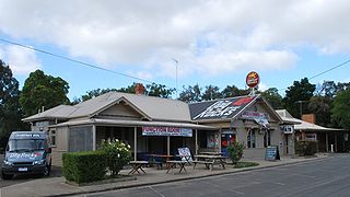
<span class="mw-page-title-main">Batesford, Victoria</span> Town in Victoria, Australia

Batesford is a small township located approximately 10 kilometres west of Geelong and 67 kilometres south-west of the state capital, Melbourne.

<span class="mw-page-title-main">Ballan, Victoria</span> Town in Victoria, Australia

Ballan is a small town in the state of Victoria, Australia located on the Werribee River, 80 kilometres (50 mi) northwest of Melbourne. At the 2021 census, Ballan had a population of 3,392.

The Serviceton railway line is part of the Melbourne–Adelaide rail corridor. It serves the west of Victoria, linking the state capital of Melbourne to the cities of Ballarat and Ararat. It once extended to the disputed South Australian border as part of the Melbourne–Adelaide railway. The former broad-gauge track was replaced in 1995 by the 1435 mm Western standard gauge line.
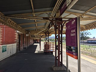
<span class="mw-page-title-main">Ararat railway station</span> Railway station in Victoria, Australia

Ararat railway station is located on the Serviceton and Western standard gauge lines in Victoria, Australia. It serves the town of Ararat, and opened on 7 April 1875.

<span class="mw-page-title-main">Gordon, Victoria</span> Town in Victoria, Australia

Gordon is a small town in Victoria, Australia, named after settler George Gordon. The town is located on the Old Melbourne Road in the Shire of Moorabool local government area, 95 kilometres (59 mi) west of the state capital, Melbourne. At the 2021 census, Gordon had a population of 1,393.

<span class="mw-page-title-main">Moyston, Victoria</span> Town in Victoria, Australia

Moyston is a town in the Western District region of Victoria, Australia, near the Grampians mountain range. The town is located in the Rural City of Ararat local government area, 224 kilometres (139 mi) north west of the state capital, Melbourne. At the 2021 census, Moyston and the surrounding area had a population of 403.

The Mininera & District Football League is based in South-western Victoria, with clubs located east of Hamilton, south of Ararat and west of Colac. The league absorbed several teams from the defunct Ararat & District Football Association in 2000.

<span class="mw-page-title-main">Willaura</span> Town in Victoria, Australia

Willaura is a town in western Victoria, Australia in the Rural City of Ararat local government area, 231 kilometres (144 mi) west of the state capital, Melbourne. At the 2021 census, Willaura and surrounding area had a population of 439.
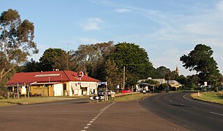
<span class="mw-page-title-main">Wickliffe, Victoria</span> Town in Victoria, Australia

Wickliffe is a small town in the Rural City of Ararat local government area in western Victoria, Australia. At the 2021 census, Wickliffe and the surrounding area had a population of 123.

Yeelanna is a town on the Lower Eyre Peninsula in South Australia located 77 kilometres (48 mi) north of Port Lincoln. It is on the Tod Highway and Eyre Peninsula Railway between Lock and Cummins. The Yeelanna district is known for its extremely fertile farming land, where nearly all farms in the district are continuously cropped.

The Hamilton Spectator is a tri-weekly tabloid newspaper, which has been published in Hamilton, Victoria, Australia since 1859. It is published by the Hamilton Spectator Partnership Pty Ltd. Originally, the Spectator was known as the Hamilton Courier as established in 1859 by Thomas Wotton Shevill, it then became the Hamilton Spectator and Grange District Advertiser in 1860, and later The Hamilton Spectator.

<span class="mw-page-title-main">Robert Francis Burns</span> Irish-Australian murderer

Robert Francis Burns was an Irish Australian murderer and probable serial killer. He was hanged at Ararat Gaol in September 1883, convicted of the murder of Michael Quinlivan near Wickliffe in western Victoria. After Burns' death the hangman made a sensational claim that the prisoner had stated to him, prior to the execution, that he had murdered eight people in total, five in Victoria and three in New South Wales. The revelation prompted speculation in the colonial press, attempting to identify other murder victims with whom Burns had been associated.

Mannanarie is a rural locality in the Mid North region of South Australia, situated in the Northern Areas Council. It was established in April 2001, when boundaries were formalised for the "long established local name". It comprises most of the cadastral Hundred of Mannanarie, apart from a northern section which lies in Tarcowie and Yatina. The name stems from an Aboriginal word, "manangari", meaning "good string or cord", stemming from a local native plant useful for string making.

References

  1. 1 2 Australian Bureau of Statistics (27 June 2017). "Glenthompson (State Suburb)". 2016 Census QuickStats. Retrieved 7 July 2017. OOjs UI icon edit-ltr-progressive.svg
  2. "Welcome". Glenthompson Bricks. Retrieved 3 March 2009.
  3. Phoenix Auctions History. "Post Office List" . Retrieved 7 March 2021.
  4. 1 2 3 4 "Glenthompson". Victorian Places. Monash University & the University of Queensland. Retrieved 15 June 2022.
  5. Country News, The Age (Melbourne), 20 May 1872, page 3; reprinted from the Ararat Advertiser, 17 May 1872.
  6. Opening of the Ararat and Hamilton Railway, Leader (Melbourne), 3 November 1877, page 2.
  7. Devaney, John. "Australian Football - Glenthompson Dunkeld Football Club - Info". Australian Football. Retrieved 24 December 2016.
  8. "Monthly rainfall - Glenthompson". Bureau of Meteorology. Retrieved 24 December 2016.

Commons-logo.svg Media related to Glenthompson, Victoria at Wikimedia Commons