
Dumbo is a neighborhood in the New York City borough of Brooklyn. It encompasses two sections: one situated between the Manhattan and Brooklyn Bridges, which connect Brooklyn to Manhattan across the East River, and another extending eastward from the Manhattan Bridge to the Vinegar Hill area. The neighborhood is bounded by Brooklyn Bridge Park to the north, the Brooklyn Bridge to the west, Brooklyn Heights to the south, and Vinegar Hill to the east. Dumbo is part of Brooklyn Community Board 2.

The Magnificent Mile is a section of Michigan Avenue in Chicago devoted to retail, dining, hotels and tourist attractions. Running from the Chicago River to Oak Street in the Near North Side, the district is located one block east of Rush Street and is the main retail corridor between the Loop and Gold Coast. It is bounded by Streeterville neighborhood to its east and River North to its west.

More than 1,100 properties and districts in Nebraska are on the National Register of Historic Places. Of these, 20 are National Historic Landmarks. There are listings in 90 of the state's 93 counties.
This is a list of the National Register of Historic Places listings in Dane County, Wisconsin. It aims to provide a comprehensive listing of buildings, sites, structures, districts, and objects in Dane County, Wisconsin listed on the National Register of Historic Places.

This is a list of the National Register of Historic Places listings in Rock County, Wisconsin. It is intended to provide a comprehensive listing of entries in the National Register of Historic Places that are located in Rock County, Wisconsin. The locations of National Register properties for which the latitude and longitude coordinates are included below may be seen in a map.

The boundary markers of the original District of Columbia are the 40 milestones that marked the four lines forming the boundaries between the states of Maryland and Virginia and the square of 100 square miles (259 km2) of federal territory that became the District of Columbia in 1801. Working under the supervision of three commissioners that President George Washington had appointed in 1790 in accordance with the federal Residence Act, a surveying team led by Major Andrew Ellicott placed these markers in 1791 and 1792. Among Ellicott's assistants were his brothers Joseph and Benjamin Ellicott, Isaac Roberdeau, George Fenwick, Isaac Briggs and an African American astronomer, Benjamin Banneker.

This is a list of the National Register of Historic Places listings in Sauk County, Wisconsin. It is intended to provide a comprehensive listing of entries in the National Register of Historic Places that are located in Sauk County, Wisconsin. The locations of National Register properties for which the latitude and longitude coordinates are included below may be seen on a map.

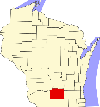
This is a list of the National Register of Historic Places listings in Brown County, Wisconsin. It is intended to provide a comprehensive listing of entries in the National Register of Historic Places that are located in Brown County, Wisconsin. The locations of National Register properties for which the latitude and longitude coordinates are included below may be seen in a map.

This is a list of the National Register of Historic Places listings in Eau Claire County, Wisconsin. It is intended to provide a comprehensive listing of entries in the National Register of Historic Places that are located in Eau Claire County, Wisconsin. The locations of National Register properties for which the latitude and longitude coordinates are included below may be seen in a map.

This is a list of the National Register of Historic Places listings in Marathon County, Wisconsin. It is intended to provide a comprehensive listing of entries in the National Register of Historic Places that are located in Marathon County, Wisconsin. The locations of National Register properties for which the latitude and longitude coordinates are included below may be seen in a map.

This is a list of the National Register of Historic Places listings in Ashland County, Wisconsin. It is intended to provide a comprehensive listing of entries in the National Register of Historic Places that are located in Ashland County, Wisconsin. The locations of National Register properties for which the latitude and longitude coordinates are included below may be seen in a map.

This is a list of the National Register of Historic Places listings in Bayfield County, Wisconsin. It is intended to provide a comprehensive listing of entries in the National Register of Historic Places that are located in Bayfield County, Wisconsin. The locations of National Register properties for which the latitude and longitude coordinates are included below may be seen in a map.

This is a list of the National Register of Historic Places listings in Portage County, Wisconsin. It is intended to provide a comprehensive listing of entries in the National Register of Historic Places that are located in Portage County, Wisconsin. The locations of National Register properties for which the latitude and longitude coordinates are included below may be seen in a map.

This is a list of the National Register of Historic Places listings in Chippewa County, Wisconsin. It is intended to provide a comprehensive listing of entries in the National Register of Historic Places that are located in Chippewa County, Wisconsin. The locations of National Register properties for which the latitude and longitude coordinates are included below may be seen in a map.
This list comprises buildings, sites, structures, districts, and objects in the City of Milwaukee, Wisconsin, which are listed on the National Register of Historic Places. There are 290 NRHP sites listed in Milwaukee County, including 73 outside the City of Milwaukee included in the National Register of Historic Places listings in Milwaukee County, Wisconsin and 217 in the city, listed below. Two previously listed sites in the city have been removed.

This is a list of the National Register of Historic Places listings in Polk County, Wisconsin. It is intended to provide a comprehensive listing of entries in the National Register of Historic Places that are located in Polk County, Wisconsin. The locations of National Register properties for which the latitude and longitude coordinates are included below may be seen in a map.

The Old Astoria City Hall, now known as the Clatsop County Historical Society Heritage Museum, is a historic building located in Astoria, Oregon, United States, that is listed on the National Register of Historic Places. The building served as the city hall of Astoria from 1905 until 1939. It was the first location of the Columbia River Maritime Museum, from 1963 to 1982, and has been the Heritage Museum since 1985.

Tank Cottage is located within Heritage Hill State Historical Park in Green Bay, Wisconsin. It was added to the National Register of Historic Places in 1970 and may be the oldest building in Wisconsin.


