
Space weather is a branch of space physics and aeronomy, or heliophysics, concerned with the varying conditions within the Solar System and its heliosphere. This includes the effects of the solar wind, especially on the Earth's magnetosphere, ionosphere, thermosphere, and exosphere. Though physically distinct, space weather is analogous to the terrestrial weather of Earth's atmosphere. The term "space weather" was first used in the 1950s and popularized in the 1990s. Later, it prompted research into "space climate", the large-scale and long-term patterns of space weather.

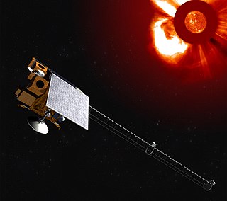
The Solar and Heliospheric Observatory (SOHO) is a European Space Agency (ESA) spacecraft built by a European industrial consortium led by Matra Marconi Space that was launched on a Lockheed Martin Atlas IIAS launch vehicle on 2 December 1995, to study the Sun. It has also discovered more than 5,000 comets. It began normal operations in May 1996. It is a joint project between the European Space Agency (ESA) and NASA. SOHO was part of the International Solar Terrestrial Physics Program (ISTP). Originally planned as a two-year mission, SOHO continues to operate after almost 29 years in space; the mission has been extended until the end of 2025, subject to review and confirmation by ESA's Science Programme Committee.
Helioseismology is the study of the structure and dynamics of the Sun through its oscillations. These are principally caused by sound waves that are continuously driven and damped by convection near the Sun's surface. It is similar to geoseismology, or asteroseismology, which are respectively the studies of the Earth or stars through their oscillations. While the Sun's oscillations were first detected in the early 1960s, it was only in the mid-1970s that it was realized that the oscillations propagated throughout the Sun and could allow scientists to study the Sun's deep interior. The term was coined by Douglas Gough in the 90s. The modern field is separated into global helioseismology, which studies the Sun's resonant modes directly, and local helioseismology, which studies the propagation of the component waves near the Sun's surface.

Advanced Composition Explorer is a NASA Explorer program satellite and space exploration mission to study matter comprising energetic particles from the solar wind, the interplanetary medium, and other sources.

The Mauna Loa Observatory (MLO) is an atmospheric baseline station on Mauna Loa, on the island of Hawaii, located in the U.S. state of Hawaii.

The Space Weather Prediction Center (SWPC), named the Space Environment Center (SEC) until 2007, is a laboratory and service center of the US National Weather Service (NWS), part of the National Oceanic and Atmospheric Administration (NOAA), located in Boulder, Colorado. SWPC continually monitors and forecasts Earth's space environment, providing solar-terrestrial information. SWPC is the official source of space weather alerts and warnings for the United States.
Solar physics is the branch of astrophysics that specializes in the study of the Sun. It intersects with many disciplines of pure physics and astrophysics.

The Solar Dynamics Observatory (SDO) is a NASA mission which has been observing the Sun since 2010. Launched on 11 February 2010, the observatory is part of the Living With a Star (LWS) program.
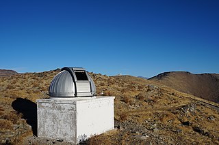
The Birmingham Solar Oscillations Network (BiSON) consists of a network of six remote solar observatories monitoring low-degree solar oscillation modes. It is operated by the High Resolution Optical Spectroscopy group of the School of Physics and Astronomy at the University of Birmingham, UK, in collaboration with Sheffield Hallam University, UK. They are funded by the Science and Technology Facilities Council (STFC).

Heliophysics is the physics of the Sun and its connection with the Solar System. NASA defines heliophysics as "(1) the comprehensive new term for the science of the Sun - Solar System Connection, (2) the exploration, discovery, and understanding of Earth's space environment, and (3) the system science that unites all of the linked phenomena in the region of the cosmos influenced by a star like our Sun."
The Solar Observing Optical Network (SOON) consists of three U.S. Air Force (USAF) Air Force Weather Agency (AFWA) solar observatories. AFWA operates a solar telescope at each site to monitor solar active regions at optical wavelengths. The National Geophysical Data Center (NGDC) archives histograms of intensity versus area every minute for the active regions. It also archives magnetograms of the magnetic field structure and tachograms of plasma velocities on an irregular schedule.

The Heliophysics Science Division of the Goddard Space Flight Center (NASA) conducts research on the Sun, its extended Solar System environment, and interactions of Earth, other planets, small bodies, and interstellar gas with the heliosphere. Division research also encompasses geospace—Earth's uppermost atmosphere, the ionosphere, and the magnetosphere—and the changing environmental conditions throughout the coupled heliosphere.

Solar phenomena are natural phenomena which occur within the atmosphere of the Sun. They take many forms, including solar wind, radio wave flux, solar flares, coronal mass ejections, coronal heating and sunspots.

The Interstellar Mapping and Acceleration Probe (IMAP) is a heliophysics mission that will simultaneously investigate two important and coupled science topics in the heliosphere: the acceleration of energetic particles and interaction of the solar wind with the local interstellar medium. These science topics are coupled because particles accelerated in the inner heliosphere play crucial roles in the outer heliospheric interaction. In 2018, NASA selected a team led by David J. McComas of Princeton University to implement the mission, which is currently scheduled to launch no earlier than September 2025. IMAP will be a Sun-tracking spin-stabilized satellite in orbit about the Sun–Earth L1 Lagrange point with a science payload of ten instruments. IMAP will also continuously broadcast real-time in-situ data that can be used for space weather prediction.

Space climate is the long-term variation in solar activity within the heliosphere, including the solar wind, the Interplanetary magnetic field (IMF), and their effects in the near-Earth environment, including the magnetosphere of Earth and the ionosphere, the upper and lower atmosphere, climate, and other related systems. The scientific study of space climate is an interdisciplinary field of space physics, solar physics, heliophysics, and geophysics. It is thus conceptually related to terrestrial climatology, and its effects on the atmosphere of Earth are considered in climate science.

The solar storms of August 1972 were a historically powerful series of solar storms with intense to extreme solar flare, solar particle event, and geomagnetic storm components in early August 1972, during solar cycle 20. The storm caused widespread electric- and communication-grid disturbances through large portions of North America as well as satellite disruptions. On 4 August 1972 the storm caused the accidental detonation of numerous U.S. naval mines near Haiphong, North Vietnam. The coronal mass ejection (CME)'s transit time from the Sun to the Earth is the fastest ever recorded.
Space Weather Follow On-Lagrange 1 (SWFO-L1) is a future spacecraft mission planned to monitor signs of solar storms, which may pose harm to Earth's telecommunication network. The spacecraft will be operated by the National Oceanic and Atmospheric Administration (NOAA), with launch scheduled for no earlier than September 2025. It is planned to be placed at the Sun–Earth L1 Lagrange point, a location between the Earth and the Sun. This will allow SWFO-L1 to continuously watch the solar wind and energetic particles heading for Earth. SWFO-L1 is an ESPA Class Spacecraft, sized for launch on an Evolved Expendable Launch Vehicle Secondary Payload Adapter (ESPA) Grande ring in addition to the rocket's primary payload. The spacecraft's Solar Wind Instrument Suite (SWIS) which includes three instruments will monitor solar wind, and the Compact Coronagraph (CCOR) will monitor the Sun's surroundings to image coronal mass ejection (CME). A CME is a large outburst of plasma sent from the Sun towards interplanetary space.

Synoptic Optical Long-term Investigations of the Sun (SOLIS) is a synoptic facility for solar observations over a long time frame that is funded by the National Science Foundation (NSF) and designed and built by the National Solar Observatory (NSO). It is operated by the NSO Integrated Synoptic Program (NISP). SOLIS is a single set of three instruments mounted on a common observing platform. The instruments are the 50 cm aperture Vector Spectromagnetograph (VSM), the 8 mm aperture Integrated Sunlight Spectrometer (ISS), and the 14 cm aperture Full-Disk Patrol (FDP). The VSM telescope is a quasi-Ritchey-Chretien design with a primary mirror operating at f/1.6. The ~ 400 W of solar light from the primary is reflected by a secondary mirror fabricated from a single silicon crystal. The final f/6.6 full-disk solar image is focused on a spectrograph slit that is cooled by a flow of chilled water-propylene glycol solution. The mirrors are coated with protected silver. To improve the internal seeing, the VSM is sealed by 74 cm diameter, 6 mm thick fused silica window. Originally, it was filled with helium at about ambient pressure and temperature. In 2014, helium was replaced by nitrogen due to the increasing cost of helium. Due to this change, the image sharpness was slightly degraded.

The Wilcox Solar Observatory (WSO) is a solar observatory in Stanford, California that is used to produce daily observations of the magnetic and velocity field at the Sun's surface. It began daily observations of the Sun's mean magnetic field in May 1975. Formerly known as the Stanford Solar Observatory, it is operated by Stanford University and is located 2 kilometers (1.2 mi) south of the Stanford University campus. It would later be named after solar physicist John M. Wilcox. WSO has historically been funded by NASA Heliophysics, the National Science Foundation, and the Office of Naval Research.

Irene González Hernández was a Spanish researcher and astrophysicist, promoter of the development of holographic techniques in local helioseismology, which allow detecting solar activity in the non-visible hemisphere of the Sun.


