
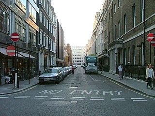
Mayfair is an area in London, England and is located in the City of Westminster. It is in Central London and part of the West End. It is between Oxford Street, Regent Street, Piccadilly and Park Lane and one of the most expensive districts in the world.
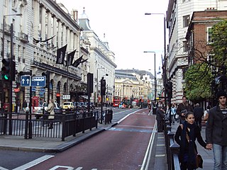
Piccadilly is a road in the City of Westminster, London, England, to the south of Mayfair, between Hyde Park Corner in the west and Piccadilly Circus in the east. It is part of the A4 road that connects central London to Hammersmith, Earl's Court, Heathrow Airport and the M4 motorway westward. St James's is to the south of the eastern section, while the western section is built up only on the northern side. Piccadilly is just under 1 mile (1.6 km) in length, and it is one of the widest and straightest streets in central London.
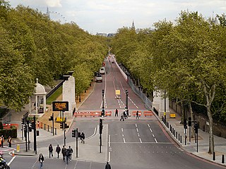
Constitution Hill is a road in the City of Westminster in London. It connects the western end of The Mall with Hyde Park Corner, and is bordered by Buckingham Palace Gardens to the south, and Green Park to the north. At the top of the rise in the roadway at the Corner is the Wellington Arch, near where the road is flanked by the Memorial Gates war memorial.

Clarence House is a royal residence on The Mall in the City of Westminster, London. It was built in 1825–1827, adjacent to St James's Palace, for the royal Duke of Clarence, the future King William IV.

Farringdon Road is a road in Clerkenwell, London.

Pall Mall is a street in the St James's area of the City of Westminster, Central London. It connects St James's Street to Trafalgar Square and is a section of the regional A4 road. The street's name is derived from pall-mall, a ball game played there during the 17th century, which in turn is derived from the Italian pallamaglio, literally "ball-mallet".

Hanover Square is a green square in Mayfair, Westminster, south west of Oxford Circus where Oxford Street meets Regent Street. Six streets converge on the square which include Harewood Place with links to Oxford Street, Princes Street, Hanover Street, Saint George Street, Brook Street and Tenderden Street, linking to Bond Street and Oxford Street.

Waterlow Park is a 26-acre (11 ha) park in the south east of Highgate Village, in north London. It was given to the public by Sir Sydney Waterlow, as "a garden for the gardenless" in 1889.

York House is a historic wing of St James's Palace, London, built for Frederick, Prince of Wales, on his marriage in 1736. It is in the north-western part of the palace on the site of a former suttling-house (canteen) for the Guards; it overlooks Ambassadors' Court and Cleveland Row to the west of the old Chapel Royal. Prince Frederick occupied it for about a year, until his quarrel with his father drove him from Court.
St Martin's Lane is a street in the City of Westminster, which runs from the church of St Martin-in-the-Fields, after which it is named, near Trafalgar Square northwards to Long Acre. At its northern end, it becomes Monmouth Street. St Martin's Lane and Monmouth Street together form the B404.
Curzon Street is located within the Mayfair district of London. The street is located entirely within the W1J postcode district; the eastern end is 200 metres (660 ft) north-east of Green Park underground station. It is within the City of Westminster, running approximately east to west from Fitzmaurice Place past Shepherd Market to Park Lane.

Albany Street is a road in London running from Marylebone Road to Gloucester Gate following the east side of Regent's Park. It is about three-quarters of a mile in length.
Old Burlington Street is a street in central London that is on land that was once part of the Burlington Estate.
Hinde Street is a street in the Marylebone district of the City of Westminster, London, that contains the Hinde Street Methodist Church and was home to the novelist Rose Macaulay until her death.

Devereux Court, a street in the City of Westminster located just south of the Strand and east of Essex Street, is completely pedestrianised. This narrow lane is lined with well-preserved seventeenth-century buildings. The court's distinctive dog-leg layout has remained unchanged since its establishment in the 1670s on the grounds of Essex House, a stately home renowned for its expansive gardens.

South Audley Street is a major shopping street in Mayfair, London. It runs north to south from the southwest corner of Grosvenor Square to Curzon Street.
Green Street is a street in Mayfair, London. It has been built up since the mid-18th century, but most of the current properties date from the late 19th and early 20th century. It has had a number of significant residents, including various members of the British aristocracy, the James Bond author Ian Fleming, and the Beatles.

The Maypole in the Strand was a landmark maypole on the Strand, London, that was in place during the 17th and early 18th centuries, on the site of the current St Mary le Strand church.

Gloucester Avenue is a street in the Primrose Hill area of London, England. Located in the London Borough of Camden, it is a residential road featuring many nineteenth century properties including several pubs as well as the neo-Georgian Cecil Sharp House. For much of its route it runs adjacent to the West Coast Main Line out of Euston Station.

Connaught Street is a street in Central London. Located in the City of Westminster, it is part of the Tyburnia area of Paddington north of Hyde Park. It runs west to east from Hyde Park Square to the Edgware Road. It continues eastwards becoming Upper Berkeley Street in Marylebone. The street contains a mixture of commercial and residential properties, forming part of Connaught Village. Connaught Square and Albion Street are located on its southern side. The Duke of Kendal public house sits at the junction between Connaught Street and Kendal Street.

