
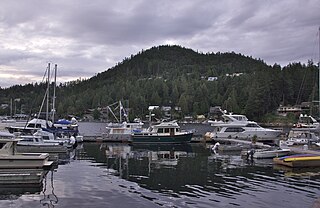
Powell River is a city on the northern Sunshine Coast of southwestern British Columbia, Canada. Most of its population lives near the eastern shores of Malaspina Strait, which is part of the larger Georgia Strait between Vancouver Island and the Mainland. With two intervening long, steep-sided fjords inhibiting the construction of a contiguous road connection with Vancouver to the south, geographical surroundings explain Powell River's remoteness as a community, despite relative proximity to Vancouver and other populous areas of the BC Coast. The city is the location of the head office of the qathet Regional District.
The Sunshine Coast is a geographic subregion of the British Columbia Coast that generally comprises the regional districts of qathet and Sunshine Coast.

Garibaldi Provincial Park, also called Garibaldi Park, is a wilderness park located on the coastal mainland of British Columbia, Canada, 70 kilometres (43.5 mi) north of Vancouver. It was established in 1920 and named a Class A Provincial Park of British Columbia in 1927. The park is a popular destination for outdoor recreation, with over 30,000 overnight campers and over 106,000 day users in the 2017/2018 season.

Bowron Lake Provincial Park is a wilderness provincial park located in east-central British Columbia, Canada, near the border with Alberta. It is 117 km (73 mi) east of the city of Quesnel. Other nearby towns include Wells and the historic destination of Barkerville. Once a popular hunting and fishing destination, today the park is protected and known for its abundant wildlife, rugged glaciated mountains, and freshwater lakes.

The Chilcotin River /tʃɪlˈkoʊtɪn/ located in Southern British Columbia, Canada is a 241 km (150 mi) long tributary of the Fraser River. The name Chilcotin comes from Tŝilhqot’in, meaning "ochre river people," where ochre refers to the mineral used by Tŝilhqot’in Nation and other Indigenous communities as a base for paint or dye. The Chilcotin River, Chilko River and Lake, and Taseko River and Lake make up the Chilcotin River watershed. This 19,200 km2 (7,400 sq mi) watershed drains the Chilcotin Plateau which reaches north to south from the Nechako Plateau to Bridge River county and east to west from Fraser River to the Coast Mountains. It is also one of twelve watersheds that make up the Fraser River Basin. Made up of seven major tributaries, Chilcotin River starts northeast of Itcha Mountain, flowing southeast until it joins the Fraser River south of Williams Lake, 22 km (14 mi) upstream from Gang Ranch.

The North Shore Mountains are a mountain range overlooking Vancouver in British Columbia, Canada. Their southernmost peaks are visible from most areas in Vancouver and form a distinctive backdrop for the city.

Alert Bay is a village on Cormorant Island, near the town of Port McNeill on northeast Vancouver Island, in the Regional District of Mount Waddington, British Columbia, Canada.

Pinecone Burke Provincial Park is a provincial park in British Columbia, Canada. It extends from the southwest corner of Garibaldi Provincial Park, west of Pitt Lake and Pitt River to include Burke Mountain in the City of Coquitlam. Most of the park is unserviced wilderness with very rough trails such as the Fools Gold Trail in the Boise Valley. There is canoe access to Widgeon Slough and from there hiking trails that lead to Widgeon Lake, and a network of old logging roads, hiking and mountain biking trails on Burke Mountain. Visitors can also use the park for camping, backcountry skiing, and snowshoeing.

Cathedral Provincial Park and Protected Area, usually known as Cathedral Provincial Park and also as Cathedral Park, is a provincial park in British Columbia, Canada. It is located east of E.C. Manning Provincial Park, south of BC Highway 3, and southeast of the town of Princeton, and southwest of Keremeos. Its southern boundary is the border with the United States. Much of the park is the basin of the Ashnola River. Cathedral Park is home to teal sub-alpine lakes, vast ridges and jarred peaks, old-growth forests, and rock formations of siltstone, granodiorite, and basalt. Hikers can scramble along various peaks such as the 8000-foot Grimface Mountain and Lakeview Mountain. Tourists flock to Smokey the Bear and Stone City because of their unique formations with incredible views formed by millennia of erosion, volcanic and tectonic activity, and glacial recession.

Davis Lake Provincial Park is a 185 acres (0.75 km2) park in British Columbia, Canada, established as a protected provincial park in October 1963. It is located east of the southern end of Stave Lake, northeast of Mission, British Columbia, approximately 18 km north on Sylvester Rd from BC Highway 7. There are campgrounds and beaches at the south end of the lake, access is walk-in only via a 1 km unmaintained gravel road.

Skidegate is a Haida community in Haida Gwaii in British Columbia, Canada. It is on the southeast coast of Graham Island, the largest island in the archipelago, and is approximately 50 kilometres (31 mi) west of mainland British Columbia across Hecate Strait.
Spatsizi Plateau Wilderness Provincial Park is located in the northern portion of British Columbia, Canada, approximately 698, 659 hectares and encompasses the Spatsizi River and Gladys Lake Ecological Reserve. The park is a designated protected area that is intended for the conservation and research on caribou, grizzly bears, fish, and other wildlife species populations. Before the provincial park's establishment in 1975, the area was a historical hunting ground for local Indigenous communities like the Tahltan First Nations.It is the second largest provincial park in British Columbia.

Strathcona-Westmin Provincial Park is a Class B provincial park located at the southern extremity of Buttle Lake on Vancouver Island in British Columbia, Canada. The park was separated out from Strathcona Provincial Park by BC Parks in 1987 so that mining operations could proceed within park boundaries. Strathcona-Westmin is expected to be reabsorbed into Strathcona Provincial Park once mining operations cease.

The Squamish Nation is a First Nations government of the Squamish people. The Squamish Nation government includes an elected council and an administrative body based primarily in West Vancouver, North Vancouver, and Squamish, BC.
The Crease Range is a small, low mountain range in northern western British Columbia, Canada, located on north-central Graham Island of Haida Gwaii, between Lan and Adam Lakes. It has an area of 79 km2 and consists of hills. It is a subrange of the Queen Charlotte Mountains which in turn form part of the Insular Mountains.

The Salmo River is a tributary of the Pend d'Oreille River in the West Kootenay region of the Regional District of Central Kootenay in the Canadian province of British Columbia. The river is 60 km long and its source is 12 km south of Nelson in the Selkirk Mountains. The Salmo River is part of the Columbia River drainage basin, being a tributary of the Pend d'Oreille River, which flows into the Columbia River.
Hucuktlis Lake, also known as Henderson Lake, is a lake on Vancouver Island that drains south into head of Uchucklesaht Inlet on the north side of lower Alberni Inlet.
Anarchist Protected Area is a 467-hectare (1,150-acre) park in British Columbia, Canada, with limited public access.

Homfray Channel is a deep water channel, reaching depths of 731 meters, located between East Redonda and the mainland coast of British Columbia, Canada.
Francis Peninsula, also known as Beaver Island, is a tidal island located on the west coast of the Sechelt Peninsula in British Columbia, Canada.
