Gogo Falls

Last updated
Gogo Falls
Kenya relief location map.jpg
Archaeological site icon (red).svg
Location in Kenya
Location Kenya
Region Migori County
Coordinates 0°54′S34°35′E / 0.900°S 34.583°E / -0.900; 34.583 Coordinates: 0°54′S34°35′E / 0.900°S 34.583°E / -0.900; 34.583
Altitude1,296 m (4,252 ft)
History
Periods Neolithic
Cultures Elmenteitan
Associated withancient pastoralist peoples
Site notes
Excavation datessince 1983
ArchaeologistsKarega-Munene, Samuel Kahinju [1]

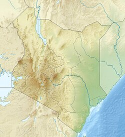
Gogo Falls is an archaeological site near a former and since 1956 dammed waterfall, located in the Lake Victoria Basin in Migori County, western Kenya. [2] This site is important to archaeology as it includes some of the earliest appearances of artifacts and domestic animals in the area. [3] The findings at the site help to reconstruct the later prehistory around Lake Victoria, including a Pastoral Neolithic occupation by Elmenteitan peoples and a later Iron Age occupation. Artifacts found at the site included pottery and iron artifacts. Through these artifacts some of the cultural traditions of the people who lived near Gogo Falls were discovered. [4]

Contents

Location and environmental setting

Gogo Falls is located in the Lake Victoria Basin in Kenya. Gogo Falls is located on the Kanyamkago Hillside near the modern dam on the West bank of Gucha River (also known as Kuja River). The Kanyamkago Hills were formed out of Pre-Cambrian rocks. [5] :69 The modern dam is fairly close to Gogo Falls but it did not form any of the falls in the area; the falls were all formed naturally. [5] :69 The falls were a good place to collect fish because they offered easy access to those who resided in the area.

History of research

The first archaeologist to work in the Lake Victoria region of Kenya was Archdeacon W.E. Owen, he later enlisted the help of Louis Leakey. [5] :63 After their work, there were a few caves that were excavated but they did not present any important artifacts. That was the extent of the work done in the Lake Victoria Basin until 1980 when Peter Robertshaw started his work in Gogo Falls. [5] :65 Robertshaw and David Collett visited Gogo Falls in 1981, they found that some of the ground had been disturbed due to work on the local dam. From the visible disturbance they found the ground had archaeological evidence that should be further examined. The items found were ash midden that included Oltome pottery (Kansyore pottery), faunal remains and stone artifacts. There were cattle teeth found in the area but through further research it appeared that the cattle and the pottery were not related. [5] :65 Robertshaw returned to Gogo Falls in 1983 to further excavate the site with new trenches located in different areas of the falls. In 1989, Karega-Munene excavated Gogo Falls on a larger scale using similar excavations techniques to Robertshaw’s in 1983.

Research and excavation strategy

In 1983, Robertshaw dug five trenches of varying sizes about 2m x 2m. The strategy for excavation of the five trenches included the removal of topsoil with picks and shovels. [5] :71 Once below the topsoil, trowels were used for the remainder of the excavations. The deposit was then separated in 10 cm deep units which were then identified by both a number and letter. After the deposit was separated into units, it was then dry-sieved using a sieve with 5 mm mesh.

The 1989 excavations of this area were conducted by Karega-Munene. The excavation decided to focus on the area that was adjacent to the river. They established a grid that resulted in 52 squares, each measured 5m x 5m. There were two plots that produced the most finds and they were identified as Area A. [6] :59 After those plots provided so many finds they excavated more squares in that area which were labeled 1 through 30. [6] :59 The excavations of these squares were different than Robertshaw’s excavations because the topsoil was not removed by shovels, but instead separated into 10 cm spits.

Dating

Different types of dating were used at Gogo Falls. Archaeologists sent small charcoal samples to the University of Oxford to be radiocarbon dated. [6] :69 However, the samples of charcoal found were less than 30g, which meant the dates were only average dates because the samples were smaller than what was needed to obtain an exact date. [6] The samples were not able to give exact dates because they could have come from the levels above or below the level that was being dated. Even though the samples had minor problems for obtaining dates, they were the best option for dates in those levels. [6] :70 However, there were items that were dated using this method that did support the understanding of the site. [5] :73 The dates found did not always match the stratigraphy but the dates themselves were not statistically different. [5] :73 The other technique used to date items in Gogo Falls was obsidian hydration. For the excavations in 1983, J.W. Michele performed the obsidian hydration dating at MOHLAB. [5] :72 There were also problems with this kind of dating because rates of hydration are not always constant enough to date correctly. The date of an item could change based on how much sunlight that it receives and the chemical composition that is in its environment. [6] :70 Some dates of samples that were found did not match because there was a 1500-year gap between the two and some of the other dates were older than the ones that were found in deeper layers. [6] :70 However, there were other dates that showed stratigraphic consistency because there were layers in the trenches that showed the deeper levels were older than the ones above it. The dates that were attained from the excavations date to about 2000 BP and range between the years of 1510-990 BC and AD 4 and AD 410. [5] :73–74 [6] :71

Finds

There were many different items excavated at Gogo Falls, found were ash midden, Akira pottery, Kansyore pottery, Elementeitan pottery, Urewe pottery, iron artifacts, regular shells beads, ostrich eggshell beads, faunal remains, stone artifacts and charcoal. The stone Artifacts include obsidian, quartz, small microliths and modified blades of different sizes. [5] :77–78 In 1989, the excavations found more stone artifacts that had been found earlier but they also found arrowheads. [6] :73 In 1983, there were some bone artifacts found, including one possible harpoon, which would make it the first in the Lake Victoria Basin. [5] :147 The faunal remains include mammalian fauna which were bones and teeth from cattle, fish bones which were believed to be the first associated with Elementeitan pottery, shellfish and botanical remains. Based on evidence, Gogo Falls was a site for herding cattle, sheep and goats. [7] :8 People at Gogo Falls also hunted; bones of zebra, warthog, bush pig, and oribi were found at the site. [7] :8 Finds were spread throughout the different areas that were excavated but all of the areas were consistent with the others.

Discussion

Gogo Falls helps archaeologists today because based on recent studies of stable isotopes of animal teeth, a path has been found that would have allowed people to travel to South Africa. [8] :3674 Since it is known that there were large numbers of domestic animals and wild animals at the site, this proves that there was no tsetse flies in the area. If there were tsetse flies, then there would not have been evidence of herding in Gogo Falls. The stable isotopes also prove that the area had been covered in grasses for the last 2000 years due to the increase of rainfall in the later Holocene, the environment was ideal to have supported domestic animals. [8] :3677 This evidence helps prove that there could have been a movement of people from eastern Africa to southern Africa, because the main source of food for people were animals and they would have had to travel through areas that animals could survive.

See also

Related Research Articles

<span class="mw-page-title-main">Kalambo Falls</span> Waterfalls on the Tanzania and Zambia border.

The Kalambo Falls on the Kalambo River is a 772-foot (235 m) single-drop waterfall on the border of Zambia and Rukwa Region, Tanzania at the southeast end of Lake Tanganyika. The falls are some of the tallest uninterrupted falls in Africa. Downstream of the falls is the Kalambo Gorge, which has a width of about 1 km and a depth of up to 300 m, running for about 5 km before opening out into the Lake Tanganyika rift valley. The Kalambo waterfall is the tallest waterfall in both Tanzania and Zambia. The expedition which mapped the falls and the area around it was in 1928 and led by Enid Gordon-Gallien. Initially it was assumed that the height of falls exceeded 300 m, but measurements in the 1920s gave a more modest result, above 200 m. Later measurements, in 1956, gave a result of 221 m. After this several more measurements have been made, each with slightly different results. The width of the falls is 3.6–18 m.

Hyrax Hill is a prehistoric site near Nakuru in the Rift Valley province of Kenya. It is a rocky spur roughly half a kilometer in length, with an elevation of 1,900 meters above sea level at its summit. The site was first discovered in 1926 by Louis Leakey during excavations at the nearby Nakuru Burial Site, and Mary Leakey conducted the first major excavations between 1937 and 1938. There are two distinct areas of occupation at Hyrax Hill: one which was occupied during the Pastoral Neolithic and late Iron Age, and one which was occupied by the Sirikwa earlier in the Iron Age.

<span class="mw-page-title-main">Fort Rock Cave</span> United States historic place

Fort Rock Cave was the site of the earliest evidence of human habitation in the US state of Oregon before the excavation of Paisley Caves. Fort Rock Cave featured numerous well-preserved sagebrush sandals, ranging from 9,000 to 13,000 years old. The cave is located approximately 1.5 miles (2.4 km) west of Fort Rock near Fort Rock State Natural Area in Lake County. Fort Rock Cave was declared a National Historic Landmark in 1961, and added to the National Register of Historic Places in 1966.

The Mooney site is a precontact Native American archaeological site on the Red River Levee in Norman County, Minnesota. It is a multicomponent site consisting of remains from both the Archaic and Woodland traditions. No diagnostic Archaic artifacts were found. However, animal remains and lithic materials recovered from one meter below the Woodland artifacts returned a carbon 14 date that provided the basis for the Archaic classification. The Woodland tradition is defined by a vertical scatter of materials, dated to about 1000 using thermoluminescence methods. Many animal bones were found at the site, reflecting a great emphasis on a wide range of hunting activity that focused on bison. Artifacts such as local and exotic lithic materials were found, as well as a wide variety of pottery and other ceramic remains. Much of the pottery followed the Sandy Lake model; however, some artifacts were placed in a new class of artisanship known as Red River Ware.

<span class="mw-page-title-main">Leary Site</span> Archaeological site in Nebraska, US

Leary Site, also known as 25-RH-1 or Leary-Kelly Site is an archaeological site near Rulo, Nebraska and the Big Nemaha River. The site now lies entirely on the reservation of the Iowa Tribe of Kansas and Nebraska. The area was once a village and burial site.

Enkapune Ya Muto, also known as Twilight Cave, is a site spanning the late Middle Stone Age to the Late Stone Age on the Mau Escarpment of Kenya. This time span has allowed for further study of the transition from the Middle Stone Age to the Late Stone Age. Beads made of perforated ostrich egg shells found at the site have been dated to 40,000 years ago. The beads found at the site represent the early human use of personal ornaments.

The Gobero archaeological site, dating to approximately 8000 BCE, is the oldest known graveyard in the Sahara Desert. The site contains important information for archaeologists on how early humans adapted to a constantly changing environment. Gobero is located in the Ténéré desert of Niger, and is named after the Tuareg name for the region. It is the type site of the Holocene era Kiffian culture and Tenerian culture.

<span class="mw-page-title-main">Franktown Cave</span> Archaeological site in Colorado, United States

Franktown Cave is located 25 miles south of Denver, Colorado on the north edge of the Palmer Divide. It is the largest rock shelter documented on the Palmer Divide, which contains artifacts from many prehistoric cultures. Prehistoric hunter-gatherers occupied Franktown Cave intermittently for 8000 years beginning about 6400 B.C. The site held remarkable lithic and ceramic artifacts, but it is better known for its perishable artifacts, including animal hides, wood, fiber and corn. Material goods were produced for their comfort, task-simplification and religious celebration. There is evidence of the site being a campsite or dwelling as recent as AD 1725.

Ngenyn is a Late Stone Age and/or a Savanna Pastoral Neolithic archaeological site located in the Kapthurin River Basin, which is part of the Tugen Hills, west of Lake Baringo. It falls within the Baringo County in north central Kenya. The occupied area is situated on the floodplain of the River Ndau's confluence with the Sekutionnen River, on a widespread terrace called the Low Terrace, the top of which is about 3m above the level of the modern river. The site was initially discovered by Louis Leakey in 1969. It was visible as a large exposure of bones, stone tools and pottery eroding out of the terrace. The site was excavated in the late 1970s as part of Francoise Hivernel's PhD research. Ngenyn remains the only Late Holocene site excavated in the Lake Baringo Basin and in general very little archaeological work has been done on the Late Holocene within the Baringo County.

Dewil Valley, located in the northernmost part of Palawan, an island province of the Philippines that is located in the Mimaropa region, is an archaeological site composed of thousands of artifacts and features. According to the University of the Philippines Archaeological Studies Program, or UP-ASP, the closest settlement can be found in New Ibajay, which is covered by the town capital of El Nido, which is located around 9 km (5.6 mi) south-east of Dewil Valley. Physically it measures around 7 km (4.3 mi) long, and 4 km (2.5 mi) wide. It is in this place which the Ille Cave, one of the main archaeological sites, can be found. It is actually a network of 3 cave mouths located at its base. It has been discovered that this site in particular has been used and occupied by humans over multiple time periods.

Ntusi is a Late Iron Age archaeological site located in southwestern Uganda that dates from the tenth century to the fifteenth century AD. Ntusi is dominated by two large mounds and manmade scraped valley basins called, bwogero. Long abandoned by the time Hima herdsman grazed their cattle on the Bwera, the herdsman named the site "Ntusi" meaning, "the mounds", after the prominent earthworks. The archaeological record at Ntusi is unmistakable in the signs of intense occupation and activity and it represents the beginning of political complexity in this region of Africa. Bigo bya Mugenyi, another site with prominent earthworks, lies 13 km to the north of Ntusi.

Ngamuriak is an archaeological site located in south-western Kenya. It has been interpreted as an Elmenteitan Pastoral Neolithic settlement. The excavation of this site produced pottery sherds, stone tools with obsidian fragments and obsidian blades, along with large amounts of animal bones.

To understand past cultures archaeologists analyze many artifacts. Pottery proves to be of most importance to the archaeological record. Pottery is durable and even allows its broken fragments to withstand time, which would otherwise decompose other artifacts. More importantly, the style of pottery often changes through time, and shifts in shape, size, or decoration can be used to resolve the age of the artifact and/or site. Furthermore, though pottery is common, different cultures had their own distinct styles that can be used to determine its similarities or differences with one another. Therefore, even fragments of pottery can reconstruct many facets of past cultures.

<span class="mw-page-title-main">Haua Fteah</span>

Haua Fteah is a large karstic cave located in the Cyrenaica in northeastern Libya. This site has been of significance to research on African archaeological history and anatomically modern human prehistory because it was occupied during the Middle and Upper Paleolithic, the Mesolithic and the Neolithic. Evidence of modern human presence in the cave date back to 200,000 BP.

Munsa is an archaeological site in Uganda, located in the south-eastern part of Bunyoro, and is commonly recognized by a rocky hill known by the locals as "Bikegete", which is enclosed within an earthworks system of ancient ditches. The site is approximately 5 kilometres (3.1 mi) north-west of Kakumiro township in Bugangaizi County, Kakumiro District. "Munsa" is a Runyoro(Lunyoro/Runyoro Edited by Nicholas Aliganyira Nkuuna) name that means "in the trenches". The architects of the earthworks are unknown, although it has been speculated that the site can be linked to the Bachwezi. There is no evidence for this, however, and it seems likely that association of Munsa with the Bachwezi or Chwezi is a recent development.

Melkhoutboom Cave is an archaeological site dating to the Later Stone Age, located in the Zuurberg Mountains, Cape Folded Mountain Belt, Sarah Baartman District Municipality in the Eastern Cape Province of South Africa.

Njoro River Cave is an archaeological site on the Mau Escarpment, Kenya, that was first excavated in 1938 by Mary Leakey and her husband Louis Leakey. Excavations revealed a mass cremation site created by Elmenteitan pastoralists during the Pastoral Neolithic roughly 3350-3050 BP. Excavations also uncovered pottery, beads, stone bowls, basket work, pestles and flakes. The Leakeys' excavation was one of the earliest to uncover ancient beads and tools in the area and a later investigation in 1950 was the first to use radiocarbon dating in East Africa.

<span class="mw-page-title-main">Elmenteitan</span> African Pastoral Neolithic culture

The Elmenteitan culture was a prehistoric lithic industry and pottery tradition with a distinct pattern of land use, hunting and pastoralism that appeared and developed on the western plains of Kenya, East Africa during the Pastoral Neolithic c.3300-1200 BP. It was named by archaeologist Louis Leakey after Lake Elmenteita, a soda lake located in the Great Rift Valley, about 120 km (75 mi) northwest of Nairobi.

<span class="mw-page-title-main">Lothagam North Pillar Site</span> Archaeological site in Kenya

The Lothagam North Pillar Site, registered as GeJi9, is an archaeological site on the west side of Lake Turkana in Kenya dating to the Pastoral Neolithic and the Holocene. It is a communal cemetery, built between 3000 BCE and 2300 BCE by the region's earliest herders as rainfall in the area decreased and Lake Turkana receded. It is thought to be eastern Africa's largest and earliest monumental cemetery.

Kom K and Kom W are Neolithic archaeological sites in the northern Fayum region of Egypt dating to the mid-5th millennium BCE with evidence of human occupation for approximately three centuries from the stratified hearth mounds. Radiocarbon dates from charcoal and botanicals found beyond the mounds yield older yet scattered dates well into the 6th millennium BCE. Both sites are situated near the shores of Lake Qarun, which was extensively researched for its water level fluctuation, due to shifts in the Nile floods and its effect on human occupation periods. Kom K and Kom W were both situated within 1 km of the lake during most of its human occupation periods when lake levels were much higher. The first academic fieldwork was carried out by archaeologist Gertrude Caton-Thompson and geologist Elinor Wight Gardner in the three seasons of 1924-5, 1925-6, and 1927-8. Kom K and Kom W yielded archaeological findings that differ from the culture units within the Egyptian Neolithic known at the time leading Caton-Thompson and Gardner to claim the sites as part of Fayum A and B cultures. The area has been re-investigated by the URU Fayum Project since 2004 where it has since been threatened by agriculture and development.

References

  1. "The archaelology dig at Gogo Falls yields an exclusive pottery". Actforlibraries. Retrieved December 4, 2016.
  2. "Gogo Falls". Mapcarta. Retrieved December 4, 2016.
  3. Robertshaw, Peter (February 26, 2010). "Gogo Falls Excavations at a complex archaeological site east of Lake Victoria". Azania: Archaeological Research in Africa. 26: 63–195. doi:10.1080/00672709109511425.
  4. "Environments and trypanosomiasis risks for early herders in the later Holocene of the Lake Victoria basin, Kenya" (PDF). PNAS. Retrieved December 4, 2016.
  5. 1 2 3 4 5 6 7 8 9 10 11 12 Robertshaw, Peter (January 1991). "Gogo Falls: Excavations as a complex archaeological site east of Lake Victoria". Azania: Archaeological Research in Africa. 26 (1): 63–195. doi:10.1080/00672709109511425.
  6. 1 2 3 4 5 6 7 8 9 Karega-Mũnene (2002). Holocene foragers, fishers and herders of western Kenya. Oxford: Archaopress. ISBN   9781841714172.
  7. 1 2 Marshall, Fiona; Stewart, Kathlyn (1995). "Hunting, Fishing and herding pastoralists of Western Kenya: the fauna from Gogo Falls". Archaeozoologia. 7 (1).
  8. 1 2 Chritz, Kendra L.; Marshall, Fiona B.; Zagal, M. Esperanza; Kirera, Francis; Cerling, Thure E. (2015). "Environments and trypanosomiasis risks for early herders in the later Holocene of the Lake Victoria basin, Kenya". Proceedings of the National Academy of Sciences. 112 (12): 3674–3679. Bibcode:2015PNAS..112.3674C. doi: 10.1073/pnas.1423953112 . PMC   4378429 . PMID   25775535.