Comilla District, officially known as Cumilla District, is a district of Bangladesh located about 100 kilometres south east of Dhaka. Comilla is bordered by Brahmanbaria and Narayanganj districts to the north, Noakhali and Feni districts to the south, Tripura of India to the east and Munshiganj and Chandpur districts to the west. Comilla district is located in the southeastern part of Bangladesh.
Gopalganj is a district in the Dhaka Division of Bangladesh. The district has about 1,172,415 civilians and its surface area is 1,490 km2. The main city of the district is also called Gopalganj. It stands on the bank of the Madhumati river and located at 23°00’47.67" N 89°49’21.41". It is bounded by Faridpur district on the North, Pirojpur and Bagerhat district on the south, Madaripur & Barisal district on the East and Narail district on the West.

Kurigram District is a district of Bangladesh in the Rangpur Division. The district is located in northern Bangladesh along the country's border with India. Under Indian rule, the area was organized as a mahakuma and was not established as a district until 1984.

Chandpur District (চাঁদপুর) is a district located in Chattogram Division, Bangladesh. It was a part of the Cumilla District until 15 February 1984.

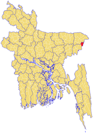
Brahmanbaria is a district in eastern Bangladesh located in the Chittagong Division. Geographically, it is mostly farmland and is topographically part of the Gangetic Plain. It is bounded by the districts of Kishoreganj and Habiganj to the north, Narsingdi District and Narayanganj to the west, Comilla to the south, and the Indian state of Tripura to its east. It was a part of Comilla until 15 February 1984.
Akhaura is an upazila of Brahmanbaria District, a district under Chattogram, Bangladesh. Akhaura Upazila has an area of 99.28 km2. The main river that run through this upazila is the Titas River. Akhaura played an important historical role during both World War II and Liberation War of Bangladesh.
Brahmanbaria Sadar is an upazila of Brahmanbaria District in the Division of Chittagong, Bangladesh. Brahmanbaria Sadar is located at 23.9528°N 91.1167°E.
Nabinagar is an upazila of Brahmanbaria District in the Division of Chattogram, Bangladesh. Nabinagar Thana was turned into an upazila in 1983.
Nasirnagar is an upazila of Brahmanbaria District in the Division of Chittagong, Bangladesh.
Lakhai is an upazila of Habiganj District in the Division of Sylhet, Bangladesh.
Barlekha is an upazila (sub-district) of Moulvibazar District, located in Bangladesh's Sylhet Division.

Tahirpur is an upazila of Sunamganj District in the Division of Sylhet, Bangladesh.

Durgapur is an upazila of the Netrokona District in the Mymensingh Division of Bangladesh.
Mirzapur is an upazila of Tangail District in the division of Dhaka, Bangladesh.
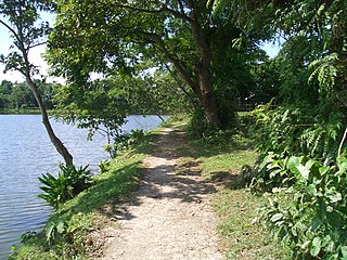
Mohanganj is an upazila of Netrokona District in the Mymensingh division of Bangladesh. It is one of the 10 upazilas of Netrakona district. Mohanganj is largely known as the capital of Lower Bangladesh as it is the economic heart of Lower Bangladesh generally known as Haor.
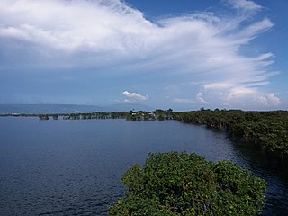
A haor is a wetland ecosystem in the north eastern part of Bangladesh which physically is a bowl or saucer shaped shallow depression, also known as a backswamp. During monsoon haors receive surface runoff water from rivers and canals to become vast stretches of turbulent water.

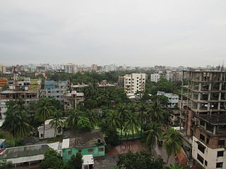
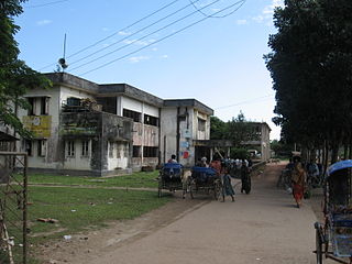
Brahmanbaria is a city of Bangladesh and the capital of Brahmanbaria Sadar Upazila as well as Brahmanbaria District. It is the second largest city after Cumilla in eastern Bangladesh and one of the oldest municipalities in Bangladesh, established in 1868. Brahmanbaria was declared a district headquarters in 1984. Its municipality area has a population of 270,000 in 2020. It is the 17th largest city in Bangladesh.
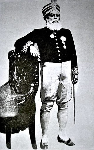
Syed Shamsul Huda (1862–1922) was a Muslim political leader of the Bengal Executive Council. He became the first British Indian Muslim President of the Legislative council in 1921. Huda was born in Gokarna, palace known as Gokarna Nawab Bari Complex Nasirnager, Brahmanbaria. It was the part of Comilla. Earlier known as greater Hill Tipperah. His father Syed Riazat Ullah was the editor of The Doorbeen, a Persian weekly journal.
Jethagram is a village of Gokarna Union in Nasirnagar Upazila at Brahmanbaria District under Chittagong Division of eastern Bangladesh. This village is surrounded by paddy fields, ponds, deghees and jungles. Most of the people are engaged in agriculture and fisheries. Important institutions are available here such as schools, Mosque, School of Islamic science, Temple etc. Hindus and Muslims are living together in this village from log ago.

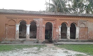
Haripur Barabari, is a palace in Horipur Union of Nasirnagar Upazila at Brahmanbaria district, Bangladesh earlier known as East Bengal. This palace founded by Jamindar Krishna Prasad Roy Choudhury(1870-1936) in eighteenth century.


