
The Pennine Way is a National Trail in England, with a small section in Scotland. The trail stretches for 268 miles (431 km) from Edale, in the northern Derbyshire Peak District, north through the Yorkshire Dales and Northumberland National Park and ends at Kirk Yetholm, just inside the Scottish border. The path runs along the Pennine hills, sometimes described as the "backbone of England". Although not the United Kingdom's longest National Trail, it is according to The Ramblers, "one of Britain's best known and toughest".

The Dales Way is an 78.5-mile (126.3 km) long-distance footpath in Northern England, from Ilkley, West Yorkshire, to Bowness-on-Windermere, Cumbria. This walk was initially devised by the West Riding Ramblers' Association with the 'leading lights' being Colin Speakman and Tom Wilcock. The route was announced to the public in 1968 and the first recorded crossing was by a group of Bradford Grammar School Venture Scouts in 1969.

Ingleton is a village and civil parish in the Craven district of North Yorkshire, England. The village is 19 miles (30 km) from Kendal and 17 miles (28 km) from Lancaster on the western side of the Pennines. It is 9.3 miles (15 km) from Settle. The River Doe and the River Twiss meet to form the source of the River Greta, a tributary of the River Lune. The village is on the A65 road and at the head of the A687. The B6255 takes the south bank of the River Doe to Ribblehead and Hawes. All that remains of the railway in the village is the landmark Ingleton Viaduct. Arthur Conan Doyle was a regular visitor to the area and was married locally, as his mother lived at Masongill from 1882 to 1917. It has been claimed that there is evidence that the inspiration for the name Sherlock Holmes came from here.
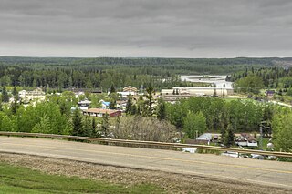
Fort Assiniboine is a hamlet in northwest Alberta, Canada, within Woodlands County. It is located along the north shore of the Athabasca River at the junction of Highway 33 and Highway 661. It is approximately 39 kilometres (24 mi) northwest of Barrhead, 62 kilometres (39 mi) southeast of Swan Hills and 91 kilometres (57 mi) northeast of Whitecourt.
Monsal Dale is a valley in Derbyshire, England, in the White Peak limestone area of the Peak District National Park. It is a Site of Special Scientific Interest (SSSI), a Special Area of Conservation (SAC) (1) and part of a Europe-wide network called Natura 2000.

Millers Dale is a valley on the River Wye in Derbyshire, England, where there is also a hamlet of the same name.

Human Rights Now! was a worldwide tour of twenty benefit concerts on behalf of Amnesty International that took place over six weeks in 1988. Held not to raise funds but to increase awareness of both the Universal Declaration of Human Rights on its 40th anniversary and the work of Amnesty International, the shows featured Bruce Springsteen and the E Street Band, Sting, Peter Gabriel, Tracy Chapman, and Youssou N'Dour, plus guest artists from each of the countries where concerts were held.

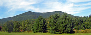
Anthony's Nose is a 900+ ft (270 m) peak in the Hudson Highlands along the east bank of the Hudson River in the hamlet of Cortlandt Manor, New York. It lies at the extreme northwest end of Westchester County, and serves as the east anchor of the Bear Mountain Bridge.

The River Spodden is a watercourse in North West England, one of two major tributaries of the River Roch. It rises in the Lancashire South Pennine hills north of Whitworth and flows south through what is now known as the Whitworth Valley to Rochdale, Greater Manchester, where the river merges with the River Roch. Nestled within the picturesque wooded valley is Healey Dell Nature Reserve.
The 1980 Labour Party leadership election was held following the resignation of James Callaghan, who had been Prime Minister from 1976 to 1979 and had stayed on as leader of the Labour Party for eighteen months in order to oversee an orderly transition to his favoured successor, Denis Healey, over his own deputy Michael Foot. However, during this period the party had become bogged down in internal arguments about its procedures and future direction.

Healey is a small village and civil parish in the Harrogate district of North Yorkshire, England. It is situated in the valley of the River Burn, to the immediate west of Fearby. It is about three miles west of Masham in the Nidderdale Area of Outstanding Natural Beauty. There are several holiday cottages and four Grade II Listed buildings, one of which is Healey Mill, a former corn mill.

Colsterdale is the valley of the River Burn, a tributary of the River Ure, in the Yorkshire Dales in North Yorkshire, England. It gives its name to a hamlet and civil parish in the upper part of the dale, about 7 miles (11 km) west of Masham. The population of the civil parish was estimated at 20 in 2010. The lower part of the dale around the hamlet of Gollinglith Foot is in the civil parish of Healey. The area is in Harrogate district.

Brace Mountain is the peak of a ridge in the southern Taconic Mountains, near the tripoint of the U.S. states of New York, Connecticut and Massachusetts. Its 2,311-foot (704 m) main summit is located in New York; it is the highest point in that state's Dutchess County.

Fiskavaig or Fiscavaig is a picturesque crofting settlement on the north-west shore of the Minginish peninsula, Isle of Skye in the Highland Council area.
Mount Tremper, officially known as Tremper Mountain and originally called Timothyberg, is one of the Catskill Mountains in the U.S. state of New York. It is located near the hamlet of Phoenicia, in the valley of Esopus Creek.
The Six Dales Trail is a long distance footpath in North Yorkshire, England, with a short section in West Yorkshire. It is 38 miles (61 km) long and connects Otley and Middleham.

Oromocto is a Canadian town in Sunbury County, New Brunswick.

Widdale is a small side dale on the south side of Wensleydale in North Yorkshire, England. The dale lies to the east of Great Knoutberry Hill and is bounded on the west by Dentdale, south by Sleddale and north by Mossdale. It is drained by Widdale and Snaizeholme Becks which feed the waters north into the River Ure at Appersett. The name Widdale means 'The Wooded Valley' in Old Norse.

The River Burn is a river that flows wholly within North Yorkshire, England. The river starts as several small streams on Masham Moor and drains Colsterdale flowing eastwards before emptying into the River Ure just south of Masham. Conservation work on removing a weir, and introducing fish to the river in 2016, has meant that salmon have been recorded spawning in the river for the first time in over 100 years.

The Wye Valley is the limestone valley of the River Wye in the White Peak of Derbyshire, England. The source of the River Wye is west of Buxton on Axe Edge Moor. One main channel runs underground through Poole's Cavern. The river flows though Buxton Pavilion Gardens and then along a culvert under the town centre. After leaving the flat area of central Buxton, the Wye Valley becomes distinct as a gorge running east for 10 miles (16 km) before the valley broadens at Ashford-in-the Water.

