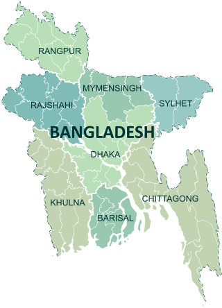
Divisions are the first-level administrative divisions in Bangladesh. As of 2023, there are eight divisions of Bangladesh, each named after the major city within its jurisdiction that also serves as the administrative seat of that division. Each division is divided into several districts which are further subdivided into upazilas, then union councils.

Gopalganj is one of the administrative districts in the Indian state of Bihar. The district headquarters is the town of Gopalganj, and the district is part of Saran Division. Major languages spoken are Hindi and Bhojpuri.
Gopalganj is a district in the Dhaka Division of Bangladesh. The district has 1,172,415 inhabitants and its surface area is 1,490 km2. The main town of the district is also called Gopalganj. It stands on the bank of the Madhumati river and located at 23°00’47.67" N 89°49’21.41". It is bounded by Faridpur district on the North, Pirojpur and Bagerhat district on the south, Madaripur & Barisal district on the east and Narail district on the West. This district is also known as "GP" to the youth.

Pirojpur is a district (zilla) in southern-western Bangladesh. It is a part of Barisal Division.

Bagerhat District is a district in south-western Bangladesh. It is a part of the Khulna Division.

Gopalganj Sadar is an upazila of Gopalganj District in the Division of Dhaka, Bangladesh.

Kashiani is an upazila of Gopalganj District in the Division of Dhaka, Bangladesh.

Kotalipara is an upazila of Gopalganj District in the Division of Dhaka, Bangladesh.
Muksudpur is an upazila of Gopalganj District in the Division of Dhaka, Bangladesh.

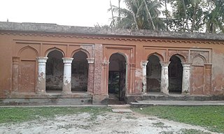
Tungipara is an upazila of Gopalganj District in the Division of Dhaka, Bangladesh. It is the birthplace of Sheikh Mujibur Rahman, the founder of independent Bangladesh and his grave is also here. In 1995 it was carved out of Gopalganj Sadar Upazila to become an Upazila.

Rajoir is an upazila of Madaripur District in the Division of Dhaka, Bangladesh.
Goalgram is a village in Gopalganj District, Bangladesh, part of Muksudpur Upazila. The village is bordered by the villages of Nanikhir, Barovatra, Mahishtali, and Jalirpar.

Sheikh Lutfur Rahman was a Bangladeshi serestadar, an officer responsible for record-keeping at the Gopalganj civil court in British India. His son Sheikh Mujibur Rahman was the first president of Bangladesh. Lutfar was also the paternal grandfather of Sheikh Hasina.
Bagerhat-1 is a constituency represented in the Jatiya Sangsad of Bangladesh since 2009 by Sheikh Helal Uddin of the Awami League.

Narail-1 is a constituency represented in the Jatiya Sangsad of Bangladesh since 2008 by Kabirul Haque Mukti of the Awami League.

Narail-2 is a constituency represented in the Jatiya Sangsad of Bangladesh since 2019 by Mashrafe Mortaza of the Awami League.

Gopalganj-1 is a constituency represented in the Jatiya Sangsad of Bangladesh since 1996 by Faruk Khan of the Awami League.

Gopalganj-2 is a constituency represented in the Jatiya Sangsad of Bangladesh since 1991 by Sheikh Fazlul Karim of the Awami League.
Gopalganj-3 is a constituency represented in the Jatiya Sangsad of Bangladesh since June 1996 by Sheikh Hasina of the Awami League.

